Blue Ash, Ohio

Last updated

Blue Ash, Ohio
Blue Ash south of the airport.jpg
Offices and houses in southern Blue Ash
Flag of Blue Ash, Ohio.png
Seal of Blue Ash, Ohio.png
Logo of Blue Ash, Ohio.png
Motto(s): 
Aspire; Achieve; Advance
Hamilton County Ohio Incorporated and Unincorporated areas Blue Ash highlighted.svg
Location in Hamilton County and the state of Ohio.
Coordinates: 39°14′50″N84°22′34″W / 39.24722°N 84.37611°W / 39.24722; -84.37611
Country United States
State Ohio
County Hamilton
Government
  MayorMarc Sirkin [1]
Area
[2]
  Total7.60 sq mi (19.69 km2)
  Land7.58 sq mi (19.64 km2)
  Water0.02 sq mi (0.05 km2)
Elevation
[3]
810 ft (250 m)
Population
 (2020)
  Total13,394
  Estimate 
(2023) [4]
13,408
  Density1,766.09/sq mi (681.89/km2)
Time zone UTC-5 (Eastern (EST))
  Summer (DST) UTC-4 (EDT)
ZIP code
45242
Area code 513
FIPS code 39-07300 [5]
GNIS feature ID1086199 [3]
Website www.blueash.com
Downtown Blue Ash Blue Ash OH USA.JPG
Downtown Blue Ash

Blue Ash is a city in Hamilton County, Ohio. An inner suburb of Cincinnati, the population was 13,394 at the time of the 2020 census. [6]

Contents

History

The area that is now Blue Ash was settled around 1791. In 1797, the first settlers built Carpenter's Run Baptist Church out of blue ash logs, giving the area its eventual name. [7]

In the late 19th century, the Cincinnati, Lebanon and Northern Railway provided narrow gauge commuter rail service to Blue Ash.

Blue Ash was the site of Cincinnati–Blue Ash Airport from 1921 to 2012. Originally a private airfield called Grisard Field, it was sold to the City of Cincinnati in 1946, becoming Ohio's first municipal airport. Cincinnati desired to expand the airport for major commercial service through the 1950s, [8] but Blue Ash fought the city by incorporating first as a village in 1955 and then as a city in 1961. [7] Eventually, through Reed Hartman's Community Improvement Corporation, Cincinnati developed the surrounding area as an industrial park and golf course. The airport closed on August 29, 2012, and the property was sold to the City of Blue Ash, which opened Summit Park on the property. [9]

In 1998, the Southwest Ohio Regional Transit Authority proposed a MetroMoves light rail system with a Green Line that would initially run 19-mile (31 km) from Blue Ash to Covington, Kentucky. A future phase would have extended the line further north to Kings Island and south to the Cincinnati/Northern Kentucky International Airport. However, MetroMoves was rejected by Hamilton County voters.

On April 9, 1999, Blue Ash experienced an F4 tornado that caused four deaths. [10]

Geography

According to the 2010 census, the city has a total area of 7.59 square miles (19.7 km2), of which 7.58 square miles (19.6 km2) (or 99.87%) is land and 0.01 square miles (0.026 km2) (or 0.13%) is water. [11]

Blue Ash can be reached by Interstate 71 to the east, Interstate 275 to the north, and Ronald Reagan Cross County Highway to the south.

Demographics

Historical population
CensusPop.Note
1960 8,341
1970 8,324−0.2%
1980 9,51014.2%
1990 11,86024.7%
2000 12,5135.5%
2010 12,114−3.2%
2020 13,39410.6%
2023 (est.)13,408 [4] 0.1%
Sources: [12] [13] [5] [14]

2020 census

As of the census of 2020, there were 13,394 people living in the city, for a population density of 1,766.09 per square mile (681.89/km2). There were 5,851 housing units. The racial makeup of the city was 74.0% White, 6.6% African American, 0.2% Native American, 13.2% Asian, 1.4% from other races, and 6.0% from two or more races. Hispanic or Latino of any race were 3.8% of the population. [15]

There were 5,530 households, out of which 33.1% had children under the age of 18 living with them, 51.6% were married couples living together, 13.8% had a male householder with no spouse present, and 26.2% had a female householder with no spouse present. 25.5% of all households were made up of individuals, and 14.1% were someone living alone who was 65 years of age or older. The average household size was 2.37, and the average family size was 2.90. [15]

23.8% of the city's population were under the age of 18, 56.7% were 18 to 64, and 19.5% were 65 years of age or older. The median age was 38.9. For every 100 females, there were 96.1 males. [15]

According to the U.S. Census American Community Survey, for the period 2016-2020 the estimated median annual income for a household in the city was $103,658, and the median income for a family was $117,010. About 4.8% of the population were living below the poverty line, including 5.2% of those under age 18 and 6.4% of those age 65 or over. About 65.0% of the population were employed, and 34.8% had a bachelor's degree or higher. [15]

2010 census

As of the census [16] of 2010, there were 12,114 people, 5,015 households, and 3,404 families residing in the city. The population density was 1,598.2 inhabitants per square mile (617.1/km2). There were 5,360 housing units at an average density of 707.1 per square mile (273.0/km2). The racial makeup of the city was 79.9% White, 6.5% African American, 0.2% Native American, 10.6% Asian, 0.6% from other races, and 2.1% from two or more races. Hispanic or Latino of any race were 2.5% of the population.

There were 5,015 households, of which 31.1% had children under the age of 18 living with them, 53.7% were married couples living together, 10.4% had a female householder with no husband present, 3.8% had a male householder with no wife present, and 32.1% were non-families. 26.7% of all households were made up of individuals, and 10.3% had someone living alone who was 65 years of age or older. The average household size was 2.40 and the average family size was 2.91.

The median age in the city was 41.6 years. 22.7% of residents were under the age of 18; 6.6% were between the ages of 18 and 24; 24.8% were from 25 to 44; 30.6% were from 45 to 64; and 15.4% were 65 years of age or older. The gender makeup of the city was 49.0% male and 51.0% female.

2000 census

As of the census [5] of 2000, there were 12,513 people, 4,990 households, and 3,468 families residing in the city. The population density was 1,634.6 inhabitants per square mile (631.1/km2). There were 5,251 housing units at an average density of 686.0 per square mile (264.9/km2). The racial makeup of the city was 87.09% White, 5.01% African American, 0.25% Native American, 6.39% Asian, 0.02% Pacific Islander, 0.29% from other races, and 0.96% from two or more races. Hispanic or Latino of any race were 0.97% of the population.

There were 4,990 households, out of which 32.7% had children under the age of 18 living with them, 57.2% were married couples living together, 9.4% had a female householder with no husband present, and 30.5% were non-families. 25.3% of all households were made up of individuals, and 8.4% had someone living alone who was 65 years of age or older. The average household size was 2.48 and the average family size was 3.01.

In the city the population was spread out, with 25.4% under the age of 18, 6.4% from 18 to 24, 27.8% from 25 to 44, 26.1% from 45 to 64, and 14.2% who were 65 years of age or older. The median age was 39 years. For every 100 females, there were 93.7 males. For every 100 females age 18 and over, there were 91.0 males.

The median income for a household in the city was $81,591, and the median income for a family was $88,494. Males had a median income of $72,743 versus $65,060 for females. The per capita income for the city was $63,801. About 3.8% of families and 4.7% of the population were below the poverty line, including 6.8% of those under age 18 and 2.9% of those age 65 or over.

Economy

Blue Ash's "daytime population" reaches approximately 55,000 due to the 2,000 businesses within the city limits. [7] The city's industrial and commercial parks are home to many corporate headquarters, including:

Culture

Blue Ash offers two summer events each year: "Red, White, and Blue Ash"; [18] and "Taste of Blue Ash". [18] "Red, White and Blue Ash" is held annually in celebration of the 4th of July and features the biggest Independence Day firework display in the region.[ citation needed ] These events draw internationally popular headlining rock acts. On July 4, 2010, the bands Yes and Peter Frampton drew a record estimated 150,000 people to that year's Red, White, and Blue Ash event. Due to budget constraints the city decided to suspend their "Summerbration" event for 2010–2013, with hopes to resume the event in the near future. [19]

Blue Ash and the neighboring city of Montgomery partner to support the Blue Ash Montgomery Symphony Orchestra, which performs at local events. In addition, the City provides an annual Concert Series [20] each year during the summer months.

Education

Blue Ash is mostly served by the Sycamore Community School District, which has had the most National Merit Scholars of any public school in Ohio for the past four years and has been given the highest rating of "Excellent" by the Ohio Department of Education for eight consecutive years. The Princeton City School District covers a western portion of the city. Moeller High School, located just outside the city limits, is a Catholic private high school for boys, while Ursuline Academy is a Catholic independent high school for girls. Blue Ash is also home to UC Blue Ash, formally called Raymond Walters College, a satellite campus of University of Cincinnati.

Blue Ash is served by a branch of the Public Library of Cincinnati and Hamilton County. [21]

Notable people

Sister city

Blue Ash is a sister city of Ilmenau in Germany. [22]

Related Research Articles

<span class="mw-page-title-main">Trenton, Ohio</span> City in Ohio, United States

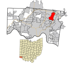
Trenton is a city in northeastern Butler County, Ohio, United States, west of Middletown. The population was 13,021 at the 2020 census. It is part of the Cincinnati metropolitan area.

<span class="mw-page-title-main">Williamsburg, Ohio</span> Village in Ohio, United States

Williamsburg is a village in Clermont County, Ohio, United States. The population was 2,570 at the 2020 census.

<span class="mw-page-title-main">Amberley, Ohio</span> Village in Ohio, United States

Amberley, locally known as Amberley Village, is a village in Hamilton County, Ohio, United States. The population was 3,840 at the 2020 census.

<span class="mw-page-title-main">Cheviot, Ohio</span> City in Ohio, United States

Cheviot is a city in west-central Hamilton County, Ohio, United States. It is a suburb of Cincinnati. The population was 8,658 at the 2020 census.

<span class="mw-page-title-main">Covedale, Ohio</span> Census-designated place in Ohio, United States

Covedale is a census-designated place (CDP) in Green Township, Hamilton County, Ohio, United States. The population was 6,472 at the 2020 census. The CDP represents the part of the former village of Covedale that was not annexed by the city of Cincinnati in 1930.

<span class="mw-page-title-main">Deer Park, Ohio</span> City in Ohio, United States

Deer Park is a city in Hamilton County, Ohio, United States. It is a suburb of Cincinnati. The population was 5,432 at the 2020 census.

<span class="mw-page-title-main">Elmwood Place, Ohio</span> Village in Hamilton County, Ohio, United States

Elmwood Place is a village in Hamilton County, Ohio, United States. The population was 2,087 at the 2020 census. Except for a small portion which touches neighboring St. Bernard, Elmwood Place is nearly surrounded by the city of Cincinnati.

<span class="mw-page-title-main">Forest Park, Ohio</span> City in Ohio, United States

Forest Park is the second most populous city in Hamilton County, Ohio, United States. It is a suburb of Cincinnati. The population was 20,189 at the 2020 census.

<span class="mw-page-title-main">Mariemont, Ohio</span> Village in Ohio, United States

Mariemont is a village in eastern Hamilton County, Ohio, United States. The population was 3,518 at the 2020 census. A planned community in the Cincinnati metropolitan area, it includes two overlapping historic districts, the Village of Mariemont and Mariemont Historic District. In 2007, the Village of Mariemont was designated a National Historic Landmark.

<span class="mw-page-title-main">Montgomery, Ohio</span> City in Ohio, United States

Montgomery is a city in Hamilton County, Ohio, United States. It is an eastern suburb of Cincinnati. The population was 10,853 at the 2020 census.

<span class="mw-page-title-main">Mount Healthy, Ohio</span> City in Ohio, United States

Mount Healthy is a city in Hamilton County, Ohio, United States. It is a suburb of Cincinnati. The population was 6,996 at the 2020 census.

<span class="mw-page-title-main">North Bend, Ohio</span> Village in Ohio, United States

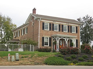
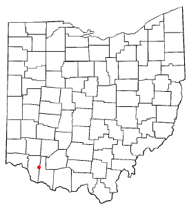
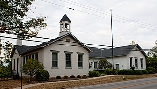
North Bend is a village in Miami Township, Hamilton County, Ohio, United States, along the Ohio River. It is a part of the Greater Cincinnati area. The population was 835 at the 2020 census.

<span class="mw-page-title-main">Springdale, Ohio</span> City in Ohio, United States

Springdale is a city in Hamilton County, Ohio, United States. It is a suburb of Cincinnati. The population was 11,007 at the 2020 census.

<span class="mw-page-title-main">St. Bernard, Ohio</span> Village in Ohio, United States

St. Bernard or Saint Bernard is a village in Hamilton County, Ohio, United States. It is an enclave and suburb of Cincinnati. The population was 4,070 at the 2020 census.

<span class="mw-page-title-main">Indian Hill, Ohio</span> City in Ohio, United States

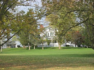
The Village of Indian Hill is a city in Hamilton County, Ohio, United States, and a suburb of the Greater Cincinnati area. The population was 6,087 at the 2020 census. Prior to 1970, Indian Hill was incorporated as a village, but under Ohio law became designated as a city once its population was verified as exceeding 5,000. The municipality then changed its name to add "Village" into the official name; legally it is "The City of The Village of Indian Hill". The Village of Indian Hill is served by the Indian Hill Exempted Village School District.

<span class="mw-page-title-main">Monroe, Ohio</span> City in Ohio, United States

Monroe is a city in east central Butler and west central Warren counties in the southwestern part of the U.S. state of Ohio. The population was 15,412 at the 2020 census. Monroe is a part of the Cincinnati metropolitan area.

<span class="mw-page-title-main">Sharonville, Ohio</span> City in Ohio, United States

Sharonville is a city largely in Hamilton County in the U.S. state of Ohio. The population was 14,117 at the 2020 census.

<span class="mw-page-title-main">Brecon, Ohio</span> Census-designated place in Ohio, United States

Brecon is a census-designated place (CDP) in Sycamore Township, Hamilton County, Ohio, United States. The population was 408 at the 2020 census.

<span class="mw-page-title-main">Rossmoyne, Ohio</span> Census-designated place in Ohio, United States

Rossmoyne is a census-designated place (CDP) in Sycamore Township, Hamilton County, Ohio, United States, 13 miles (21 km) northeast of downtown Cincinnati. The population of Rossmoyne was 1,788 at the 2020 census.

Cincinnati is a city in Ohio, United States.

References

  1. "Mayor Marc Sirkin". Welcome to the City of Blue Ash, Ohio. City of Blue Ash. Retrieved July 19, 2020.
  2. "ArcGIS REST Services Directory". United States Census Bureau. Retrieved September 20, 2022.
  3. 1 2 U.S. Geological Survey Geographic Names Information System: Blue Ash, Ohio
  4. 1 2 "Annual Estimates of the Resident Population for Incorporated Places in Ohio: April 1, 2020 to July 1, 2023". United States Census Bureau. Retrieved June 3, 2024.
  5. 1 2 3 "U.S. Census website". United States Census Bureau . Retrieved January 31, 2008.
  6. "Profile of General Population and Housing Characteristics: 2010 Demographic Profile Data (DP-1): Blue Ash city, Ohio". United States Census Bureau . Retrieved October 30, 2012.
  7. 1 2 3 "Brief History of Blue Ash". City of Blue Ash, Ohio. Archived from the original on October 12, 2013. Retrieved August 28, 2011.
  8. Mecklenborg, Jake (February 14, 2008). "Blue Ash Airport". Cincinnati-Transit.net. Retrieved August 28, 2011.
  9. "summit park master plan" . Retrieved August 5, 2023.
  10. "The Blue Ash/Symmes Township Tornado: 25 Years Later". Wilmington, OH Weather Forecast Office, NOAA. Retrieved April 5, 2024.
  11. "2010 Census U.S. Gazetteer Files for Places – Ohio". United States Census. Archived from the original on July 2, 2016. Retrieved October 19, 2012.
  12. "Number of Inhabitants: Ohio" (PDF). 18th Census of the United States. U.S. Census Bureau. 1960. Retrieved April 24, 2020.
  13. "Ohio: Population and Housing Unit Counts" (PDF). U.S. Census Bureau. Retrieved November 22, 2013.
  14. "Blue Ash city, Ohio". census.gov. Retrieved June 28, 2022.
  15. 1 2 3 4 "Blue Ash city, Ohio - Census Bureau Profile". United States Census Bureau. Retrieved September 29, 2023.
  16. "U.S. Census website". United States Census Bureau . Retrieved January 6, 2013.
  17. "Kroger Blue Ash Grocery Pickup - Blue Ash, OH" . Retrieved August 5, 2023.
  18. 1 2 "Blue Ash Events :: Come to all of the Blue Ash Special Events for 2012!". Archived from the original on October 22, 2012. Retrieved December 17, 2012.
  19. "Thousands Jam Pack Blue Ash Park", Thompson, Ann, Cincinnati Public Radio, July 5, 2010 Archived July 17, 2011, at the Wayback Machine
  20. "Blue Ash Events.com :: Concert Series". Archived from the original on September 23, 2012. Retrieved December 17, 2012.
  21. "Blue Ash Branch". Public Library of Cincinnati and Hamilton County. Retrieved June 12, 2014.
  22. "Partnerstädte" (in German). Ilmenau. Retrieved January 19, 2023.