Boston Post Road

Last updated

Boston Post Road

Boston Post Road map.png
Routes of the Boston Post Road
Major junctions
South endUS 1.svg US 1 in New York City
North endMA Route 1A.svg Route 1A in Boston
Location
Country United States
Highway system

The Boston Post Road was a system of mail-delivery routes between New York City and Boston, Massachusetts, that evolved into one of the first major highways in the United States.

Contents

The three major alignments were the Lower Post Road (now U.S. Route 1 (US 1) along the shore via Providence, Rhode Island), the Upper Post Road (now US 5 and US 20 from New Haven, Connecticut, by way of Springfield, Massachusetts), and the Middle Post Road (which diverged from the Upper Road in Hartford, Connecticut, and ran northeastward to Boston via Pomfret, Connecticut).

In some towns, the area near the Boston Post Road has been placed on the National Register of Historic Places, since it was often the first road in the area, and some buildings of historical significance were built along it. The Boston Post Road Historic District, including part of the road in Rye, New York, has been designated a National Historic Landmark. The Post Road is also famous for milestones that date from the 18th century, many of which survive to this day. In parts of Connecticut (generally east of Hartford), it is also known as Route 6.

History

The Upper Post Road was originally called the Pequot Path and had been in use by Native Americans long before Europeans arrived. [1] Some of these important native trails were in many places as narrow as two feet. [2]

What is now called the Old Connecticut Path and the Bay Path were used by John Winthrop the Younger to travel from Boston to Springfield in November 1645, and these form much of the basis for the Upper Post Road.

The colonists first used this trail to deliver the mail using post riders. The first ride to lay out the Upper Post Road started on January 1, 1673. [3] Later, the newly blazed trail was widened and smoothed to the point where horse-drawn wagons or stagecoaches could use the road. The country's first successful long-distance stagecoach service was launched by Levi Pease along the upper road in October 1783. [4]

During the 19th century, turnpike companies took over and improved pieces of the road. Large sections of the various routes are still called the King's Highway and Boston Post Road. Much of the Post Road is now U.S. Route 1, U.S. Route 5, and U.S. Route 20.

Mileposts were measured from the intersection of Broadway and Wall Street in New York (one block west of Federal Hall) and from the old Boston city-line on Washington Street, near the present-day Massachusetts Turnpike.

The Metropolitan Railroad Company was chartered in 1853 to run streetcars down the stretch of the road on Washington Street in Roxbury, which is now served by the MBTA Silver Line. The Upper and Lower Boston Post Roads were designated U.S. Routes 1 and 20 in 1925 (though Route 20 has since been substantially modified). [4]

New York

The Post Road in New York BPR NY map.png
The Post Road in New York

Manhattan

Much of the route in Manhattan, where it was known as the Eastern Post Road, was abandoned between 1839 and 1844, when the current street grid was laid out as part of the Commissioners' Plan that had been originally advanced in 1811. [5] The following sections of the road still exist:

These milestones were once present in Manhattan:

The Bronx

The "Road to Kings Bridge, where the Rebels mean to make a Stand" in a British map of 1776 NYC1776.jpg
The "Road to Kings Bridge, where the Rebels mean to make a Stand" in a British map of 1776

In southwestern Westchester County, now the Bronx, the Boston Post Road came off the Kings Bridge and quickly turned east, with the Albany Post Road continuing north to Albany, New York. It passed over the Bronx River on the Williams Bridge, and left The Bronx on Bussing Avenue, becoming Kingsbridge Road in Westchester County. In more detail, it used the following modern roads:

East and north towards West Farms Square Boston Rd Suburban La jeh.JPG
East and north towards West Farms Square

Westchester County

The Boston Post Road entered what is now Westchester County on Kingsbridge Road, and turned north on Third Avenue-Columbus Avenue (Route 22), forking off onto Colonial Place. It continued across Sandford Boulevard (Sixth Street) where there is no longer a road, and curved east and southeast around the hill, hitting Sandford Boulevard-Colonial Avenue at the Hutchinson River Parkway interchange. It then continued east on Colonial Avenue-Kings Highway, merging with U.S. Route 1. From there to the Connecticut border, the Post Road used US 1, except for several places, where Post Road used the following roads:

Upper Post Road

The Upper Post Road was the most traveled of the three routes, being the furthest from the shore and thus having the fewest and shortest river crossings. It was also considered to have the best taverns, which contributed to its popularity.[ citation needed ] The Upper Post Road roughly corresponds to the alignment of U.S. Route 5 from New Haven, Connecticut, to Hartford; Connecticut Route 159 from Hartford to Springfield, Massachusetts; U.S. Route 20 from Springfield to Warren, Massachusetts (via Route 67); Massachusetts Route 9 from Warren to Worcester; an unnumbered road (Lincoln Street in Worcester, Main Street in Shrewsbury, and West Main Street in Northborough) to Northborough; and U.S. Route 20 from Northborough to Boston. A series of historic milestones erected in the 18th century survive along its route from Springfield to Boston.

Connecticut

Milestone 8 on the Upper Post Road in Harvard Square, Cambridge Massachusetts Upper Post Road MP 8.jpg
Milestone 8 on the Upper Post Road in Harvard Square, Cambridge Massachusetts

Massachusetts

Lower Post Road

The Lower Post Road hugged the shoreline of Long Island Sound all the way to Rhode Island and then turned north through Providence to Boston. This is now the best-known of the routes. The Lower Post Road roughly corresponds to the original alignment of U.S. Route 1 in eastern Connecticut, Rhode Island, and Massachusetts.

Connecticut

Rhode Island

Massachusetts

In Massachusetts, the Norfolk and Bristol Turnpike was established in 1803 as a straighter route between Pawtucket, Rhode Island, and Roxbury, Massachusetts, mostly west of the Post Road. It is known as Washington Street in many of the towns it passes through. Due to its avoidance of built-up areas, the southern half of this road was little-used. In addition, another well-used route passed west of this turnpike along current Route 1A.

South Attleboro

The Post Road entered Massachusetts at the town of Attleboro's Newport Avenue (Route 1A) through the settlement of South Attleboro. It continued northeast on Newport Avenue along Route 123, splitting to the north (staying with Newport Avenue) to cross into North Attleborough.

North Attleborough

South of North Attleborough center, the old road is known as Old Post Road. The old road crossed the turnpike (now US 1) just south of the intersection with Route 120, forming a small curve before merging with the turnpike north of the intersection. This curved alignment is now gone, so traffic must use US 1. Additionally, US 1 leaves the turnpike at the Route 120 intersection to bypass North Attleborough center on East Washington Street.

The Lower Post Road passed through North Attleborough Center on Washington Street, later used as part of the turnpike. Another short curved alignment still exists to the west of Washington Street north of the center, now called "Park Street". Just north of this, the route crosses the Ten Mile River and then enters a complicated five-way intersection with US 1 and Route 1A. US 1 straight ahead is the old turnpike, and US 1 to the right was built in the 1930s. The Post Road went to the right onto Elmwood Street. The fork to the left onto Route 1A through Plainville center was an alternate route to Boston.

Elmwood Street enters the town of Plainville, where it becomes Messenger Street. The road merges with Route 106 before crossing Route 152 at Wilkins Four Corners and entering Foxborough.

Sharon

There is a road passing from the town of Sharon into East Walpole which is known as Old Post Road, which continues north as Pleasant Street into Norwood.

East Walpole (part of Walpole)
Norwood

In Norwood, the oldest route of the Post Road followed Neponset Street south until the intersection with Pleasant Street. The newer route followed Washington Street through the center of Norwood, south towards Walpole.

Islington (part of Westwood)

The Post Road turned from East Street onto Washington Street, heading south towards Norwood.

Dedham

In Dedham, the road followed modern-day Lower East Street north to Boston. Here the Post Road splits, with the oldest route (prior to 1704) following East Street in an arc around the old marshes until it meets Washington Street (Route 1A) south of the Dedham village center.

The new road (in use by 1744) followed High Street to Court Street, and continued south along Highland Street and Elm Street, rejoining East Street south of Interstate 95.

Roxbury

In Roxbury, the road turned down Roxbury Street and followed modern-day Centre Street around the edge of Fort Hill, crossing Stony Brook at a bridge in the location of the modern-day Jackson Square MBTA station. The road continued following Centre Street southwards through modern-day Hyde Square and Jamaica Plain, and southwards to Dedham.

Boston

In the colonial city, the road began at the Old State House, the government center of the 18th-century city. Once called Cornhill, Orange, and Newbury Street, it's now modern-day Washington Street, running southwards off the Boston Neck towards the village of Roxbury.

Middle Post Road

The Middle Post Road was the shortest, fastest, and youngest portion of the route. From Hartford, it ran into the Eastern Upper Highlands, an area with large native Indian populations. During King Philip's War of 1675, travel in these areas was often dangerous for settlers. It was not until the end of the war and establishment of the Colonial post system that the area began to become populated, and the middle post road was established as the fastest route. This area of the state continues to remain underpopulated in contrast to other portions of Connecticut, and accordingly, portions of the original post road have been preserved due to various circumstances. It split from the Upper Post Road in Hartford, and initially ran roughly along current U.S. Route 44 through Bolton Notch and towards Mansfield Four Corners. From Mansfield, it went through Ashford, Pomfret, and headed into Massachusetts via the town of Thompson, along Thompson Road. In Massachusetts, the Middle Post Road runs along sections of modern Route 16 to Mendon, then through Bellingham, and then via Route 109 from Medway to Dedham where it meets with the Lower Post Road (old U.S. Route 1) heading into Boston.

Connecticut

Hartford

Starting at the Old State House, the road crossed the Connecticut River over the area that is now occupied by the Founders Bridge, initially by ferry and later by bridge. It is notable that until 1783, Hartford's eastern boundaries included present-day East Hartford and Manchester.

East Hartford

Although the road crossed via the route of the Founders Bridge from Hartford, this area was later developed into an enormous highway interchange, and thus much of the historic road was destroyed. In the early years of Connecticut's history, East Hartford was privately owned. What remains of the route is the path of Interstate 84 / Route 6, which connects to Manchester's Middle Turnpike East.

Manchester

Since Manchester was a part of Hartford until 1783, the area was made up of settlements and present-day boroughs. The post road can be traced along present-day Middle Turnpike East through central Manchester. It later passed through Manchester Green, where the post road became reconnected with Route 6, and, for the first time, U.S. Route 44. Just before leaving Manchester and entering Bolton, the post road breaks off Route 44 onto Middle Turnpike East (the portion of Route 44 between Manchester and Bolton is known as "New Bolton Road")

Bolton

Bolton serves a unique role in the post road, as it was the border between the flat and tranquil Connecticut River Valley, and the hilly and turbulent Eastern Upper Highlands. Entering Bolton on Middle Turnpike East, the traveler encountered a fork and could choose to head southeast on Bolton Center Street (later Center Street) to the settlement of Bolton, or stay on Middle Turnpike East to reconnect with Route 44 and head east on the original Mohegan Indian Trail through Bolton Notch, a natural depression in the ridge that dramatically sped up transit and served as a demarcation between the two geologic landscapes. Within the Bolton settlement was White's Tavern, notable for having housed the staff of General Rochambeau, whose unit camped in the settlement during the revolutionary war. To exit Bolton, one heads north on Notch Road until reaching Route 44, just outside Bolton Notch. Route 44 then connects to Coventry.

Coventry

Between Bolton and Mansfield, the road passed through the borough of North Coventry, entirely along present-day U.S. Route 44, known locally as the Boston Turnpike. Along the Willimantic River (and border of Mansfield) stands the Brigham Tavern, which holds the distinction of having housed George Washington around the period of the Revolutionary War. This plaque can be seen in front of the Brigham Tavern; it is currently a private residence.

Mansfield

Like Coventry, the post road follows the path of present-day U.S. Route 44. After crossing the Willimantic River from Coventry, the road crosses through Mansfield Four Corners, and towards Ashford.

Ashford

The road connects on Route 44 from Mansfield, and runs directly through the borough of Ashford. It stops, however, at Phoenixville, which then heads north towards Eastford on Route 198. Before reaching Eastford, however, it takes a right onto Route 244 ("Brayman Hollow Road") which headed directly to Pomfret.

Pomfret

At the center of Pomfret, Route 244 headed east turns into U.S. Route 44. The post road turns left shortly after the intersection with Route 169 onto Allen Road which quickly merges into Freedley Road. The road then heads northeast into Woodstock.

Woodstock

The post road briefly passes through the Harrisville section of town on Tripp Road before entering Putnam.

Putnam

Soon after entering Putnam, the road crosses over Route 171 onto West Thompson Road headed into Thompson.

Thompson

The post road soon follows over West Thompson Dam. The road once passed through the village of West Thompson, which was flooded purposely to control the Quinebaug River. The original post road can be seen from the Dam when water levels in West Thompson Lake are low enough. Once over the Dam the road turns into Route 193 and travels through historic Thompson Hill. Continuing northeast, the road bears right at a fork onto East Thompson Road and follows all the way to the Massachusetts state line.

Massachusetts

Douglas

Crosses the Massachusetts state line into the town of Douglas as Southwest Main Street. This section passes through Douglas State Forest and is one of the most remote parts of the route that is still used as a public road. A 1-mile (1.6 km) section here was still unpaved until 2002. At the center of Douglas, the Post Road follows Massachusetts Route 16 eastward to East Douglas. Where Route 16 turns south, the Post Road continues east as Northeast Main Street, which leads to the Uxbridge town line. French General Lafayette traveled this road to join forces with Washington, and stopped in Douglas during the Revolutionary War.

The Stone Arch Bridge in Uxbridge, Massachusetts Stone Arch Bridge on Hartford Ave, Uxbridge MA.jpg
The Stone Arch Bridge in Uxbridge, Massachusetts
Uxbridge

Entering Uxbridge, the name of the road changes to Hartford Avenue. Hartford Avenue is a major cross-town road and follows the route of the Post Road for its entire length. From the Douglas town line to the intersection of Massachusetts Route 122, it is known as Hartford Avenue West; from Route 122 to the Mendon town line, it is known as Hartford Avenue East. The original stone arch bridge over the Blackstone Canal is still in use today. There was a Civil War encampment near the stone-arch bridge, and the road was used by troops during the French and Indian Wars and as a supply route during the War of 1812. George Washington stopped here a number of times when traveling this road, including when he took command of the Continental Army at Boston in 1775, and on his post-Inaugural tour of New England in 1789.

Mendon

The Post Road enters the town from Uxbridge as Hartford Avenue West. It follows that road to Route 16, which follows the route of the Post Road for approximately one-half-mile eastward to Maple Street, which follows the route into Mendon town center. From there, the Post Road followed a Providence-Worcester post road south out of the village. This section is now part of Providence Street. About 1-mile (1.6 km) south of the town center the roads diverged. The Post Road heads east, now known as Hartford Avenue East. This road follows the original Post Road route to the Bellingham town line. Historic milestone 37 is still located along the route.

Bellingham

The Post Road enters from Mendon as Hartford Avenue. Massachusetts Route 126 joins the road shortly before crossing over Interstate 495. Route 126 follows the Post Road route the remainder of the way to the Medway town line.

Medway

The original Post Road from Mendon followed Village Street through Medway to the Tavern and Inn in Medway Village near the Charles River. The post road followed (present day) Village Street through Millis (part of Medway until 1885). In the early 19th century, the Hartford and Dedham Turnpike was built (now Rt 109), a straight route built through the Great Black Swamp, and up a large hill in the center of town.

Millis

The original Post Road in Millis followed Village St from Medway, crossing current Massachusetts Rt 109, and then following the current Dover Road to the location of a series of Bridges over the Charles River leading into Medfield. In the period from 1806 to 1810, the Hartford and Dedham Turnpike was built (now Route 109), nearly going broke in attempting to build a causeway over the Charles River at the Medfield town line and through the Great Black Swamp.

Medfield
Dedham

The upper post road (US 20) also runs through Weston, and links directly to The Gifford School

See also

Related Research Articles

<span class="mw-page-title-main">U.S. Route 5</span> Highway in the United States

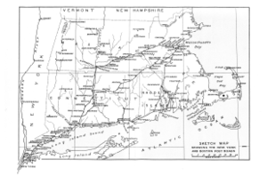
U.S. Route 5 (US 5) is a north–south United States Numbered Highway running through the New England states of Connecticut, Massachusetts, and Vermont. Significant cities along the route include New Haven, Connecticut; Hartford, Connecticut; and Springfield, Massachusetts. From Hartford northward to St. Johnsbury, Vermont, the road closely follows the route of the Connecticut River.

The Southwest Corridor or Southwest Expressway was a project designed to bring an eight-lane highway into the City of Boston from a direction southwesterly of downtown. It was supposed to connect with Interstate 95 (I-95) at Route 128. As originally designed, it would have followed the right of way of the former Penn Central/New Haven Railroad mainline running from Readville, north through Roslindale, Forest Hills and Jamaica Plain, where it would have met the also-cancelled I-695. The 50-foot-wide median for the uncompleted "Southwest Expressway" would have carried the southwest stretch of the MBTA Orange Line within it, replacing the Washington Street Elevated railway's 1901/1909-built elevated railbed. Another highway, the four-lane South End Bypass, was proposed to run along the railroad corridor between I-695 in Roxbury and I-90 near Back Bay.

<span class="mw-page-title-main">Connecticut Route 15</span> State highway in Connecticut, US

Route 15 is a state highway in the U.S. state of Connecticut that runs 83.53 miles (134.43 km) from a connection with New York's Hutchinson River Parkway in Greenwich, Connecticut, to its northern terminus intersecting with Interstate 84 (I-84) in East Hartford, Connecticut. Route 15 consists of four distinct sections: the Merritt Parkway, the Wilbur Cross Parkway, the Berlin Turnpike, and part of the Wilbur Cross Highway. The unified designation was applied to these separate highways in 1948 to provide a continuous through route from New York to Massachusetts. The parkway section of Route 15 is often referred to locally as "The Merritt".

Washington Street is a street originating in downtown Boston, Massachusetts, which extends southwestward to the Massachusetts–Rhode Island state line. The majority of its length outside of the city was built as the Norfolk and Bristol Turnpike in the early 19th century. It is the longest street in Boston and remains one of the longest streets in the Commonwealth of Massachusetts. Due to various municipal annexations with the city of Boston, the name Washington Street now exists 6 or more times within the jurisdiction(s) of the City of Boston.

The Norfolk and Bristol Turnpike is a road in Massachusetts. In Boston, it is known as Washington Street and in Dedham it runs along Washington Street and Court Street.

<span class="mw-page-title-main">U.S. Route 1A</span> Highways in United States

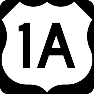
U.S. Route 1A (US 1A) is the name of several highways found in the United States.

<span class="mw-page-title-main">Massachusetts Route 28</span> Highway in Massachusetts

for MBTA route 28, see https://en.m.wikipedia.org/wiki/List_of_MBTA_bus_routes

<span class="mw-page-title-main">Route 159 (Connecticut–Massachusetts)</span> Highway in Connecticut and Massachusetts

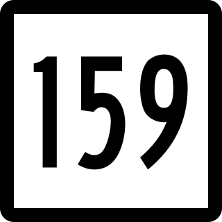
Route 159 is a 21.14-mile-long (34.02 km) state highway connecting the Hartford and Springfield areas in the U.S. states of Connecticut and Massachusetts. It begins as the northern extension of Main Street in Hartford and proceeds northward along the west bank of the Connecticut River towards Agawam, Massachusetts. The route ends at the junction of Route 147 and Route 75 in Agawam center just south of the West Springfield city line. The route was originally designated as U.S. Route 5A in 1932 and was renumbered to its modern designation in October 1968.

<span class="mw-page-title-main">Route 83 (Connecticut–Massachusetts)</span> Highway in Connecticut and Massachusetts

Route 83 is a 35.65-mile-long (57.37 km) north–south state highway in the Greater Hartford and Greater Springfield areas of the U.S. states of Connecticut and Massachusetts. It serves as the main north–south artery for the towns of Manchester, Vernon, Ellington, and Somers, and continues through East Longmeadow center into downtown Springfield. The route in Massachusetts is town-maintained, except for the ramps connecting to U.S. Route 5 parallel to Interstate 91.

<span class="mw-page-title-main">Interstate 95 in Massachusetts</span> Highway in Massachusetts, United States

Interstate 95 (I-95) is a part of the Interstate Highway System that parallels the East Coast of the United States from Miami, Florida, in the south to Houlton, Maine, in the north. In the US state of Massachusetts, it spans 92 miles (148 km) along a north–south axis. It is the third-longest Interstate Highway in Massachusetts, behind I-90 and I-495, while I-95 in full is the longest north–south Interstate and sixth-longest Interstate Highway in the US.

<span class="mw-page-title-main">U.S. Route 6 in Rhode Island</span> Section of U.S. Highway in Rhode Island, United States

U.S. Route 6 (US 6) is a major east–west road in the U.S. state of Rhode Island. Nationally, the route continues west to Bishop, California, and east to Provincetown, Massachusetts. In western Rhode Island, it forms part of one of several routes between Hartford, Connecticut, and Providence and was planned to be replaced by Interstate 84 (I-84). The part of I-84 that was built, from I-295 to Olneyville, is now part of US 6. At Olneyville, US 6 joins Route 10 and heads east toward Downtown, Providence, where it turns south on I-95 and east on I-195. US 6 splits from I-195 in East Providence, crossing into Massachusetts on Warren Avenue. The whole route of US 6 is a state highway maintained by the Rhode Island Department of Transportation (RIDOT).

<span class="mw-page-title-main">Needham Line</span> MBTA Commuter Rail line

The Needham Line is a branch of the MBTA Commuter Rail system, running west from downtown Boston, Massachusetts through Roxbury, Jamaica Plain, Roslindale, West Roxbury, and the town of Needham. The second-shortest line of the system at just 13.7 miles (22.0 km) long, it carried 4,881 daily riders in October 2022. Unlike the MBTA's eleven other commuter rail lines, the Needham Line is not a former intercity mainline; instead, it is composed of a former branch line, a short segment of one intercity line, and a 1906-built connector.

<span class="mw-page-title-main">Massachusetts Route 109</span> State highway in eastern Massachusetts, US

Route 109 is a 20.97-mile-long (33.75 km) state highway in eastern Massachusetts. It runs from Route 16 in Milford east to the VFW Parkway in Boston. Most of Route 109 runs along a portion of the Hartford and Dedham Turnpike.

<span class="mw-page-title-main">U.S. Route 5 in Connecticut</span> Section of U.S. Route in Connecticut, United States

U.S. Route 5 (US 5), a north–south United States Numbered Highway that is generally paralleled by Interstate 91 (I-91), begins at the city of New Haven in Connecticut and heads north through western Massachusetts and eastern Vermont to the international border with Canada. Within Connecticut, US 5 proceeds north from New Haven and passes through Meriden and Hartford toward Springfield, Massachusetts.

<span class="mw-page-title-main">U.S. Route 1 in Massachusetts</span> Section of U.S. Route in Massachusetts, United States

U.S. Route 1 (US 1) is a major north–south U.S. Route in the state of Massachusetts, traveling through Essex, Middlesex, Suffolk, Norfolk, and Bristol counties. The portion of US 1 south of Boston is also known as the Boston–Providence Turnpike, Washington Street, or the Norfolk and Bristol Turnpike, and portions north of Boston are known as the Northeast Expressway and the Newburyport Turnpike.

<span class="mw-page-title-main">U.S. Route 1 in Connecticut</span> Highway in Connecticut

U.S. Route 1 (US 1) in the U.S. state of Connecticut is a major east–west U.S. Route along Long Island Sound. It has been replaced by Interstate 95 (I-95) as a through route, which it closely parallels, and now primarily serves as a local business route. Despite its largely east–west orientation, it is part of a north–south route and is mostly signed north–south.

<span class="mw-page-title-main">Connecticut Route 190</span> Highway in Connecticut

Route 190 is a state route in the northern part of the U.S. state of Connecticut. It starts at Route 75 in the town of Suffield and proceeds eastward across the Connecticut River through the towns of Enfield, Somers, and Stafford. It ends at Route 171, in the town of Union. Route 190 was established in 1932 as a route between the state line at Southwick and the town of Enfield. The route was later extended eastward to Union but was truncated in the west to Suffield center.

<span class="mw-page-title-main">Massachusetts Route 16</span> Highway in Massachusetts

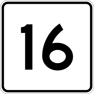
Route 16 is a 59.8646-mile-long (96.3427 km) east–west state highway in Massachusetts. It begins in the west at an intersection with Route 12 and Route 193 in Webster, just north of the Connecticut state border. It runs in a generally southwest-northeast routing through a number of Boston's suburbs and runs to the west and then north of the city before ending in Revere at an intersection with Route 1A and Route 60.

<span class="mw-page-title-main">History of rail in Dedham, Massachusetts</span>

The history of rail in Dedham, Massachusetts begins with the introduction of the first rail line in 1836 and runs to the present day. Multiple railroads have serviced Dedham since then, and current service is provided by the MBTA. The station in Dedham Square built in 1881 out of Dedham Granite was demolished in 1951 and the stones were used to put an addition on the Town's library. There are two active stations today, and multiple others in close proximity.

<span class="mw-page-title-main">U.S. Route 44</span> Highway in the United States

U.S. Route 44 (US 44) is an east–west United States Numbered Highway that runs for 237 miles (381 km) through four states in the Northeastern United States. The western terminus is at US 209 and New York State Route 55 (NY 55) in Kerhonkson, New York, a hamlet in the Hudson Valley region. The eastern terminus is at Route 3A in Plymouth, Massachusetts.

References

Notes

  1. Bourne, p.13
  2. Clark, George Larkin (1914). A History of Connecticut. ISBN   9780722249826.
  3. Daughters of the American Revolution Magazine, January 1917, Vol. 50, page 386,
  4. 1 2 "How the Post Road wrote New England’s history", The Boston Globe
  5. Walsh, Kevin (July 2001). "DE-CLASSIFIED 4-A". Forgotten New York. Retrieved November 4, 2017.
  6. One Mile House, on the corner of Rivington Street, demolished in 1921, was a meeting-ground for Tammany Hall politicians. "Bowery Landmark in $170,000 lease", The New York Times 1 April 1921; the painted sign for One Mile House, on the flank of a building on the east side of Bowery, survived into the 1980s.

Bibliography

Further reading