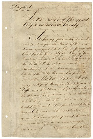
The Treaty of Paris, signed in Paris by representatives of King George III of Great Britain and representatives of the United States on September 3, 1783, officially ended the American Revolutionary War and recognized the Thirteen Colonies, which had been part of colonial British America, as an independent, sovereign nation.
The 49th parallel north is a circle of latitude that is 49° north of Earth's equator. It crosses Europe, Asia, the Pacific Ocean, North America, and the Atlantic Ocean.

The Rush–Bagot Treaty or Rush–Bagot Disarmament was a treaty between the United States and Great Britain limiting naval armaments on the Great Lakes and Lake Champlain, following the War of 1812. It was ratified by the United States Senate on April 16, 1818, and was confirmed by Canada, following Confederation in 1867.

The terms international waters or transboundary waters apply where any of the following types of bodies of water transcend international boundaries: oceans, large marine ecosystems, enclosed or semi-enclosed regional seas and estuaries, rivers, lakes, groundwater systems (aquifers), and wetlands.
The Treaty of Washington was a treaty signed and ratified by the United Kingdom and the United States in 1871 during the first premiership of William Gladstone and the presidency of Ulysses S. Grant. It settled various disputes between the countries, including the Alabama Claims for damages to American shipping caused by British-built warships, as well as illegal fishing in Canadian waters and British civilian losses in the American Civil War. It inaugurated permanent peaceful relations between the United States and Canada, and also with the United Kingdom. After the arbitrators endorsed the American position in 1872, Britain settled the matter by paying the United States $15.5 million, ending the dispute and leading to a treaty that restored friendly relations between Britain and the United States. That international arbitration established a precedent, and the case aroused interest in codifying public international law.

The International Joint Commission is a bi-national organization established by the governments of the United States and Canada under the Boundary Waters Treaty of 1909. Its responsibilities were expanded with the signing of the Great Lakes Water Quality Agreement of 1972. The commission deals with issues affecting the extensive waters and waterways along the Canada–United States border.

Water resources law is the field of law dealing with the ownership, control, and use of water as a resource. It is most closely related to property law, and is distinct from laws governing water quality.
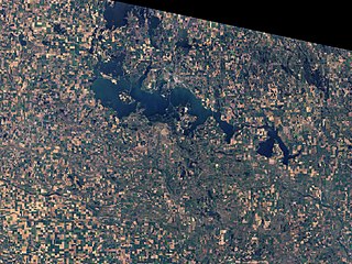
Devils Lake is a lake in the U.S. state of North Dakota. It is the largest natural body of water and the second-largest body of water in North Dakota after Lake Sakakawea. It can reach a level of 1,458 ft (444 m) before naturally flowing into the Sheyenne River via the Tolna Coulee. On June 27, 2011, it reached an unofficial historical high elevation of 1,454.3 ft (443.3 m). The cities of Devils Lake and Minnewaukan take their name from the lake as does the Spirit Lake Reservation, which is located on the lake's southern shores.

The Canada–United States border is the longest international border in the world. The boundary is 8,891 km (5,525 mi) long. The land border has two sections: Canada's border with the contiguous United States to its south, and with the U.S. state of Alaska to its west. The bi-national International Boundary Commission deals with matters relating to marking and maintaining the boundary, and the International Joint Commission deals with issues concerning boundary waters. The agencies responsible for facilitating legal passage through the international boundary are the Canada Border Services Agency (CBSA) and U.S. Customs and Border Protection (CBP).

The Convention respecting fisheries, boundary and the restoration of slaves, also known as the London Convention, Anglo-American Convention of 1818, Convention of 1818, or simply the Treaty of 1818, is an international treaty signed in 1818 between the United States and the United Kingdom. This treaty resolved standing boundary issues between the two nations. The treaty allowed for joint occupation and settlement of the Oregon Country, known to the British and in Canadian history as the Columbia District of the Hudson's Bay Company, and including the southern portion of its sister district New Caledonia.

The International Boundary and Water Commission is an international body created by the United States and Mexico in 1889 to apply the rules for determining the location of their international boundary when meandering rivers transferred tracts of land from one bank to the other, as established under the Convention of November 12, 1884.

The Similkameen River runs through southern British Columbia, Canada, eventually discharging into the Okanagan River near Oroville, Washington, in the United States. Through the Okanagan River, it drains to the Columbia River. The river is said to be named for an indigenous people called Similkameigh, meaning "treacherous waters".
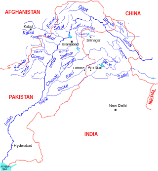
The Indus Water Treaty (IWT) is a water-distribution treaty between India and Pakistan, arranged and negotiated by the World Bank, to use the water available in the Indus River and its tributaries. It was signed in Karachi on 19 September 1960 by then Indian Prime Minister Jawaharlal Nehru and then Pakistani president Ayub Khan.

Great Lakes Areas of Concern are designated geographic areas within the Great Lakes Basin that show severe environmental degradation. There are a total of 43 areas of concern within the Great Lakes, 26 being in the United States, 12 in Canada, and five shared by the two countries.
The United States of America was formed after thirteen British colonies in North America declared independence from the British Empire on July 4, 1776. In the Lee Resolution, passed by the Second Continental Congress two days prior, the colonies resolved that they were free and independent states. The union was formalized in the Articles of Confederation, which came into force on March 1, 1781, after being ratified by all 13 states. Their independence was recognized by Great Britain in the Treaty of Paris of 1783, which concluded the American Revolutionary War. This effectively doubled the size of the colonies, now able to stretch west past the Proclamation Line to the Mississippi River. This land was organized into territories and then states, though there remained some conflict with the sea-to-sea grants claimed by some of the original colonies. In time, these grants were ceded to the federal government.

The history of post-confederation Canada began on July 1, 1867, when the British North American colonies of Canada, New Brunswick, and Nova Scotia were united to form a single Dominion within the British Empire. Upon Confederation, the United Province of Canada was immediately split into the provinces of Ontario and Quebec. The colonies of Prince Edward Island and British Columbia joined shortly after, and Canada acquired the vast expanse of the continent controlled by the Hudson's Bay Company, which was eventually divided into new territories and provinces. Canada evolved into a fully sovereign state by 1982.
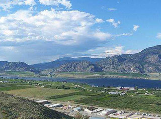
Osoyoos Lake is a lake located in British Columbia, Canada, and Washington state of the United States. Osoyoos is derived from the word sẁiẁs meaning "narrowing of the waters" in the local Okanagan language (Syilx'tsn).

The Moses-Saunders Power Dam, short for Robert Moses-Robert H. Saunders Power Dam, is a dam on the Saint Lawrence River straddling the border between the United States and Canada. It is located between Massena in New York and Cornwall in Ontario. The dam supplies water to two adjacent hydroelectric power generating stations, the United States' 912 MW St. Lawrence-Franklin D. Roosevelt Power Project and Canada's 1,045 MW R.H. Saunders Generating Station. Constructed between 1954 and 1958 as part of the larger Saint Lawrence Seaway project, the dam created Lake St. Lawrence. Aside from providing significant amounts of renewable power, the dam regulates the St. Lawrence River and affords passage for the navigation of large vessels. Despite the enormous economic advantages to the dam, it required the relocation of 6,500 people and caused harm to the surrounding environment. Efforts have been made over the years to improve shoreline and fish habitats.
The Convention on the Protection and Use of Transboundary Watercourses and International Lakes, also known as the Water Convention, is an international environmental agreement and one of five UNECE's negotiated environmental treaties. The purpose of this convention is to improve national attempts and measures for protection and management of transboundary surface waters and groundwaters. On the international level, Parties are obliged to cooperate and create joint bodies. The Convention includes provisions on: monitoring, research, development, consultations, warning and alarm systems, mutual assistance and access as well as exchange of information.
