Braman, Oklahoma

Last updated

Braman, Oklahoma
OKMap-doton-Braman.PNG
Location of Braman, Oklahoma
Coordinates: 36°55′25″N97°20′09″W / 36.92361°N 97.33583°W / 36.92361; -97.33583
Country United States
State Oklahoma
County Kay
Area
[1]
  Total0.20 sq mi (0.51 km2)
  Land0.20 sq mi (0.51 km2)
  Water0.00 sq mi (0.00 km2)
Elevation
[2]
1,047 ft (319 m)
Population
 (2020)
  Total160
  Density816.33/sq mi (315.68/km2)
Time zone UTC-6 (Central (CST))
  Summer (DST) UTC-5 (CDT)
ZIP code
74632
Area code 580
FIPS code 40-08450 [3]
GNIS feature ID2411719 [2]

Braman is a town in Kay County, Oklahoma, United States. The population was 217 at the 2010 census, a decline of 11.1 percent from the figure of 244 in 2000. [4]

Contents

History

Braman was named for railroad developer Dwight Braman, when its post office was first established on April 22, 1898. In that year, the Kansas and Southeastern Railroad—which was bought by the Atchison, Topeka and Santa Fe Railroad (AT&SF) in 1899—built a track from Hunnewell, Kansas to Braman. The following year, the Blackwell and Southern Railway—which was bought by the AT&SF in 1900—continued the line south through Blackwell to Tonkawa. [5] Meanwhile the town, located 5 miles (8.0 km) inside the Kansas-Oklahoma state line, officially incorporated on January 9, 1899. There were 249 residents in 1900, growing to 300 by statehood in 1907. [6]

In 1920, the population was 396 and the local economy was largely based on wheat farming. Oil was discovered nearby during the 1920s, briefly attracting a peak population of nearly five thousand, but the population dropped quickly to 507 in 1930. This was the highest number ever recorded in the census for Braman. It has remained an agricultural center since then. [6]

Geography

According to the United States Census Bureau, Braman has a total area of 0.2 square miles (0.52 km2), all land.

Demographics

Historical population
CensusPop.Note
1900 249
1910 33936.1%
1920 39616.8%
1930 50728.0%
1940 427−15.8%
1950 392−8.2%
1960 336−14.3%
1970 295−12.2%
1980 35520.3%
1990 251−29.3%
2000 244−2.8%
2010 217−11.1%
2020 160−26.3%
U.S. Decennial Census [7]

As of the census [3] of 2000, there were 244 people, 103 households, and 66 families residing in the town. The population density was 1,558.2 inhabitants per square mile (601.6/km2). There were 117 housing units at an average density of 747.2 per square mile (288.5/km2). The racial makeup of the town was 85.66% White, 0.41% African American, 6.56% Native American, and 7.38% from two or more races. Hispanic or Latino of any race were 3.28% of the population.

There were 103 households, out of which 31.1% had children under the age of 18 living with them, 49.5% were married couples living together, 11.7% had a female householder with no husband present, and 35.0% were non-families. 31.1% of all households were made up of individuals, and 7.8% had someone living alone who was 65 years of age or older. The average household size was 2.37 and the average family size was 2.99.

In the town, the population was spread out, with 25.4% under the age of 18, 6.1% from 18 to 24, 26.6% from 25 to 44, 29.5% from 45 to 64, and 12.3% who were 65 years of age or older. The median age was 39 years. For every 100 females, there were 92.1 males. For every 100 females age 18 and over, there were 93.6 males.

The median income for a household in the town was $27,841, and the median income for a family was $33,750. Males had a median income of $23,750 versus $21,667 for females. The per capita income for the town was $17,721. About 3.0% of families and 10.0% of the population were below the poverty line, including 5.0% of those under the age of eighteen and 24.0% of those 65 or over.

Transportation

Braman is served by Interstate 35 and US Route 177. [8]

Braman has freight rail service through the Blackwell Northern Gateway Railroad. [9]

The nearest airfield is Blackwell-Tonkawa Municipal Airport (FAA Identifier: BKN), about 12 miles south, with a 3501’ x 60’ paved runway. [10] [11] Commercial airline service is available at Wichita Dwight D. Eisenhower National Airport, about 58 miles to the north. [11] [12]

Notable person

Related Research Articles

<span class="mw-page-title-main">Washington County, Oklahoma</span> County in Oklahoma, United States

Washington County is a county located in the northeastern part of the U.S. state of Oklahoma. As of the 2020 census, the population was 52,455. Its county seat is Bartlesville. Named for President George Washington, it is the smallest county in Oklahoma in total area, adjacent to the largest county in Oklahoma, Osage County.

<span class="mw-page-title-main">Grant County, Oklahoma</span> County in Oklahoma, United States

Grant County is a county located on the northern border of the U.S. state of Oklahoma. As of the 2020 census, the population was 4,169. Its county seat is Medford. Originally designated as part of the Cherokee Outlet, it was named County L in Oklahoma Territory at the time of its opening to non-Indian settlement. A county election renamed it for U.S. President Ulysses S. Grant.

<span class="mw-page-title-main">Garfield County, Oklahoma</span> County in Oklahoma, United States

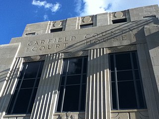
Garfield County is a county located in the U.S. state of Oklahoma. As of the 2020 census, the population was 62,846. Enid is the county seat and largest city within Garfield County. The county is named after President James A. Garfield.

<span class="mw-page-title-main">Morris County, Kansas</span> County in Kansas, United States

Morris County is a county located in the U.S. state of Kansas. Its county seat and largest city is Council Grove. As of the 2020 census, the county population was 5,386. The county was named for Thomas Morris, a U.S. Senator from Ohio and anti-slavery advocate.

<span class="mw-page-title-main">Atchison, Kansas</span> City and County seat in Kansas, United States

Atchison is a city and county seat of Atchison County, Kansas, United States, along the Missouri River. As of the 2020 census, the population of the city was 10,885. The city is named in honor of US Senator David Rice Atchison from Missouri and was the original eastern terminus of the Atchison, Topeka and Santa Fe Railway. Atchison is also the home of Benedictine College.

<span class="mw-page-title-main">Strong City, Kansas</span> City in Chase County, Kansas

Strong City is a city in Chase County, Kansas, United States. Originally known as Cottonwood Station, in 1881 it was renamed Strong City after William Barstow Strong, then vice-president and general manager, and later president of the Atchison, Topeka and Santa Fe Railway. As of the 2020 census, the population of the city was 386. It is located along U.S. Route 50 highway.

<span class="mw-page-title-main">Hope, Kansas</span> City in Dickinson County, Kansas

Hope is a city in southern Dickinson County, Kansas, United States. As of the 2020 census, the population of the city was 317.

<span class="mw-page-title-main">Manchester, Kansas</span> City in Dickinson County, Kansas

Manchester is a city in Dickinson County, Kansas, United States. As of the 2020 census, the population of the city was 47.

<span class="mw-page-title-main">Anthony, Kansas</span> City in Harper County, Kansas

Anthony is a city in and the county seat of Harper County, Kansas, United States. As of the 2020 census, the population of the city was 2,108.

<span class="mw-page-title-main">Webber, Kansas</span> City in Jewell County, Kansas

Webber is a city in Jewell County, Kansas, United States. As of the 2020 census, the population of the city was 30.

<span class="mw-page-title-main">Hunnewell, Kansas</span> City in Sumner County, Kansas

Hunnewell is a city in Sumner County, Kansas, United States. As of the 2020 census, the population of the city was 44.

<span class="mw-page-title-main">Keyes, Oklahoma</span> Town in Oklahoma, United States

Keyes is a town in Cimarron County, Oklahoma, United States. As of the 2020 census, the town’s population was 276.

<span class="mw-page-title-main">Fargo, Oklahoma</span> Town in Oklahoma, United States

Fargo is a town in Ellis County, Oklahoma, United States. The population was 312 at the time of the 2020 census. Fargo, like many towns in the region, has never fully recovered from the Dust Bowl years.

<span class="mw-page-title-main">Breckinridge, Oklahoma</span> Town in Oklahoma, United States

Breckinridge, sometimes spelled Breckenridge, is a town in Garfield County, Oklahoma, United States. The population was 199 as of the 2020 Census.

<span class="mw-page-title-main">Blackwell, Oklahoma</span> City in Oklahoma, United States

Blackwell is a city in Kay County, Oklahoma, United States, located at the intersection of U.S. Highway 177 and State Highway 11 along Interstate 35. The population was 6,085 as of the 2020 census. Blackwell was established following the September 16, 1893 Cherokee Outlet land run by A. J. Blackwell. Blackwell has an agricultural and fossil fuel based economy.

<span class="mw-page-title-main">Tonkawa, Oklahoma</span> City in Oklahoma, United States

Tonkawa is a city in Kay County, Oklahoma, United States, along the Salt Fork Arkansas River. The population was 3,015 as of the 2020 United States census.

<span class="mw-page-title-main">Reydon, Oklahoma</span> Town in Oklahoma, United States

Reydon is a town in Roger Mills County, Oklahoma, United States.

Dewey is a city in Washington County, Oklahoma, United States. The population was 3,179 at the 2000 census and 3,432 at the 2010 census, an increase of 8 percent. It is located near the north side of Bartlesville.

<span class="mw-page-title-main">Waynoka, Oklahoma</span> City in Oklahoma, United States

Waynoka is a city in Woods County, Oklahoma, United States. It is located on U.S. Highway 281 and State Highway 14, seventy miles west of Enid. The population, which peaked at 2,018 in 1950, was 708 at the time of the 2020 Census.

The Blackwell and Southern Railway ("B&SR") constructed a rail line running from Braman, Oklahoma to Tonkawa, Oklahoma. The 15.95-mile (25.67 km) route was built in 1899, and sold to the Atchison, Topeka and Santa Fe Railway (AT&SF) in early 1900.

References

  1. "ArcGIS REST Services Directory". United States Census Bureau. Retrieved September 20, 2022.
  2. 1 2 U.S. Geological Survey Geographic Names Information System: Braman, Oklahoma
  3. 1 2 "U.S. Census website". United States Census Bureau . Retrieved January 31, 2008.
  4. CensusViewer:Braman, Oklahoma Population.
  5. "The Atchison, Topeka and Santa Fe Railway Company". Railroads of Oklahoma, June 6, 1870-April 1, 1978, pp. 29-38 (accessed on Oklahoma Digital Prairie). Retrieved March 24, 2023.
  6. 1 2 Johnston, Jerry. Encyclopedia of Oklahoma History and Culture. "Braman". Archived from the original on January 5, 2009. Retrieved August 31, 2009.
  7. "Census of Population and Housing". Census.gov. Retrieved June 4, 2015.
  8. "Braman, Oklahoma". Google Maps. Retrieved March 24, 2023.
  9. "Oklahoma 2018-2020 State Railroad Map" (PDF). Oklahoma Department of Transportation. Retrieved March 24, 2023.
  10. "Blackwell-Tonkawa Municipal Airport". AirNav.com. Retrieved March 24, 2023.
  11. 1 2 "Major airports near Braman, Oklahoma". TravelMath. Retrieved March 24, 2023.
  12. "Wichita Dwight D. Eisenhower National Airport to Braman, Oklahoma". Google Maps. Retrieved March 24, 2023.