Brentwood, Austin, Texas

Last updated
Brentwood
Neighborhood
Arroyo Seco 2013-08-02 13-19.jpg
Arroyo Seco
Brentwood, Austin, Texas
CountryUnited States
StateTexas
City Austin
Time zone UTC-6 (CST)
  Summer (DST) UTC-5 (CDT)
ZIP Codes
78756, 78757
Area code(s) 512, 737

Brentwood is a neighborhood in central Austin, Texas.

Contents

Brentwood comprises United States Census tracts 15.05 and 2.05, and ZIP Codes 78756 and 78757. The area is bordered by Burnet Road and Allandale to the west, North Lamar Boulevard and North Loop on the east, 45th Street and Rosedale to the south, and Justin Lane and Crestview to the north. Running through the middle of the area is a tree-lined street named Arroyo Seco, which follows a creek of the same name. [1]

The neighborhood of Brentwood in north central Austin was originally a cotton farm until the late 1940s [1] when the City of Austin annexed the land and land was purchased to build a school, Brentwood Elementary, which opened in the early 1950s. Brentwood Park opened that same year. Many of the homes in Brentwood are bungalow style. Bungalows are normally one and a half stories and have a low pitched roof and horizontal shape. Many of the bungalows were two and three bedrooms and were purchased by GIs who desired to start families after World War II. [2]

Demographics

According to the 2000 census, 86% of the Brentwood population is over the age of 18, and the average household size is 1.9 persons. Only 17% of the population is over the age of 65. Forty-five percent of the neighborhood's residents are from 25 to 44 years of age, and 50% of the homes occupied in Brentwood are one-person households. Just over 20% of the neighborhood's total population are Hispanic American or Latino, while 74% of Brentwood's population are White, 1.8% are Asian, and 2.3% are Black or African American.

Among people over age 25, approximately 57% have a bachelor's degree or higher, while 28% percent are currently enrolled in graduate school. The median family income, according to the 2000 census was $42,616. Only 5% of Brentwood residents work outside Travis County. The average drive time to work for residents who work outside the home is 17.5 minutes. Ten percent of residents carpool, and five percent use public transportation. [3] The 2000 Census also reported just over 4,275 housing units in Brentwood, mostly single-family homes. Large, modern apartment complexes and condominiums are located on most of the district's primary and secondary thoroughfares, many of which are home to young professionals and students attending the University of Texas. [4]

Recreation

Brentwood is divided by a wide median creek on which stand many large trees on Arroyo Seco. These 150 trees were planted in February 1993. [5] Nearby popular attractions include the 120-foot (37 m) mosaic Wall of Welcome, which was completed and dedicated in March 2008.

Public open space includes Brentwood Park, spanning just over 9 acres (3.6 ha), with tennis courts, soccer fields, baseball diamonds and a playscape. Only 1% of the Brentwood neighborhood is public open space, but plans for the neighborhood include a neighborhood dog park at a location yet to be decided. Brentwood is known for its native old-fashioned bars and hamburger joints, some of which date to the 1930s. Threadgill's was frequented by Janis Joplin when she attended the University of Texas in the 1960s. Local traditions include annual events sponsored by the neighborhood nonprofit Violet Crown Community Works, which helped raise funds to make the Wall of Welcome possible, and the annual holiday decoration of the canal along Arroyo Seco with luminarias. [6]

Education

Public schools

Brentwood is located in the Austin Independent School District.

Private schools

Related Research Articles

<span class="mw-page-title-main">Crestview Hills, Kentucky</span> City in Kentucky, United States

Crestview Hills is a home rule-class city in Kenton County, Kentucky, in the United States. The population was 3,148 at the 2010 census.

<span class="mw-page-title-main">Highland Park, Los Angeles</span> Neighborhood of Los Angeles in California, United States

Highland Park is a neighborhood in Los Angeles, California, located in the city's Northeast region. It was one of the first subdivisions of Los Angeles and is inhabited by a variety of ethnic and socioeconomic groups.

<span class="mw-page-title-main">Elysian Park, Los Angeles</span> Neighborhood of Los Angeles in California, United States

Elysian Park is a neighborhood in Central Los Angeles, California. The city park, Elysian Park, and Dodger Stadium are within the neighborhood, as are an all-boys Catholic high school and an elementary school.

<span class="mw-page-title-main">Montecito Heights, Los Angeles</span> Neighborhood of Los Angeles in California, United States

Montecito Heights is a neighborhood in the Northeast Los Angeles region of Los Angeles, California. The population in 2000 was estimated at 16,768.

<span class="mw-page-title-main">Hermon, Los Angeles</span> Neighborhood of Los Angeles in California, United States

Hermon is a neighborhood in the northeast area of Los Angeles. It was established in 1903 and became part of Los Angeles in 1912.

<span class="mw-page-title-main">Cypress Park, Los Angeles</span> Neighborhood of Los Angeles

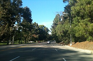
Cypress Park is a densely populated neighborhood of 10,000+ residents in Northeast Los Angeles, California. Surrounded by hills on three sides, it sits in the valley created by the Los Angeles River and the Arroyo Seco. It is the site of the Rio de Los Angeles State Park, the Los Angeles River Bike Path and other recreational facilities. It hosts one private and four public schools.

West Campus is a neighborhood in central Austin, Texas west of Guadalupe Street and its namesake, the University of Texas at Austin. Due to its proximity to the university, West Campus is heavily populated by college students. The area is known for its colorful residential buildings.

<span class="mw-page-title-main">Capitol View/Stifft's Station</span> United States historic place

Capitol View/Stifft's Station is a neighborhood of Little Rock, Arkansas, in the west-central portion of the city encompassing approximately 1500 homes. Roughly, its boundaries include the area south of West Markham, north of Interstate 630, east of Pine, and west of Summit, as well as south of Riverview between Park and Summit. Capitol View/Stifft's Station is just west of Downtown, north of the Central High School Historic District, southeast of Pulaski Heights and uses the 72205 ZIP code.

<span class="mw-page-title-main">Northeast Los Angeles</span> District in Los Angeles, California, United States

Northeast Los Angeles is a 17.18 sq mi (44.5 km2) region of Los Angeles County, comprising seven neighborhoods within the City of Los Angeles. The area is home to Occidental College located in Eagle Rock.

<span class="mw-page-title-main">Arroyo Seco, New Mexico</span> Census-designated place in New Mexico, United States

Arroyo Seco is a census-designated place in Taos County near Taos, New Mexico. Arroyo Seco's economy is based on tourism and services to residents of retirement and vacation homes.

North Shoal Creek is a neighborhood in north central Austin, Texas established in the 1960s.

Allandale, Austin, Texas is a neighborhood in North Central Austin, in the U.S. State of Texas known for its large lots, mature trees, and central location.

Sustainable Neighborhoods of North Central Austin is a civic organization based in the north central part of Austin, Texas. SN's mission is to ensure that redevelopment occurring on commercial arterials in North Central Austin is neighborhood-friendly.

Crestview, Austin, Texas is a neighborhood in north central Austin, in the U.S. state of Texas.

Galindo is a neighborhood in Austin, Texas. The area covers part of ZIP code 78704 in south Austin.

South River City is a community located in Austin, Texas. Also frequently called Travis Heights, the neighborhood is located south of the city's urban core, just below Lake Lady Bird in South Austin. The area encompasses a portion of ZIP code 78704.

East César Chávez is a neighborhood in Austin, Texas. It is located in the central-east part of Austin's urban core on the north bank of the Colorado River. The neighborhood encompasses much of ZIP code 78702.

Alice Parsons Millard was an American bookseller and promoter of culture in the Arroyo Seco region of Los Angeles County. She is widely known for commissioning Frank Lloyd Wright to build her house in Pasadena.

The Wall of Welcome is a 120-foot-long community public art mosaic located at 7100 Woodrow Avenue in the Crestview neighborhood of Austin, Texas. First envisioned by artist and Brentwood resident Jean Graham in 2002, the Wall reflects the community and documents some of the history of the Brentwood and Crestview neighborhoods. Fundraising for the wall began in 2003 with the first Violet Crown Festival. Jean and hundreds of neighbors worked together for five years to make the wall a reality; it was completed and dedicated in March 2008.

References

  1. 1 2 Bramlett, Eric. "Brentwood: An Austin Neighborhood". streetdirectory.com. Retrieved October 31, 2011.
  2. Duncan, John (December 16, 2008). "Brentwood Neighborhood ~ Pure Austin for 50+ Years". Trulia. Archived from the original on April 3, 2012. Retrieved October 31, 2011.
  3. U.S. Census Bureau, Census 2000 Summary File 3.
  4. Rojo, Gus (February 11, 2011). "Crestview/Brentwood: Central Austin at its Finest". West Campus Living. Archived from the original on April 25, 2012. Retrieved October 31, 2011.
  5. "Brentwood Trees". Austin American-Statesman. 18 February 1993. p. 96.
  6. "Brentwood Park History". Friends of Brentwood Park. Archived from the original on 2019-04-24. Retrieved October 31, 2011.

30°20′24″N97°43′51″W / 30.339917°N 97.730856°W / 30.339917; -97.730856