Kalyan-Dombivli is a twin city and it comes under Mumbai Metropolitan Region and it is a municipal corporation with its headquarters located in Kalyan in Thane district in the Indian state of Maharashtra. It was formed in 1982 to administer the twin townships of Kalyan and Dombivli. Kalyan has a history of over 700 years. Kalyan is also a major Railway Junction for the trains operating in Central Railway.

Katra is a city and Tehsil in the Reasi district of the Indian union territory of Jammu and Kashmir, situated at the foot of the Trikuta Mountains, where the shrine of Vaishno Devi is located. Katra is located 24 km from the town of Reasi, 42 km (26 mi) from the city of Jammu and around 685 km (426 mi) north of the national capital New Delhi and is the base for pilgrims visiting the Mata Vaishno Devi Temple.
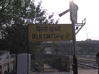
Delhi Cantonment is a Class I Cantonment Board established in 1914. The area of the Cantonment is 10,452 acres (42.30 km2) and the population of the Cantonment as per the 2011 census is 110,351.

Firozpur, also known as Ferozepur, is a city on the banks of the Sutlej River in Firozpur District, Punjab, India. After the partition of India in 1947, it became a border town on the India–Pakistan border with memorials to soldiers who died fighting for India.

Ghaziabad district is a largely suburban district of Uttar Pradesh state in northern India. It is also a core part of the National Capital Region. The city of Ghaziabad is the administrative headquarters of the district. This district is part of Meerut Division. It has become a major bedroom community for Delhi.
Kokrajhar is a town in the Bodoland Territorial Region, an autonomous territory in Assam, one of the North Eastern states of India.
Farrukhabad is a city in the Indian state of Uttar Pradesh. It is the administrative headquarters of the Farrukhabad tehsil. This city is on the banks of river Ganges is 295 kilometres (183 mi) from the national capital Delhi and 210 kilometres (130 mi) from the state capital Lucknow.
Firozpur district, also known as Ferozepur district, is one of the twenty-three districts in the state of Punjab, India. Firozpur district comprises an area of 2,190 km2 (850 sq mi).

Shimla district is one of the twelve districts of the state of Himachal Pradesh in northern India. Its headquarters is the state capital of Shimla. Neighbouring districts are Mandi and Kullu in the north, Kinnaur in the east, Uttarakhand in the southeast, Solan to the southwest and Sirmaur in the south. The elevation of the district ranges from 987 metres (3,238 ft) to 4,500 metres (14,764 ft).
Deoli is a census town in the South district of the state of Delhi, India.
Jharoda Majra Burari is a census town in North Delhi District in the National Capital Territory of Delhi, India. It is a municipal corporation in New Delhi. It is divided into three areas: Jharoda part 01, Jharoda part 02, and Jharoda part 03
Mustafabad is a census town in the North East district of Delhi, a union territory of India.
Nangloi Jat, popularly known as "Nangloi", is a locality in West district in the Union Territory of Delhi in India, surrounded by Paschim Vihar, Delhi Outer Ring road and Najafgarh.
Shahbad Daulatpur is a Village located in Rohini, North West District in Union Territory of Delhi, India.
Siras Pur village is a census town in North West district in the Indian state of Delhi.
Sultan Pur Majra is a census town in North West district in the Indian state of Delhi.

North Delhi is an administrative district of the National Capital Territory of Delhi in India. Alipur is the administrative headquarters of this district. North Delhi is bounded by the Yamuna River and the district of Central Delhi on the east and by the district of North West Delhi to the west.
North West Delhi is an administrative district of the National Capital Territory of Delhi in India.
West Delhi is one of the 11 administrative districts of the National Capital Territory of Delhi in India. Administratively, the district is divided into three subdivisions, Patel Nagar, Rajouri Garden and Punjabi Bagh.
Joida is a town located in the Uttara Kannada district in the Indian state of Karnataka. The town is the headquarters of the eponymous taluk. Earlier it was known as Supa taluka but as Supa village got submerged due to dam built across river Kali, Joida taluka came into existence. Joida town has a Post office, branch of nationalised banks and a Police station.
