
The Yorkshire Wolds are low hills in the counties of the East Riding of Yorkshire and North Yorkshire in north-eastern England. The name also applies to the district in which the hills lie.

Duggleby Howe is one of the largest round barrows in Britain, located on the southern side of the Great Wold Valley in the district of Ryedale, and is one of four such monuments in this area, known collectively as the Great barrows of East Yorkshire. Duggleby Howe is believed on the basis of artefacts recovered to be of Late Neolithic date, but no radiocarbon dates are available. Howe as a place name is believed to have originated from the Old Norse word haugr.

John Robert Mortimer was an English corn-merchant and archaeologist who lived in Driffield, East Riding of Yorkshire.
The Arras culture is an archaeological culture of the Middle Iron Age in East Yorkshire, England. It takes its name from the cemetery site of Arras, at Arras Farm, (53.86°N 0.59°W) near Market Weighton, which was discovered in the 19th century. The site spans three fields, bisected by the main east-west road between Market Weighton and Beverley, and is arable farmland; little to no remains are visible above ground. The extent of the Arras culture is loosely associated with the Parisi tribe of pre-Roman Britain.

Chariot burials are tombs in which the deceased was buried together with their chariot, usually including their horses and other possessions. An instance of a person being buried with their horse is called horse burial.

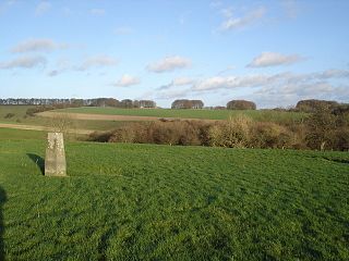
Burton Fleming is a village and civil parish in the East Riding of Yorkshire, England. It lies close to the border with North Yorkshire. The village is situated approximately 7 miles (11 km) north-west of Bridlington and 6 miles (10 km) south of Filey.

The Walkington Wold burials in the East Riding of Yorkshire, England, comprise the skeletal remains of 13 individuals from the Anglo-Saxon period which were discovered in the late 1960s, during the excavation of a Bronze Age barrow. Subsequent examinations have concluded that they were decapitated Anglo-Saxon criminals, and that the site is the most northerly of its kind known in England.
Ferrybridge Henge is a Neolithic henge near Ferrybridge, West Yorkshire. It is close to the A1 and M62 and Ferrybridge power station. Ferrybridge Henge is the furthest south of Yorkshire's henges, and is the only one in West Yorkshire. The site is of national importance and is protected from unauthorised change as a Scheduled Ancient Monument; despite this it is under threat from ploughing.
Farmana Khas or Daksh Khera is an archaeological site in Meham block of Rohtak district in northern Indian state of Haryana spread over 18.5 hectares. It is located near the village of Farmana Khas, about 15 kilometers from the Rohtak-Hissar highway and 60 kilometres from Delhi. It is significant particularly for its burial site, with 70 burials, of the Mature Harappan period (2500–2000 BC) and fairly recent addition to Indus Valley Civilisation sites excavated in India.
Burial in Early Anglo-Saxon England refers to the grave and burial customs followed by the Anglo-Saxons between the mid 5th and 11th centuries CE in Early Mediaeval England. The variation of the practice performed by the Anglo-Saxon peoples during this period, included the use of both cremation and inhumation. There is a commonality in the burial places between the rich and poor - their resting places sit alongside one another in shared cemeteries. Both of these forms of burial were typically accompanied by grave goods, which included food, jewelry, and weaponry. The actual burials themselves, whether of cremated or inhumed remains, were placed in a variety of sites, including in cemeteries, burial mounds or, more rarely, in ship burials.

The Street House Anglo-Saxon cemetery is an Anglo-Saxon burial ground, dating to the second half of the 7th century AD, that was discovered at Street House Farm near Loftus, in the unitary authority of Redcar and Cleveland, England. Monuments dating back as far as 3300 BC are located in the vicinity of the cemetery, which was discovered after aerial photography revealed the existence of an Iron Age rectangular enclosure. The excavations, carried out between 2005 and 2007, revealed over a hundred graves dating from the 7th century AD and the remains of several buildings. An array of jewellery and other artefacts was found, including the jewels once worn by a young high-status Anglo-Saxon woman who had been buried on a bed and covered by an earth mound.
Wetwang Slack is an Iron Age archaeological site containing remains of the Arras culture and chariot burial tradition of East Yorkshire. Archaeological investigation took place in 2001 and 2002.

Danes Graves is an archaeological site in the East Riding of Yorkshire. It forms part of the Arras Culture of inhumation and chariot burial prevalent in the region during the British Iron Age. It is a prehistoric cemetery site situated in Danesdale – a dry river valley with gravel and chalk deposits. The site is north of Driffield near the village of Kilham.

The Lilleberge Viking Burial or Lilleberge Ship Burial is a major hoard of Viking objects found in a barrow at Lilleberge in Namdalen, central Norway in the late nineteenth century. Since 1891, it has been an important part of the British Museum's early medieval collection.
The Kirkburn Burial is an Iron Age warrior burial dating from 250 BC–160 BC, discovered at Kirkburn, in the East Riding of Yorkshire, England. The burial was uncovered in an archaeological dig in 1987.
The Pocklington Iron Age burial ground is a prehistoric cemetery discovered in 2014 on the outskirts of Pocklington in the East Riding of Yorkshire, England. Excavations carried out on an ongoing basis since then, have uncovered more than 160 skeletons and more than 70 square barrows thought to date to the Middle Iron Age that are attributed to the Arras culture, an ancient British culture of East Yorkshire. A variety of grave goods have been found along with the human remains, including weapons, beads, pots, and a rare chariot burial.
Bodzia Cemetery is a large 10th – 11th century chamber burial site in Bodzia, a town in the Kuyavia region of Central Poland, approximately 15 km to the northwest of Włocławek. A group from the Polish Academy of Sciences, led by Polish archaeologist, Andrzej Buko, excavated this site between 2007 – 2009. The excavation uncovered a large elite necropolis containing more than 58 graves, cenotaphs, weapons and riches. The Bodzia Cemetery is considered to be one of the most significant and "spectacular" Early Medieval findings in Poland in the last century. Artefacts uncovered in the site were mostly of foreign origin, which is atypical of other sites in the area. Information gleaned from the Bodzia Cemetery provided archaeologists with evidence of burial practices during the Early Medieval period in Poland.
Rotherley Down Settlement is an archaeological site of the late Iron Age and Romano-British period on Cranborne Chase, England. It is about 1.5 miles (2.4 km) south of Berwick St John, and 1 mile (1.6 km) north of Tollard Royal, in Wiltshire, near the boundary with Dorset. It is a scheduled monument.

Pexton Moor is an archaeological site in North Yorkshire containing a prehistoric cemetery. It is located at the western edge of Dalby Forest, north of Thornton-le-Dale. It forms part of the Arras Culture of inhumation and chariot burial prevalent in the region during the British Iron Age.

Lovea is a modern village and archaeological site located in the Puok district of Siem Reap province, Cambodia. Lovea's circular mound measures 210 metres (690 ft) north–south and 312 metres (1,024 ft) east-west and is notable for its two circular embankments or moats that surround the mound, an unusual habitation pattern in this part of Cambodia. The site was first identified and described by French archaeologist Louis Malleret in the 1950s. More recent archaeological excavations have identified burials and residential occupation. The site dates from the second century BCE through the Angkor period to the present day.
