
Arsenal is a London Underground station located in Highbury, London. It is on the Piccadilly line, between Holloway Road and Finsbury Park stations, in Travelcard Zone 2. Originally known as Gillespie Road, it was renamed in 1932 after Arsenal Football Club, who at the time played at the nearby Highbury Stadium. It is the only tube station named directly after a football club. Although Highbury Stadium closed in 2006, the station retains its name and is still used by spectators attending matches at Arsenal's nearby Emirates Stadium.

King's Cross St Pancras is a London Underground station on Euston Road in the Borough of Camden, Central London. It serves King's Cross and St Pancras main line stations in fare zone 1, and is an interchange between six Underground lines. The station was one of the first to open on the network. As of 2021, it is the most used station on the network for passenger entrances and exits combined.

Acton Town is a London Underground station in the south-west corner of Acton, West London, in the London Borough of Ealing, close to the border with the London Borough of Hounslow. The station is served by the District and Piccadilly lines and is in Travelcard Zone 3. On the District line, it is between Chiswick Park and Ealing Common stations, and on the Piccadilly line it is between Hammersmith and Ealing Common on the Uxbridge branch & South Ealing on the Heathrow branch. Acton Town station was opened as Mill Hill Park on 1 July 1879 by the District Railway. It remained as a terminus until on 1 May 1883 and 23 June 1903 the DR opened two branches from Acton Town to Hounslow Town and Park Royal & Twyford Abbey respectively. On 4 July 1932 the Piccadilly line was extended to Acton Town. District line services to both the Hounslow and Uxbridge branches were withdrawn completely on 9 and 10 October 1964 after which operations were provided by the Piccadilly line alone.

Uxbridge is a London Underground station in Uxbridge in the London Borough of Hillingdon, West London. The station is the terminus of the Uxbridge branches of both the Metropolitan line and the Piccadilly line. The next station towards London is Hillingdon. The station is 15.5 miles (25 km) west of Charing Cross and is in Travelcard Zone 6. The closest station on the Chiltern Line and Central line is West Ruislip, accessible by the U1 and U10 buses. The closest station on the Elizabeth line is West Drayton, accessible by the U1, U3, U5 and 222 buses. Uxbridge was formerly the terminus of a branch of the District line which ran from Ealing Common; the Piccadilly line took over in 1933.

Rayners Lane is a London Underground station in the district of Rayners Lane in north west London, amid a 1930s development originally named Harrow Garden Village. The station is on the Uxbridge branch of both the Metropolitan line, between Eastcote and West Harrow stations, and the Piccadilly line, between Eastcote and South Harrow stations. The station is located to the west of the junction of Rayners Lane, Alexandra Avenue and Imperial Drive (A4090). It is in Travelcard Zone 5. Just east of the station, the Piccadilly and Metropolitan lines tracks join for services to Uxbridge and separate for those to Central London.
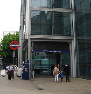
Euston Square is a London Underground station at the corner of Euston Road and Gower Street, just north of University College London – its main entrance faces the tower of University College Hospital. The multi-interchange Euston station is beyond Euston Square Gardens, which is one street east. The station is between Great Portland Street and King's Cross St Pancras on the Circle, Hammersmith & City and Metropolitan lines in Travelcard Zone 1.

Barons Court is a London Underground station in West Kensington in the London Borough of Hammersmith and Fulham, Greater London. This station serves the District line and the Piccadilly line. Barons Court is between West Kensington and Hammersmith on the District line, and between Earl's Court and Hammersmith on the Piccadilly line and is in Travelcard Zone 2. East of the station, the Piccadilly line descends into tunnel towards Earl's Court and the District line continues in a cutting to West Kensington. The station is the last open air stop for eastbound trains on the Piccadilly line until Arnos Grove and has cross-platform interchange with the District line.

Ruislip is a London Underground station in Ruislip in west London. The station is on the Uxbridge branch of both the Metropolitan line and Piccadilly line, between Ruislip Manor and Ickenham stations. The station is located on Station Approach. It is in Travelcard Zone 6. It is the oldest station on the Uxbridge branch and was originally the only intermediate station on the line between Uxbridge and Harrow-on-the-Hill.

Eastcote is a London Underground station in Eastcote in the west of Greater London. The station is on the Uxbridge branch of both the Metropolitan line and Piccadilly line, between Rayners Lane and Ruislip Manor stations. The station is located on Field End Road. It is in Travelcard Zone 5.

South Harrow is a London Underground station on the Uxbridge branch of the Piccadilly line. It is between Rayners Lane and Sudbury Hill stations. It is located on Northolt Road (A312). The station is in Travelcard Zone 5. There are several bus stands outside the station as well as overnight train stabling sidings.
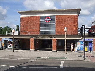
Sudbury Hill is a London Underground station on the Uxbridge branch of the Piccadilly line. The station is between Sudbury Town and South Harrow, and is in Travelcard Zone 4. It is located on Greenford Road (A4127) north of the junction with Whitton Avenue, on the border between the London Boroughs of Harrow and Ealing. The station is close to Sudbury Hill Harrow railway station.

Alperton is a London Underground station on the Uxbridge branch of the Piccadilly line. The station is between Sudbury Town and Park Royal, in Travelcard Zone 4. It is located on Ealing Road a short distance from the junction with Bridgewater Road (A4005) and is close to Alperton Bus Garage and the Paddington branch of the Grand Union Canal. The station was refurbished in 2006.

Ealing Common is a London Underground station on the Uxbridge branch of the Piccadilly line and on the Ealing Broadway branch of the District line. Eastbound, the next station is Acton Town; westbound, the next station is North Ealing on the Piccadilly line and Ealing Broadway on the District line. Here, the District and Piccadilly lines share the same pair of tracks through the station – the only other example where a deep level line and a sub surface line share the same pair of tracks is further up the Uxbridge branch, where the Piccadilly line shares tracks with the Metropolitan line from Rayners Lane to Uxbridge. It is the only station west of Acton Town to be served by both the Piccadilly and District lines.

Holloway Road is a station on the London Underground. It is on the Piccadilly line between Caledonian Road and Arsenal stations, and in Travelcard Zone 2. The station opened on 15 December 1906.
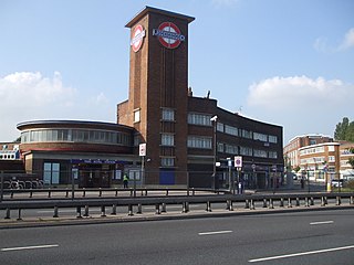
Park Royal is a station on the Piccadilly line of the London Underground. It is between North Ealing and Alperton and is in Travelcard Zone 3. It is situated on the south side of the east–west Western Avenue (A40), surrounded by residential Ealing and industrial Park Royal. There is a pedestrian subway under the A40 road near the station.

Ickenham is a London Underground station located in Ickenham in the London Borough of Hillingdon. The station is on the Uxbridge branch of both the Metropolitan line and Piccadilly line, between Ruislip and Hillingdon stations. It is in Travelcard Zone 6.
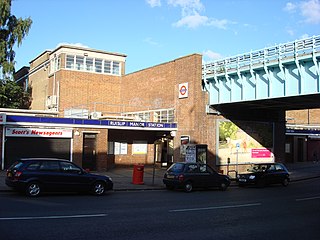
Ruislip Manor is a London Underground station in Ruislip Manor in west London. The station is on the Uxbridge branch of both the Metropolitan line and Piccadilly line, between Eastcote and Ruislip stations. The station is located on Victoria Road, where the line crosses on a bridge: there are two curved entrances, with access to the platforms being by stairways. It is in Travelcard Zone 6. The closest station on the Central line is Ruislip Gardens.
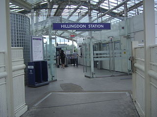
Hillingdon tube station is a London Underground station in North Hillingdon in the London Borough of Hillingdon, West London. Located between Uxbridge and Ickenham, it is in Travelcard Zone 6. It is the penultimate station on the Uxbridge branch of both the Metropolitan line and the Piccadilly line. Resited in 1992, it is also the most recently constructed station on the Metropolitan line.

Sudbury Town is a London Underground station on the Uxbridge branch of the Piccadilly line. The station is between Alperton and Sudbury Hill, and is in Travelcard Zone 4. It is located on the border between the London Boroughs of Brent and Ealing, with its main entrance on Station Approach in Sudbury. The forecourt of the station is known as Station Crescent. The station serves Sudbury, which forms the western part of Wembley.
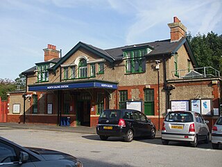
North Ealing is a London Underground station on the Uxbridge branch of the Piccadilly line between Ealing Common and Park Royal. The station is located on Station Road, a short distance from the junction of Queen's Drive and Hanger Lane. It is in Travelcard Zone 3. West Acton station on the Central line is located about 550 metres to the east at the other end of Queen's Drive.


