California, Maryland

Last updated

California, Maryland
CDP
2016-07-20 20 05 12 View northwest up the Patuxent River from the Governor Thomas Johnson Bridge (Maryland State Route 4) along the border of Solomons, Calvert County, Maryland and California, St. Mary's County, Maryland just before sunset.jpg
Patuxent River from the Governor Thomas Johnson Bridge
St. Mary's County Maryland Incorporated and Unincorporated areas California Highlighted.svg
Location of California, Maryland
Coordinates: 38°18′20″N76°29′40″W / 38.30556°N 76.49444°W / 38.30556; -76.49444
Country Flag of the United States.svg United States
State Flag of Maryland.svg  Maryland
County St. Mary's
Area
[1]
  Total14.98 sq mi (38.80 km2)
  Land12.87 sq mi (33.32 km2)
  Water2.11 sq mi (5.48 km2)
Elevation
105 ft (33 m)
Population
 (2020)
  Total12,947
  Density1,006.30/sq mi (388.53/km2)
Time zone UTC−5 (Eastern (EST))
  Summer (DST) UTC−4 (EDT)
ZIP code
20619
Area code(s) 301, 240
FIPS code 24-12150
GNIS feature ID0594621

California is a census-designated place and community in St. Mary's County, Maryland, United States. The population was 11,857 at the 2010 census, an increase of 27.4% from the 2000 census. [2] California has been growing with the spread of population from the older adjacent community of Lexington Park and the growth in both technology-related and defense-related jobs at the Patuxent River Naval Air Station. There are department stores and numerous shopping centers situated along Maryland Highway 235 ("Three Notch Road"). Maryland Route 4 crosses Highway 235 in California, providing access to the wide Governor Thomas Johnson Bridge and the popular weekend resort town of Solomons on its opposite side. Bridge-bound traffic is notorious for backing up during rush hour.

Contents

History

The community was named after the state of California before 1897. [3] The exact origins are unknown, however one story is that a family from the state moved to the area, using materials from their home state to build their new house, called the “California Farmstead.” Eventually, the name stuck. [4]

Geography

California is located at 38°18′20″N76°29′40″W / 38.305506°N 76.494517°W / 38.305506; -76.494517 . [5]

According to the United States Census Bureau, California has a total area of 14.8 square miles (38 km2), of which 12.8 square miles (33 km2) is land and 1.9 square miles (4.9 km2) (12.64%) is water.

Demographics

Historical population
CensusPop.Note
1980 5,770
1990 7,62632.2%
2000 9,30722.0%
2010 11,85727.4%
2020 12,9479.2%
source: [2] [6]

As of the census of 2010, there were 11,857 people residing in California in 4,327 households. The population density was 928.1 inhabitants per square mile (358.3/km2). There were 4,697 housing units and a 71.8% home ownership rate. The racial makeup was 70.7% White, 18.3% Black, 5.7% Hispanic or Latino, 4.6% Asian, 0.5% Indigenous American, and 0.1% Pacific Islander. [2]

Of the 4,327 households, 42.7% had children under the age of 18 living in them, 57.2% had married couples, 9.9% had a female householder with no husband present, and 29.4% were non-families. 25.4% of all households were made up of individuals, and 4.1% had someone living alone who was 65 years of age or older. The average household size was 2.74 and the average family size was 3.31. [7]

The population consisted of 29.8% under the age of 20, 6.6% from 20 to 24, 17.7% from 25 to 34, 17.3% from 35 to 44, 11.4% from 45 to 54, 10.5% from 55 to 64, and 6.5% who were 65 years of age or older. The median age was 32.5 years. The population was 49.1% male and 50.9% female. [8]

The median household income was $85,240 and the median family income was $91,935. Male full-time year-round workers had a median income of $63,657 versus $44,390 for females. The per capita income for the CDP was $35,386. Just 0.8% of families and 3.1% of people were below the poverty line, including 2.3% of people under age 18 and 4.8% of those age 65 or over. [9] In 2017, California, Maryland was listed as the metropolitan area with the fourth highest number of households with investable assets above one million dollars. [10] In 2019, Forbes Magazine listed California, Maryland as one of the best small places for business and careers in the nation with a ranking of 69. [11]

Related Research Articles

<span class="mw-page-title-main">Corona de Tucson, Arizona</span> CDP in Pima County, Arizona

Corona de Tucson is a census-designated place (CDP) in Pima County, Arizona, United States. The population was 9,240 at the 2020 census, an increase of 1036% from the 2000 population of 813.

<span class="mw-page-title-main">Mayflower Village, California</span> Census-designated place in California, United States

Mayflower Village is a census-designated place (CDP) in the San Gabriel Valley, in Los Angeles County, California, United States. The population was 5,515 at the 2010 census, up from 5,081 at the 2000 census. The ZIP Codes serving the community are 91006, which is served by Arcadia and 91016, which is served by Monrovia.

<span class="mw-page-title-main">South San Gabriel, California</span> Census-designated place in California, United States

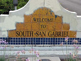
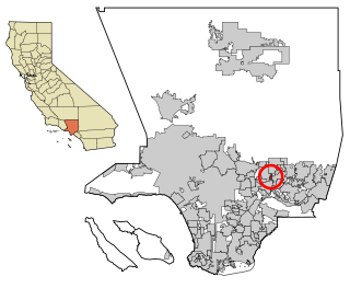
South San Gabriel is a census-designated place (CDP) in Los Angeles County, California, United States. The population was 8,070 at the 2010 census, up from 7,595 at the 2000 census.

<span class="mw-page-title-main">Mayo, Maryland</span> Census-designated place in Maryland, United States

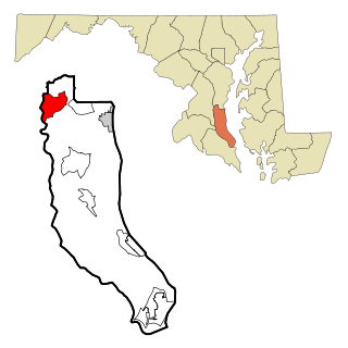
Mayo is a census-designated place (CDP) in Anne Arundel County, Maryland, United States. The population was 8,298 in the 2010 census. The Mayo CDP of 2010 includes all of the area that used to be counted as the Selby-on-the-Bay CDP. The beach in Mayo used to be a popular weekend resort.

<span class="mw-page-title-main">Parole, Maryland</span> Census-designated place in Maryland, United States

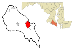
Parole, a suburb of Annapolis, is a census-designated place (CDP) in Anne Arundel County, Maryland, United States. The population was 15,922 at the 2010 census. It has several major roads intersect at the western edge of the state capital, Annapolis, and it contains the Annapolis Mall, a number of other large shopping centers, and the Anne Arundel Medical Center. It is generally considered to be part of Annapolis, rather than a separate town. The neighborhood was named because it was a parole camp, where Union and Confederate prisoners of war were brought for mutual exchange and eventual return to their respective homes.

<span class="mw-page-title-main">Shady Side, Maryland</span> Census-designated place in Maryland, United States

Shady Side is a census-designated place (CDP) in Anne Arundel County, Maryland, United States. The population was 5,803 at the 2010 census.

<span class="mw-page-title-main">Dunkirk, Maryland</span> Census-designated place in Maryland, United States

Dunkirk is a census-designated place (CDP) in Calvert County, Maryland, United States. The population was 2,521 at the 2010 census.

<span class="mw-page-title-main">Algonquin, Maryland</span> Census-designated place in Maryland, United States

Algonquin is a census-designated place (CDP) in Dorchester County, Maryland, United States. The population was 1,241 at the 2010 census. The community was named for the Algonquin people, one of the Native American tribes in the East.

<span class="mw-page-title-main">Potomac, Maryland</span> Census-designated place in Maryland, United States

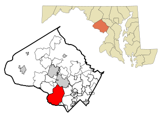
Potomac is an unincorporated community and census-designated place (CDP) in Montgomery County, Maryland. As of the 2020 census, it had a population of 47,018. It is named after the nearby Potomac River.

<span class="mw-page-title-main">East Riverdale, Maryland</span> Census-designated place in Maryland

East Riverdale is an unincorporated area and census-designated place (CDP) in Prince George's County, Maryland, United States. The population was 18,459 at the 2020 census.

<span class="mw-page-title-main">Rosaryville, Maryland</span> Census-designated place in Maryland, US

Rosaryville is an unincorporated area and census-designated place (CDP) in Prince George's County, Maryland, United States, located south of Cinton and Upper Marlboro beside U.S. Route 301. Per the 2020 census, the population was 11,548. including housing developments and rural open space. It was named for a local Roman Catholic church. Close to Rosaryville are the Marlton housing development, Maryland Veterans Cemetery, the Southern Maryland Farmers Market, and Rosaryville State Park.

<span class="mw-page-title-main">South Laurel, Maryland</span> Census-designated place in Maryland

South Laurel is an unincorporated area and census-designated place (CDP) in Prince George's County, Maryland, United States. Per the 2020 census, the population was 29,602.

<span class="mw-page-title-main">Springdale, Maryland</span> Census-designated place in Maryland

Springdale is an unincorporated area and census-designated place (CDP) in Prince George's County, Maryland, United States. Per the 2020 census, the population was 5,301.

<span class="mw-page-title-main">Woodlawn, Prince George's County, Maryland</span> Census-designated place in Maryland

Woodlawn is an unincorporated area and census-designated place (CDP) in Prince George's County, Maryland, United States. As of the 2020 census it had a population of 7,541.

<span class="mw-page-title-main">Eden, Maryland</span> CDP in Maryland, United States

Eden is a census-designated place (CDP) in Somerset County, Maryland, United States. The Eden zip code (21822) also includes parts of Wicomico and Worcester counties. The population was 793 at the 2000 census. It is included in the Salisbury, Maryland-Delaware Metropolitan Statistical Area.

<span class="mw-page-title-main">Fairmount, Maryland</span> CDP in Maryland, United States

Fairmount is a census-designated place (CDP) in Somerset County, Maryland, United States. The population was 537 at the 2000 census. It is included in the Salisbury, Maryland-Delaware Metropolitan Statistical Area.

<span class="mw-page-title-main">Mount Vernon, Maryland</span> CDP in Maryland, United States

Mount Vernon is a census-designated place (CDP) in Somerset County, Maryland, United States. The population was 761 at the 2000 census. It is included in the Salisbury, Maryland-Delaware Metropolitan Statistical Area.

<span class="mw-page-title-main">Girdletree, Maryland</span> CDP in Maryland, United States

Girdletree is a census-designated place in Worcester County, Maryland, United States. The population was 149 at the 2010 census. It is part of the Salisbury, Maryland-Delaware Metropolitan Statistical Area.

<span class="mw-page-title-main">Carnot-Moon, Pennsylvania</span> Census-designated place in Pennsylvania, United States

Carnot-Moon is a census-designated place (CDP) in central Moon Township, Allegheny County, Pennsylvania, United States. The population was 13,151 at the 2020 census.

<span class="mw-page-title-main">West Springfield, Virginia</span> Census-designated place in Virginia, United States

West Springfield is a census-designated place (CDP) in Fairfax County, Virginia, United States. The population was 23,369 at the 2020 census.

References

  1. "2020 U.S. Gazetteer Files". United States Census Bureau. Retrieved April 26, 2022.
  2. 1 2 3 "California CDP, Maryland". State and County Quick Facts. U.S. Census Bureau. Archived from the original on June 20, 2012. Retrieved May 9, 2012.
  3. "Towns named after states". Reading Eagle. July 2, 1897. p. 3. Retrieved October 14, 2015.
  4. Shoemaker, Sandy. "Tobacco to Tomcats: St. Mary's County since the Revolution". StreamLine Enterprises, Leonardtown, Maryland: 160. Archived from the original on December 10, 2008. Retrieved January 1, 2008.{{cite journal}}: Cite journal requires |journal= (help)
  5. "US Gazetteer files: 2010, 2000, and 1990". United States Census Bureau. February 12, 2011. Retrieved April 23, 2011.
  6. "CENSUS OF POPULATION AND HOUSING (1790-2000)". U.S. Census Bureau. Archived from the original on July 8, 2010. Retrieved July 17, 2010.
  7. "California CDP, Maryland Quicklinks - Social Characteristics". State and County Quick Facts. U.S. Census Bureau. Archived from the original on February 21, 2012. Retrieved May 9, 2012.
  8. "California CDP, Maryland Quicklinks - Demographic Characteristics". State and County Quick Facts. U.S. Census Bureau. Archived from the original on February 21, 2012. Retrieved May 9, 2012.
  9. "California CDP, Maryland Quicklinks - Economic Characteristics". State and County Quick Facts. U.S. Census Bureau. Archived from the original on February 21, 2012. Retrieved May 9, 2012.
  10. "Do You Live Among Millionaires?". Wall Street Journal. Retrieved February 9, 2018.
  11. "The Best Small Places For Business And Careers". Forbes Magazine. Retrieved February 6, 2020.