
In navigation, a rhumb line, rhumb, or loxodrome is an arc crossing all meridians of longitude at the same angle, that is, a path with constant bearing as measured relative to true north.

A compass rose, sometimes called a wind rose, rose of the winds or compass star, is a figure on a compass, map, nautical chart, or monument used to display the orientation of the cardinal directions and their intermediate points. It is also the term for the graduated markings found on the traditional magnetic compass. Today, a form of compass rose is found on, or featured in, almost all navigation systems, including nautical charts, non-directional beacons (NDB), VHF omnidirectional range (VOR) systems, global-positioning systems (GPS), and similar equipment.

A mappa mundi is any medieval European map of the world. Such maps range in size and complexity from simple schematic maps 25 millimetres or less across to elaborate wall maps, the largest of which to survive to modern times, the Ebstorf map, was around 3.5 m in diameter. The term derives from the Medieval Latin words mappa and mundus (world).

A world map is a map of most or all of the surface of Earth. World maps, because of their scale, must deal with the problem of projection. Maps rendered in two dimensions by necessity distort the display of the three-dimensional surface of the earth. While this is true of any map, these distortions reach extremes in a world map. Many techniques have been developed to present world maps that address diverse technical and aesthetic goals.

The Cantino planisphere or Cantino world map is a manuscript Portuguese world map preserved at the Biblioteca Estense in Modena, Italy. It is named after Alberto Cantino, an agent for the Duke of Ferrara, who successfully smuggled it from Portugal to Italy in 1502. It measures 220 x 105 cm.
The earliest known world maps date to classical antiquity, the oldest examples of the 6th to 5th centuries BCE still based on the flat Earth paradigm. World maps assuming a spherical Earth first appear in the Hellenistic period. The developments of Greek geography during this time, notably by Eratosthenes and Posidonius culminated in the Roman era, with Ptolemy's world map, which would remain authoritative throughout the Middle Ages. Since Ptolemy, knowledge of the approximate size of the Earth allowed cartographers to estimate the extent of their geographical knowledge, and to indicate parts of the planet known to exist but not yet explored as terra incognita.
Angelino Dulcert, probably the same person known as Angelino de Dalorto, and whose real name was probably Angelino de Dulceto or Dulceti or possibly Angelí Dolcet, was an Italian-Majorcan cartographer.

Abraham Cresques, whose real name was Cresques (son of) Abraham, was a 14th-century Jewish cartographer from Palma, Majorca. In collaboration with his son, Jehuda Cresques, Cresques is credited with the authorship of the celebrated Catalan Atlas of 1375.

Portolan charts are nautical charts, first made in the 13th century in the Mediterranean basin and later expanded to include other regions. The word portolan comes from the Italian portulano, meaning "related to ports or harbors", and which since at least the 17th century designates "a collection of sailing directions".

"Majorcan cartographic school" is the term coined by historians to refer to the collection of predominantly Jewish cartographers, cosmographers and navigational instrument-makers and some Christian associates that flourished in Majorca in the 13th, 14th and 15th centuries until the expulsion of the Jews. The label is usually inclusive of those who worked in Catalonia. The Majorcan school is frequently contrasted with the contemporary Italian cartography school.

Pietro Vesconte was a Genoese cartographer and geographer. A pioneer of the field of the portolan chart, he influenced Italian and Catalan mapmaking throughout the fourteenth and fifteenth centuries. He appears to have been the first professional mapmaker to sign and date his works regularly.
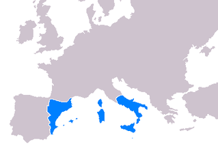
Cartography throughout the 14th-16th centuries played a significant role in the expansion of the kingdoms of the Iberian Peninsula for a multitude of reasons. Primarily, the maps developed during this period served as navigational tools for maritime folk such as explorers, sailors and navigators. Mostly the expansion of the Crown of Aragon (which included the Kingdom of Aragon, Kingdom of Valencia and Kingdom of Majorca, together with the Principality of Catalonia, all its territories with seashore on the Mediterranean Sea. The Crown of Aragon controlled the routes across the Mediterranean Sea from the Kingdom of Jerusalem to Europe, as part of the commercial-trade route known as the Silk Road.

Guillem Soler, sometimes given as Guillelmus Soleri, Guillermo Soler and Guglielmo Soleri, was a Majorcan cartographer of the 14th century.

The Mercator world map of 1569 is titled Nova et Aucta Orbis Terrae Descriptio ad Usum Navigantium Emendate Accommodata. The title shows that Gerardus Mercator aimed to present contemporary knowledge of the geography of the world and at the same time 'correct' the chart to be more useful to sailors. This 'correction', whereby constant bearing sailing courses on the sphere are mapped to straight lines on the plane map, characterizes the Mercator projection. While the map's geography has been superseded by modern knowledge, its projection proved to be one of the most significant advances in the history of cartography, inspiring map historian Nordenskiöld to write "The master of Rupelmonde stands unsurpassed in the history of cartography since the time of Ptolemy." The projection heralded a new era in the evolution of navigation maps and charts and it is still their basis.

A rhumbline network, more properly called, a windrose network, or sometimes also called harbour-finding chart, compass chart, or rhumb chart, is a navigational aid drawn on early portolan charts dating from the medieval to early modern period. This network is like a web forming a grid on the map.
Loxodromic navigation is a method of navigation by following a rhumb line, a curve on the surface of the Earth that follows the same angle at the intersection with each meridian. This serves to maintain a steady course in sailing.

La Cartografía Mallorquina is a book of essays on the Majorcan portolans written by Professor Julio Rey Pastor with the collaboration of Ernesto García Camarero. It is a scholarly essay, a key element in the study of portolans, especially those made by Majorcans as half of the book is devoted to the study of more than 400 Majorcan portolans existing worldwide.

Salvatore de Pilestrina, also known as Salvat de Pilestrina, was a mapmaker in Mallorca in the early 16th century.

A graticule, on a map, is a graphical depiction of a coordinate system as a grid of lines, each line representing a constant coordinate value. It is thus a form of isoline, and is commonly found on maps of many kinds at scales from the local to global.
