Causeway Bay

Last updated

Location

The busy Yee Wo Street crossing HongKongCitizens.jpg
The busy Yee Wo Street crossing
View from Kowloon peninsula Causeway Bay View from ICC 201105.jpg
View from Kowloon peninsula
View from Fortress Hill along with Wan Chai Wan Chai from Fortress.jpg
View from Fortress Hill along with Wan Chai

Causeway Bay is located at the eastern end of the Wanchai District and the western end of the Eastern District. Causeway Bay includes Tsing Fung Street, Causeway Bay Market, the Victoria Park, the Royal Hong Kong Yacht Club, Oil Street, Jardine's Noonday Gun, the Police Officers Club, the Queen's College and the Hong Kong Central Library. Traditionally, Causeway Bay refers to the area near today's Tin Hau Station, but Causeway Bay now comprises the area south of Victoria Harbour, with Oil Street as the eastern boundary, Tung Lo Wan Road and Leighton Road as the southern border, and Canal Road Flyover as the western boundary. However, Causeway Bay is often considered as solely[ citation needed ] including the area surrounding Causeway Bay Station, the area traditionally known as East Point.

Since 1982, two electoral constituencies of Causeway Bay (Causeway Bay North and Causeway Bay South) had been grouped into the Eastern District of district board elections, whilst Causeway Bay Central was grouped with the Wan Chai District to the west. However, local government decisions—other than electoral demarcations—still affect the region as a whole. Since 1994, the area has further been subdivided in Hong Kong district board elections into smaller constituencies. The northern sector consists of the area around Victoria Park, the middle sector coincides with the central business district, and the southern sector forms the area around Tin Hau.

To cope with population change, the constituency boundary between Wan Chai District and Eastern District was changed on the new year's day of 2016 (effective on voting in 2015 Hong Kong local elections). [2] [3] As a result, the Victoria Park and Tin Hau constituencies became a part of Wan Chai District starting from that day. As a consequence, a larger proportion of Causeway Bay is now part of Wan Chai District; [4] whereas the easternmost parts of the area, such as Oil Street, and the western side of Tin Hau Temple Road, remain in the Eastern District. [5]

Town planning is managed by the Causeway Bay Outline Zoning Plan, [6] which is not related to the electoral boundaries as drawn by the Electoral Affairs Commission. [4] The OZP also covers the other neighbourhoods of Tai Hang and So Kon Po. [6] The OZP, however, does not manage Victoria Park, which was reclaimed from the Causeway Bay/Tung Lo Wan body of water, nor Tin Hau, [6] which is historically part of Tung Lo Wan. Tung Lo Wan is the Cantonese name that collectively refers to the waters and lands around the bay.

Causeway Bay Market and Causeway Bay Fire Station are in fact located in Tin Hau, and are outside the jurisdiction of the OZP, but in terms of the electoral constituency, the market, the fire station, and Victoria Park are located within the Victoria Park constituency. Added to this confusion, Wan Chai Fire Station is located in the Canal Road constituency but some non-government sources consider it as part of the Causeway Bay area. [7] The Wan Chai Fire Station is not part of Causeway Bay OZP. [6]

History

Causeway Bay
Tin Hau 2018.jpg
High-density buildings in Causeway Bay and Victoria Park
View of Causeway Bay, 1846 1846ViewFromCausewayBayOfJardinesBuilding.jpg
View of Causeway Bay, 1846
Causeway Bay during the 2014 Hong Kong protests Causeway Bay sit-in.JPG
Causeway Bay during the 2014 Hong Kong protests

The typhoon shelter of Causeway Bay and the Tin Hau Temple reveal that the area was once a fishing town. Before urban development and massive land reclamation, Causeway Bay was a heavily silted bay. Its former shape can be found on maps by tracing Tung Lo Wan Road, which goes along the former bay. In the early stage of development, a causeway was built, which is the present-day Causeway Road. In the 1950s, the coastline was further pushed forward when the remains of the bay were reclaimed for the Victoria Park, when the statue of Queen Victoria was brought back from Japan. The statue had been taken away during the Second World War from Statue Square at Chater Road, Central. Kellett Island off the coast of Causeway Bay has been connected to the Hong Kong Island by a breakwater as a result of the land reclamation.

Causeway Bay's history as a shopping district dates back to 1960, when Daimaru, a Japanese style department store opened in Great George Street. By the 1970s, Causeway Bay has developed into Hong Kong's main shopping district. A number of other Japanese style department stores, including Matsuzakaya, Mitsukoshi and Sogo, opened in the 1970s and 1980s, giving Causeway Bay the nickname of "little Ginza". In the 1990s, several major shopping centres were constructed, strengthening Causeway Bay's status as one of the major shopping districts in Hong Kong.

The original[ citation needed ] Causeway Bay proper around the bay is actually the area now known as Tin Hau, near the present-day Tin Hau MTR station and the Causeway Bay Tin Hau Temple, whereas the Causeway Bay MTR station is at the area historically called East Point.

The present-day usage of the name Causeway Bay is usually confused with East Point, an area named after a spit on the coastline, eastern end of formerly Victoria City. The names of Yee Wo Street, Jardine's Bazaar, and Jardine's Crescent reveal that the land in this area was sold by the British colonial government to Jardines in the early 19th century.

Another area often mistaken as Causeway Bay is Bowrington area or in Cantonese Ngo Keng (鵝頸) (now part of Canal Road electoral constituency), literally "goose's neck", where is known for villain hitting activity, a voodoo-like tradition of Hong Kong.

Features

Causeway Bay or East Point is one of Hong Kong's major shopping districts. It includes the 13-storey Japanese-style department store Sogo, as well as shopping centres such as Times Square and Hysan Place. There are also smaller malls such as World Trade Centre, Windsor House, Hang Lung Centre, Fashion Island (formerly Daimaru), Fashion Walk, Lee Garden One and Lee Garden Two. Causeway Bay is one of the most crowded and central areas in Hong Kong. The area contains many trendy shops carrying both locally made and imported fashion and products from around the world. As such, it is a popular social spot for young people. Many shops are open until after midnight.

Notable hotels in Causeway Bay include Park Lane Hotel and Regal Hong Kong Hotel. Several boutique hotels have opened recently, including Mira Moon Hotel on Jaffe Road.

For years, Jardine Matheson has fired a cannon shot at noon every day in Causeway Bay, by Victoria Harbour, slightly eastward of the former Kellett Island. The gunshots have served as time signals for many generations of old inhabitants of Hong Kong. This tradition still continues today. This is the "Noonday Gun" mentioned in the Noël Coward song "Mad Dogs and Englishmen".

Although the names of certain landmarks in the western part of Causeway Bay start with "Wan Chai" (e.g. Wan Chai Fire Station), the landmarks are across the local customary limit[ citation needed ] of Wan Chai on Canal Road.

Places in Causeway Bay

Statue of Queen Victoria in Victoria Park Victoria Park.JPG
Statue of Queen Victoria in Victoria Park

Leisure and cultural

Shopping

Transport

Causeway Bay at night, at Kingston Street Causeway Bay at Night.JPG
Causeway Bay at night, at Kingston Street

Main roads and notable steeets

Causeway Bay station MTR Hong Kong station Causeway Bay.JPG
Causeway Bay station

Public transport

For the MTR, it is connected by the Island line: Tin Hau and Causeway Bay stations. Both Tram and bus services serve Causeway Bay, connecting it to most other major parts of Hong Kong. Causeway Bay is located at the entrance of Cross-Harbour Tunnel and Aberdeen Tunnel, providing convenient access to Kowloon and Southern District.

Education

Causeway Bay is in Primary One Admission (POA) School Net 12. Within the school net are multiple aided schools (operated independently but funded with government money) and the following government schools: Hennessy Road Government Primary School and Sir Ellis Kadoorie (Sookunpo) Primary School. [8]

Notable people

See also

Notes

  1. There is a separate location named "Tung Lo Wan" in the Sha Tin District in eastern New Territories. However, Causeway Bay has been named by the government not long after its colonisation, and hence the official English name of the place has always been "Causeway Bay" instead of "Tung Lo Wan". Of note is that two streets named after the area, Tung Lo Wan Road and Tung Lo Wan Drive, use romanised names, resulting in names partially identical to Sha Tin's Tung Lo Wan.

Related Research Articles

<span class="mw-page-title-main">Wan Chai District</span> District of Hong Kong

Wan Chai District is one of the 18 districts of Hong Kong. Of the four on Hong Kong Island, it is north-central, and had 166,695 residents in 2021, an increase from 152,608 residents in 2011. The district has the second-highest educationally qualified residents with the highest-bracket incomes, the second-lowest population and the third-oldest quotient. It is a relatively affluent district, with one in five persons having liquid assets of more than HKD 1 million.

<span class="mw-page-title-main">Wan Chai</span> Area of Hong Kong Island

Wan Chai is situated at the western part of Wan Chai District on the northern shore of Hong Kong Island, in Hong Kong. Its other boundaries are Canal Road to the east, Arsenal Street to the west and Bowen Road to the south. The area north of Gloucester Road is often referred to as Wan Chai North.

<span class="mw-page-title-main">Hong Kong Island</span> Second largest island in Hong Kong

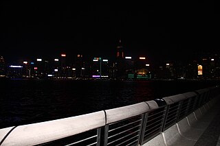
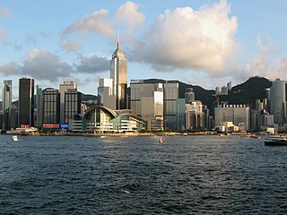
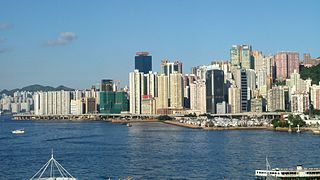
Hong Kong Island is an island in the southern part of Hong Kong. The island, known originally and on road signs simply as "Hong Kong", had a population of 1,289,500 and a population density of 16,390 per square kilometre (42,400/sq mi), as of 2008. The island had a population of about 3,000 inhabitants scattered in a dozen fishing villages when it was occupied by the United Kingdom in the First Opium War (1839–1842). In 1842, the island was formally ceded in perpetuity to the UK under the Treaty of Nanking and the City of Victoria was then established on the island by the British Force in honour of Queen Victoria. The Central area on the island is the historical, political and economic centre of Hong Kong. The northern coast of the island forms the southern shore of the Victoria Harbour, which is largely responsible for the development of Hong Kong due to its deep waters favoured by large trade ships.

<span class="mw-page-title-main">Stanley, Hong Kong</span> Town in Hong Kong

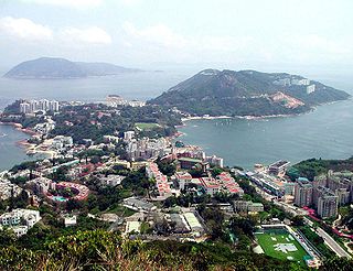
Stanley, or Chek Chue, is a coastal town and a popular tourist attraction in Hong Kong. It is located on a peninsula on Hong Kong Island. It is east of Repulse Bay and west of Shek O, adjacent to Chung Hom Kok and Tai Tam. Administratively, it is part of the Southern District.

Hong Kong counts approximately 600 temples, shrines and monasteries. While Buddhism and Christianity are the most widely practiced religions, most religions are represented in the Special Administrative Region.

<span class="mw-page-title-main">Shau Kei Wan</span>

Shau Kei Wan or Shaukiwan is a neighborhood in the Eastern District of Hong Kong Island. The area is bordered by Chai Wan to the east, Mount Parker to the south, Sai Wan Ho to the west, and Victoria Harbour to the north.

<span class="mw-page-title-main">East Point, Hong Kong</span>

East Point was a spit on the northern shore of Hong Kong Island, Hong Kong. It extended from East Point Hill, i.e. Lee Garden towards Kellett Island and marked the eastern limits of the early City of Victoria. The piece of land separated Causeway Bay in the east and Wong Nai Chung in the west. Streams and muds from Tai Hang and Wong Nai Chung shaped the spit.

<span class="mw-page-title-main">Causeway Bay station</span> MTR station on Hong Kong Island

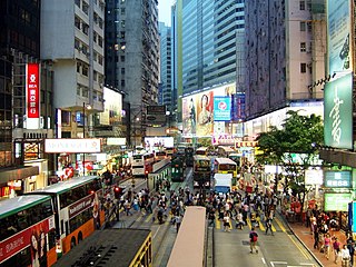
Causeway Bay is an underground metro station on the MTR network in Hong Kong. It is located between Wan Chai and Tin Hau stations on the Island line, and sits underneath Great George Street near Hennessy Road and Yee Wo Street. Named for the Causeway Bay area and its abundant shopping centres, the station serves various malls including Hysan Place, Sino Plaza, Sogo, and the nearby Victoria Park.

<span class="mw-page-title-main">Tamar station</span> Proposed MTR interchange station on Hong Kong Island

Tamar is a station on MTR's shelved North Island line (NIL) proposal on the north shore of Hong Kong Island. It will be located on the former site of HMS Tamar on Hong Kong Island, Hong Kong. Tamar station will be the eastern terminus of the Tung Chung line and the western terminus of the Tseung Kwan O line. It will also act as a transfer station between the two lines.

<span class="mw-page-title-main">Gloucester Road, Hong Kong</span> Major highway in Hong Kong

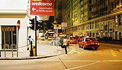
Gloucester Road is a major highway in Hong Kong. It is one of the few major roads in Hong Kong with service roads. It was named on 14 June 1929 after Prince Henry, Duke of Gloucester, to commemorate his visit to Hong Kong that year. The road is 2.2 kilometres in length and has a speed limit of 70 km/h.

<span class="mw-page-title-main">Braemar Hill</span> Hill on Hong Kong Island, Hong Kong

Braemar Hill is a hill with a height of 200 metres (660 ft) south of Braemar Point on Hong Kong Island, Hong Kong. The hill was likely named after the Scottish village of Braemar by British officials.

<span class="mw-page-title-main">Causeway Road</span> Road in Hong Kong

Causeway Road is a main road in Hong Kong. Situated in Causeway Bay, it joins Yee Wo Street in the west and King's Road. It is a boundary of Eastern District and Wan Chai District. North side of the road is Victoria Park in Eastern District while in the Wan Chai District in the south are Queen's College and Hong Kong Central Library.

<span class="mw-page-title-main">Tin Hau, Hong Kong</span>

Tin Hau is an area in Wan Chai District, on the north side of Hong Kong Island, in Hong Kong.

Articles related to Hong Kong include:

<span class="mw-page-title-main">Tin Hau temples in Hong Kong</span>

Tin Hau temples in Hong Kong are dedicated to Tin Hau (Mazu). Over 100 temples are dedicated to Tin Hau in Hong Kong. A list of these temples can be found below.

<span class="mw-page-title-main">Tin Hau Temple, Causeway Bay</span>

The Tin Hau Temple in Causeway Bay is one of the Tin Hau temples in Hong Kong. It is located at 10 Tin Hau Temple Road, Causeway Bay, east of Victoria Park, in Eastern District, on Hong Kong Island. The temple has given its name to the MTR station serving it, and consequently the neighboring area of Tin Hau.

<span class="mw-page-title-main">Metropark Hotel Causeway Bay Hong Kong</span> Building in Causeway Bay, Hong Kong

Metropark Hotel Causeway Bay Hong Kong was a four-star Hotel in Causeway Bay, Wan Chai District, Hong Kong. It was located on 148 Tung Lo Wan Road. The hotel was close to Tin Hau station with 33 floors and 266 rooms. The hotel opened in 2002 and was owned by China Travel Service.

References

  1. Straus, Karsten. "Hong Kong Beats New York For Chic Shopping ", Forbes, 21 November 2013.
  2. Hansard - Official Record of Proceedings, Wednesday, 22 January 2014, The Legislative Council
  3. District Councils Ordinance (Amendment of Schedules 1 and 3) Order 2013
  4. 1 2 https://www.eac.hk/pdf/distco/2015dc/final/dc2015b.pdf [ bare URL PDF ]
  5. "Eastern District Map" (PDF). Archived (PDF) from the original on 21 February 2020. Retrieved 3 February 2021.
  6. 1 2 3 4 "Statutory Planning Portal 2 (SPK)".
  7. 銅鑼灣. 2015香港大地圖:香港篇. 萬里地圖製作中心. 2015.
  8. "POA School Net 12" (PDF). Education Bureau . Retrieved 12 September 2022.

22°16′50″N114°10′51″E / 22.28066°N 114.18096°E / 22.28066; 114.18096