Centinela Adobe

Last updated
Centinela Adobe
Centinela Adobe, Los Angeles.JPG
The Centinela Adobe
Location7634 Midfield Ave
Westchester, California
Coordinates 33°58′03″N118°22′20″W / 33.96758°N 118.37226°W / 33.96758; -118.37226
Built1834
ArchitectYgnacio Machado
Architectural style Spanish Colonial-Adobe
NRHP reference No. 74000522
Added to NRHPMay 2, 1974

The Centinela Adobe, also known as La Casa de la Centinela, is a Spanish Colonial style adobe house built in 1834. It is operated as a house museum by the Historical Society of Centinela Valley, and it is one of the 43 surviving adobes within Los Angeles County, California. The Adobe was the seat of the 25,000-acre (100 km2) Rancho Aguaje de la Centinela, a Mexican Alta California-era land grant partitioned from the Spanish Las Californias era Rancho Sausal Redondo centered around the Centinela Springs.

Contents

The Centinela Adobe, which is the Centinela Valley's oldest residence, was built by Ygnacio Machado in 1834. Since then, farmers, ranchers, a Scotsman, and Inglewood's founding father, Daniel Freeman, have lived in the structure. [1] It is the oldest building in the area and has been called the "Birthplace of Inglewood".

History of the Ranchos and Centinela Adobe

Antonio Ygnacio Avila

In 1822, after the Mexican War of Independence brought freedom for Mexico from Spain, Antonio Ygnacio Avila received a Mexican land grant for Rancho Sausal Redondo in Alta California, where he grazed cattle. The rancho's lands encompass the present day cities of Redondo Beach, Inglewood, Hawthorne, El Segundo, Lawndale, Manhattan Beach, and Hermosa Beach.

Ygnacio Machado - Rancho Aguaje de la Centinela

Front porch of the adobe Centinela Adobe, Front Porch.JPG
Front porch of the adobe

In the early 1830s, Ygnacio Machado, son of one of the "leather jacket soldiers" who escorted the original settlers of Los Angeles, began cultivating a portion of the rancho. Ygnacio Machado's brother Augustin Machado owned the nearby 14,000-acre (57 km2) Rancho La Ballona, as well as the Rancho La Laguna and Rancho Santa Rosa. Ygnacio Machado became the grantee of a portion of Rancho Sausal Redondo, the 2,220 acres (9.0 km2) Rancho Aguaje de la Centinela and built the 'Centinela Adobe' in 1834 “of adobe brick upon foundation of field stones. Subsequent additions were built of wood frame with vertical wood sheathing…the original roof has been replaced with wood shingles.” [2] Ygnacio Machado owned Rancho Aguaje de la Centinela only briefly, trading it in 1844 for a keg of whiskey and a small home in the Pueblo de Los Angeles. [3] [4]

Robert Burnett

The rancho changed hands several times in the 1850s, including a sale in 1859 for $930. [5] Joseph Lancaster Brent bought the rancho the same year for $3,000, but when the American Civil War commenced in 1860, Brent returned to his home in the Southern states, where he served in the Confederate Army. [5] Scotsman Robert Burnett purchased the rancho from Brent for $3,000 in 1860. [5] Burnett added to the ranch, acquiring old Rancho Sausal Redondo for $29,500. [5] By 1872, Burnett had a 25,000-acre (100 km2) ranch that encompassed all of the land from what is now known as Playa del Rey to Lawndale and Redondo Beach. [3] [6]

Daniel Freeman

In 1873, Burnett returned to Scotland, leasing the ranch to Daniel Freeman, a recent arrival from Simcoe, Ontario, Canada. [5] Writer Charles Nordoff stayed at the ranch in 1874 and wrote an article about Southern California ranch life for Harper's The New Monthly Magazine saying: "I looked around with some curiosity for this was the first time I had had an opportunity to see how the old Californians of wealth live." Nordoff found the adobe style of living "poor and simple" with a mix of "squalor and splendor." [3]

Freeman paid $7,500 per year in rent, and also had an option to purchase the ranch for $150,000. [1] Freeman raised sheep and planted more than 10,000 trees, including 7,000 orange and 2,000 almond trees on the ranch. When a drought led to the death of 22,000 head of his sheep, Freeman turned to growing barley, and he eventually was producing a million barrels a year. [5] In 1885, Freeman exercised the option to buy the ranch for $140,000 in gold. [6] Freeman amassed a fortune farming barley, olives, lemons, limes, and almonds on the ranch and named his expansive land holding Inglewood, after his birthplace in Ontario. [1] In 1887, the California Central Railway laid tracks to Redondo Beach, and Freeman sold off 11,000 acres (45 km2) in small parcels as a settlement that became the city of Inglewood. [6] In 1888, Freeman built a large mansion in Inglewood, and in 1889, he built the land office that now sits on the grounds of the Centinela Adobe. Eventually, all 25,000 acres (100 km2) of the ranch were subdivided, and the only remaining portion of the ranch that remains is the 1-acre (4,000 m2) site on which the Centinela Adobe is situated. [4]

Centinela Adobe Museum

The Centinela ranch house, at 7634 Midfield Avenue, is one of the most beautifully preserved of the smaller adobes of Los Angeles County. Its simple lines, vine-clad corredores, and deeply recessed windows have remained unmarred by modern “improvements.” [7]

Historic Spots in California (1966)

Adobe saved from demolition

The Centinela Adobe in 1889. CentinelaAdobe-1890.jpg
The Centinela Adobe in 1889.

The Centinela Adobe Complex has been described as the historical centerpiece of the area known as Centinela Valley, the lands extending from the Baldwin Hills to Palos Verdes, which comprised the Centinela Ranch. [8] Yet, in the late 1940s, the adobe was threatened with demolition when the remaining land was subdivided to make room for new homes. Preservation-minded citizens raised money to purchase the property in 1950 and deeded it to City of Inglewood, which still maintains the adobe through the Parks and Recreation Department. [6]

The Centinela Adobe Complex, and Freeman's land office that was moved to the grounds, are available for docent-led tours

Adobe museum

The adobe has been restored and is operated jointly by the Historical Society of the Centinela Valley and the Inglewood Department of Parks and Recreation. The adobe and museum are located at 7634 Midfield Ave., a residential street abutting the 405 Freeway. It is open on Sundays from 2 to 4 p.m. Admission is free, and docents are available to provide tours. The adobe can be toured for groups or special occasions at other times by calling the Historical Society. The adobe is furnished with period furniture and artifacts from the late 19th century. In a 2001 profile of the museum in 2001, the Los Angeles Times wrote:

"The long, low, white stucco adobe with its porch and shingle roof looks as if it is sitting right in the middle of the 19th Century. But it's not, as the nearby San Diego Freeway visibly demonstrates. It's really a kind of time warp: the telltale sign of a modern metropolis on one side and the oldest home in the Centinela Valley on the other-still serene, still peaceful amid lawns, shrubs and shade trees." [6]

Freeman Land Office

Daniel Freeman's land office Daniel Freeman Land Office, Inglewood, California.JPG
Daniel Freeman's land office

The Freeman Land Office, built in 1887 for the Centinela-Inglewood Land Company and originally located on Florence Avenue east of Eucalyptus Avenue, is also accessible as part of the tours. The building was used to sell plots of land for what became Inglewood. The building has been moved twice, most recently in 1975 to its present site next to the adobe. The land office building is well preserved and contains many artifacts and photographs.

Heritage and research center

The grounds also include a heritage and research center which opened in 1980. The research center houses items from the Daniel Freeman mansion, which was demolished in 1972. Items on display in the research center include Freeman's library, safe, and furniture, as well as articles and photos about the history of Centinela Valley.

See also

Related Research Articles

<span class="mw-page-title-main">Inglewood, California</span> City in California, United States

Inglewood is a city in southwestern Los Angeles County, California, United States, in the Los Angeles metropolitan area. As of the 2020 U.S. Census, the city had a population of 107,762. It was incorporated on February 14, 1908. The city is in the South Bay region of Los Angeles County, near Los Angeles International Airport.

<span class="mw-page-title-main">Rancho La Ballona</span> Historical cattle ranch in Los Angeles, California, USA

Rancho La Ballona was a 13,920-acre (56.3 km2) Mexican land grant in the present-day Westside region of Los Angeles County, Southern California.

<span class="mw-page-title-main">Ygnacio Palomares Adobe</span> Historic house in California, United States

The Ygnacio Palomares Adobe, also known as Adobe de Palomares, is a one-story adobe brick structure in Pomona, California, built between 1850 and 1855 as a residence for Don Ygnacio Palomares. It was abandoned in the 1880s and was left to the elements until it was acquired by the City of Pomona in the 1930s. In 1939, the adobe was restored in a joint project of the City of Pomona, the Historical Society of Pomona Valley and the Works Project Administration. Since 1940, it has been open to the public as a museum on life in the Spanish and Mexican ranchos. It was listed on the National Register of Historic Places in 1971. Of the more than 400 sites in Los Angeles County that have been listed on the National Register, fewer than ten received the distinction prior to the Ygnacio Palomares Adobe.

<span class="mw-page-title-main">Phillips Mansion</span> Historic house in California, United States

The Phillips Mansion is a Second Empire style historic house in Pomona, Los Angeles County, California. It was built in 1875 by Louis Phillips, who by the 1890s had become the wealthiest man in Los Angeles County. Situated along the Butterfield Stage route, the Phillips Mansion became a center of community activity in the Pomona and Spadra area. It was added to the National Register of Historic Places in 1974, making it among the first 25 sites in Los Angeles County to be so designated.

Rancho San Jose was a 22,340-acre (90.4 km2) Mexican land grant in northeastern Los Angeles County given in 1837 by Governor Juan Bautista Alvarado to Ygnacio Palomares and Ricardo Véjar. Today, the communities of Pomona, LaVerne, San Dimas, Diamond Bar, Azusa, Covina, Walnut, Glendora, and Claremont are located in whole or part on land that was once part of the Rancho San Jose.

<span class="mw-page-title-main">La Casa Alvarado</span> Historic house in California, United States

La Casa Alvarado, also known as the Alvarado Adobe, is a historic adobe structure built in 1840 and located on Old Settlers Lane in Pomona, California. It was declared a historic landmark in 1954 and added to the National Register of Historic Places in 1978.

<span class="mw-page-title-main">La Casa Primera de Rancho San Jose</span> Historic house in California, United States

La Casa Primera de Rancho San Jose is a historic adobe structure built in 1837 in Pomona, California. It is the oldest home located in the Pomona Valley and in the old Rancho San Jose land grant. It was declared a historic landmark in 1954 and added to the National Register of Historic Places in April 1975.

The Workman–Temple family relates to the pioneer interconnected Workman and Temple families that were prominent in: the history of colonial Pueblo de Los Angeles and American Los Angeles; the Los Angeles Basin and San Gabriel Valley regions; and Southern California from 1830 to 1930 in Mexican Alta California and the subsequent state of California, United States.

<span class="mw-page-title-main">Rancho Sausal Redondo</span> Pre-statehood California land grant

Rancho Sausal Redondo was a 22,458-acre (91 km2) Mexican land grant in present day Los Angeles County, California given in 1837 to Antonio Ygnacio Ávila by Juan Alvarado Governor of Alta California. Rancho Sausal Redondo covered the area that now includes Playa Del Rey, El Segundo, Manhattan Beach, Lawndale, Hermosa Beach, Inglewood, Hawthorne, and Redondo Beach.

<span class="mw-page-title-main">Rancho Las Vírgenes</span> Historic land grant in Southern California, United States

Rancho Las Vírgenes was a 17,760-acre (71.9 km2) land grant in the Santa Monica Mountains and Simi Hills, in present day western Los Angeles County, California. The lands of the Rancho Las Vírgenes included present day Agoura Hills, Oak Park, and Westlake Village and part of the Santa Monica Mountains.

<span class="mw-page-title-main">Ávila family of California</span> Influential early settlers

The Ávila family was a prominent Californio family of Spanish origins from Southern California, founded by Cornelio Ávila in the 1780s. Numerous members of the family held important rancho grants and political positions, including two Alcaldes of Los Angeles.

Rancho El Conejo was a 48,572-acre (196.56 km2) Spanish land grant in California given in 1803 to Jose Polanco and Ygnacio Rodriguez that encompassed the area now known as the Conejo Valley in southeastern Ventura and northwestern Los Angeles Counties. El Conejo is Spanish for "The Rabbit", and refers to the many rabbits common to the region. The east-west grant boundaries approximately went from the border of Westlake Village near Lindero Canyon Road in the east to the Conejo Grade in the west. The north-south borders extended from the top of the Simi Hills at the end of Moorpark Road in the north to Hidden Valley in the Santa Monica Mountains in the south. The rancho is the site of the communities of Newbury Park, Thousand Oaks, and Westlake Village.

Rancho La Laguna was a 13,339-acre (53.98 km2) Mexican land grant in present-day Riverside County, California given in 1844 by Governor Manuel Micheltorena to Julian Manriquez. The rancho lands are included in the present day city of Lake Elsinore and Wildomar. At the time of the US Patent, Rancho Laguna was a part of San Diego County. The County of Riverside was created by the California Legislature in 1893 by taking land from both San Bernardino and San Diego Counties.

<span class="mw-page-title-main">Rancho La Ciénega ó Paso de la Tijera</span> Pre-statehood California land grant

Rancho La Ciénega ó Paso de la Tijera was a 4,219-acre (17.07 km2) Mexican land grant in present day Los Angeles County, California given in 1843 by Governor Manuel Micheltorena to Vicente Sánchez. "La Cienega" is derived from the Spanish word ciénega, which means swamp or marshland and refers to the natural springs and wetlands in the area between Beverly Hills and Park La Brea and the Baldwin Hills range.

<span class="mw-page-title-main">Rancho Aguaje de la Centinela</span> Pre-statehood California land grant

Rancho Aguaje de la Centinela was a 2,219-acre (8.98 km2) Mexican land grant in present-day Los Angeles County, California given in 1837 to Ygnacio Machado. The name means "Sentinel of the Waters" in Spanish, and refers to the artesian water in the area exemplified by Centinela Springs. Rancho Aguaje de la Centinela included parts of present-day Westchester and Inglewood.

Rancho Niguel was a 13,316-acre (53.89 km2) Mexican land grant in the San Joaquin Hills, within present-day Orange County, California.

<span class="mw-page-title-main">Centinela Springs</span> Historic site in Inglewood, California

The Aguaje de Centinela, or Centinela Springs, was a valued source of local spring water for Rancho Aguaje de la Centinela and what is now southwest Los Angeles and Inglewood in Southern California. The spring was known to prehistoric people and animals but the name aguaje, meaning watering place, comes from Spanish–Mexican era of California history.

<span class="mw-page-title-main">Daniel Freeman (Los Angeles County)</span>

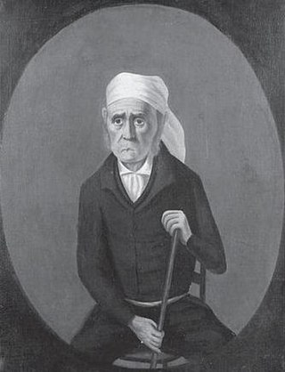
Daniel Freeman (1837–1918) was a landowner in southwest Los Angeles County, California, and a developer in downtown Los Angeles during the 19th century. He was the founder of the City of Inglewood, and the first farmer to engage extensively in wheat cultivation in Southern California.

La Casa de Carrión is an Adobe home built in 1868 by Saturnino Carrión. It is currently located in La Verne, California. The La Casa de Carrión was designated a California Historic Landmark on Dec. 14 1945. When La Casa de Carrión was built it was on the Rancho San Jose land. The Casa de Carrion the land was owned by Carrion's uncle Ygnacio Palomares and his business partner Ricardo Vejar. Ygnacio Palomares had built his own home, Ygnacio Palomares Adobe, near by in what is now Pomona, California in 1855. The land of Casa de Carrion was gifted to Saturnino Carrión by Ygnacio_Palomares. The adobe home was built in a "L" shape with the front of the house facing north. Saturnino Carrión, his wife, Dolores, and their three sons moved into La Casa de Carrión at completion. The three sons were: Ramon del Refugio, Julian and Frank. Saturnino and Dolores married on 15 May 1865 at the Plaza Church in Pueblo Los Angeles. Born at La Casa de Carrión to Saturnino and Dolores were daughters: Josefa, Agatha and Louise. Saturnino Carrión raise livestock on his ranch at La Casa de Carrión. Saturnino Carrión grew up in the City of Los Angeles, the only child of Casiano Carrión and Josefa (Lopez) Carrión. Julian continued to run the ranch after his father died.

<span class="mw-page-title-main">Mesmer family of California</span> Early Los Angeles settlers and developers

The Mesmer family of California was a wealthy family of early Los Angeles settlers who contributed to the development of the city between the rancho era and the explosive growth of the post-WWII era.

References

Notes

  1. 1 2 3 Michelle Norris (1986-09-11). "At 86, history buff gets an early start every day on Inglewood's past". Los Angeles Times.
  2. "Historic Unit Scoffs at Landmark Lack Claim". Los Angeles Times. 1962-10-14.
  3. 1 2 3 Isaacs (2002-09-15). "Centinela Adobe evokes spirit of ranchos". Daily Breeze.
  4. 1 2 www.laokay.com http://www.laokay.com/halac/CentinelaAdobe.htm . Retrieved 2010-08-22.{{cite web}}: Missing or empty |title= (help)[ title missing ]
  5. 1 2 3 4 5 6 The Valley That Grew and Grew and Grew: History of the Centinela Valley, 1700-1972. Inglewood Park Cemetery and The Historical Society of Centinela Valley.
  6. 1 2 3 4 5 Gerald Faris (1988-01-15). "A kind of time warp: oldest home in the Centinela Valley on one side and telltale sign of a modern metropolis on the other". Los Angeles Times.
  7. Hoover, Mildred Brooke; Rensch, Hero Eugene; Rensch, Ethel Grace; Abeloe, William N. (revision) (1966). Historic Spots in California (3rd ed.). Stanford University Press. p. 163.
  8. Walter Haskell (2001-03-30). "LAX expressway would wipe out Centinela Adobe". Daily Breeze.