
Telford is a town in Shropshire, England. It is in the Telford and Wrekin borough and which is both a unitary authority and covers the wider towns, villages and suburbs of the town. The town is inland and near the River Severn.

The A41 is a trunk road between London and Birkenhead, England. Now in parts replaced by motorways, it passes through or near Watford, Kings Langley, Hemel Hempstead, Aylesbury, Bicester, Solihull, Birmingham, West Bromwich, Wolverhampton, Newport, Whitchurch, Chester and Ellesmere Port.
Park, or Park Ward, is a ward of Wolverhampton City Council, West Midlands. It is located to the west of the city centre, and covers parts of the suburbs Bradmore, Compton, Finchfield, Merridale, Newbridge and Whitmore Reans. It borders the St Peter's, Graiseley, Merry Hill, Tettenhall Wightwick and Tettenhall Regis wards. It forms part of the Wolverhampton South West constituency.
St Peter's is a ward of Wolverhampton City Council, West Midlands. It has two parts: the city centre, and the inner-city areas immediately to the north and north-west, including Dunstall Hill and part of Whitmore Reans.
Bilston East is a ward of Wolverhampton City Council, West Midlands. It covers the southern and eastern parts of the town of Bilston, as well as Bradley. It borders the Spring Vale, Ettingshall, and Bilston North wards, as well as the Metropolitan Boroughs of Walsall, Sandwell, and Dudley. It forms part of the Wolverhampton South East constituency.
Bilston North is a ward of Wolverhampton City Council, West Midlands. As its name suggests, it covers the northern parts of the town of Bilston, such as Bunkers Hill, Portobello. It borders the Bilston East, Ettingshall and East Park wards, and the Metropolitan Borough of Walsall. It forms part of the Wolverhampton South East constituency.

Ettingshall is an area of Wolverhampton, West Midlands, England, and is a ward of Wolverhampton City Council. The population of this ward taken at the 2011 census was 13,482.
Spring Vale is a ward of Wolverhampton City Council, West Midlands, England. It is situated SSE of the city centre, on the city's border with the Metropolitan Borough of Dudley. The population of the ward taken at the 2011 census was 12,243.
Monmore Green is an area of Wolverhampton, West Midlands, England. It is situated about 1 mile (1.6 km) to the south-east of the city centre, in the East Park ward.

The A4150 Wolverhampton Inner Ring Road is a ring road that encircles the city centre of Wolverhampton in the West Midlands, England. The circumference of the road is around 2.1 miles (3.4 km). Technically, the route is listed as an "Inner Ring Road", although only a tiny section of the "Outer Ring Road" was ever constructed with only one of the two designed carriageways built. A second carriageway was built in 2017 along a short stretch between Patshull Avenue and Stafford Road. The section of outer ring road is called Wobaston Road and classified as U119.

The A454 is a major road in central England. It runs 28.9 miles (46.5 km) from Bridgnorth to Sutton Coldfield and is an important primary route linking Wolverhampton and Walsall with the M6 motorway.
New College Telford was a sixth form college situated in Wellington, an area within Telford, Shropshire, England. During December 2017 the merger between Telford College of Arts and Technology, and New College Telford, was officially certified by the Government, meaning the college now trades as Telford College since September 2018.

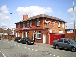
Bilston Central is a tram stop in Bilston near Wolverhampton, England. It was opened on 31 May 1999 and is situated on Midland Metro Line 1.

The Crescent tram stop is a tram stop located on Line 1 of the West Midlands Metro north of Bilston just off the A41 Wellington Road, near Wolverhampton, England. It was opened on 31 May 1999.

The Royal tram stop is a tram stop in Wolverhampton, England. Opened on 31 May 1999, it is situated on West Midlands Metro Line 1. The stop is named after the Royal Hospital, which closed in 1997.

Telford Central railway station serves the town of Telford, Shropshire, England. It is located on the Wolverhampton to Shrewsbury Line 15+1⁄2 miles (24.9 km) north west of Wolverhampton and is operated by West Midlands Trains. It is situated close to the Telford Shopping Centre, the main commercial district of the town.

The M54 is a 23-mile (37 km) east-west motorway in the counties of Shropshire and Staffordshire, England. It is also referred to as the Telford motorway, after the road's primary westbound destination, the town of Telford. It cost £65 million to construct, and is two-lane dual carriageway for the majority of its length, with sections of three-lane.

Wolverhampton is a city, metropolitan borough and administrative centre in the West Midlands, England. The population size has increased by 5.7%, from around 249,500 in 2011 to 263,700 in 2021. People from the city are called "Wulfrunians".

Telford College is a further education college in Telford, Shropshire, England. It operates from one main site and many in-company training sites and community-based courses spread out across Shropshire and the whole of the United Kingdom. During 2017 the college improved its Ofsted rating to Grade 3.
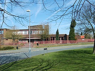
Moseley Park School is a mixed secondary school and sixth form located in the Bilston area of Wolverhampton, West Midlands, England.
