Colt, Arkansas

Last updated

Colt, Arkansas
Colt AR 02.jpg
St. Francis County Arkansas Incorporated and Unincorporated areas Colt Highlighted 0514950.svg
Location of Colt in St. Francis County, Arkansas.
Coordinates: 35°07′41″N90°48′49″W / 35.12806°N 90.81361°W / 35.12806; -90.81361
Country United States
State Arkansas
County St. Francis
Area
[1]
  Total1.26 sq mi (3.26 km2)
  Land1.26 sq mi (3.26 km2)
  Water0.00 sq mi (0.00 km2)
Elevation
[2]
253 ft (77 m)
Population
 (2020)
  Total293
  Density232.91/sq mi (89.90/km2)
Time zone UTC-6 (Central (CST))
  Summer (DST) UTC-5 (CDT)
FIPS code 05-14950
GNIS feature ID2404104 [2]
Major Highways Arkansas 1.svg Arkansas 306.svg

Colt is a town and an unincorporated area in St. Francis County, Arkansas, United States. The population was 378 at the 2010 census, an increase from 368 in 2000. [3]

Contents

Geography

According to the United States Census Bureau, the town has a total area of 1.2 square miles (3.1 km2), all land.

Demographics

Historical population
CensusPop.Note
1920 265
1930 2670.8%
1940 259−3.0%
1950 2673.1%
1960 39447.6%
1970 301−23.6%
1980 37825.6%
1990 334−11.6%
2000 36810.2%
2010 3782.7%
2020 293−22.5%
U.S. Decennial Census [4]

At the 2000 census, [3] there were 368 people, 163 households and 111 families residing in the town. The population density was 295.2 inhabitants per square mile (114.0/km2). There were 188 housing units at an average density of 150.8 per square mile (58.2/km2). The racial makeup of the town was 94.02% White, 5.43% Black or African American, 0.54% from other races. 0.54% of the population were Hispanic or Latino of any race.

There were 163 households, of which 27.6% had children under the age of 18 living with them, 55.8% were married couples living together, 7.4% had a female householder with no husband present, and 31.9% were non-families. 30.1% of all households were made up of individuals, and 13.5% had someone living alone who was 65 years of age or older. The average household size was 2.26 and the average family size was 2.77.

Age distribution was 22.8% under the age of 18, 9.2% from 18 to 24, 29.3% from 25 to 44, 24.7% from 45 to 64, and 13.9% who were 65 years of age or older. The median age was 38 years. For every 100 females, there were 94.7 males. For every 100 females age 18 and over, there were 94.5 males.

The median household income was $31,250, and the median family income was $37,000. Males had a median income of $31,000 versus $19,375 for females. The per capita income for the town was $14,958. About 11.7% of families and 13.7% of the population were below the poverty line, including 19.5% of those under age 18 and 15.9% of those age 65 or over.

Transportation

The main Highways of Colt are Arkansas State Routes 1 and 306. The two routes cross each other in the middle of the town. The Delta Regional Airport serves as the city's primary airport. Rail Service is provided by the Union Pacific.

Education

Forrest City School District operates public schools serving the community. [5] Forrest City High School is the local high school.

Notable people

Related Research Articles

<span class="mw-page-title-main">St. Francis County, Arkansas</span> County in Arkansas, United States

St. Francis County is a county in the U.S. state of Arkansas. As of the 2020 census, the population was 23,090. The county seat is Forrest City.

<span class="mw-page-title-main">Avoca, Arkansas</span> Town in Arkansas, United States

Avoca is a town in Benton County, Arkansas, United States. The population was 487 at the 2020 census. It is part of the Northwest Arkansas region.

<span class="mw-page-title-main">Decatur, Arkansas</span> City in Arkansas, United States

Decatur is a city, in Benton County, Arkansas, United States. The population was 1,773 at the 2020 census. It is part of the Northwest Arkansas region. This town is named after Commodore Stephen Decatur, Jr.

<span class="mw-page-title-main">Harrell, Arkansas</span> Town in Arkansas, United States

Harrell is a town in Calhoun County, Arkansas, United States. The population was 254 at the 2010 census. It is part of the Camden Micropolitan Statistical Area.

<span class="mw-page-title-main">Whelen Springs, Arkansas</span> Town in Arkansas, United States

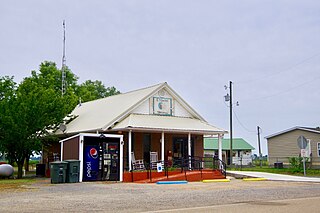
Whelen Springs is a town in Clark County, Arkansas, United States. The population was 92 at the 2010 census. From 1930 through 1939 the town thrived, being a main hub of operations for the then powerful Ozan Lumber Company.

<span class="mw-page-title-main">Lake City, Arkansas</span> City in Arkansas, United States

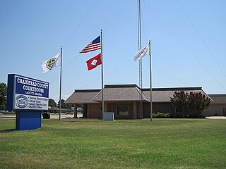
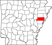
Lake City is a city in Craighead County, Arkansas, United States, along the St. Francis River. Lake City is one of two county seats in Craighead County. The population was 2,326 as of the 2020 census. It is included in the Jonesboro, Arkansas Metropolitan Statistical Area.

<span class="mw-page-title-main">Anthonyville, Arkansas</span> Town in Arkansas, United States

Anthonyville is a town in Crittenden County, Arkansas, United States. The population was 161 at the 2010 census, down from 250 in 2000.

<span class="mw-page-title-main">Edmondson, Arkansas</span> Town in Arkansas, United States

Edmondson is a town in Crittenden County, Arkansas, United States. The population was 427 at the 2010 census.

<span class="mw-page-title-main">Turrell, Arkansas</span> City in Arkansas, United States

Turrell is a city in Crittenden County, Arkansas, United States. Per the 2020 census, the population was 517.

<span class="mw-page-title-main">Haynes, Arkansas</span> Town in Arkansas, United States

Haynes is a town in Lee County, Arkansas, United States. The population was 150 at the 2010 census, down from 214 at the 2000 census.

<span class="mw-page-title-main">Wilton, Arkansas</span> City in Arkansas, United States

Wilton is a city in Little River County, Arkansas, United States. The population was 374 at the 2010 census, down from 439 at the 2000 census.

<span class="mw-page-title-main">Morrison Bluff, Arkansas</span> Town in Arkansas, United States

Morrison Bluff is a town in Logan County, Arkansas, United States. The population was 64 at the 2010 census and an estimated 81 in 2017.

<span class="mw-page-title-main">Pyatt, Arkansas</span> Town in Arkansas, United States

Pyatt is a town in western Marion County, Arkansas, United States. The population was 181 at the 2020 census, down from 221 in 2010.

<span class="mw-page-title-main">Etowah, Arkansas</span> Town in Arkansas, United States

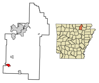
Etowah is a town in Mississippi County, Arkansas, United States. The population was 254 at the 2020 census, down from 351 in 2010.

<span class="mw-page-title-main">Mansfield, Arkansas</span> City in Arkansas, United States

Mansfield is a city in Scott and Sebastian counties Arkansas, United States. The Sebastian County portion of the city is part of the Fort Smith, Arkansas-Oklahoma Metropolitan Statistical Area. As of the 2010 Census, the population was 1,139. The population was 1,097 at the 2000 census.

<span class="mw-page-title-main">Huntington, Arkansas</span> City in Sebastian County, Arkansas, United States

Huntington is a city in Sebastian County, Arkansas, United States. It is part of the Fort Smith, Arkansas-Oklahoma Metropolitan Statistical Area. As of the 2010 Census the population was 635.

<span class="mw-page-title-main">Sidney, Arkansas</span> Town in Arkansas, United States

Sidney is a town in Sharp County, Arkansas, United States. The population was 181 at the 2010 census.

<span class="mw-page-title-main">Madison, Arkansas</span> City in Arkansas, United States

Madison is a city in St. Francis County, Arkansas, United States. The population was 769 at the 2010 census, down from 987 in 2000.

Lowell is a town in Penobscot County, Maine, United States. The population was 368 at the 2020 census.

<span class="mw-page-title-main">Grandview, Missouri</span> City in Missouri, United States

Grandview is a city in Jackson County, Missouri, United States. The population was 24,475 at the 2010 census. It is part of the Kansas City metropolitan area.

References

  1. "2020 U.S. Gazetteer Files". United States Census Bureau. Retrieved October 29, 2021.
  2. 1 2 U.S. Geological Survey Geographic Names Information System: Colt, Arkansas
  3. 1 2 "U.S. Census website". United States Census Bureau . Retrieved January 31, 2008.
  4. "Census of Population and Housing". Census.gov. Retrieved June 4, 2015.
  5. "SCHOOL DISTRICT REFERENCE MAP (2010 CENSUS): St. Francis County, AR" (PDF). U.S. Census Bureau . Retrieved November 5, 2019.