
Windham County is a county located in the northeastern corner of the U.S. state of Connecticut. As of the 2020 census, the population was 116,418, making it the least populous county in Connecticut. It forms the core of the region known as the Quiet Corner. Windham County is included in the Worcester, MA-CT Metropolitan Statistical Area, which is also included in the Boston-Worcester-Providence, MA-RI-NH-CT Combined Statistical Area. The entire county is within the Quinebaug and Shetucket Rivers Valley National Heritage Corridor, as designated by the National Park Service.
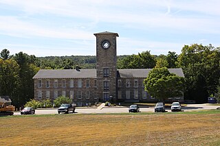
Mansfield is a town in Tolland County, Connecticut, United States. The population was 25,892 at the 2020 census.

Interstate 384 (I-384) is an auxiliary Interstate Highway located entirely within the state of Connecticut. It runs 8.2 miles (13.2 km) east to west, going from I-84 and I-291 in East Hartford to US Route 6 (US 6) and US 44 in Bolton.

Route 15 is a state highway in the U.S. state of Connecticut that runs 83.53 miles (134.43 km) from a connection with New York's Hutchinson River Parkway in Greenwich, Connecticut to its northern terminus intersecting with Interstate 84 (I-84) in East Hartford, Connecticut. Route 15 consists of four distinct sections: the Merritt Parkway, the Wilbur Cross Parkway, the Berlin Turnpike, and part of the Wilbur Cross Highway. The unified designation was applied to these separate highways in 1948 to provide a continuous through route from New York to Massachusetts. The parkway section of Route 15 is often referred to locally as "The Merritt".

Route 66 is a Connecticut state highway running from Meriden to Windham, serving as an alternate east–west route to US 6 through east-central Connecticut.

Route 32 is a 54.88-mile (88.32 km) primary north–south state highway in the U.S. state of Connecticut, beginning in New London and continuing via Willimantic to the Massachusetts state line, where it continues as Route 32 in that state.

U.S. Route 6 (US 6) within the state of Connecticut runs for 116.33 miles (187.21 km) from the New York state line near Danbury to the Rhode Island state line in Killingly. West of Hartford, the route either closely parallels or runs along Interstate 84 (I-84), which has largely supplanted US 6 as a through route in western Connecticut. East of Hartford, US 6 serves as a primary route for travel between Hartford and Providence.

Connecticut Route 14 is one of several secondary routes from eastern Connecticut into Rhode Island. It runs from the Willimantic section of the town of Windham to the Rhode Island state line in Sterling.
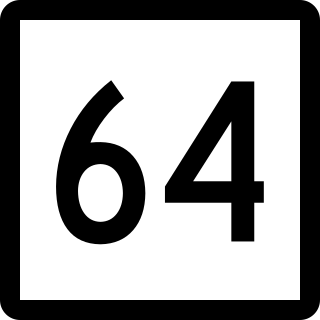
Route 64 is a Connecticut state highway connecting the towns of Woodbury and Waterbury via Middlebury.

Route 31 is a north–south state highway in Connecticut running for 14.34 miles (23.08 km) from Route 74 in Vernon to Route 32 in Mansfield. Although it is officially logged as an east-west route, it is signed north-south.

Route 74 is a state highway in Connecticut in the eastern part of the Greater Hartford area. It runs from Route 194 in South Windsor to US 44 in Ashford, going through the towns of Ellington, Vernon, Tolland, and Willington. East of its junction with I-84, it becomes a rural collector road.

Route 89 is a state highway in northeastern Connecticut, running from eastern Mansfield to southern Union. It connects the villages of Mansfield Center, Warrenville, and Westford. It is a two-lane rural collector road throughout its entire length, following the path of the Mount Hope River.

Route 87 is a Connecticut state highway running from Franklin to Andover, generally in a southeast–northwest direction. The route is part of the road connecting the towns of Norwich, Lebanon, Columbia, and Andover. Route 87 is a two-lane rural collector road for its entire length.

Northeastern Connecticut, better known as the Quiet Corner, is a historic region of the state of Connecticut, located in the northeastern corner of the state. It is generally associated with Windham County, but also sometimes incorporates eastern sections of Tolland County and the northern portion of New London County.
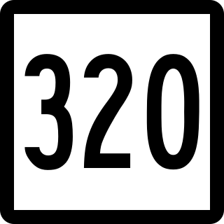
Route 320 is a state highway in northeastern Connecticut, running from Mansfield to Willington and primarily serving as a northern link to the University of Connecticut.

Route 203 is a state highway in eastern Connecticut, running entirely within the town of Windham.

Route 136 is a state highway in southwestern Connecticut, running from Darien to Easton. The route was initially established in 1932 to serve the beach communities between Darien and Southport. Its eastern end was relocated in 1963 to head northeast from Westport to Easton instead.

Route 197 is a 14.17-mile-long (22.80 km) state highway in northeastern Connecticut and southern Massachusetts, running from Union, Connecticut, to Dudley, Massachusetts. The Connecticut section is signed as an east–west route, while the Massachusetts section is signed north–south.

Route 275 is a state highway in northeastern Connecticut running from Coventry to the Storrs section of Mansfield, and serving as a western feeder to the University of Connecticut.

Route 289 is a state highway in eastern Connecticut, running from Lebanon center to Willimantic in the town of Windham.

