
Jasper County is the southernmost county in the U.S. state of South Carolina. As of the 2020 census, the population was 28,791. Its county seat is Ridgeland and its largest city is Hardeeville. The county was formed in 1912 from portions of Hampton County and Beaufort County.

Hampton County is a rural county located in the U.S. state of South Carolina. As of the 2020 census, the population was 18,561. Its county seat is Hampton. It was named for Confederate Civil War general Wade Hampton, who in the late 1870s, with the ending of Reconstruction, was elected as governor of South Carolina.

Colleton County is in the Lowcountry region of the U.S. state of South Carolina. As of the 2020 census, the population was 38,604. Its county seat is Walterboro. The county is named after Sir John Colleton, 1st Baronet, one of the eight Lords Proprietor of the Province of Carolina. After two previous incarnations, the current Colleton County was created in 1800.

Barnwell County is a county in the U.S. state of South Carolina. As of the 2020 census, its population was 20,589. Barnwell County is part of the Augusta-Richmond County, GA-SC Metropolitan Statistical Area. It is located in the Central Savannah River Area. Its county seat is Barnwell.

Allendale County is a county located in the U.S. state of South Carolina. As of the 2020 census, the population was 8,039, making it the least populous county in South Carolina. Its county seat is Allendale.
Screven County is a county located in the southeastern part of the U.S. state of Georgia. As of the 2020 census, the population was 14,067. The county seat is Sylvania.
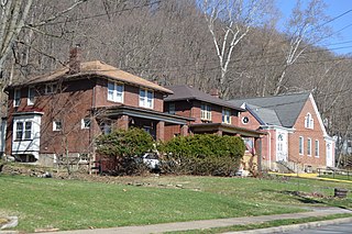
Glen Osborne is a borough in Allegheny County, Pennsylvania, United States, along the Ohio River. The population was 590 at the 2020 census. It is a residential suburb of the Pittsburgh metropolitan area.

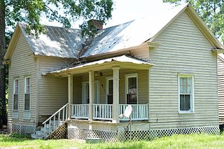
Allendale is a town in and the county seat of Allendale County, South Carolina, United States. The population was 3,482 at the 2010 census, a decline from 4,052 in 2000.

South Carolina's 6th congressional district is in central and eastern South Carolina. It includes all of Allendale, Bamberg, Calhoun, Clarendon, Hampton, and Williamsburg counties and parts of Charleston, Colleton, Dorchester, Florence, Jasper, Orangeburg, Richland and Sumter counties. With a Cook Partisan Voting Index rating of D+14, it is the only Democratic district in South Carolina.
The Salkehatchie River originates near the City of Barnwell, South Carolina and accepts drainage from Turkey Creek and Whippy Swamp before merging with the Little Salkehatchie River to form the Combahee River Basin, which empties into Saint Helena Sound and the Atlantic Ocean. Prior to the confluence, the Little Salkehatchie River accepts drainage from Lemon Creek, Buckhead Creek, and Willow Swamp.
The Little Salkehatchie River is a stream in Barnwell, Bamberg, and Colleton counties in the U.S. state of South Carolina. It originates in the Town of Blackville and accepts drainage from Lake Cynthia, Guess Pond, Brooker Pond, Ghants Branch, Halfmoon Branch, and Long Gall Branch. Further downstream, the river accepts drainage from Long Pond, Ben Rice Bay, Colston Branch, and Long Branch. There are a total of 111.7 stream miles and 397.4 acres (1.608 km2) of lake waters in this watershed, all classified freshwater.

Saint Helena Sound is a coastal inlet in the Lowcountry region South Carolina, located along the Atlantic Ocean between Beaufort and Colleton counties. Located within the relatively undeveloped ACE Basin, the sound consists of the mouths of the Ashepoo, Combahee, and the south branch of the Edisto rivers, of which the ACE moniker derives from. The inlet is located 15-mile (24 km)east of Beaufort, between Edisto Island and Hunting Island. At its widest point, Saint Helena Sound is 7.5-mile (12.1 km) across. The Intracoastal Waterway crosses the sound. Much of the land surrounding St. Helena Sound has been preserved through the St. Helena Sound Heritage Preserve and the larger ACE Basin project.
The Broad River is a tidal channel in Beaufort and Jasper counties, South Carolina. The channel flows between the mainland on the west and Port Royal and Parris islands on the east. The Coosawhatchie River flows into the Broad River at the head. It joins Coosaw River channel Northeast and continues Southeast to the Atlantic Ocean as Port Royal Sound.
Port Royal Sound is a coastal sound, or inlet of the Atlantic Ocean, located in the Sea Islands region, in Beaufort County in the U.S. state of South Carolina. It is the estuary of several rivers, the largest of which is the Broad River.

South Carolina Highway 170 (SC 170) is a 49.010-mile (78.874 km) state highway, connecting northern Beaufort County with southern portions of Beaufort and Jasper counties. Due to increased population growth in both areas, the majority of the road is four lanes wide, with certain areas retaining the original two-lane configuration.

U.S. Highway 17 (US 17) is a 221.454-mile (356.396 km) north–south United States Numbered Highway in the U.S. state of South Carolina located near the Atlantic Ocean. The highway enters the state from Georgia at the Savannah River and serves Hardeeville, Charleston, Georgetown, and Myrtle Beach, before entering North Carolina near Calabash.

Coosawhatchie (koo-saw-HATCH-ee) is an unincorporated community and census-designated place (CDP) located in Jasper County, South Carolina, United States at the northern head of the Broad River. It served as the headquarters for General Robert E. Lee during the early part of the American Civil War. It was first listed as a CDP in the 2020 census with a population of 57. It is accessible from Interstate 95 via Exit 28.
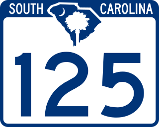
South Carolina Highway 125 (SC 125) is a 56.212-mile (90.464 km) primary state highway in the U.S. state of South Carolina. The highway serves as a direct route between Allendale and Augusta, Georgia, through the Savannah River Site (SRS); and an alternate to U.S. Route 278 (US 278).
The West Ashley Greenway is a rail trail in Charleston, South Carolina. It stretches across the West Ashley neighborhood from Main Road in the west to Folly Road in the east. It is a straight and mostly paved path utilized for walking, jogging, roller skating, and off-street cycling. The distance of the main trail currently covers 8.8 miles (14.2 km). It is a contributing segment of the East Coast Greenway. In 2019, the U.S. Department of Transportation gave the city of Charleston a $18 million grant to build a pedestrian bridge across the Ashley River connecting West Ashley to downtown Charleston. The planned pedestrian bridge may eventually connect with the Lowcountry Lowline.

South Carolina Highway 462 (SC 462) is a 35.920-mile (57.808 km) primary state highway in the U.S. state of South Carolina. It serves as a circuitous routing through northern and eastern Jasper County.
