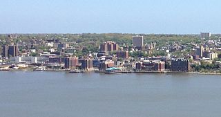
Yonkers is a city in Westchester County, New York, United States and a suburb of New York City. Developed along the Hudson River, it is the 9th-most populous community in New York state. The population of Yonkers was 211,569 as counted by the 2020 United States Census, its highest decennial count ever. It is classified as an inner suburb of New York City, located directly to the north of the Bronx and approximately 2.4 miles (4 km) north of Marble Hill, the northernmost point in Manhattan.

Tuckahoe is a village in Westchester County, New York, United States. One-and-a-half miles long and three-quarters of a mile wide, with the Bronx River serving as its western boundary, the Village of Tuckahoe is approximately sixteen miles north of midtown Manhattan in Southern Westchester County. As of the 2010 census, the village's population was 6,486.
The Bronx River Parkway is a 19.12-mile (30.77 km) long parkway in downstate New York in the United States. It is named for the nearby Bronx River, which it parallels. The southern terminus of the parkway is at Story Avenue near the Bruckner Expressway in the Bronx neighborhood of Soundview. The northern terminus is at the Kensico Circle in Valhalla, Mount Pleasant, Westchester County, where the parkway connects to the Taconic State Parkway and, via a short connector, New York State Route 22 (NY 22). Within the Bronx, the parkway is maintained by the New York State Department of Transportation and is designated New York State Route 907H (NY 907H), an unsigned reference route. In Westchester County, the parkway is maintained by the Westchester County Department of Public Works and is designated unsigned County Route 9987 (CR 9987).

Riverdale is a residential neighborhood in the northwestern portion of the New York City borough of the Bronx. Riverdale, which had a population of 47,850 as of the 2000 United States Census, contains the city's northernmost point at the College of Mount Saint Vincent. Riverdale's boundaries are disputed, but it is commonly agreed to be bordered by Yonkers to the north, Van Cortlandt Park and Broadway to the east, the Kingsbridge neighborhood to the southeast, either the Harlem River or the Spuyten Duyvil neighborhood to the south, and the Hudson River to the west. Riverdale Avenue is the primary north–south thoroughfare through Riverdale.

Bronx River Road is a major street and neighborhood in Yonkers, New York. It runs alongside the Bronx River, Bronx River Parkway, and Metro-North railroad tracks in south-eastern Yonkers. On the other side of the Bronx River is the City of Mount Vernon, New York as well as the Bronx. Bronx River Road runs down to McLean Avenue at the city line with New York City where it becomes Webster Avenue in the Woodlawn section of the Bronx. To the north, when it reaches the Cross County Parkway, Bronx River Road merges into Midland Avenue which leads to the Village of Bronxville, New York.

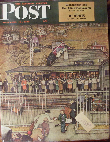
Crestwood station is a commuter rail stop on the Metro-North Railroad's Harlem Line, serving the communities of Tuckahoe, Yonkers, and Eastchester, New York. Because of its location at the northern end of the triple-track segment of the Harlem Line, Crestwood is often the first/last stop outside New York City on Harlem Line express trains, and its center island platform is frequently used to short turn local trains during rush hour.

Dunwoodie is a neighborhood in Yonkers, New York, noted for being the home of St. Joseph's Seminary and College on Valentine Hill. Dunwoodie (proper) is located north of the Seminary, while Dunwoodie Heights includes the seminary and what is south of it. Dunwoodie also includes Yonkers' "Little Italy" and a public golf course.

The Saw Mill River Parkway is a north–south parkway that extends for 28.93 miles (46.56 km) through Westchester County, New York, in the United States. It begins at the border between Westchester County and the Bronx, as the continuation of the Henry Hudson Parkway leaving New York City, and heads generally northeastward to an interchange with Interstate 684 (I-684). At its north end, the parkway serves as a collector/distributor road as it passes east of the hamlet of Katonah. The parkway is named for the Saw Mill River, which the highway parallels for most of its length.

The Sprain Brook Parkway is a 12.65-mile (20.36 km) long north–south parkway in Westchester County, New York, United States. It begins at an interchange with the Bronx River Parkway in the city of Yonkers, and ends at the former site of the Hawthorne Circle, where it merges into the Taconic State Parkway. The parkway serves an alternate to the Bronx River Parkway, boasting an interchange connection through western Westchester with Interstate 287. New York's Department of Transportation (NYSDOT) refers to it internally as New York State Route 987F (NY 987F), an unsigned reference route.

Woodlawn station is a commuter rail stop on the Metro-North Railroad's Harlem Line, serving the Woodlawn section of the Bronx, New York City. It is located on East 233rd Street near Webster Avenue. Just north of the station is Woodlawn Junction, where the New Haven Line splits from the Harlem Line to join the Northeast Corridor.
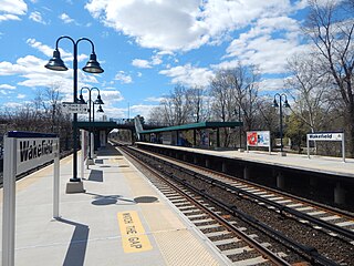
Wakefield station is a commuter rail stop on the Metro-North Railroad's Harlem Line, serving the Wakefield section of the Bronx, New York City. The station is located on East 241st Street and is the last stop in New York City on the Harlem Line.
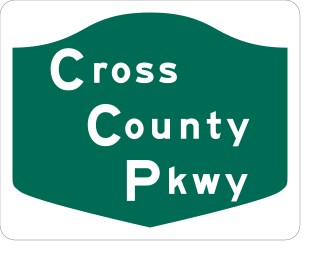
The Cross County Parkway (CCP) is a 4.46-mile-long (7.18 km) parkway in lower Westchester County, New York, in the United States. The parkway is a critical east–west connection throughout Westchester, having full interchanges with every major north–south highway in southern Westchester with the exception of Interstate 95. Among its junctions, it has access to the New York State Thruway mainline. The western terminus is at the Saw Mill Parkway in Yonkers. The eastern terminus is at the Hutchinson River Parkway in New Rochelle.

Fleetwood station is a commuter rail stop on the Metro-North Railroad's Harlem Line, located in the Fleetwood section of Mount Vernon, New York.
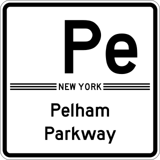
The Bronx and Pelham Parkway, also known formally as the Bronx–Pelham Parkway but called Pelham Parkway in everyday use, is a 2.25-mile-long (3.62 km) parkway in the borough of the Bronx in New York City. The road begins in Bronx Park at the Bronx River Parkway and U.S. Route 1 and ends at Interstate 95 (I-95), the New England Thruway, in Pelham Bay Park, hence the roadway's name. The parkway is designated as New York State Route 907F (NY 907F), an unsigned reference route, by the New York State Department of Transportation (NYSDOT).
The West Bronx is a region in the New York City borough of the Bronx. The region lies west of the Bronx River and roughly corresponds to the western half of the borough.

Sedgwick Avenue is a major street in the Bronx, New York City. It runs roughly parallel to Jerome Avenue, the Major Deegan Expressway, and University Avenue. Sedgwick Avenue is one of the longest streets in the western part of the Bronx, running from Mosholu Parkway at the north to Macombs Dam Bridge at its southern end, about 800 feet west of Yankee Stadium.
Armour Villa is a neighborhood in Northeast Yonkers, New York, that shares a postal zip code with the town of Bronxville, New York.

This is a list of the National Register of Historic Places listings in southern Westchester County, New York, excluding the cities of New Rochelle and Yonkers, which have separate lists of their own.

The history of Westchester County, a county in the state of New York, can be traced back to the founding of a settlement between the Hudson River and Long Island Sound in the 17th century. The area now known as Westchester County had seen human occupation since at least the Archaic period, but significant growth in the settlements that are now incorporated into the county did not occur until the Industrial Revolution.

Cedar Knolls is a neighborhood of the city of Yonkers in New York's Westchester Countyknown for the neoclassical-style architecture of its houses, which give it a "frozen in time" look of an early-20th century town. It shares a zip code and postal address with the neighboring village of Bronxville, New York.