Dawson, Texas

Last updated

Dawson, Texas
TXMap-doton-Dawson.PNG
Location of Dawson, Texas
Navarro County Dawson.svg
Coordinates: 31°53′44″N96°42′55″W / 31.89556°N 96.71528°W / 31.89556; -96.71528
Country United States
State Texas
County Navarro
Area
[1]
  Total1.80 sq mi (4.67 km2)
  Land1.78 sq mi (4.62 km2)
  Water0.02 sq mi (0.04 km2)
Elevation
482 ft (147 m)
Population
 (2010)
  Total807
  Estimate 
(2019) [2]
801
  Density448.74/sq mi (173.24/km2)
Time zone UTC-6 (Central (CST))
  Summer (DST) UTC-5 (CDT)
ZIP code
76639
Area code 254
FIPS code 48-19420 [3]
GNIS feature ID1334106 [4]
Website https://www.cityofdawsontx.com/
Historical population
CensusPop.Note
1890 365
1910 803
1920 95018.3%
1930 1,13119.1%
1940 1,1552.1%
1950 1,107−4.2%
1960 911−17.7%
1970 848−6.9%
1980 747−11.9%
1990 7662.5%
2000 85211.2%
2010 807−5.3%
2019 (est.)801 [2] −0.7%
U.S. Decennial Census [5]

Dawson is a town in Navarro County, in the U.S. state of Texas. The population was 807 at the 2010 census.

Contents

History

The town was established in 1847 [6] and was the second town established in the county. [7]

Geography

Dawson is located at 31°53′44″N96°42′55″W / 31.89556°N 96.71528°W / 31.89556; -96.71528 (31.895427, –96.715345). [8]

According to the United States Census Bureau, the town has a total area of 1.8 sq mi (4.7 km2), of which 1.8 square miles (4.7 km2) are land and 0.56% is covered by water.

Demographics

As of the census [3] of 2000, 852 people, 361 households, and 229 families were residing in the town. The population density was 480.8 inhabitants per square mile (185.6/km2). The 408 housing units averaged 230.2 per square mile (89.0/km2). The racial makeup of the town was 80.99% White, 15.14% African American, 0.12% Native American, 0.12% Asian, 1.64% from other races, and 2.00% from two or more races. Hispanics or Latinos of any race were 6.34% of the population.

Of the 361 households, 25.2% had children under the age of 18 living with them, 46.8% were married couples living together, 13.0% had a female householder with no husband present, and 36.3% were not families. About 34.6% of all households were made up of individuals, and 23.0% had someone living alone who was 65 years of age or older. The average household size was 2.36, and the average family size was 3.07.

In the town, the population was distributed as 24.1% under the age of 18, 7.6% from 18 to 24, 23.9% from 25 to 44, 21.7% from 45 to 64, and 22.7% who were 65 years of age or older. The median age was 40 years. For every 100 females, there were 90.6 males. For every 100 females age 18 and over, there were 81.2 males.

The median income for a household in the town was $25,658, and for a family was $40,441. Males had a median income of $30,250 versus $20,417 for females. The per capita income for the town was $13,190. About 13.2% of families and 20.9% of the population were below the poverty line, including 27.8% of those under age 18 and 27.1% of those age 65 or over.

Education

The Town of Dawson is served by the Dawson Independent School District.

Braniff Flight 352

Braniff Flight 352 was a scheduled domestic flight from William P. Hobby Airport in Houston, Texas, to Love Field in Dallas. On May 3, 1968, a Lockheed L-188A Electra flying on the route, registration N9707C, broke up in midair and crashed near Dawson, Texas, after flying into a severe thunderstorm. It was carrying a crew of five and 80 passengers. No one survived. Investigation revealed that the accident was caused by the captain's decision to penetrate an area of heavy weather followed by a structural overstress and failure of the airframe while attempting recovery from loss of control during a steep 180° turn executed in an attempt to escape the weather.

Notable people

Climate

The climate in this area is characterized by hot, humid summers and generally mild to cool winters. According to the Köppen climate classification, Dawson has a humid subtropical climate,Cfa on climate maps. [9]

Related Research Articles

<span class="mw-page-title-main">Navarro County, Texas</span> County in Texas, United States

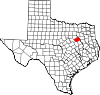
Navarro County is a county in the U.S. state of Texas. As of the 2020 census, the population was 52,624. Its county seat is Corsicana. The county is named for José Antonio Navarro, a Tejano leader in the Texas Revolution who signed the Texas Declaration of Independence.

<span class="mw-page-title-main">Olga, Florida</span> Census-designated place in Florida, United States

Olga is an unincorporated community and census-designated place (CDP) in Lee County, Florida, United States. The population was 2,270 at the 2020 census, up from 1,952 at the 2010 census. It is part of the Cape Coral-Fort Myers, Florida Metropolitan Statistical Area.

<span class="mw-page-title-main">Fairfield, Texas</span> City in Texas, United States

Fairfield is a city and county seat of Freestone County, Texas, United States. The population was 2,850 at the 2020 census, down from 3,094 at the 2000 census. It was founded in 1851.

<span class="mw-page-title-main">Southmayd, Texas</span> City in Texas, United States

Southmayd is a city in Grayson County, Texas, United States. The population was 992 at the 2010 census. It is part of the Sherman–Denison Metropolitan Statistical Area.

<span class="mw-page-title-main">Trinidad, Texas</span> City in Texas, United States

Trinidad is a city in Henderson County, Texas, United States, near the Trinity River from which the town's name was derived. The population was 860 at the 2020 census, down from 886 at the 2010 census.

<span class="mw-page-title-main">Jewett, Texas</span> City in Texas, United States

Jewett is a city in Leon County, Texas, United States. The population was 1,167 at the 2010 census. It was laid out in 1871 by the International Railroad Company.

<span class="mw-page-title-main">Thornton, Texas</span> Town in Texas, United States

Thornton is a town in Limestone County, Texas, United States. The population was 526 at the 2010 census.

<span class="mw-page-title-main">Blooming Grove, Texas</span> Town in Texas, United States

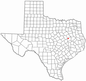
Blooming Grove is a town in western Navarro County, Texas, United States. As of the 2010 census, the town population was 821.

<span class="mw-page-title-main">Emhouse, Texas</span> Town in Texas, United States

Emhouse is a town in Navarro County, Texas, United States. The population was 133 at the 2010 census.

<span class="mw-page-title-main">Frost, Texas</span> City in Texas, United States

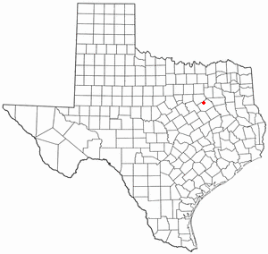
Frost is a city in Navarro County, Texas, United States. The population was 643 at the 2010 census.

<span class="mw-page-title-main">Kerens, Texas</span> City in Texas, United States

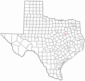
Kerens is a city in Navarro County, Texas, United States. The population was 1,573 at the 2010 census.

<span class="mw-page-title-main">Mildred, Texas</span> Town in Texas, United States

Mildred is a town in Navarro County, Texas, United States. The population was 368 at the 2010 census.

<span class="mw-page-title-main">Navarro, Texas</span> Town in Texas, United States

Navarro is a town in Navarro County, Texas, United States. The population was 210 at the 2010 census.

<span class="mw-page-title-main">Oak Valley, Texas</span> Town in Texas, United States

Oak Valley is a town in Navarro County, Texas, United States. The population was 368 at the 2010 census.

<span class="mw-page-title-main">Powell, Texas</span> Town in Texas, United States

Powell is a town in Navarro County, Texas, United States. The population was 136 at the 2010 census.

<span class="mw-page-title-main">Retreat, Texas</span> Town in Texas, United States

Retreat is a town in Navarro County, Texas, United States. The population was 377 at the 2010 census.

<span class="mw-page-title-main">Rice, Texas</span> City in Texas, United States

Rice is a city in Navarro County, Texas, United States. The population was 923 at the 2010 census.

<span class="mw-page-title-main">Ackerly, Texas</span> City in Texas, United States

Ackerly is a city in Dawson and Martin Counties in the U.S. state of Texas. As of the 2020 Census, the population was 264. The Martin county portion of Ackerly is part of the Midland-Odessa metropolitan area.

<span class="mw-page-title-main">Streetman, Texas</span> Town in Freestone and Navarro counties in Texas, United States

Streetman is a town in Freestone and Navarro counties in Texas, United States. As of the 2020 census the population was 248.

<span class="mw-page-title-main">Power, Montana</span> CDP in Montana, United States

Power is a census-designated place (CDP) in Teton County, Montana, United States. The population was 171 at the 2000 census. The town is named after Montana pioneer, Thomas Charles Power, who platted the townsite in 1910.

References

  1. "2019 U.S. Gazetteer Files". United States Census Bureau. Retrieved August 7, 2020.
  2. 1 2 "Population and Housing Unit Estimates". United States Census Bureau. May 24, 2020. Retrieved May 27, 2020.
  3. 1 2 "U.S. Census website". United States Census Bureau . Retrieved January 31, 2008.
  4. "US Board on Geographic Names". United States Geological Survey. October 25, 2007. Retrieved January 31, 2008.
  5. "Census of Population and Housing". Census.gov. Retrieved June 4, 2015.
  6. "Dawson, Texas". Texas State Historical Association. Retrieved February 6, 2012.
  7. A Memorial and Biographical History of Navarro, Henderson, Anderson, Limestone, Freestone and Leon Counties, Texas. Chicago: Lewis Publishing Company. 1893. p. 172. Retrieved September 28, 2014.
  8. "US Gazetteer files: 2010, 2000, and 1990". United States Census Bureau. February 12, 2011. Retrieved April 23, 2011.
  9. Climate Summary for Dawson, Texas