| Part of a series on the |
| History of Japan |
|---|
 |
Demographic features of the population of Japan before the Meiji Restoration include aspects of nationality, religion, and ethnicity.
| Part of a series on the |
| History of Japan |
|---|
| |
Demographic features of the population of Japan before the Meiji Restoration include aspects of nationality, religion, and ethnicity.
Before the establishment of the religious and population investigation registers system by the Tokugawa shogunate, several less reliable sources existed upon which an estimate of the population was made. The first record of the population was the Chinese text "Records of Three Kingdoms" where the summated number of houses in eight countries of Wō is given as 159,000.
The household registration system (Hukou (simplified Chinese :户口; traditional Chinese :戶口; pinyin :hùkǒu) or Huji (simplified Chinese :户籍; traditional Chinese :戶籍; pinyin :hùjí)), which is called koseki (戸籍, family registries) in Japanese, was introduced from ancient China to Japan during the 7th century. According to "Nihon Shoki (日本書記)", the first koseki system, called Kōgo no Nen Jaku ( 庚午年籍 ) or Kōin no Nen Jaku ( 庚寅年籍 ), was established between 670 or 690, and was to be readministered every six years. However, most of the original koseki texts were lost because they were to be preserved only 30 years. The oldest koseki fragments - which were reused as reinforcement papers (Shihai Monjo ( 紙背文書 , scroop document)) in Shōsōin (正倉院) - records names, ages and estates of people including slaves (e.g. 1,119 persons were recorded for the village named Hanyū ( 半布里 ) (present day Tomika-chō (富加町)) in 702)). A discarded lacquer-coated paper document (Urushigami Monjo ( 漆紙文書 , lacquer paper document)) found in Kanoko C Ruins (鹿ノ子C遺跡), Ishioka, Ibaraki records the total population of families of taxpayers in Hitachi no kuni (常陸国) in 795 was 191,660 (excluding families of officers, families of workers for Shintō shrines and slaves); this is the only reliable remaining census recorded for a whole province before the Edo period. The ancient koseki system later collapsed during the early Heian period, when aristocrats achieved power as landowners of Shōen.
The following estimates by different scholars are based upon the number of houses, villages, kokudaka, areas of rice fields and soldiers which were recorded in "Wamyō Ruijushō (和名類聚抄)" (10th century), "Record of Song or History of Song (Chinese :宋史; pinyin :Sòng Shǐ)", "Shūgaishō (拾芥抄)" (14th century), "Tenshōki (天正記)" (late 16th century), "Tōdaiki (当代記)" (early 17th century), or fragments of papers of the Shōsōin (8th century) and others, as well as remnants of specific periods.
| Year | Estimated Population | Estimated Population | Estimated Population | Estimated Population |
|---|---|---|---|---|
| 6100 BC | 20,100 | |||
| 3200 BC | 105,500 | |||
| 2300 BC | 261,300 | |||
| 1300 BC | 160,300 | |||
| 900 BC | 75,800 | |||
| 400 BC | 100,000 | |||
| 200 BC | 100,000 | 200,000 | ||
| 1 AD | 300,000 | 300,000 | ||
| 200 | 700,000 | 594,900 | 500,000 | |
| 400 | 1,500,000 | 1,500,000 | ||
| 500 | 2,000,000 | |||
| 600 | 3,000,000 | 4,000,000 | ||
| 700 | 5,000,000 | |||
| 715 | 4,512,200 | |||
| 730 | 5,800,000– 6,400,000 | |||
| 800 | 4,000,000 | 5,506,200 | 6,000,000 | |
| 900 | 6,441,400 | 7,000,000 | ||
| 950 | 4,400,000– 5,600,000 | |||
| 1000 | 4,500,000 | 7,000,000 | ||
| 1100 | 5,750,000 | 7,000,000 | ||
| 1150 | 6,836,900 | 5,500,000– 6,300,000 | ||
| 1200 | 7,500,000 | 6,000,000 | ||
| 1250 | 6,000,000 | |||
| 1280 | 5,700,000– 6,200,000 | |||
| 1300 | 9,750,000 | 7,000,000 | ||
| 1340 | 7,000,000 | |||
| 1400 | 12,500,000 | 8,000,000 | ||
| 1450 | 9,600,000– 10,500,000 | |||
| 1500 | 17,000,000 | 8,000,000 | ||
| 1600 | 22,000,000 | 12,273,000 | 12,000,000 | 15,000,000– 17,000,000 |
| 1650 | 25,000,000 | 17,497,900 | ||
| 1700 | 29,000,000 | 28,287,200 | 28,000,000 | |
Since Kyōto (or Heian-kyō) became the capital of Japan in 794, it has been one of the most important cities in Japan. Hiraizumi and Kamakura flourished under Northern Fujiwara clans (during 12th century) and Kamakura shogunate (1192 to 1333), respectively. The urban area of Kyōto suffered from the Ōnin War (1467 to 1477) and split into two districts, but coalesced into a great city of more than 400,000 inhabitants after the end of Sengoku period. The Christian missionaries led by Francis Xavier reported that the number of houses in Kyōto, Yamaguchi or Hakata was more than 90,000, more than 10,000 or 10,000, respectively, in the late 16th century according to History of Japan written by Luís Fróis. After the unification of Japan by Toyotomi Hideyoshi, Ōsaka grew into a populous city with tens of thousands of people. Several castle towns also began to grow, where samurai classes were settled.
| Year | Asuka | Heijō-kyō (Nara) | Heian-kyō (Kyōto) | Hiraizumi | Hakata | Kamakura | Yamaguchi | Sakai | Ōsaka | Sumpu (Shizuoka) | Edo (Tōkyō) | Kanazawa |
|---|---|---|---|---|---|---|---|---|---|---|---|---|
| 622 | 50,000– 60,000 | |||||||||||
| 750 | 100,000 | |||||||||||
| 800 | 200,000 | |||||||||||
| 900 | 200,000 | |||||||||||
| 925 | 200,000 | |||||||||||
| 1000 | 175,000 | |||||||||||
| 1100 | 175,000 | |||||||||||
| 1150 | 150,000 | 50,000-100‚000 | 9,000 | |||||||||
| 1200 | 100,000 | [6] 175,000 | ||||||||||
| 1250 | 70,000 | [6] 200,000 | ||||||||||
| 1300 | 40,000 | [6] 200,000 | ||||||||||
| 1350 | [7] 8,000 | 150,000 | ||||||||||
| 1400 | 150,000 | 40,000 | ||||||||||
| 1450 | 8,000 | 150,000 | (1471) 50,000 | 35,000 | ||||||||
| 1500 | 40,000 | 30,000 | 35,000 | 30,000 | 25,000– 26,000 | |||||||
| 1550 | 10,000 | 100,000 | (1570) 17,000 | 60,000 | 60,000 | [7] (1562) 10,000 | [7] (1530) 10,000 | |||||
| 1575 | 300,000 | (1579) 35,000 | 90,000 | 75,000 | (1583) 100,000 | |||||||
| 1600 | 300,000 | 50,000 | 80,000 | (1582) 82,000 | [8] 280,000 | 100,000 | 60,000 | 50,000 | ||||
After the Shimabara Rebellion, several daimyōs adopted certification systems where all the individuals were to be registered to temples and shrines to avoid Christianity. The Danka system (or terauke seido (寺請制度, temple-certification system)) was officially set by Tokugawa shogunate in 1664, and demographic data of individuals registered to temples and shrines (Shūmon Ninbetsu Aratame Chō) were recorded. After decades, Tokugawa Yoshimune decided to survey the total population of Japan and ordered to collect demographic data of all the domains (han (藩)) and shogunate territories (tenryō (天領)). The first census was surveyed every six years since 1721 and finished in 1846, because the confusion after the Perry Expedition and death of Tokugawa Ieyoshi in 1853 postponed the calculation process of the demographic data collected in 1852, according to Suijin Roku (吹塵録) edited by (Katsu Kaishū (勝海舟).
Some of population censuses during Edo era remain recorded in diaries or official texts as below. The population of samurai class and their servants as well as imperial families and noblemen was officially excluded from the census. In addition, the demographic data were summarized by individual domains according to their rules, where babies and children, Buddhist monks, nuns and Shintō priests, discriminated classes of eta and hinin were sometimes excluded from the total population. Unregistered people were also excluded.
In 1732, Tokugawa Yoshimune also ordered nine big Tozama daimyōs whose Domains were not changed since 1664 to report earlier population growths in their Domains. Here, population of Morioka Domain increased from 245,635 in 1669 to 322,109 in 1732; population of Tokushima Domain increased from 308,880 in 1665 to 470,512 in 1732; population of Tsu Domain increased from 252,061 in 1665 to 287,242 in 1732; population of Okayama Domain increased from 185,043 in 1686 to 396,469 in 1732; population of Kagoshima Domain increased from 260,961 in 1698 to 339,955 in 1732; population of Sendai Domain increased from 599,241 in 1690 to 647,427 in 1732; population of Tsuruoka Domain increased from 126,383 in 1694 to 131,164 in 1732; population of Kaga Domain increased from 551,754 in 1720 to 576,734 in 1732; while population of Nihonmatsu Domain only decreased from 73,351 in 1685 to 70,614 in 1732, according to the records written in "Chikkyō Yohitsu Besshū", which supports the rapid population growth in the early Edo era.
| Year in | Year in | No. of Bakufu | Total | Male | Female | Sources | Estimated Population | Estimated Population |
|---|---|---|---|---|---|---|---|---|
| 1721 | Kyōhō 6 | 1st | 26,065,422 | Sanka Manroku (三暇謾録), Chikkyō Yohitsu Besshū (竹橋余筆別集) (written by Ōta Nanpo (大田南畝)) | 30,496,900 | 31,278,500 | ||
| 1726 | Kyōhō 11 | 2nd | 26,548,998 | Chikkyō Yohitsu Besshū, Suijin Roku | 31,104,400 | |||
| 1732 | Kyōhō 17 | 3rd | 26,921,816 | 14,407,107 | 12,514,709 | Kinotomi Zakki (乙巳雑記)(written by Mukaiyama Seisai (向山誠斎)), Chikkyō Yohitsu Besshū, Suijin Roku | 31,498,500 | |
| 1744 | Enkyō 3 | 5th | 26,153,450 | Kanchū Hisaku (官中秘策) (written by Nishiyama Genbun (西山元文)) | 30,599,500 | |||
| 1750 | Kan'en 3 | 6th | 25,917,830 | 13,818,654 | 12,099,176 | Kanchū Hisaku, Suijin Roku | 30,323,900 | 31,010,800 |
| 1756 | Hōreki 6 | 7th | 26,061,830 | 13,833,311 | 12,228,519 | Koku Shi (国史) (written by Shibui Taishitsu (渋井大室)) Kanchū Hisaku, Suijin Roku | 30,502,700 | 31,282,500 |
| 1762 | Hōreki 12 | 8th | 25,921,458 | 13,785,400 | 12,136,058 | Suijin Roku | 30,328,100 | |
| 1768 | Meiwa 5 | 9th | 26,252,057 | Suijin Roku | 30,714,900 | |||
| 1774 | An'ei 3 | 10th | 25,990,451 | Suijin Roku | 30,408,800 | |||
| 1780 | An'ei 9 | 11th | 26,010,600 | Suijin Roku | 30,432,400 | |||
| 1786 | Tenmei 6 | 12th | 25,086,466 | 13,230,656 | 11,855,810 | Suijin Roku, Tenmei Kansei Ninzū Chō (天明寛政人数帳) Suijin Roku | 29,351,200 | 30,103,800 |
| 1792 | Kansei 4 | 13th | 24,891,441 | 13,034,521 | 11,856,920 | Zassai (雑載) Vol. 25, Kasshi Yawa (甲子夜話) Vol. 87 (written by Matsura Seizan (松浦静山)), Suijin Roku | 29,123,000 | 29,869,700 |
| 1798 | Kansei 10 | 14th | 25,471,033 | 13,360,520 | 12,110,513 | Zassai, Kasshi Yawa Vol. 87, Suijin Roku, Kansei Jū-nen Oyobi Bunsei Go-nen Kunibetsu Ninzū Chō (寛政十年及文政五年国別人数帳) | 29,801,100 | 30,565,200 |
| 1804 | Bunka 1 | 15th | 25,621,957 | 13,427,249 | 12,194,708 | Suijin Roku, Tenmei Kansei Ninzū Chō (天明寛政人数帳) | 29,977,690 | 30,746,400 |
| 1822 | Bunsei 5 | 18th | 26,602,110 | 13,894,436 | 12,707,674 | Tokugawa Rizai Kaiyō (徳川理財会要), Kansei Jū-nen Oyobi Bunsei Go-nen Kunibetsu Ninzū Chō | 31,124,500 | 31,913,500 |
| 1828 | Bunsei 11 | 19th | 27,201,400 | 14,160,736 | 13,040,664 | Bunkyōkō Jitsuroku (文恭公実録), Tokugawa Rizai Kaiyō, Taihei Nenpyō (泰平年表) | 31,825,600 | 32,625,800 |
| 1834 | Tenpo 5 | 20th | 27,063,907 | 14,053,455 | 13,010,452 | Tenpō Go Umanotoshi Shokoku Ninzū (天保五午年諸国人数) | 31,664,800 | 32,476,700 |
| 1840 | Tenpo 11 | 21st | 25,918,412 | 13,359,384 | 12,559,028 | Tenpō Jūichi Nenotoshi Kōgō Shokoku Ninzū-Chō (天保十一子年諸国人数帳) | 31,102,100 | |
| 1846 | Kōka 3 | 22nd | 26,907,625 | 13,854,043 | 13,053,582 | Suijin Roku | 31,481,900 | 32,297,200 |
| Jul 28, 1870 | 7th month, 1st day Meiji 3 | 32,773,698 | 16,733,698 | 16,061,199 | Kōgo-nen Gaisan (庚午年概算) [10] (Total Koseki Population) | 34,620,000 | ||
| Mar 8, 1872 | 1st month, 29th day Meiji 5 | 33,110,825 | 16,796,158 | 16,314,667 | Nihon Zenkoku Koseki hyō (日本全国戸籍表) (Total Koseki Population) | 34,883,000 | 34,806,000 | |
| Jan 1, 1873 | Jan 1, Meiji 6 | 33,300,644 | 16,891,715 | 16,408,929 | Nihon Zenkoku Koseki hyō (Total Koseki Population) | 35,069,000 | 34,985,000 | |
The total fertility rate is the number of children born per woman. It is based on approximated and fairly good data for the entire period. Sources: Our World In Data and Gapminder Foundation. [11]
| Years | 1800 | 1801 | 1802 | 1803 | 1804 | 1805 | 1806 | 1807 | 1808 | 1809 | 1810 [11] |
|---|---|---|---|---|---|---|---|---|---|---|---|
| Total Fertility Rate in Japan | 4.08 | 4.11 | 4.14 | 4.17 | 4.2 | 4.23 | 4.25 | 4.28 | 4.31 | 4.34 | 4.37 |
| Years | 1811 | 1812 | 1813 | 1814 | 1815 | 1816 | 1817 | 1818 | 1819 | 1820 [11] |
|---|---|---|---|---|---|---|---|---|---|---|
| Total Fertility Rate in Japan | 4.4 | 4.43 | 4.43 | 4.44 | 4.44 | 4.45 | 4.45 | 4.45 | 4.46 | 4.46 |
| Years | 1821 | 1822 | 1823 | 1824 | 1825 | 1826 | 1827 | 1828 | 1829 | 1830 [11] |
|---|---|---|---|---|---|---|---|---|---|---|
| Total Fertility Rate in Japan | 4.47 | 4.47 | 4.48 | 4.48 | 4.48 | 4.49 | 4.49 | 4.5 | 4.5 | 4.51 |
| Years | 1831 | 1832 | 1833 | 1834 | 1835 | 1836 | 1837 | 1838 | 1839 | 1840 [11] |
|---|---|---|---|---|---|---|---|---|---|---|
| Total Fertility Rate in Japan | 4.51 | 4.51 | 4.52 | 4.52 | 4.53 | 4.53 | 4.54 | 4.54 | 4.55 | 4.56 |
| Years | 1841 | 1842 | 1843 | 1844 | 1845 | 1846 | 1847 | 1848 | 1849 | 1850 [11] |
|---|---|---|---|---|---|---|---|---|---|---|
| Total Fertility Rate in Japan | 4.58 | 4.59 | 4.6 | 4.61 | 4.62 | 4.64 | 4.65 | 4.66 | 4.67 | 4.68 |
| Years | 1851 | 1852 | 1853 | 1854 | 1855 | 1856 | 1857 | 1858 | 1859 | 1860 [11] |
|---|---|---|---|---|---|---|---|---|---|---|
| Total Fertility Rate in Japan | 4.7 | 4.71 | 4.72 | 4.73 | 4.74 | 4.76 | 4.77 | 4.78 | 4.79 | 4.8 |
| Years | 1861 | 1862 | 1863 | 1864 | 1865 | 1866 | 1867 | 1868 | 1869 | 1870 | 1871 | 1872 | 1873 [11] |
|---|---|---|---|---|---|---|---|---|---|---|---|---|---|
| Total Fertility Rate in Japan | 4.82 | 4.83 | 4.84 | 4.7 | 4.55 | 4.41 | 4.27 | 4.13 | 3.98 | 3.7 | 3.7 | 3.56 | 3.41 |
Some demographic data for former provinces or kuni (国) remain recorded. Similarly to the total population, recorded provincial population excludes ruling and exceptional classes, while that in 1873 (after Meiji Restoration) includes all the registered people.
| Province | Japanese | 1721 [12] | 1750 [13] | 1756 [14] | 1786 [15] | 1792 | 1798 [16] | 1804 [17] | 1822 [18] | 1828 [19] | 1834 [20] | 1840 | 1846 [21] | 1873 (all | Area (hōri) [22] | Area (km2) | Number of Counties in 1834 | Number of Villages in 1834 [23] | Cereal production (Koku) in 1834 |
|---|---|---|---|---|---|---|---|---|---|---|---|---|---|---|---|---|---|---|---|
| Kinai | 畿内 | 2,249,792 | 2,139,480 | 2,170,087 | 2,041,309 | 2,027,334 | 2,048,799 | 2,017,308 | 2,074,967 | 2,099,644 | 2,077,269 | 1,935,301 | 1,998,736 | 2,036,842 | 445.59 | 6,872.54 | 55 | 3,651 | 1,615,527.199925 |
| Yamashiro no kuni | 山城国 | 564,994 | 522,626 | 527,334 | 507,488 | 506,324 | 480,993 | 469,517 | 478,652 | 498,296 | 488,726 | 445,432 | 452,140 | 431,453 | 73.08 | 1,127.15 | 8 | 477 | 230,131.760865 |
| Yamato no kuni | 大和国 | 413,331 | 374,041 | 367,724 | 336,254 | 329,286 | 344,043 | 340,706 | 346,319 | 356,627 | 360,071 | 338,571 | 361,157 | 423,004 | 201.42 | 3,106.60 | 15 | 1,354 | 501,361.691560 |
| Kawachi no kuni | 河内国 | 243,820 | 231,266 | 206,568 | 205,585 | 209,296 | 218,102 | 214,945 | 244,816 | 223,747 | 224,822 | 211,559 | 224,055 | 239,191 | 43.99 | 678.48 | 16 | 545 | 293,786.634500 |
| Izumi no kuni | 和泉国 | 218,405 | 207,952 | 226,480 | 190,762 | 190,466 | 199,083 | 202,283 | 205,545 | 208,884 | 207,211 | 189,786 | 197,656 | 212,251 | 33.47 | 516.22 | 4 | 320 | 172,847.986000 |
| Settsu no kuni | 摂津国 | 809,242 | 803,595 | 841,981 | 801,220 | 791,962 | 806,578 | 789,857 | 799,635 | 812,090 | 796,439 | 749,953 | 763,728 | 730,943 | 93.63 | 1,444.10 | 12 | 955 | 417,399.127000 |
| Tōkaidō | 東海道 | 6,612,785 | 6,605,014 | 6,522,189 | 6,031,917 | 5,864,119 | 6,061,401 | 6,032,987 | 6,182,091 | 6,384,212 | 6,169,363 | 6,192,155 | 6,425,259 | 7,451,669 | 2,660.63 | 41,036.15 | 129 | 15,323 | 6,652,134.556760 |
| Iga no kuni | 伊賀国 | 95,978 | 91,392 | 88,526 | 82,352 | 79,648 | 80,647 | 80,196 | 85,636 | 87,949 | 89,243 | 88,616 | 91,774 | 97,190 | 47.34 | 730.15 | 14 | 182 | 110,096.536000 |
| Ise no kuni | 伊勢国 | 543,737 | 523,037 | 519,187 | 478,906 | 462,682 | 477,899 | 476,500 | 494,640 | 498,171 | 499,958 | 480,032 | 499,874 | 581,669 | 231.15 | 3,565.14 | 13 | 1,325 | 716,451.492700 |
| Shima no kuni | 志摩国 | 31,856 | 34,068 | 34,261 | 37,184 | 36,888 | 38,617 | 37,875 | 40,401 | 40,919 | 41,888 | 39,210 | 40,693 | 46,943 | 19.74 | 304.46 | 2 | 56 | 21,470.398000 |
| Owari no kuni | 尾張国 | 554,561 | 553,340 | 576,363 | 595,264 | 582,183 | 605,084 | 605,686 | 631,809 | 646,555 | 643,977 | 622,539 | 653,678 | 731,974 | 104.18 | 1,606.82 | 8 | 1,008 | 545,875.793000 |
| Mikawa no kuni | 三河国 | 416,204 | 419,283 | 425,745 | 419,349 | 360,795 | 423,893 | 420,697 | 437,019 | 439,635 | 440,264 | 421,432 | 431,800 | 485,470 | 208.62 | 3,217.64 | 8 | 1,292 | 466,080.746800 |
| Tōtōmi no kuni | 遠江国 | 342,663 | 333,744 | 341,724 | 332,100 | 334,246 | 352,033 | 342,398 | 386,581 | 361,236 | 360,818 | 350,967 | 363,959 | 416,543 | 196.44 | 3,029.79 | 12 | 1,094 | 369,552.575180 |
| Suruga no kuni | 駿河国 | 245,834 | 313,817 | 250,582 | 242,165 | 242,457 | 248,127 | 252,072 | 288,824 | 277,763 | 253,848 | 274,705 | 286,290 | 369,731 | 219.77 | 3,389.62 | 7 | 780 | 250,538.753090 |
| Kai no kuni | 甲斐国 | 291,168 | 314,193 | 317,349 | 305,934 | 284,474 | 309,604 | 297,903 | 291,675 | 391,499 | 318,474 | 300,152 | 310,273 | 362,973 | 289.85 | 4,470.49 | 4 | 769 | 312,159.329490 |
| Izu no kuni | 伊豆国 | 96,650 | 105,120 | 105,272 | 120,629 | 98,226 | 102,551 | 125,505 | 134,722 | 136,796 | 144,595 | 110,523 | 115,197 | 150,549 | 106.11 | 1,636.58 | 4 | 284 | 84,171.293620 |
| Sagami no kuni | 相模国 | 312,638 | 310,796 | 305,569 | 279,427 | 277,699 | 277,211 | 278,068 | 269,839 | 289,376 | 294,009 | 285,196 | 303,271 | 359,598 | 128.87 | 1,987.62 | 9 | 671 | 286,719.756890 |
| Musashi no kuni | 武蔵国 | 1,903,316 | 1,771,214 | 1,774,064 | 1,626,968 | 1,634,048 | 1,666,131 | 1,654,368 | 1,694,255 | 1,717,455 | 1,714,054 | 1,721,359 | 1,777,371 | 1,968,753 | 391.63 | 6,040.29 | 22 | 3,042 | 1,281,431.068820 |
| Awa no kuni | 安房国 | 115,579 | 158,440 | 137,565 | 125,052 | 130,836 | 133,513 | 132,993 | 139,662 | 140,830 | 144,581 | 139,442 | 143,500 | 155,331 | 34.86 | 537.66 | 4 | 280 | 95,736.239070 |
| Kazusa no kuni | 上総国 | 407,553 | 453,460 | 438,788 | 388,542 | 376,441 | 368,831 | 364,560 | 372,347 | 362,411 | 364,240 | 358,714 | 360,761 | 423,596 | 140.69 | 2,169.93 | 9 | 1,194 | 425,080.453410 |
| Shimōsa no kuni | 下総国 | 542,661 | 567,603 | 565,614 | 483,526 | 468,413 | 484,641 | 478,721 | 419,106 | 497,758 | 402,093 | 499,507 | 525,041 | 648,394 | 206.50 | 3,184.95 | 12 | 1,623 | 681,062.631660 |
| Hitachi no kuni | 常陸国 | 712,387 | 655,507 | 641,580 | 514,519 | 495,083 | 492,619 | 485,445 | 495,575 | 495,859 | 457,321 | 499,761 | 521,777 | 652,955 | 334.88 | 5,165.01 | 11 | 1,723 | 1,005,707.489030 |
| Tōsandō | 東山道 | 5,879,324 | 5,680,006 | 5,659,556 | 5,267,640 | 5,204,842 | 5,294,135 | 5,303,859 | 5,435,750 | 5,511,868 | 5,446,583 | 5,089,068 | 5,328,995 | 6,785,623 | 6,847.50 | 105,612.22 | 132 | 14,691 | 7,954,049.255308 |
| Ōmi no kuni | 近江国 | 602,367 | 575,216 | 573,797 | 583,940 | 573,617 | 538,442 | 532,968 | 557,491 | 547,724 | 511,948 | 527,412 | 541,732 | 578,099 | 257.15 | 3,966.15 | 12 | 1,516 | 853,095.305590 |
| Mino no kuni | 美濃国 | 545,919 | 533,091 | 543,510 | 556,165 | 536,904 | 563,863 | 566,355 | 598,580 | 609,459 | 607,269 | 570,807 | 583,137 | 668,148 | 402.87 | 6,213.65 | 21 | 1,602 | 699,764.321660 |
| Hida no kuni | 飛騨国 | 67,032 | 72,323 | 74,907 | 77,939 | 76,401 | 79,393 | 81,768 | 89,818 | 91,382 | 93,765 | 82,967 | 86,338 | 98,822 | 268.58 | 4,142.44 | 3 | 414 | 56,602.309000 |
| Shinano no kuni | 信濃国 | 693,947 | 686,651 | 706,974 | 723,295 | 714,199 | 742,791 | 748,142 | 778,025 | 797,099 | 808,073 | 775,313 | 794,698 | 924,867 | 853.76 | 13,167.94 | 10 | 1,615 | 767,788.077600 |
| Kōzuke no kuni | 上野国 | 569,550 | 576,075 | 579,987 | 522,869 | 513,915 | 514,172 | 497,034 | 456,950 | 464,226 | 451,830 | 426,073 | 428,092 | 509,941 | 407.25 | 6,281.21 | 14 | 1,217 | 637,331.633100 |
| Shimotsuke no kuni | 下野国 | 560,020 | 554,261 | 535,743 | 434,791 | 404,818 | 413,337 | 404,495 | 395,045 | 375,957 | 342,260 | 367,654 | 378,665 | 501,849 | 411.77 | 6,350.92 | 9 | 1,365 | 769,905.027038 |
| Mutsu no kuni | 陸奥国 | 1,962,839 | 1,836,134 | 1,806,192 | 1,563,719 | 1,568,218 | 1,589,178 | 1,602,948 | 1,650,629 | 1,680,102 | 1,690,509 | 1,506,193 | 1,603,881 | 2,305,961 | 2,956.76 | 45,603.50 | 51 | 4,519 | 2,874,239.059880 |
| Iwaki no kuni | 磐城国 | 349,594 | 429.83 | 6,629.47 | 14 | 963 | 613,924.675660 | ||||||||||||
| Iwashiro no kuni | 岩代国 | 430,163 | 497.52 | 7,673.49 | 9 | 1,305 | 755,703.961220 | ||||||||||||
| Rikuzen no kuni | 陸前国 | 539,614 | 525.92 | 8,111.51 | 14 | 702 | 697,838.180000 | ||||||||||||
| Rikuchū no kuni | 陸中国 | 513,273 | 830.98 | 12,816.60 | 10 | 537 | 423,134.490000 | ||||||||||||
| Mutsu no kuni | 陸奥国 | 473,317 | 672.51 | 10,372.44 | 4 | 1,012 | 383,637.753000 | ||||||||||||
| Dewa no kuni | 出羽国 | 877,650 | 846,255 | 838,446 | 804,922 | 816,770 | 852,959 | 870,149 | 909,212 | 945,919 | 940,929 | 832,649 | 912,452 | 1,197,936 | 1,289.36 | 19,886.41 | 12 | 2,443 | 1,295,323.521440 |
| Uzen no kuni | 羽前国 | 567,361 | 546.64 | 8,431.09 | 4 | 1,204 | 804,569.693740 | ||||||||||||
| Ugo no kuni | 羽後国 | 630,575 | 742.72 | 11,455.32 | 8 | 1,239 | 490,753.827700 | ||||||||||||
| Hokurikudō | 北陸道 | 2,155,663 | 2,160,541 | 2,212,937 | 2,108,387 | 2,190,010 | 2,269,348 | 2,307,745 | 2,511,390 | 2,598,219 | 2,640,844 | 2,401,206 | 2,534,477 | 3,309,335 | 1,633.01 | 25,186.68 | 33 | 8,910 | 3,622,488.969650 |
| Wakasa no kuni | 若狭国 | 86,598 | 78,072 | 77,729 | 79,323 | 76,124 | 78,356 | 78,715 | 83,056 | 84,678 | 84,366 | 83,956 | 77,183 | 85,813 | 54.75 | 844.44 | 3 | 255 | 91,018.822200 |
| Echizen no kuni | 越前国 | 367,652 | 348,052 | 344,830 | 332,019 | 335,813 | 350,833 | 354,038 | 375,572 | 386,071 | 397,823 | 328,217 | 353,674 | 454,229 | 217.67 | 3,357.23 | 8 | 1,533 | 689,304.819870 |
| Kaga no kuni | 加賀国 | 206,933 | 202,429 | 160,778 | 196,732 | 189,682 | 192,738 | 196,725 | 220,004 | 220,267 | 230,461 | 223,338 | 238,291 | 405,268 | 147.83 | 2,280.05 | 4 | 768 | 483,665.848700 |
| Noto no kuni | 能登国 | 152,113 | 157,765 | 212,048 | 137,427 | 159,436 | 165,188 | 167,534 | 193,569 | 198,111 | 197,704 | 179,431 | 186,970 | 264,379 | 122.72 | 1,892.77 | 4 | 666 | 275,369.990210 |
| Etchū no kuni | 越中国 | 314,158 | 313,562 | 313,710 | 317,265 | 327,327 | 337,129 | 345,419 | 383,265 | 413,888 | 402,411 | 383,583 | 403,121 | 623,977 | 266.41 | 4,108.97 | 4 | 1,376 | 808,008.461820 |
| Echigo no kuni | 越後国 | 932,461 | 970,185 | 1,013,331 | 954,524 | 1,011,067 | 1,053,674 | 1,072,904 | 1,154,052 | 1,191,935 | 1,224,947 | 1,099,980 | 1,172,973 | 1,372,116 | 767.29 | 11,834.28 | 7 | 4,051 | 1,142,555.535850 |
| Sado no kuni | 佐渡国 | 95,748 | 90,476 | 90,511 | 91,097 | 90,561 | 91,430 | 92,410 | 101,872 | 103,269 | 103,132 | 102,701 | 102,265 | 103,553 | 56.34 | 868.96 | 3 | 261 | 132,565.491000 |
| San'indō | 山陰道 | 1,263,340 | 1,306,567 | 1,340,875 | 1,368,649 | 1,362,540 | 1,427,610 | 1,441,698 | 1,519,467 | 1,544,033 | 1,569,651 | 1,430,878 | 1,487,122 | 1,634,188 | 1,109.83 | 17,117.43 | 53 | 4,214 | 1,499,296.436760 |
| Tanba no kuni | 丹波国 | 284,893 | 276,336 | 282,018 | 281,356 | 275,038 | 281,234 | 282,493 | 290,243 | 291,869 | 292,808 | 276,117 | 280,947 | 295,681 | 206.67 | 3,187.57 | 6 | 880 | 324,136.268670 |
| Tango no kuni | 丹後国 | 125,276 | 134,476 | 135,392 | 141,191 | 141,364 | 146,762 | 147,403 | 154,763 | 157,401 | 159,211 | 149,063 | 154,308 | 162,084 | 77.10 | 1,189.15 | 5 | 388 | 147,614.804460 |
| Tajima no kuni | 但馬国 | 149,732 | 156,612 | 154,980 | 158,455 | 160,030 | 164,764 | 167,549 | 179,408 | 181,052 | 184,323 | 162,243 | 173,573 | 187,980 | 165.92 | 2,559.06 | 8 | 623 | 144,313.084030 |
| Inaba no kuni | 因幡国 | 122,030 | 125,085 | 125,091 | 123,622 | 123,532 | 126,695 | 128,643 | 132,670 | 135,969 | 136,204 | 120,879 | 127,797 | 162,920 | 98.59 | 1,520.60 | 8 | 553 | 177,844.624000 |
| Hōki no kuni | 伯耆国 | 132,981 | 140,719 | 144,552 | 155,289 | 155,532 | 166,449 | 169,570 | 180,730 | 186,813 | 191,175 | 168,310 | 177,420 | 194,525 | 125.57 | 1,936.73 | 6 | 754 | 217,990.822280 |
| Izumo no kuni | 出雲国 | 222,330 | 234,896 | 220,094 | 258,916 | 260,189 | 271,667 | 279,177 | 299,708 | 308,346 | 315,270 | 302,837 | 309,906 | 340,222 | 181.61 | 2,801.06 | 10 | 504 | 302,627.465000 |
| Iwami no kuni | 石見国 | 207,965 | 219,512 | 259,202 | 229,113 | 225,783 | 248,076 | 245,203 | 257,508 | 257,349 | 264,948 | 225,657 | 236,963 | 262,035 | 232.32 | 3,583.18 | 6 | 451 | 172,209.768320 |
| Oki no kuni | 隠岐国 | 18,133 | 18,931 | 19,546 | 20,707 | 21,072 | 21,963 | 21,660 | 24,437 | 25,234 | 25,712 | 25,772 | 26,208 | 28,741 | 22.05 | 340.09 | 4 | 61 | 12,559.600000 |
| San'yōdō | 山陽道 | 2,657,695 | 2,634,975 | 2,702,284 | 2,747,716 | 2,733,792 | 2,823,445 | 2,822,910 | 2,960,990 | 3,038,751 | 3,065,355 | 2,915,809 | 3,028,359 | 3,550,654 | 1,571.35 | 24,235.67 | 81 | 4,813 | 3,211,546.810710 |
| Harima no kuni | 播磨国 | 633,725 | 551,393 | 627,943 | 607,758 | 602,410 | 608,890 | 599,401 | 609,246 | 613,534 | 600,731 | 581,713 | 594,560 | 639,576 | 238.58 | 3,679.73 | 16 | 1,796 | 651,964.813500 |
| Mimasaka no kuni | 美作国 | 194,226 | 175,168 | 173,421 | 157,747 | 132,445 | 157,066 | 153,397 | 159,007 | 159,850 | 164,018 | 156,196 | 165,468 | 215,676 | 170.56 | 2,630.63 | 12 | 628 | 262,099.098000 |
| Bizen no kuni | 備前国 | 338,523 | 322,982 | 325,550 | 321,627 | 316,881 | 321,221 | 318,273 | 318,203 | 318,771 | 318,647 | 304,229 | 310,576 | 333,714 | 94.25 | 1,453.66 | 8 | 673 | 416,581.854000 |
| Bitchū no kuni | 備中国 | 333,731 | 365,410 | 325,531 | 316,904 | 316,735 | 327,100 | 328,408 | 337,155 | 343,792 | 347,415 | 335,494 | 346,927 | 399,218 | 156.50 | 2,413.77 | 11 | 484 | 363,915.614210 |
| Bingo no kuni | 備後国 | 321,008 | 306,818 | 310,989 | 303,731 | 307,029 | 315,363 | 318,577 | 342,184 | 351,597 | 360,656 | 344,919 | 360,832 | 459,109 | 234.03 | 3,609.55 | 14 | 494 | 312,054.932000 |
| Aki no kuni | 安芸国 | 361,431 | 396,878 | 414,209 | 454,112 | 466,261 | 491,278 | 499,081 | 547,296 | 564,271 | 578,516 | 527,849 | 553,708 | 673,301 | 286.72 | 4,422.22 | 8 | 436 | 310,648.489000 |
| Suō no kuni | 周防国 | 262,927 | 289,392 | 291,334 | 344,800 | 351,110 | 357,507 | 358,761 | 397,836 | 429,329 | 436,198 | 413,630 | 435,188 | 498,732 | 189.20 | 2,918.12 | 6 | 152 | 489,428.677000 |
| Nagato no kuni | 長門国 | 212,124 | 226,934 | 233,307 | 241,037 | 240,921 | 245,020 | 247,012 | 250,063 | 257,607 | 259,171 | 251,779 | 261,100 | 331,328 | 201.51 | 3,107.98 | 6 | 150 | 404,853.333000 |
| Nankaidō | 南海道 | 2,156,379 | 2,204,070 | 2,227,504 | 2,268,283 | 2,240,675 | 2,280,438 | 2,350,336 | 2,490,692 | 2,537,174 | 2,577,251 | 2,491,662 | 2,565,745 | 3,244,966 | 1,599.32 | 24,667.07 | 51 | 4,451 | 1,889,261.906450 |
| Kii no kuni | 紀伊国 | 519,022 | 508,674 | 512,898 | 500,621 | 478,499 | 473,609 | 477,361 | 508,112 | 516,478 | 520,902 | 489,036 | 499,826 | 620,241 | 381.17 | 5,878.96 | 7 | 1,337 | 440,858.377710 |
| Awaji no kuni | 淡路国 | 105,226 | 107,113 | 107,120 | 106,161 | 104,352 | 104,269 | 112,449 | 119,327 | 123,748 | 123,500 | 119,147 | 122,773 | 165,485 | 36.73 | 566.50 | 2 | 251 | 97,164.784000 |
| Awa no kuni | 阿波国 | 342,386 | 362,905 | 363,254 | 369,280 | 368,536 | 375,358 | 425,304 | 446,291 | 454,120 | 459,244 | 431,050 | 448,287 | 590,048 | 271.13 | 4,181.77 | 10 | 455 | 268,894.329000 |
| Sanuki no kuni | 讃岐国 | 334,153 | 357,326 | 362,874 | 384,851 | 386,062 | 396,122 | 395,980 | 409,815 | 422,508 | 432,648 | 419,969 | 433,880 | 564,351 | 113.74 | 1,754.27 | 11 | 377 | 291,320.256400 |
| Iyo no kuni | 伊予国 | 504,045 | 499,860 | 508,592 | 514,773 | 516,186 | 531,378 | 529,829 | 563,669 | 574,847 | 585,651 | 580,589 | 599,948 | 778,556 | 341.56 | 5,268.04 | 14 | 955 | 460,997.639340 |
| Tosa no kuni | 土佐国 | 351,547 | 368,192 | 372,766 | 392,597 | 387,040 | 399,702 | 409,413 | 443,478 | 445,473 | 455,306 | 451,871 | 461,031 | 526,285 | 454.99 | 7,017.53 | 7 | 1,076 | 330,026.520000 |
| Saikaidō | 西海道 | 3,074,829 | 3,165,370 | 3,203,636 | 3,226,255 | 3,240,720 | 3,237,146 | 3,299,697 | 3,366,302 | 3,422,274 | 3,449,732 | 3,397,987 | 3,468,045 | 5,163,730 | 2,831 | 43,661 | 96 | 7,509 | 4,114,612.705576 |
| Chikuzen no kuni | 筑前国 | 302,160 | 307,439 | 306,173 | 307,778 | 304,199 | 307,982 | 313,420 | 321,857 | 329,886 | 335,803 | 339,434 | 346,942 | 445,278 | 158.63 | 2,446.63 | 15 | 901 | 651,782.278440 |
| Chikugo no kuni | 筑後国 | 266,426 | 260,875 | 263,176 | 270,448 | 273,293 | 272,239 | 277,579 | 284,169 | 292,913 | 307,206 | 295,678 | 299,041 | 393,656 | 80.87 | 1,247.30 | 10 | 710 | 375,588.897800 |
| Buzen no kuni | 豊前国 | 248,187 | 242,653 | 254,195 | 237,537 | 236,331 | 234,342 | 235,950 | 239,269 | 243,949 | 247,176 | 240,798 | 249,274 | 307,535 | 136.63 | 2,107.31 | 8 | 677 | 368,913.640500 |
| Bungo no kuni | 豊後国 | 524,394 | 511,880 | 511,706 | 469,687 | 468,200 | 464,722 | 466,106 | 474,016 | 474,540 | 475,985 | 457,229 | 470,875 | 565,460 | 344.11 | 5,307.37 | 8 | 1,473 | 417,514.227150 |
| Hizen no kuni | 肥前国 | 609,926 | 632,923 | 647,831 | 662,342 | 678,029 | 674,272 | 712,654 | 683,536 | 701,527 | 699,154 | 692,334 | 713,593 | 1,082,488 | 319.80 | 4,932.43 | 11 | 1,400 | 706,470.723196 |
| Higo no kuni | 肥後国 | 614,007 | 620,244 | 621,294 | 646,892 | 656,035 | 663,414 | 671,316 | 720,216 | 738,078 | 743,544 | 741,677 | 755,781 | 950,389 | 489.29 | 7,546.55 | 14 | 1,116 | 611,920.291100 |
| Hyūga no kuni | 日向国 | 211,614 | 225,421 | 225,713 | 230,133 | 228,691 | 229,624 | 230,783 | 241,310 | 243,412 | 245,476 | 249,955 | 247,621 | 382,564 | 511.40 | 7,887.56 | 5 | 483 | 340,128.861790 |
| Ōsumi no kuni | 大隅国 | 112,616 | 131,623 | 132,787 | 126,022 | 121,031 | 116,167 | 114,166 | 107,603 | 104,218 | 103,096 | 97,228 | 99,212 | 220,578 | 247.36 | 3,815.15 | 8 | 230 | 170,833.451000 |
| Satsuma no kuni | 薩摩国 | 149,039 | 194,312 | 205,385 | 237,889 | 236,127 | 235,630 | 238,493 | 250,831 | 251,649 | 248,364 | 239,891 | 241,797 | 586,324 | 332.68 | 5,131.08 | 13 | 258 | 315,005.600120 |
| Iki-shima | 壱岐嶋 | 19,993 | 23,200 | 23,404 | 23,391 | 24,771 | 24,968 | 25,368 | 26,532 | 27,624 | 27,215 | 27,210 | 27,005 | 32,929 | 8.81 | 135.88 | 2 | 50 | 32,742.921000 |
| Tsushima-jima | 対馬嶋 | 16,467 | 14,800 | 11,972 | 14,136 | 14,013 | 13,786 | 13,862 | 16,963 | 14,478 | 16,713 | 16,553 | 16,904 | 29,740 | 44.33 | 683.72 | 2 | 140 | 0.000000 |
| Ryūkyū-han | 琉球藩 | 166,789 | 156.91 | 2,420.10 | 0 | 71 | 123,711.813480 | ||||||||||||
| Hokkaidō [24] | 北海道 | 15,615 | 21,807 | 22,632 | 26,310 | 27,409 | 28,711 | 45,417 | 61,948 | 65,023 | 67,862 | 64,346 | 70,887 | 123,668 | 6,093.93 | 93,989.55 | 0 | 128 | 0.000000 |
| Ezo chi–Matsumae han | 蝦夷地松前藩 | 15,615 | 21,807 | 22,632 | 26,310 | 27,409 | 28,711 | 45,417 | 61,948 | 65,023 | 67,862 | 64,346 | 70,887 | 123,668 | 6,093.93 | 93,989.55 | 0 | 128 | 0.000000 |
| Ishikari no kuni | 石狩国 | 6,003 | |||||||||||||||||
| Shiribeshi no kuni | 後志国 | 19,098 | |||||||||||||||||
| Iburi no kuni | 胆振国 | 6,251 | |||||||||||||||||
| Oshima no kuni | 渡島国 | 75,830 | |||||||||||||||||
| Hidaka no kuni | 日高国 | 6,574 | |||||||||||||||||
| Tokachi no kuni | 十勝国 | 1,464 | |||||||||||||||||
| Kushiro no kuni | 釧路国 | 1,734 | |||||||||||||||||
| Nemuro no kuni | 根室国 | 832 | |||||||||||||||||
| Chishima no kuni | 千島国 | 437 | |||||||||||||||||
| Kitami no kuni | 北見国 | 1,511 | |||||||||||||||||
| Teshio no kuni | 天塩国 | 1,576 | |||||||||||||||||
| Karafuto Kaitaku-shi | 樺太開拓使 | 2,358 | |||||||||||||||||
| Total | 26,065,422 | 25,917,830 | 26,061,700 | 25,086,466 | 24,891,441 | 25,471,033 | 25,621,957 | 26,603,597 | 27,201,198 | 27,063,907 | 25,918,412 | 26,907,625 | 33,300,675 | 24,791.98 | 382,378.39 | 630 | 63,690 | 30,558,917.841139 | |
| General total | 26,065,422 | 25,917,830 | 26,061,830 | 25,086,466 | 24,891,441 | 25,471,033 | 25,621,957 | 26,602,110 | 27,201,400 | 27,063,907 | 25,918,412 | 26,907,625 | 33,300,675 | 24,796.63 | 382,450.11 | 630 | 63,690 | 30,558,917.841139 | |
After the beginning of the Tokugawa census, population growth fell almost to zero until the end of the Sakoku policy. On the other hand, regional demographic data suggest that population growth differed depending on area; the population of Tōhoku region (Mutsu and Dewa), especially in Mutsu decreased drastically, probably because of famines. The population of Kansai region (Kinai and its surrounding areas), which was the most densely populated and the most cultivated area of that time, as well as that of Kantō region, also slightly decreased, probably because the surplus population in the rural areas moved to the big cities such as Kyoto, Osaka, and Edo, where the life expectancy at birth were much lower than that in rural areas. On the other hand, populations in most of western Japan including Chūgoku region (San'indō and San'yodō), Shikoku (Nankaidō except for Kii) and Kyūshū (Saikaidō) steadily increased, where growth was sustained by the introduction of New World crops such as sweet potato, pumpkin, or corn.
The populations of Ryūkyū and Amami Islands were surveyed by the Satsuma Domain, which had formal possession of Satsuma, Ōsumi and part of Hyūga (Morokata-gun (諸県郡)) in southern Kyūshū, and recorded in Satsuma domestic texts, although they were not reported to the Tokugawa shogunate and were thus excluded from the total population of Japan. The populations of Ryūkyū and Amami Islands were included in the total populations of Japan after the Meiji Restoration.
| Year | Ryūkyū | Amami | mainland | |||
|---|---|---|---|---|---|---|
| Satsuma | Ōsumi | Morokata, Hyūga | total | |||
| 1632 | 108,958 | |||||
| 1636 | 111,669 | 63,723 | ||||
| 1659 | 112,764 | |||||
| 1665 | 110,241 | |||||
| ca. 1670 | 110,211 | 31,377 | 178,101 | 115,459 | 60,767 | 354,327 |
| 1672 | 116,483 | |||||
| 1677 | 122,213 | 379,142 | ||||
| 1684 | 129,995 | 183,376 | 117,583 | 54,428 | 355,387 | |
| 1690 | 128,567 | |||||
| 1699 | 141,187 | |||||
| 1706 | 155,108 | 49,472 | 461,961 | |||
| 1707 | 155,261 | |||||
| 1713 | 157,760 | |||||
| 1721 | 167,672 | |||||
| 1729 | 173,969 | |||||
| 1761 | 188,530 | |||||
| 1772 | 174,211 | 74,910 | 638,101 | |||
| 1795 | 623,627 | |||||
| 1800 | 155,650 | 74,593 | 373,046 | 177,312 | 76,971 | 627,329 |
| 1826 | 140,565 | 77,667 | 404,774 | 169,830 | 76,598 | 651,202 |
| 1852 | 132,678 | 85,125 | 393,527 | 157,111 | 74,727 | 625,365 |
| 1871 | 457,213 | 191,334 | 79,087 | 727,634 | ||
The populations recorded in Satsuma domestic texts include all the classes, from several samurai classes to people who were discriminated against.
On the other hand, the populations of Ainu in eastern Ezo (including Chishima (Kuril Islands)) and western Ezo (including Karafuto (Sakhalin)) have been recorded since 1798 and 1810, respectively, and were thus included in the total population of Japan.
| Year | Total | Wajin | Ainu | ||||
|---|---|---|---|---|---|---|---|
| Matsumae-han | Eastern Ezo-chi (incl. Chishima) | Western Ezo-chi (excl. Karfuto) | Northern Ezo-chi (Karafuto) | total | |||
| 1804 | 56,461 | 32,664 | 526 | 12,227 | 8,944 | 2,100 | 23,797 |
| ca. 1810 | 58,540 | 31,740 | 450 | 26,800 | |||
| 1822 | 61,948 | 37,138 | 472 | 12,119 | 9,648 | 2,571 | 24,810 |
| 1839 | 65,263 | 41,886 | 422 | 12,900 | 7,449 | 2,606 | 23,377 |
| 1848 | 395 | 10,912 | 9,320 | ||||
| 1854 | 82,639 | 63,834 | 377 | 10,506 | 5,253 | 2,669 | 18,805 |
| 1873 | 123,688 | 105,058 | 259 | 12,532 | 3,481 | 2,358 | 18,630 |
Meiji government tried to unify the registered system of Shūmon Ninbetsu Aratame Chō in consonant with that of each other among domains and prefectures into a single registered system of koseki. However population were still surveyed by domains until the Abolition of the han system in 1871. The total population of Japan on July 28, 1870 (32,773,698) was collected by different systems of domains, but included all the registered people of all classes. [10]
The uniformed system of Jinshin koseki (壬申戸籍) was finally established in 1872, where the discriminated classes of eta and hinin were assimilated into the citizens class (heimin (平民, normal people)), though they kept unofficially called shin-heimin (新平民, new normal people)) and discriminated. The honseki population in 1872 (33,110,825) includes 29 imperial members (kōzoku (皇族, imperial family)), 2,666 noblemen (kazoku (華族, noble family)), 1,282,167 former samurai class members (shizoku (士族, samurai family)), 658,074 and 3,316 lower former samurai class members (sotsuzoku (卒族, soldier family) and chishi (地士, squire), respectively), 211,846 and 9,621 Buddhist monks and nuns (sōryo (僧侶, monk) and ama (尼, nun), respectively), 102,477 former Shintō priests (kyū-shinkan (旧神官, former Shintō priest)), 30,837,271 citizens (heimin, which includes ca. 550,000 shin-heimin and 2,358 unclassified people in Sakhalin.)
After the Battle of Sekigahara, Yamaguchi declined, while Edo (Tōkyō) and Sumpu (Shizuoka) became important under the Tokugawa shogunate. According to Rodrigo de Vivero y Velasco, the populations of Kyōto, Ōsaka, Edo, Sumpu and Sakai were 300,000–400,000 (or 800,000), 200,000, 150,000, 120,000 and 80,000, respectively, while the two towns between Sumpu and Kyōto had 30,000 and 40,000 inhabitants (probably Hamamatsu and Nagoya (or Kiyosu), respectively) in 1609. After the death of Tokugawa Ieyasu, Sumpu became less important, while Edo, Ōsaka and Kyōto became the three most important cities and were called the santo (三都, three capitals) with tens of thousands of inhabitants.
Below is a list of the estimated population of major Japanese urbans during Edo period. Although Hiroshima, Wakayama, Tokushima, Hagi, Takamatsu and Sumpu (Shizuoka) were important castle towns of major domains, estimated populations are not given because of the lack of sufficient demographic records. Population of Shuri, the capital of the Kingdom of Ryūkyū, is also not estimated, while Yokohama was only a small village of less than 100 houses until the opening of the port in 1859.
| Urban | 1650 | 1750 | 1850 | 1873 | Type |
|---|---|---|---|---|---|
| Edo (Tōkyō) | 430,000 | 1,220,000 | 1,150,000 | 595,905 | de facto capital |
| Ōsaka | 220,000 | 410,000 | 330,000 | 271,992 | market town |
| Kyōto | 430,000 | 370,000 | 290,000 | 238,663 | de jure capital |
| Nagoya | 87,000 | 106,000 | 116,000 | 125,193 | castle town |
| Kanazawa | 114,000 | 128,000 | 118,000 | 109,685 | castle town |
| Kagoshima | 50,000 | 58,000 | 42,000 | 89,374 | castle town |
| Hiroshima | n.a. | n.a. | n.a. | 74,305 | castle town |
| Yokohama | n.a. | n.a. | n.a. | 64,602 | fishery village before 1859 |
| Wakayama | n.a. | n.a. | n.a. | 61,124 | castle town |
| Sendai | 57,000 | 60,000 | 48,000 | 51,998 | castle town |
| Tokushima | n.a. | n.a. | n.a. | 48,861 | castle town |
| Hagi | n.a. | n.a. | n.a. | 45,318 | castle town |
| Shuri | n.a. | n.a. | n.a. | 44,984 | capital of Ryūkyū |
| Toyama | 8,000 | 17,000 | 33,000 | 44,682 | castle town |
| Kumamoto | 17,000 | 29,000 | 41,000 | 44,620 | castle town |
| Hakata and Fukuoka | 53,000 | 43,000 | 32,000 | 41,635 | port and castle towns |
| Hyōgo and Kōbe | 20,000 | 25,000 | 22,000 | 40,900 | port town and fishery village |
| Fukui | 48,000 | 43,000 | 39,000 | 39,784 | castle town |
| Kōchi | 20,000 | 24,000 | 28,000 | 39,757 | castle town |
| Sakai | 69,000 | 47,000 | 41,000 | 38,838 | port town |
| Kubota (Akita) | 18,000 | 22,000 | 27,000 | 38,118 | castle town |
| Matsue | 18,000 | 28,000 | 36,000 | 37,808 | castle town |
| Niigata | 4,000 | 14,000 | 27,000 | 33,152 | port town |
| Hirosaki | 11,000 | 31,000 | 37,000 | 32,886 | castle town |
| Takamatsu | n.a. | n.a. | n.a. | 32,736 | castle town |
| Okayama | 29,000 | 26,000 | 20,000 | 32,372 | castle town |
| Sumpu (Shizuoka) | n.a. | n.a. | n.a. | 31,555 | castle town |
| Nagasaki | 37,000 | 45,000 | 31,000 | 29,656 | overseas port town |
| Hakodate | 0 | 3,000 | 10,000 | 28,825 | port town |
| Takada (Jōetsu) | 21,000 | 16,000 | 18,000 | 27,460 | castle town |
| Matsuyama | 23,000 | 16,000 | 16,000 | 26,141 | castle town |
| Tsuruoka | 15,000 | 18,000 | 16,000 | 24,964 | castle town |
| Yonezawa | 35,000 | 32,000 | 29,000 | 24,945 | castle town |
| Himeji | 21,000 | 22,000 | 24,000 | 24,521 | castle town |
| Hikone | 38,000 | 33,000 | 29,000 | 24,368 | castle town |
| Nagaoka | n.a. | n.a. | n.a. | 24,067 | castle town |
| Takaoka | 12,000 | 11,000 | 14,000 | 23,724 | market town |
| Yamada (Ise) | 30,000 | 23,000 | 16,000 | 22,473 | Shintō holy town |
| Fushimi | 16,000 | 33,000 | 46,000 | 22,334 | riverside port town |
| Annōtsu (Tsu) | 12,000 | 18,000 | 16,000 | 22,080 | castle town |
| Saga | n.a. | n.a. | n.a. | 21,660 | castle town |
| Morioka | 17,000 | 27,000 | 30,000 | 21,306 | castle town |
| Nara | 35,000 | 35,000 | 27,000 | 21,158 | Buddhism holy town |
| Tottori | 32,000 | 35,000 | 35,000 | 20,782 | castle town |
| Wakamatsu (Aizu-Wakamatsu) | 27,000 | 26,000 | 25,000 | 20,588 | castle town |
| Kurume | n.a. | n.a. | n.a. | 20,381 | castle town |
| Obama | n.a. | n.a. | n.a. | 19,271 | castle town |
| Mito | n.a. | n.a. | n.a. | 19,010 | castle town |
| Shinminato | n.a. | n.a. | n.a. | 18,904 | port town |
| Sakata | n.a. | n.a. | n.a. | 18,619 | port town |
| Akamazeki | n.a. | n.a. | n.a. | 18,500 | port town |
| Kuwana | 22,000 | 19,000 | 16,000 | 18,064 | castle town |
| Ōtsu | 22,000 | 19,000 | 17,000 | 17,924 | lakefront port town |
| Yamagata | 25,000 | 23,000 | 21,000 | 17,631 | castle town |
| Kōfu | 26,000 | 24,000 | 22,000 | 15,529 | castle town |
| Tsuruga | 21,000 | 15,000 | 13,000 | 11,476 | castle town |
| Ōgaki | 22,000 | 20,000 | 18,000 | 10,158 | castle town |
Estimated populations of castle towns contain considerable errors compared to those of the business towns (Ōsaka, Sakai, Hyōgo, Niigata, Nagasaki, Hakodate and Fushimi) with fewer samurai-class inhabitants, because demographics of samurai classes and their servants (or dwellers of samurai districts) were recorded separately or kept secret, which easily lead to the loss of original data after the abolition of the Han system. On the other hand, the demography of chōnin classes (civilian), or dwellers of chōnin districts plus chōnin classes who dwelt in temple/shrine districts (i.e. excluding demographics of Buddhist monks, nuns and Shintō priests which were usually summed separately), rather remain recorded for most of the cases.
Even the peak estimated population of Edo varies from 788,000 to 1,500,000. For example, Yoshida (1910) estimated the peak population of Edo (shortly before Perry's expeditions) at 1,400,000 based on the average amount of rice carried into Edo (1,400,000 koku per year). Chandler (1987) estimated the peak population of Edo at 788,000 by adding samurai population as 3/8 of the recorded chōnin population. Sekiyama (1958) estimated the peak population of Edo at 1,100,000 by adding samurai and servants population as 500,000 (215,000 Hatamoto, Gokenin, their servants and families, 100,000 shōgun 's Ashigaru, other lower servants and their families, 180,000 Daimyo, their servants and their families). Diaries recorded that the population of Edo was 1,287,800 in 1837, the population of monks and priests was ca. 40,000 or the samurai population of Edo was 700,973. According to the map of Edo illustrated in 1725, area for samurai occupied 66.4% of the total area of Edo (estimated population density: 13,988 /km2 for 650,000 individuals), while areas for chōnin and temples-shrines occupied 12.5% (estimated chōnin population density: 68,807 /km2 for 600,000 individuals) and 15.4% (estimated population density: 4,655 /km2 for 50,000 individuals), respectively.
| Urban | Year | Total areas | Imperial and nobiliary districts | Samurai districts (including castles) | Chōnin districts | Temples and shrines districts | Other districts |
|---|---|---|---|---|---|---|---|
| Edo | ca. 1647 | 43.95 km2 | 34.06 km2 (77.4%) | 4.29 km2 (9.8%) | 4.50 km2 (10.3%) | 1.10 km2 (2.5%) | |
| 1670–1673 | 63.42 km2 | 43.66 km2 (68.9%) | 6.75 km2 (10.6%) | 7.90 km2 (12.4%) | 5.11 km2 (8.1%) | ||
| 1725 | 69.93 km2 | 46.47 km2 (66.4%) | 8.72 km2 (12.5%) | 10.74 km2 (15.4%) | 4.00 km2 (5.7%) | ||
| 1865 | 79.8 km2 | 50.7 km2 (63.5%) | 14.2 km2 (17.8%) | 10.1 km2 (12.7%) | 4.8 km2 (6.0%) | ||
| 1869 | 56.36 km2 | 38.65 km2 (68.6%) | 8.92 km2 (15.8%) | 8.80 km2 (15.6%) | |||
| Kyōto (Rakuchū, or within walls) | ca. 1647 | 20.87 km2 | 0.68 km2 (3.3%) | 1.05 km2 (5.0%) | 8.37 km2 (40.1%) | 2.92 km2 (14.0%) | 7.85 km2 (37.6%) |
| Ōsaka | ca. 1655 | 15.05 km2 | 3.36 km2 (22.3%) | 8.68 km2 (57.7%) | 1.18 km2 (7.8%) | 1.83 km2 (12.2%) | |
| Sendai | ca. 1647 | 10.37 km2 | 7.56 km2 (72.9%) | 1.15 km2 (11.1%) | 1.66 km2 (16.0%) | ||
| Nagoya | ca. 1660 | 9.20 km2 | 5.69 km2 (61.8%) | 2.18 km2 (23.7%) | 1.14 km2 (12.4%) | 0.19 km2 (2.1%) | |
| Kanazawa | ca. 1647 | 7.46 km2 | 4.91 km2 (65.8%) | 1.58 km2 (21.2%) | 0.79 km2 (10.6%) | 0.18 km2 (2.4%) | |
Selected recorded populations of urbans listed above are as follows. Sources for koseki censuses are given in Japanese Wikipedia page.

Edo, also romanized as Jedo, Yedo or Yeddo, is the former name of Tokyo.
The Edo period or Tokugawa period is the period between 1603 and 1867 in the history of Japan, when Japan was under the rule of the Tokugawa shogunate and the country's 300 regional daimyo. Emerging from the chaos of the Sengoku period, the Edo period was characterized by economic growth, strict social order, isolationist foreign policies, a stable population, perpetual peace, and popular enjoyment of arts and culture.

The siege of Osaka was a series of battles undertaken by the Japanese Tokugawa shogunate against the Toyotomi clan, and ending in that clan's destruction. Divided into two stages, and lasting from 1614 to 1615, the siege put an end to the last major armed opposition to the shogunate's establishment. The end of the conflict is sometimes called the Genna Armistice, because the era name was changed from Keichō to Genna immediately following the siege.

Iwasa Matabei was a Japanese artist of the early Tokugawa period, who specialized in genre scenes of historical events and illustrations of classical Japanese and Chinese literature, as well as portraits. He was the son of Araki Murashige, a prominent daimyō of the Sengoku period who had been made to commit suicide, leaving Matabei to be raised with his mother's family name, Iwasa.

Matsudaira Katamori was a samurai who lived in Bakumatsu period and the early to mid Meiji period Japan. He was the 9th daimyō of the Aizu Domain and the Kyoto Shugoshoku. He initiated and established the Shinsengumi in 1863. During the Boshin War, he led Aizu Domain against the incipient Meiji government, but was severely defeated at the Battle of Aizu. Katamori's life was spared, and he later became the head kannushi of the Nikkō Tōshō-gū shrine. He, along with his three brothers Matsudaira Sadaaki, Tokugawa Yoshikatsu, and Tokugawa Mochiharu, had highly influential roles during the Meiji restoration and were called the "four Takasu brothers".

Chōnin was a social class that emerged in Japan during the early years of the Tokugawa period. In the social hierarchy, it was considered subordinate to the samurai warrior class.

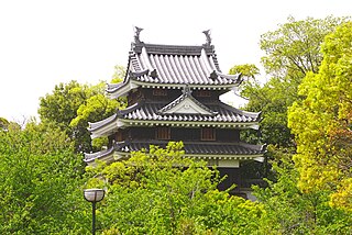
Kanazawa is the capital city of Japan's Ishikawa Prefecture. As of 1 January 2018, the city had an estimated population of 466,029 in 203,271 households, and a population density of 990 persons per km2. The total area of the city was 468.64 square kilometres (180.94 sq mi).
Shōnai Domain was a feudal domain in Edo period Japan, located in Dewa Province, Japan. It was centered on Tsuruoka Castle in what is now the city of Tsuruoka in Yamagata Prefecture, and was thus also known as the Tsuruoka Domain. It was governed for the whole of its history by the Sakai clan, which resulted in an unusually stable and prosperous domain. During their rule over Shōnai, the Sakai clan was ranked as a province-holding daimyō family, and as such, had the privilege of shogunal audiences in the Great Hall (Ohiroma) of Edo Castle. In the Boshin War of 1868–69, the domain joined the Ōuetsu Reppan Dōmei, the alliance of northern domains supporting the Tokugawa shogunate, but then later defected to the imperial side. As with all other domains, it was disbanded in 1871.

Rice brokers, which rose to power and significance in Osaka and Edo in the Edo period (1603-1867) of Japanese history, were the forerunners to Japan's banking system. The concept actually originally arose in Kyoto several hundred years earlier; the early rice brokers of Kyoto, however, operated somewhat differently, and were ultimately not nearly as powerful or economically influential as the later Osaka system would be.
The Kyoto Mimawarigumi was a special police force created by the Tokugawa shogunate during the late Bakumatsu period to restore public order to Kyoto.

Bugyō (奉行) was a title assigned to samurai officials during the feudal period of Japan. Bugyō is often translated as commissioner, magistrate, or governor, and other terms would be added to the title to describe more specifically a given official's tasks or jurisdiction.
Yoita Domain was a fudai feudal domain under the Tokugawa shogunate of Edo period Japan. It was located in Echigo Province, Honshū. The domain was centered at Yoita Jin'ya, located in what is now part of the city of Nagaoka in Niigata Prefecture.
Matsudaira Sadaaki was a Japanese daimyō of the Bakumatsu period, who was the last ruler of the Kuwana Domain. Sadaaki was the adopted heir of Matsudaira Sadamichi, the descendant of Sadatsuna, the third son of Hisamatsu Sadakatsu (1569–1623), who was Tokugawa Ieyasu's brother. His family was known as the Hisamatsu Matsudaira clan. It was to this family that Matsudaira Sadanobu also belonged.
Nishio Domain was a feudal domain of the Tokugawa shogunate of Edo period Japan, located in former Mikawa Province, in what is now the modern-day city of Nishio in Aichi Prefecture, Japan. It was centered on Nishio Castle.

Kishiwada Domain was a feudal domain under the Tokugawa shogunate of Edo period Japan, located in Izumi Province in what is now the southern portion of modern-day Osaka Prefecture. It was centered around Kishiwada Castle and was controlled by the fudai daimyō Okabe clan throughout much of its history.
Sasayama Domain was a feudal domain under the Tokugawa shogunate of Edo period Japan, located in Tanba Province in what is now the west-central portion of modern-day Hyōgo Prefecture. It was centered initially around Sasayama Castle in what is now the city of Tamba-Sasayama.
Ogasawara Nagashige, also known as Sado-no-kami or Etchū-no-kami, was a Japanese samurai daimyō of the mid-Edo period.
Fires in Edo (江戸), the former name of Tokyo, during the Edo period (1600−1868) of Japan were so frequent that the city of Edo was characterized as the saying "Fires and quarrels are the flowers of Edo" goes. Even in the modern days, the old Edo was still remembered as the "City of Fires" (火災都市).

The term Jōkamachi refers to a type of urban structures in Japan in which the city surrounds a feudal lord's castle. These cities did not necessarily form around castles after the Edo period; some are known as Jin'yamachi, cities that have evolved around Jin'ya or government offices that are not intended to provide military services. Defined broadly, Jokamachi includes Jin'yamachi. It is also referred to as Jōka as was common before the early modern period.
Tōyama Tomoyoshi was the 12th and final daimyō of Naegi Domain under the Bakumatsu period Tokugawa Shogunate of Japan. His wife was a daughter of Shimazu Tadayuki of Sadowara Domain. His courtesy titles were Buzen-no-kami, Shinano-no-kami and Mino-no-kami, and he was also called Tōyama Tomoaki (遠山友詳).