Denton, North Carolina

Last updated

Denton, North Carolina
Denton, North Carolina 03.jpg
Salisbury Street
NCMap-doton-Denton.PNG
Location of Denton, North Carolina
Coordinates: 35°37′14″N80°05′52″W / 35.62056°N 80.09778°W / 35.62056; -80.09778
Country United States
State North Carolina
County Davidson
Government
  MayorLarry D. Ward
Area
[1]
  Total2.11 sq mi (5.46 km2)
  Land2.10 sq mi (5.45 km2)
  Water0.01 sq mi (0.02 km2)
Elevation
[2]
712 ft (217 m)
Population
 (2020)
  Total1,494
  Density710.41/sq mi (274.32/km2)
Time zone UTC−5 (Eastern (EST))
  Summer (DST) UTC−4 (EDT)
ZIP Code
27239
Area code 336
FIPS code 37-16980 [3]
GNIS feature ID2406375 [2]
Website www.townofdenton.com

Denton is a town in Davidson County, North Carolina, United States. As of the 2020 census, the population of the town was 1,494. [4]

Contents

Geography

Denton is located in southern Davidson County 17 miles (27 km) southeast of Lexington, the county seat.

According to the United States Census Bureau, the town has a total area of 2.0 square miles (5.1 km2), of which 0.006 square miles (0.015 km2), or 0.31%, is water. [5]

Climate

Climate data for Denton, North Carolina
MonthJanFebMarAprMayJunJulAugSepOctNovDecYear
Record high °F (°C)78
(26)
82
(28)
92
(33)
93
(34)
97
(36)
103
(39)
104
(40)
105
(41)
100
(38)
96
(36)
87
(31)
79
(26)
105
(41)
Mean daily maximum °F (°C)49
(9)
54
(12)
62
(17)
71
(22)
78
(26)
84
(29)
88
(31)
86
(30)
80
(27)
71
(22)
62
(17)
52
(11)
70
(21)
Mean daily minimum °F (°C)30
(−1)
33
(1)
40
(4)
48
(9)
56
(13)
65
(18)
69
(21)
68
(20)
61
(16)
49
(9)
40
(4)
33
(1)
49
(10)
Record low °F (°C)−8
(−22)
2
(−17)
8
(−13)
25
(−4)
33
(1)
39
(4)
45
(7)
46
(8)
36
(2)
21
(−6)
10
(−12)
−1
(−18)
−8
(−22)
Average precipitation inches (mm)3.83
(97)
3.78
(96)
4.02
(102)
3.64
(92)
3.52
(89)
3.90
(99)
4.08
(104)
4.17
(106)
3.94
(100)
3.68
(93)
3.41
(87)
3.27
(83)
45.24
(1,148)
Source: The Weather Channel [6]

Demographics

Historical population
CensusPop.Note
1910 320
1920 55974.7%
1930 540−3.4%
1940 67725.4%
1950 76613.1%
1960 85211.2%
1970 1,01719.4%
1980 949−6.7%
1990 1,29236.1%
2000 1,45012.2%
2010 1,63612.8%
2020 1,494−8.7%
U.S. Decennial Census [7]

2020 census

Denton racial composition [8]
RaceNumberPercentage
White (non-Hispanic)1,39393.24%
Black or African American (non-Hispanic)70.47%
Native American 40.27%
Asian 120.8%
Pacific Islander 20.13%
Other/Mixed 523.48%
Hispanic or Latino 241.61%

As of the 2020 United States census, there were 1,494 people, 671 households, and 403 families residing in the town.

2010 census

As of the census [3] of 2010, there were 1,636 people. The population density was 821.5 inhabitants per square mile (317.2/km2). There were 651 housing units at an average density of 368.8 per square mile (142.4/km2). The racial makeup of the town was 98.07% White, 0.62% African American, 0.34% Asian, 0.34% from other races, and 0.62% from two or more races. Hispanic or Latino of any race were 2.00% of the population.

There were 595 households, out of which 34.1% had children under the age of 18 living with them, 51.8% were married couples living together, 11.8% had a female householder with no husband present, and 30.9% were non-families. 26.2% of all households were made up of individuals, and 11.9% had someone living alone who was 65 years of age or older. The average household size was 2.44 and the average family size was 2.89.

In the town, the population was spread out, with 25.9% under the age of 18, 6.6% from 18 to 24, 33.3% from 25 to 44, 19.7% from 45 to 64, and 14.4% who were 65 years of age or older. The median age was 36 years. For every 100 females, there were 90.8 males. For every 100 females age 18 and over, there were 88.1 males.

The median income for a household in the town was $30,950, and the median income for a family was $40,375. Males had a median income of $28,571 versus $21,354 for females. The per capita income for the town was $19,439. About 11.2% of families and 14.4% of the population were below the poverty line, including 23.1% of those under age 18 and 10.5% of those age 65 or over.

History

The founding of Denton may be dated from the time the place acquired a post office, began to be called "Denton" and ceased to be "Finch's Cross Road". The General Assembly passed a bill incorporating the town of Denton on March 11, 1907. The town had its first mayor, J.E. Varner, in 1907, with B.I. Harrison, Arthur E. Davis, J.M. Daniel, L.A. Newsom and Jesse C. Morris as town commissioners. Abel Anderson was the town physician, and John F. Carroll as the chief of police. [9]

The Adderton - Badgett House, Chapel Hill Church Tabernacle, Mor-Val Hosiery Mill, and Mount Ebal Methodist Protestant Church are listed on the National Register of Historic Places. [10] [11]

The Southeast Old Threshers' Reunion, described as "the largest antique tractor and engine show in the Southeast", takes place during the July 4 holiday at Denton FarmPark, a historical park with several restored buildings. A one-day event with airplane rides later expanded to include displays of farm equipment to give people something to do while they waited. As of the 48th annual event in 2018, over 50,000 attended from 20 states, and the five-day event includes 125 vendors, train and helicopter rides, musical performances and fireworks. The primary purpose is to teach people, especially children, about the history of agriculture. Lawn and garden equipment was added in 2018. [12]

Education

Denton has two area elementary schools; Denton Elementary and Silver Valley Elementary. Silver Valley is the smallest elementary school in the Davidson County Schools system, having just under 275 students. Denton Elementary is almost twice the size of Silver Valley, with about 460 children. Both schools feed into South Davidson Middle School, which lies just a mile north of the Denton town limits. South Davidson Middle has just under 395 students. The middle school feeds into the adjoined high school, South Davidson High School. South Davidson is the smallest high school in Davidson County with 413 students at the 2011-2012 school year. The closest college to Denton is Davidson County Community College, a two-year college in northern Davidson County. The closest four-year college is Pfeiffer University, located 19 miles south, near Richfield.

Notable people

Related Research Articles

<span class="mw-page-title-main">Washington County, North Carolina</span> County in North Carolina, United States

Washington County is a county located in the U.S. state of North Carolina. As of the 2020 census, the population was 11,003. Its county seat is Plymouth. The county was formed in 1799 from the western third of Tyrrell County. It was named for George Washington.

<span class="mw-page-title-main">Stanly County, North Carolina</span> County in North Carolina, United States

Stanly County is a county in the U.S. state of North Carolina. As of the 2020 census, the population was 62,504. Its county seat is Albemarle.

<span class="mw-page-title-main">Davidson County, North Carolina</span> County in North Carolina, United States

Davidson County is a county located in the U.S. state of North Carolina. As of the 2020 census, the population was 168,930. Its county seat is Lexington, and its largest community is Thomasville.

<span class="mw-page-title-main">New Paris, Indiana</span> Census-designated place in Indiana, United States

New Paris is a census-designated place (CDP) in Elkhart County, Indiana, United States. The population was 1,494 at the 2010 census.

<span class="mw-page-title-main">Greene, Maine</span> Town in the state of Maine, United States

Greene is a town in Androscoggin County, Maine, United States. The population was 4,376 at the 2020 census. It is included in both the Lewiston-Auburn, Maine metropolitan statistical area and the Lewiston-Auburn, Maine Metropolitan New England city and town area. The central village in the town comprises the Greene census-designated place.

<span class="mw-page-title-main">Seward, Nebraska</span> City in and county seat of Seward County, Nebraska, United States

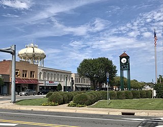
Seward is a city and county seat of Seward County, Nebraska, United States. The population was 6,964 at the 2010 census. Seward is part of the Lincoln, Nebraska Metropolitan Statistical Area.

<span class="mw-page-title-main">Icard, North Carolina</span> Census-designated place in North Carolina, United States

Icard is a census-designated place (CDP) in Burke County, North Carolina, United States. The population was 2,664 at the 2010 census. It is part of the Hickory–Lenoir–Morganton Metropolitan Statistical Area.

<span class="mw-page-title-main">Summerfield, North Carolina</span> Town in North Carolina, United States

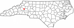
Summerfield is a town in Guilford County, North Carolina. As of the 2020 census, the population was 10,951.

<span class="mw-page-title-main">Cornelius, North Carolina</span> Town in North Carolina, United States

Cornelius is a suburban town located along Lake Norman in northern Mecklenburg County, North Carolina, United States. It is a major suburb in the Charlotte metropolitan area. The population was 24,866 at the 2010 census.

<span class="mw-page-title-main">Mint Hill, North Carolina</span> Town in North Carolina, United States

Mint Hill is a suburban town in southeastern Mecklenburg and northwestern Union counties in the U.S. state of North Carolina, it is a major suburb on the outskirts of Charlotte and near the Cabarrus County line. The population was 22,722 at the 2010 census.

<span class="mw-page-title-main">Jackson, North Carolina</span> Town in North Carolina, United States

Jackson is a town in Northampton County, North Carolina, United States. The population was 513 at the 2010 census. It is the county seat of Northampton County.

<span class="mw-page-title-main">Bethel, North Carolina</span> Town in North Carolina, United States

Bethel is a town in Pitt County, North Carolina, United States. The population was 1,577 at the 2010 census. The town is a part of the Greenville Metropolitan Area located in North Carolina's Inner Banks region. Confusingly, there are three other towns in the state named "Bethel." One is between Edenton and Hertford in the "Finger Counties" region in the northeastern corner of the state, another is in the north-central part, in Caswell County and the third is located in the Mountain Region of North Carolina, in Haywood County. There is also a community named Bethel located in Watauga County.

<span class="mw-page-title-main">Quintana, Texas</span> Town in Texas, United States

Quintana is a town in Brazoria County, Texas, United States. Its population was 56 at the 2010 census.

<span class="mw-page-title-main">Bartonville, Texas</span> Town in Texas, United States

Bartonville is a town in Denton County, Texas, United States. The population was 1,469 at the 2010 census.

<span class="mw-page-title-main">Draper, Texas</span> Town in Texas, United States

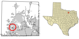
Draper, formerly Corral City, is a town in Denton County, Texas, United States. The population was 27 at the 2010 census.

<span class="mw-page-title-main">Double Oak, Texas</span> Town in Texas, United States

Double Oak is a town in Denton County, Texas, United States. The population was 2,867 at the 2010 census.

<span class="mw-page-title-main">Hickory Creek, Texas</span> Town in Texas, United States

Hickory Creek is a town in Denton County, Texas, United States, located 30 miles (48 km) north of downtown Dallas. The population of Hickory Creek has grown from 219 at its incorporation in 1963 to 3,247 at the 2010 census. It is also one of the four communities in the Lake Cities.

<span class="mw-page-title-main">Lincoln Park, Texas</span> Former Town in Texas, United States

Lincoln Park was a town in Denton County, Texas, United States. The population was 308 at the 2010 census.

<span class="mw-page-title-main">Shady Shores, Texas</span> Town in Texas, United States

Shady Shores is a town in Denton County, Texas, United States. The population was 2,612 at the 2010 census. It is also one of four communities in the Lake Cities.

<span class="mw-page-title-main">Thomasville, North Carolina</span> City in North Carolina, United States

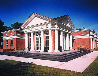
Thomasville is a city in Davidson County, North Carolina, United States. The population was 27,183 at the 2020 census. The city was once notable for its furniture industry, as were its neighbors High Point and Lexington. This Piedmont Triad community was established in 1852 and hosts the state's oldest festival, "Everybody's Day".

References

  1. "ArcGIS REST Services Directory". United States Census Bureau. Retrieved September 20, 2022.
  2. 1 2 U.S. Geological Survey Geographic Names Information System: Denton, North Carolina
  3. 1 2 "U.S. Census website". United States Census Bureau . Retrieved January 31, 2008.
  4. "Explore Census Data". data.census.gov. Retrieved October 27, 2023.
  5. "Geographic Identifiers: 2010 Demographic Profile Data (G001): Denton town, North Carolina". U.S. Census Bureau, American Factfinder. Archived from the original on February 13, 2020. Retrieved November 25, 2015.
  6. "Denton, NC Monthly Weather Forecast - weather.com". The Weather Channel. Retrieved August 20, 2019.
  7. "Census of Population and Housing". Census.gov. Retrieved June 4, 2015.
  8. "Explore Census Data". data.census.gov. Retrieved December 20, 2021.
  9. more history of Denton
  10. "National Register Information System". National Register of Historic Places . National Park Service. July 9, 2010.
  11. "National Register of Historic Places Listings". Weekly List of Actions Taken on Properties: 4/23/12 through 4/27/12. National Park Service. May 4, 2012.
  12. Myers, Sharon (July 3, 2018). "Threshers' Reunion brings friends and collectors together". The Dispatch . Retrieved July 4, 2018.
  13. Associated Press, "Sportswriter Furman Bisher dies at 93; NC native wrote for Atlanta newspaper for 59 years [ dead link ]," The Washington Post (March 18, 2012). Retrieved March 19, 2012.
  14. "Max Lanier". baseball-reference.com . Retrieved April 19, 2014.