Detroit, Oregon | |
---|---|
Coordinates: 44°44′02″N122°09′04″W / 44.73389°N 122.15111°W | |
Country | United States |
State | Oregon |
County | Marion |
Incorporated | 1952 |
Government | |
• Mayor | Jim Trett[ citation needed ] |
Area | |
• Total | 0.95 sq mi (2.47 km2) |
• Land | 0.59 sq mi (1.52 km2) |
• Water | 0.37 sq mi (0.95 km2) |
Elevation | 1,604 ft (489 m) |
Population | |
• Total | 203 |
• Density | 346.42/sq mi (133.71/km2) |
Time zone | UTC-8 (Pacific) |
• Summer (DST) | UTC-7 (Pacific) |
ZIP code | 97342 |
Area code(s) | 503 and 971 |
FIPS code | 41-19100 [4] |
GNIS feature ID | 2410330 [2] |
Detroit is a city in Marion County, Oregon, United States. It was named for Detroit, Michigan, in the 1890s because of the large number of people from Michigan in the community. The population was 203 at the 2020 census. It is part of the Salem Metropolitan Statistical Area.
The original townsite of Detroit was inundated in the summer of 1952 when the Corps of Engineers finished Detroit Dam on the Santiam River. [5] The community was relocated about 1⁄2 mile (0.80 km) northwest of the original site, on Route 22, and was incorporated as a city the same year.
Construction on the concrete Detroit Dam began on April 1, 1949 as part of the U.S. Army Corps of Engineers’ Willamette Valley Project. The completed dam was dedicated by former Oregon Governor Douglas McKay and the U. S. Secretary of the Interior on June 10, 1953. In addition to flood control, the dam benefited navigation, irrigation, electric power production, stream purification and recreation. [6]
Located near Detroit Lake and Detroit Lake State Park, Detroit's economy is dependent on tourism. The community suffered from a drought in 2001, when Detroit Lake was little more than the Santiam River through the summer. [7]
In 2010, by a vote of 47–37, [8] citizens in Detroit voted down a ballot measure that would have changed the city's name to Detroit Lake, the name of the neighboring reservoir and one of the most visited summer sites in Oregon. The proposal was put forth by Doug DeGeorge, a builder and motel owner who resides in Arizona and wanted to disassociate the town from Detroit, Michigan, and its close ties to "crime, corruption, failing schools, and a shaky auto industry". DeGeorge was not present on the day of the city council vote, but repercussions from his comments had phone lines flooded with angry calls from Michigan residents. Voters chose to keep the original name of the city, though most residents and tourists still call it Detroit Lake. [9] Gary Brown, a city councilman in Detroit, Michigan, disagreed with the proposal, saying local residents would have made a big mistake because "the Motor City will one day return to its previous glory". [10]
On September 9, 2020, the entire city of Detroit was mostly burned to the ground during the Santiam Fire. [11] Dozens of people were trapped, but managed to escape on a forest road through the active fire. [12] [13] [14] A few months later, during the February 2021 winter and ice storm, the city received 26 in (66 cm) of snow—the most of any place affected by the storm. [15]
According to the United States Census Bureau, Detroit has a total area of 0.96 square miles (2.49 km2), of which 0.59 square miles (1.53 km2) is land and 0.37 square miles (0.96 km2) is water. [16]
This region experiences warm (but not hot) and dry summers, with no average monthly temperatures above 71.6 °F (22.0 °C). According to the Köppen Climate Classification system, Detroit has a warm-summer Mediterranean climate, abbreviated "Csb" on climate maps. [17]
Climate data for 1948-1972 Detroit, Oregon. | |||||||||||||
---|---|---|---|---|---|---|---|---|---|---|---|---|---|
Month | Jan | Feb | Mar | Apr | May | Jun | Jul | Aug | Sep | Oct | Nov | Dec | Year |
Mean daily maximum °F (°C) | 40.7 (4.8) | 46.9 (8.3) | 50.3 (10.2) | 58.1 (14.5) | 65.8 (18.8) | 72.4 (22.4) | 81.7 (27.6) | 81.2 (27.3) | 75.2 (24.0) | 62.5 (16.9) | 50.5 (10.3) | 42.8 (6.0) | 60.7 (15.9) |
Mean daily minimum °F (°C) | 26.9 (−2.8) | 29.7 (−1.3) | 30.5 (−0.8) | 33.9 (1.1) | 40.0 (4.4) | 45.6 (7.6) | 47.9 (8.8) | 47.6 (8.7) | 42.9 (6.1) | 37.8 (3.2) | 32.8 (0.4) | 29.7 (−1.3) | 37.1 (2.8) |
Average precipitation inches (mm) | 14.23 (361) | 9.95 (253) | 9.07 (230) | 5.05 (128) | 3.71 (94) | 2.35 (60) | 0.52 (13) | 1.19 (30) | 2.99 (76) | 7.60 (193) | 11.86 (301) | 13.99 (355) | 82.51 (2,096) |
Average snowfall inches (cm) | 31.4 (80) | 13.8 (35) | 14.8 (38) | 1.9 (4.8) | 0.1 (0.25) | 0.0 (0.0) | 0.0 (0.0) | 0.0 (0.0) | 0.0 (0.0) | 0.1 (0.25) | 2.6 (6.6) | 17.2 (44) | 82.1 (209) |
Source: The Western Regional Climate Center [18] |
Census | Pop. | Note | %± |
---|---|---|---|
1960 | 206 | — | |
1970 | 328 | 59.2% | |
1980 | 367 | 11.9% | |
1990 | 331 | −9.8% | |
2000 | 262 | −20.8% | |
2010 | 202 | −22.9% | |
2020 | 203 | 0.5% | |
U.S. Decennial Census [19] [3] |
As of the census of 2010, there were 202 people, 96 households, and 59 families living in the city. The population density was 342.4 inhabitants per square mile (132.2/km2). There were 368 housing units at an average density of 623.7 per square mile (240.8/km2). The racial makeup of the city was 95.5% White, 1.5% Native American, and 3.0% from two or more races. Hispanic or Latino of any race were 3.0% of the population. [4]
There were 96 households, of which 19.8% had children under the age of 18 living with them, 53.1% were married couples living together, 7.3% had a female householder with no husband present, 1.0% had a male householder with no wife present, and 38.5% were non-families. 30.2% of all households were made up of individuals, and 9.4% had someone living alone who was 65 years of age or older. The average household size was 2.10 and the average family size was 2.64. [4]
The median age in the city was 51.4 years. 18.3% of residents were under the age of 18; 4% were between the ages of 18 and 24; 13.9% were from 25 to 44; 48.1% were from 45 to 64; and 15.8% were 65 years of age or older. The gender makeup of the city was 49.5% male and 50.5% female. [4]
As of the census of 2000, there were 262 people, 119 households, and 69 families living in the city. The population density was 496.7 inhabitants per square mile (191.8/km2). There were 383 housing units at an average density of 726.2 per square mile (280.4/km2). The racial makeup of the city was 96.56% White, 1.15% Native American, 0.38% from other races, and 1.91% from two or more races. Hispanic or Latino of any race were 3.82% of the population. [4]
There were 119 households, out of which 21.8% had children under the age of 18 living with them, 47.1% were married couples living together, 10.1% had a female householder with no husband present, and 41.2% were non-families. 33.6% of all households were made up of individuals, and 16.0% had someone living alone who was 65 years of age or older. The average household size was 2.20 and the average family size was 2.77. [4]
In the city, the population was spread out, with 22.1% under the age of 18, 5.0% from 18 to 24, 23.3% from 25 to 44, 33.2% from 45 to 64, and 16.4% who were 65 years of age or older. The median age was 45 years. For every 100 females, there were 103.1 males. For every 100 females age 18 and over, there were 100.0 males. [4]
The median income for a household in the city was $32,250, and the median income for a family was $35,156. Males had a median income of $41,875 versus $22,188 for females. The per capita income for the city was $19,857. About 17.9% of families and 16.1% of the population were below the poverty line, including 44.1% of those under the age of eighteen and none of those 65 or over. [4]
Detroit is served by the Santiam Canyon School District, whose schools are located in nearby Mill City, Oregon. [20]
Montpelier is a city in Bear Lake County, Idaho, United States. The population was 2,538 at the 2019 estimation, down from 2,597 in 2010 census. The city is the largest community in the Bear Lake Valley, a farming region north of Bear Lake in southeastern Idaho along the Utah border. It was settled in 1863 by Mormon pioneers on the route of the Oregon Trail. Nearby to the east is the border with Wyoming.
Omer is a city in Arenac County in the U.S. state of Michigan. The population was 274 at the 2020 census, which ranks it as the least-populated city in the state.
East Jordan is a city in Charlevoix County in the U.S. state of Michigan. The population was 2,239 at the 2020 census.
Garden is a village in Delta County of the U.S. state of Michigan. The population was 174 at the 2020 census. The village is located within Garden Township.
Gladwin is a city in Gladwin County in the U.S. state of Michigan. The population was 3,069 at the 2020 census. Gladwin is the county seat of Gladwin County. The city is at the southwest corner of Gladwin Township, but the two are administered autonomously.
Harbor Beach is a city in Huron County in the U.S. state of Michigan. The population was 1,604 at the 2020 census.
Iron River is a city in Iron County in the U.S. state of Michigan. As of the 2020 census, the city population was 3,007. The city is situated at the southeast corner of Iron River Township, but is administratively autonomous.
Fraser is a city in Macomb County in the U.S. state of Michigan. A northern suburb of Detroit, Fraser is located roughly 15 miles (24.1 km) northeast of downtown Detroit. As of the 2020 census, the city had a population of 14,726.
Big Bay is an unincorporated community in Marquette County of the U.S. state of Michigan. It is a census-designated place (CDP) for statistical purposes and does not have any legal status as an incorporated municipality. As of the 2020 census, the CDP had a population of 257, down from 319 in 2010. The community is located within Powell Township near the shore of Big Bay on Lake Superior.
Lakeview is a village in Cato Township in Montcalm County of the U.S. state of Michigan. The population was 1,024 at the 2020 census.
Chelsea is a city in Washtenaw County in the U.S. state of Michigan. The population was 5,467 at the 2020 census.
Belleville is a city in Wayne County in the U.S. state of Michigan. A western suburb of Detroit, Belleville is located roughly 29 miles (46.7 km) southwest of downtown Detroit, and 18 miles (29.0 km) southeast of Ann Arbor, and is completely surrounded by Van Buren Township. As of the 2010 census, the city had a population of 3,991.
Gibraltar is a city in Wayne County in the U.S. state of Michigan. The population was 4,656 at the 2010 census.
Sisters is a city in Deschutes County, Oregon, United States. It is part of the Bend, Oregon Metropolitan Statistical Area. The population was 2,038 at the 2010 census.
Waterloo is a city in Linn County, Oregon, United States. The population was 229 at the 2010 census.
Jefferson is a city in Marion County, Oregon, United States. It is part of the Salem Metropolitan Statistical Area. The population was 3,327 at the 2020 census. The city sits on the right bank of the Santiam River between Salem and Albany along Oregon Route 164 east of Interstate 5.
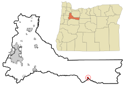
Stayton is a city in Marion County, Oregon, United States, located 12 miles (19 km) southeast of the state capital, Salem, on Oregon Route 22. It is south of Sublimity and east of Aumsville. Located on the North Santiam River, Stayton is a regional agricultural and light manufacturing center. The population was 8,244 at the 2020 census. Established in 1872, it was incorporated in 1891. Stayton is part of the Salem Metropolitan Statistical Area.
Gates is a city on the border of Linn and Marion counties in Oregon, United States. The population was 548 at the 2020 census. The greater part of Gates' population is in Marion County and the city is primarily under Marion County's jurisdiction.
Idanha is a city on the Marion County/Linn County line in Oregon, United States, on Oregon Route 22 and the Santiam River. The population was 156 at the 2020 census.
Mill City is a city in Linn and Marion counties in the U.S. state of Oregon on Oregon Route 22. The population was 1,971 at the 2020 census. It is on the North Santiam River, downstream from Detroit Lake.