Dhule is a city located in the Dhule District in the northwestern part of Maharashtra state, India known as West Khandesh. Situated on the banks of Panzara River, Dhule is the regional headquarters of MIDC, RTO, and MTDC.
The city, with industrial areas, schools, hospitals, and residential areas, has communications and transport infrastructures. Dhule is largely emerging as one of the upcoming hubs of textile, edible oil, Information Technology, and power-loom across the state and has gained a strategic advantage for being on the junction of three National Highways viz. NH-3, NH-6, and NH-211 and on most anticipated Manmad – Indore Rail Project. Recently Ministry of Surface Transport has granted conversion of surrounding 4 state highways to National Highway, after which Dhule would be the one amongst very few cities in India being located on convergence of 7 National Highways. Conversion of NH-3 from four lanes to six lanes between Dhule and Nashik with modern facilities is under process.[2][3]
Dhule city is also a part of Delhi Mumbai Industrial Corridor Project, as Node – 17, India's most ambitious infrastructure program, aiming to develop new industrial cities and converging next generation technologies across infrastructure sectors.[4][5][6]
Until the beginning of the 19th century, Dhule was an insignificant village, subordinate to Laling, the capital of the Laling or Fatehabad Subdivision. Under the rule of the Nizam, Laling was incorporated with the District of Daulatabad. The town passed successively through the hands of the Arab kings, the Mughals, and the Nizam, and into the power of the Peshwas about 1795. In 1803, it was completely deserted by its inhabitants on account of the ravages of Holkar and the terrible famine of that year. In the following year, Balaji Balwant, a dependant of the Vinchurkar, to whom the parganas of Laling and Songir had been granted by the Peshwa, repeopled the town and received from the Vinchurkar, in return for his services, a grant of inam land and other privileges. He was subsequently entrusted with the entire management of the territory of Songir and Laling, and fixed his headquarters at Dhule, where he continued to exercise authority till the occupation of the country by the British in 1818. Dhule was immediately chosen as the headquarters of the newly formed District of Khandesh by Captain John Briggs. In British Raj Britishers call it Dhulia.In January 1819, he obtained sanction for building public offices for the transaction of revenue and judicial business. Artificers were brought from distant places, and the buildings were erected at a total cost of £2700. Every encouragement was offered to traders and others to settle in the new town. Building sites were granted rent-free in perpetuity, and advances were made both to the old inhabitants and strangers to enable them to erect substantial houses. At this time, Captain Briggs described Dhule as a small town, surrounded by garden cultivation, and shut in between an irrigation channel and the river. The town was located on the southern bank of the Panzara River with an area of about one square mile. In 1819, the population numbered only 2509 persons, living in 401 houses. In 1863, there were 10,000 inhabitants; while by 1872 the number had further increased to 12,489, with 2620 houses. From the date of its occupation by the British, the progress of Dhule had been steady. Towards the end of the 19th century the town had already become a significant trading center due to the trade in cotton and linseed. Coarse cotton, woolen cloths and turbans were manufactured for local use around this time. In 1872, Dhule was visited by a severe flood, which did much damage to houses and property.[9][10]
The Dhulia aka Dhule civil hospital was established in 1825 by British government[11]
Dhule was a cantonment town, and in year 1881 had two hospitals, telegraph and post offices. In 1873–74 there were four Government schools, with 551 pupils. Historically, the town has been divided into New and Old Dhule. In the latter, the houses were irregularly built, the majority being of a very humble description.[9][10]
The climate of the district is on the whole dry except during the south-west monsoon season. The year may be divided into four seasons. The cold season from December to February is followed by the hot season from March to May. The south-west monsoon season which follows thereafter, lasts till September. October and November constitute the post-monsoon season.
The average annual rainfall in the district is 674.0mm. The rainfall is heavier in the hilly regions of the Western Ghats mountain range and the Satpura ranges. From about the latter half of February, temperatures increase steadily till May which is the hottest part of the year with the mean daily maximum temperature at 40.7 degrees Celsius.
From November, both day and night temperatures drop rapidly till January which is the coldest month with the mean daily minimum at 16.2-degree Celsius. Except during the south-west monsoon season when the humidity is above 70 per cent, the air is rather dry over the district during the rest of the year.
As of 2011[update] India census,[14] Dhule had a population of 375,603. At the 2011 census, males constitute 52% of the population and females 48%. Dhule has an average literacy rate of 85%, higher than the national average of 74%: male literacy is 80% and, female literacy is 69%. 13% of the population is under 6 years of age.
Shri Bhausaheb Hire Government Medical College was founded in 1989. Earlier hospital of Medical College was sub-merged with that of District Civil Hospital. However, since it was leading to several conflicts amongst staff of respective departments, Department of Medical Education decided to venture out itself from District Civil Hospital and erected its new building with state of the art medical facilities at Chakkar Bardi area of the city; around 8km away from city alongside NH-6 with total capacity of 500 beds and have shifted with effect from 14 March 2016.
At the old site in city, New Civil Hospital with a total capacity of 200 to 250 beds is proposed. MSRTC has resumed city-bus service connecting Central Bus Stand to Chakkar Bardi, so as to avoid any inconvenience to public.[16][17]
Industries and Economy of the City
Dhule is well known for purest 'milk and ghee' production, maximum cultivable land and production of groundnut, foremost in agro-based industries, leader in wind power generation.
In the Sakri Taluka there is the one of Asia's Largest Solar projects near Chhadvel Korde village.
Also there is Asia's largest Wind Mills Project run by Suzlon Company near Chhadvel Korde and Nijampur villages.
Dondaicha in Shindkheda taluka is famous for the chilly market. There is also a Starch factory here. Many cottage industries are operational in the district. Beedi rolling, pottery, brick making, knitting saris on handlooms, oil extraction from ground nut and sesame are few of them. Wood cutting units are operated at Dhule, Shirpur and Pimpalner.[18][bettersourceneeded]
As part of the successful development of the region under DMIC, there is a need to focus on ensuring the requisite irrigation infrastructure for ensuring availability of water throughout the year.
Reasons for selecting Dhule- Nardana Investment Region (DNIR):
Being located close to the intersection of NH-6, NH-3 and NH-211, this region enjoys advantage of excellent connectivity to ports and hinterland.
With abundant supply of raw materials and human resources, this region has wide potential for setting up of manufacturing units for textile products.
Dhule Airport is also located close to the proposed region.
This region is served by the major river basin formed by Tapi River[21][22][23]
Keep apart proposed DNIR, snapshot of existing Dhule M.I.D.C. is as under:[24]
1) Dhule Industrial Area:
M.I.D.C. has planned to develop an industrial area on 400.35 Hect. of land. About 278.08 Hect. of land has come into possession of MIDC. MIDC has provided all the basic infrastructure such as roads, street lights, water supply pipe lines in this area.
MIDC has constructed an earthen dam on Motinala to fulfill the requirement of water of the industrial area. MIDC has provided water supply scheme of 4.50 MLD capacity. Presently the consumption of the water is about 2.20 MLD. The rate of allotment of the industrial plot is Rs. 100.00 per sqm. The Association namely "Dhule Avdhan Manufacturers Association Avadhan, Dhule" has been established for the development of Industries in MIDC Dhule Industrial Area.
The expansion of existing MIDC has been proposed vide Phase- II in Raver area, situated in outskirts of the city, which is having an area of more than 1600 acres (643 hectares) and currently this proposal is under consideration of State Government.
Planned Manmad-Dhule-Indore Railway line have also been considered in the original proposal of DMIC (Delhi-Mumbai Industrial Corridor Project), which will boost Industrial growth in and around city.[25][26]
2) Nardana Central Government sponsored Growth Centre:
MIDC has planned to develop an industrial area on 750.09 Hect. of land. About 648.56 Hect. of land has come in possession of MIDC. The reservation of water for 4.38 MM3 per year has been granted by Irrigation Department. MIDC has provided the water supply scheme for this industrial area. This scheme includes Jackwell, 600mm dia PSC raw water rising main (13.50km.), 400mm dia PSC pure water rising main (9.50km.) water treatment plant of 6 MLD capacity & 1000 cum capacity ESR. Presently MIDC is developing phase I having land 480 Hect. MIDC has completed 7.22km. WBM roads, out of which asphalting of 2.10km road is completed. MIDC has also provided the water supply distribution pipelines. The rate of allotment of industrial plot is Rs. 50.00 per Sqm.
Under proposed DMIC, The Nardana Textile Park is being set up 30km from Dhule City. The total area of the park will be approximately 648 hectares, on which 72 plots will be demarcated. The Dhule airstrip, just 30km away from the industrial area, will provide accessibility to the park and facilitate a quick movement of material.[27]
Dhule is one of the few cities in the Maharashtra State which is located on the junction of three National Highways, these being NH-3, NH-6 and NH-211. Through the Asian highway project, portions of NH3 and NH6 passing through Dhule have been converted into numbered Asian Highways AH47 & AH46 respectively.
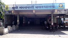
Due to the heavy use of Central Bus Stand and traffic congestion within the city, one more bus stand has been built in Deopur, which became fully operational from 23 March 2015. From this stand, about 120 route buses are running on a daily basis.[28][29][30] Central Bus Stand is connected to Deopur Bus Stand by four 25 seater mini-buses by Maharashtra State Road Transport Corporation (MSRTC). These buses run from Central Bus Stand to Nagav and from Deopur Bus Stand to Laling.[28][31] Recognizing ongoing expansion of the city limits and the increased population, Shri Annasaheb Misal (IAS), The Collector & District Magistrate of Dhule and Shri Rajendra Deore (Dhule Depot Controller) of MSRTC started city-bus services in July 2016. This service is available on four different routes – Laling to Nagav, Fagne to Morane, Walwadi to Vadjai, and CBS to Chakkar Bardi.
MSRTC started city-bus services in July 2016. This service is available on four different routes – Laling to Nagav, Fagne to Morane, Walwadi to Vadjai, and CBS to Chakkar Bardi.
Notable people
Anil Anna Gote – is an Indian politician and he was a Member of the Legislative Assembly, twice elected for the BJP from Dhule City.
Subhash Bhamre – Ex. Union Minister of State (Defence), Renowned carcinologist
Manoj Badale – Co-Owner of Rajasthan Royals, an Indian Premier League Team
Kirloskarvadi is India's second oldest industrial township that developed around the Kirloskar Brothers Ltd factory in the Palus, Sangli district, in Maharashtra state, India. It is the second oldest industrial township in India. On 10 March 2010, Kirloskarvadi celebrated 100 years of its establishment. Kirloskarvadi is a rapidly growing satellite suburb of Palus city. The famous holy place of God Datta Maharaj Audumbar is just 10 km away. While Sagareshwar picnic spot is around 8–10. The town has centric connectivity between Satara-Sangli-Kolhapur
Shahada is a town in Nandurbar district of the Indian state of Maharashtra. It is a Municipal council.
Khed is a municipal council in the Ratnagiri district of the state of Maharashtra, India. Khed town is situated on the Mumbai - Ratnagiri Highway.
Dhule district is a district of Maharashtra, India. The city of Dhule is the administrative headquarters of the district. It is part of North Maharashtra.
Chiplun ( [t͡ʃipɭuːɳ]) is a city in Ratnagiri district in the state of Maharashtra, India. It is one of the financial and commercial Hubs of Ratnagiri district, and the headquarters of Chiplun taluka. It is about 250 km south of Mumbai and 90 km North of Ratnagiri in the Konkan region of Maharashtra, on the Mumbai–Goa highway (NH-66). It has a long history and a strong cultural background. Recent decades have seen much industrial development in it and its and surrounding areas.
Erandol is a town and a taluka in Jalgaon district in the Indian state of Maharashtra state. It is situated on the banks of the Anjani River. The vehicle registration is changed now it's MH-54.
Gadhinglaj ([ɡəɖᵊɦiŋɡləd͡z]) is a city in India in the Kolhapur district in the southwest corner of the state of Maharashtra, India. It is located on the banks of the river Hiranyakeshi. It is the Taluka (Tehsil) headquarters of Gadhinglaj Taluka and a subdivision headquarters of the Gadhinglaj Subdivision of the Kolhapur District. It is governed by a municipal council. The rapidly growing city is the third largest in the Kolhapur District, with population of more than 50,000. Places to visit like Samagad fort, temples and beautiful weather.
Kalameshwar-Bramhani is a city and a municipal council also a major Industrial hub in Nagpur district in the Indian state of Maharashtra. It is connected to National Highways NH-353I, NH-353J & NH-547E.
Nandurbar is a city and a municipal council in Nandurbar district in the Indian state of Maharashtra. Nandurbar municipal corporation is the first municipal corporation. The District Nandurbar was formed from the district Dhule on July 1, 1998. Nandurbar is an administrative district in the northwest corner of of Maharashtra. On 1 July 1998 Dhule was bifurcated as two separate districts now known as Dhule and Nandurbar. The district headquarters is located at Nandurbar city. The district occupies an area of 5034 km2 and has a population of 1,311,709 of which 15.45% is urban. Nandurbar district is bounded to the south and south-east by Dhule district, to the west and north is the state of Gujarat, to the north and north-east is the state of Madhya Pradesh. The northern boundary of the district is defined by the great Narmada river. It came into limelight during February 2006 bird flu crisis which struck many of its poultry farms. Thousand of chickens from the farms had to be killed and buried in nearby grounds to stop the virus spreading.
Sakri is a census town and a taluka in the Dhule District of the Nashik division, Maharashtra state, India. The town of Sakri is the administrative headquarters for Sakri Taluka. Another Sakri is in Bihar, which is now a railway junction.
Shirpur is a town and taluka in Dhule district of Nashik Division, Maharashtra, India. It is located on National Highway 3, which runs from Agra in Uttar Pradesh to Mumbai, Maharashtra. The Arunavati River and Tapi river flows through the city. Shirpur is 50 km from the city of Dhule. It houses Asia's largest and India's first gold refinery. Narsee Monjee Institute of Management Studies has a campus in Shirpur. Ahead of Shirpur there is a small private airport at Village Tande.
Kalamboli is one of the nodes of Navi Mumbai in Raigad District. It is a transportation hub, being situated at the junction of the Sion-Panvel Highway, NH 48, Panvel By-Pass, NH 66 and Mumbai-Pune Expressway and is among the biggest iron and steel delivery centers in India. The township, like the rest of Navi Mumbai, is divided into sectors, which are further divided into plots. The residential and commercial areas of Kalamboli are divided by the NH 4 highway. Roadpali, a region to the north of Kalamboli, is developing at a faster rate than the latter with many residential projects coming up due to availability of land. Roadpali is located along the Taloja Link Road. Kalamboli also houses the Navi Mumbai Police Headquarters. CIDCO is the nodal administrative body for Kalamboli node. Kalamboli also has a Sewage Water Treatment Plant owned by CIDCO. Kalamboli is now governed by Panvel Municipal Corporation (PMC). The terminal of Mumbai-Pune Expressway is at Kalamboli. It also has Navi Mumbai's largest marble market alongside the Sion Panvel Highway.
Joya is a nagar panchayat located along highway NH-24 in Amroha district in the Western Uttar Pradesh. It is predominantly a milk producing city. Joya was a gram panchayat before 1988. The late Abrar Hussain was the first chairman of Joya in 1988.
The city of Nagpur is strategically located in central India. It has a vast railway network and its road network is well-maintained to avoid congestion. There are 4 modes of transportation in Nagpur. Nagpur is connected to India's four major metropolitan areas by road, rail and air. Auto rickshaws operate in most parts of the city, and are the main form of hired transport.
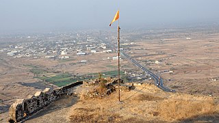
Laling Killa is a small fort (killa) situated in the present day Dhule district of Maharashtra state in India. The fort is situated on top of Laling hill about 9.65 km (6.00 mi) south of Dhule city. It was one of the important forts in the Khandesh region during the time of the Faruqi Kings.
Ner is a village standing on the Panjhara River in Dhule district of Maharashtra state in India.
Latur is a city in the Indian state of Maharashtra, and is one of the largest cities of the Marathwada region. It is the administrative headquarters of Latur district and Latur Taluka. The city is a tourist hub surrounded by many historical monuments, including Udgir Fort and Kharosa Caves. The people in Latur are called Laturkar. The most spoken language in Latur is Marathi. The city's quality of education attracts students from all over Maharashtra. It is a drought prone area with acute water shortage in its city and rural areas. The economy is agriculture intensive, but in recent years is also dependent on Educational sector & its allied activities. Industrial development is minimal in the district. Latur is 43 kilometers from the epicenter of the devastating 1993 Latur earthquake.
After 1960, Maharashtra Industrial Development Corporation (MIDC) began acquiring land and setting up industrial estates. Land was acquired near Shendra village on Aurangabad - Jalna highway in the 1990s.
The Aurangabad Industrial City is a greenfield industrial smart city spread over an area of 10,000 acres (40 km2) near Aurangabad, Maharashtra, India. It is a part of the Delhi–Mumbai Industrial Corridor Project (DMIC), which plans to develop an industrial zone spanning across six states between India's capital, Delhi and its financial hub, Mumbai.
Boisar is the largest industrial suburb in the Mumbai Metropolitan Region in the Indian state of Maharashtra. It was originally a part of the Thane district before becoming a part of the Palghar district. It is approximately 111 kilometers away from the state capital Mumbai, and is 98 km (61 mi) from the union territory Daman. It is located in the district Palghar in Maharashtra.
This page is based on this Wikipedia article Text is available under the CC BY-SA 4.0 license; additional terms may apply. Images, videos and audio are available under their respective licenses.