
Panaji is the capital of the Indian state of Goa and the headquarters of North Goa district. Previously, it was the territorial capital of the former Portuguese India. It lies on the banks of the Mandovi river estuary in the Tiswadi sub-district (taluka). With a population of 114,759 in the metropolitan area, Panaji is Goa's largest urban agglomeration, ahead of Margao and Mormugao.

The Zuari RiverZuvari, pronounced ) is the largest river in the state of Goa, India. It is a tidal river which originates at Hemad-Barshem in the Western Ghats. The Zuari is also referred to as the Aghanashani in the interior regions. It flows in the southern-western direction through the talukas of Tiswadi, Ponda, Mormugao, Salcete, Sanguem and Quepem.
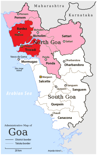
North Goa district is one of the two districts that constitutes the state of Goa, India. The district has an area of 1,736 square kilometres, and is bounded by Kolhapur and Sindhudurg districts of Maharashtra state to the north and by Belgavi district of Karnataka to the east, by South Goa district to the south, and by the Arabian Sea to the west.
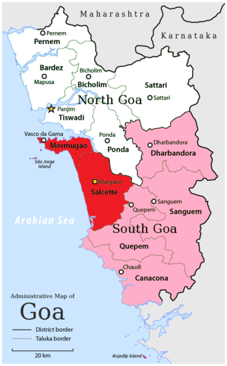
South Goa district is one of two districts that compose the state of Goa, India, within the region known as the Konkan. It is bounded by North Goa district to the north, the Uttara Kannada district of Karnataka state to the east and south, while the Arabian Sea forms its western coast.
North Goa Lok Sabha constituency is one of the two Lok Sabha (parliamentary) constituencies in Goa state in western India along with South Goa.

Bandora is a census town in Ponda Taluka in North Goa district in the state of Goa, India.
Karapur is a census town in North Goa district in the state of Goa, India.
Dharmapur is a census town in Chinsurah Mogra CD Block in Chinsurah subdivision of Hooghly district in the state of West Bengal, India. It is a part of Kolkata Urban Agglomeration.
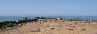
Chapora Fort, located in Bardez, Goa, rises high above the Chapora River. The site is the location of a fort built by Adil Shahi dynasty ruler Adil Shah and called Shahpoora, whose name was altered to Shapora (chapora) by Malvankar on the request of the Portuguese. It is now become a popular tourist spot and offers a view north across the Chapora river to Morjim

Assolna (Osollnnem) is a big village in the Salcete taluka of South Goa district, in the state of Goa, India. It is known for restaurants, ferry, the small traditional market, and local institutions. The Sal river flows through this village.
Dharmapur is a union of Fatikchhari Upazila of Chittagong District, Bangladesh.

Fort Santíssima Trindade also known as Fort Tiracol, is a Portuguese era fort near the village of Tiracol, in the North Goa district of Goa, India. At the mouth of the Terekhol River, the fort can be reached by a ferry from Querim, 42 km (26 mi) north of Panaji.
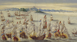
The Battle of Goa refers to a series of naval engagements between the Portuguese Armada and the Dutch East India Company fleets attempting to blockade and conquer the city of Goa. In 1638, forces commanded by the Viceroy of Portuguese India, D. Pedro da Silva and later António Teles de Meneses, fought off a large Dutch fleet sent to block the port colony of Goa, commanded by Admiral Adam Westerwolt, who was badly defeated at this encounter. The next year 1639, the Dutch Admiral Cornelis Simonsz van der Veere would conduct a new raid on Goa's port.
The Mormugão fort was located on the southern tip of the mouth of the Zuari river in Mormugao in the state of Goa on the west coast of India.

Dharmapur Assembly constituency is one of the 126 assembly constituencies of Assam Legislative Assembly. Dharmapur forms part of the Barpeta Lok Sabha constituency.
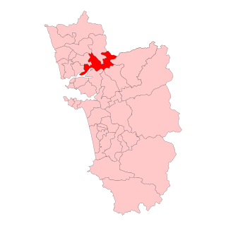
Maem Assembly constituency is one of the 40 Goa Legislative Assembly constituencies of the state of Goa in southern India. Maem is also one of the 20 constituencies falling under the North Goa Lok Sabha constituency.

Marcaim Assembly constituency is one of the 40 Goa Legislative Assembly constituencies of the state of Goa in southern India. Marcaim is also one of the 20 constituencies falling under the South Goa Lok Sabha constituency.

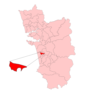
Mormugao Assembly constituency is one of the 40 Goa Legislative Assembly constituencies of the state of Goa in southern India. Mormugao is also one of the 20 constituencies falling under the South Goa Lok Sabha constituency. This constituency is the least populated constituency of Goa.
Margao Assembly constituency is one of the 40 Goa Legislative Assembly constituencies of the state of Goa in southern India. Margao is also one of the 20 constituencies falling under the South Goa Lok Sabha constituency.

Navelim Assembly constituency is one of the 40 Goa Legislative Assembly constituencies of the state of Goa in southern India. Navelim is also one of the 20 constituencies falling under the South Goa Lok Sabha constituency.

