
Seismology is the scientific study of earthquakes and the generation and propagation of elastic waves through the Earth or other planetary bodies. It also includes studies of earthquake environmental effects such as tsunamis as well as diverse seismic sources such as volcanic, tectonic, glacial, fluvial, oceanic microseism, atmospheric, and artificial processes such as explosions and human activities. A related field that uses geology to infer information regarding past earthquakes is paleoseismology. A recording of Earth motion as a function of time, created by a seismograph is called a seismogram. A seismologist is a scientist works in basic or applied seismology.

Geophysics is a subject of natural science concerned with the physical processes and physical properties of the Earth and its surrounding space environment, and the use of quantitative methods for their analysis. Geophysicists, who usually study geophysics, physics, or one of the Earth sciences at the graduate level, complete investigations across a wide range of scientific disciplines. The term geophysics classically refers to solid earth applications: Earth's shape; its gravitational, magnetic fields, and electromagnetic fields ; its internal structure and composition; its dynamics and their surface expression in plate tectonics, the generation of magmas, volcanism and rock formation. However, modern geophysics organizations and pure scientists use a broader definition that includes the water cycle including snow and ice; fluid dynamics of the oceans and the atmosphere; electricity and magnetism in the ionosphere and magnetosphere and solar-terrestrial physics; and analogous problems associated with the Moon and other planets.

A seismometer is an instrument that responds to ground noises and shaking such as caused by quakes, volcanic eruptions, and explosions. They are usually combined with a timing device and a recording device to form a seismograph. The output of such a device—formerly recorded on paper or film, now recorded and processed digitally—is a seismogram. Such data is used to locate and characterize earthquakes, and to study the internal structure of Earth.
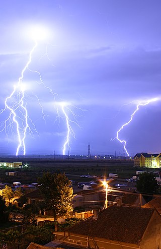
Atmospheric electricity describes the electrical charges in the Earth's atmosphere. The movement of charge between the Earth's surface, the atmosphere, and the ionosphere is known as the global atmospheric electrical circuit. Atmospheric electricity is an interdisciplinary topic with a long history, involving concepts from electrostatics, atmospheric physics, meteorology and Earth science.
The Lamont–Doherty Earth Observatory (LDEO) is the scientific research center of the Columbia Climate School, and a unit of The Earth Institute at Columbia University. It focuses on climate and earth sciences and is located on a 189-acre campus in Palisades, New York, 18 miles (29 km) north of Manhattan on the Hudson River.

The EarthScope project was an National Science Foundation (NSF) funded earth science program that, from 2003-2018, used geological and geophysical techniques to explore the structure and evolution of the North American continent and to understand the processes controlling earthquakes and volcanoes. The project had three components: USArray, the Plate Boundary Observatory, and the San Andreas Fault Observatory at Depth. Organizations associated with the project included UNAVCO, the Incorporated Research Institutions for Seismology (IRIS), Stanford University, the United States Geological Survey (USGS) and National Aeronautics and Space Administration (NASA). Several international organizations also contributed to the initiative. EarthScope data are publicly accessible.

A global atmospheric electrical circuit is the continuous movement of atmospheric charge carriers, such as ions, between an upper conductive layer and surface. The global circuit concept is closely related to atmospheric electricity, but not all atmospheres necessarily have a global electric circuit. The basic concept of a global circuit is that through the balance of thunderstorms and fair weather, the atmosphere is subject to a continual and substantial electrical current.
Hans Benndorf was an Austrian physicist. He made several contributions in the field of seismology and in his research of atmospheric electricity.

The King's Observatory is a Grade I listed building in Richmond, London. Now a private dwelling, it formerly housed an astronomical and terrestrial magnetic observatory founded by King George III. The architect was Sir William Chambers; his design of the King's Observatory influenced the architecture of two Irish observatories – Armagh Observatory and Dunsink Observatory near Dublin.
Colaba Observatory, also known as the Bombay Observatory, was an astronomical, timekeeping, geomagnetic and meteorological observatory located on the Island of Colaba, Mumbai (Bombay), India.
Lunar seismology is the study of ground motions of the Moon and the events, typically impacts or moonquakes, that excite them.
In geophysics, geology, civil engineering, and related disciplines, seismic noise is a generic name for a relatively persistent vibration of the ground, due to a multitude of causes, that is often a non-interpretable or unwanted component of signals recorded by seismometers.
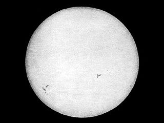
Solar cycle 9 was the ninth solar cycle since 1755, when extensive recording of solar sunspot activity began. The solar cycle lasted 12.4 years, beginning in July 1843 and ending in December 1855. The maximum smoothed sunspot number observed during the solar cycle was 219.9, and the starting minimum was 17.6. During the solar cycle minimum transit from solar cycle 9 to solar cycle 10, there were a total of 655 days with no sunspots.
The following outline is provided as an overview of and topical guide to geophysics:
The Conrad Observatory is an underground geophysical research facility of the Central Institution for Meteorology and Geodynamics (ZAMG) in Austria. The basic task of the observatory is monitoring relevant physical parameters that are of decisive importance for our understanding of processes on and below earth. At the Conrad Observatory, seismic activities (seismology), variations in gravitational acceleration and mass changes (gravimetry), magnetic field variations, geodetic parameters, atmospheric waves, as well as meteorological data are continuously monitored.

The Seismic Experiment for Interior Structure (SEIS) is a seismometer and the primary scientific instrument on board the InSight Mars lander launched on 5 May 2018 for a landing on 26 November 2018; the instrument was deployed to the surface of Mars on 19 December. SEIS is expected to provide seismic measurements of marsquakes, enabling researchers to develop 3D structure maps of the deep interior. Better understanding the internal structure of Mars will lead to better understanding of the Earth, Moon, and rocky planetary bodies in general.
Lerwick Observatory is a British meteorological observatory located near the port at Lerwick, Shetland Islands, United Kingdom. Along with Eskdalemuir and Hartland, Lerwick is one of three permanent geomagnetic observatories in the United Kingdom and is operated by the Met Office.

MERMAID is a marine scientific instrument platform, short for Mobile Earthquake Recorder for Marine Areas by Independent Divers.
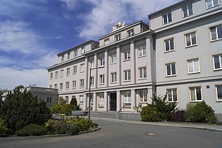
The Institute of Geophysics, GFÚ, is a publicly funded scientific research institution in Prague affiliated with the Czech Academy of Sciences. It focuses on pure and applied research in the Earth and environmental sciences.

