
This article describes the geography of the United States territory of Guam.

Signy Island is a small subantarctic island in the South Orkney Islands of Antarctica. It was named by the Norwegian whaler Petter Sørlle (1884–1933) after his wife, Signy Therese.
This article describes extreme locations on Earth. Entries listed in bold are Earth-wide extremes.

This is a list of the extreme points of North America: the points that are highest and lowest, and farther north, south, east or west than any other location on the continent. Some of these points are debatable, given the varying definitions of North America.

In demographics, the center of population of a region is a geographical point that describes a centerpoint of the region's population. There are several different ways of defining such a "center point", leading to different geographical locations; these are often confused.
A list of highest points typically contains the name, elevation, and location of the highest point in each of a set of geographical regions. Such a list is important in the sport of highpointing. A partial list of highpoint lists is below:

The geographic center of the contiguous United States is the center of 48 U.S. states. It has been regarded as such by the U.S. National Geodetic Survey (NGS) since the 1912 additions of New Mexico and Arizona to the United States.
This is a list of the extreme points of Central America, the points that are farther north, south, east, or west than any other location on the region. The list also included highest and lowest points and identifies the most extensive lake.

The NR postcode area, also known as the Norwich postcode area, is a group of 35 postcode districts in the east of England, within 16 post towns. These cover central and eastern Norfolk and part of north-east Suffolk.
In geography, the centroid of the two-dimensional shape of a region of the Earth's surface is known as its geographic centre or geographical centre or gravitational centre. Informally, determining the centroid is often described as finding the point upon which the shape would balance. This method is also sometimes described as the "gravitational method".

Afro-Eurasia, nicknamed the World Island, is a landmass comprising the continents of Africa, Asia, and Europe. The terms are portmanteaus of the names of its constituent parts. Its mainland is the largest contiguous landmass on Earth, as well as the most populous.
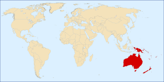
The following outline is provided as an overview and topical guide to Oceania.
The following lists include the extreme and significant geographic points of the islands of the Caribbean Sea.

Mount Wellington is a mountain located in the Central New York Region of New York. It is located south of the Hamlet of Springfield Center at the northern end of Otsego Lake. Mount Wellington rises 600 feet (180 m) above lake level. The extreme southern point of the mountain is called Clarke Point and also referred to as the Shad Cam. It is known as "The Sleeping Lion", as it looks similar to a lion laying down, viewed from Cooperstown, New York. It was originally named Mount Millington, but was renamed by George Hyde Clarke in honor of Field Marshal The 1st Duke of Wellington, the victor of Waterloo, who had been Clarke's schoolmate at Eton College in England.

This is a list of the extreme points of Afghanistan.