Fernhill, West Sussex

Last updated

The junction of Peeks Brook Lane and Fernhill Road in Fernhill Junction of Peeks Brook Lane and Fernhill Road, Fernhill, Crawley.JPG
The junction of Peeks Brook Lane and Fernhill Road in Fernhill

Fernhill is a hamlet close to Gatwick Airport in West Sussex, England. Its fields and farmhouses formerly straddled the county boundary between Surrey and West Sussex, but since 1990 (when there were about 60 households) [1] the whole area has been part of the county of West Sussex and the borough of Crawley. Fernhill is bounded on three sides by motorways and the airport. A fatal aeroplane crash occurred here in 1969.

Contents

Location

Fernhill's former Baptist chapel is now a house. Touchwood Chapel, Peeks Brook Lane, Fernhill, Crawley.JPG
Fernhill's former Baptist chapel is now a house.

Fernhill is in the far northeast corner of the borough of Crawley and the far north of the county of West Sussex. The borough and county boundaries run along the M23 motorway, which lies to the north and east. [2] To the west, Balcombe Road (part of the B2036 HorleyBurgess Hill road) separates Fernhill from Gatwick Airport. Antlands Lane (part of the B2037 to East Grinstead) leads from Tinsley Green to Shipley Bridge and Burstow, forming the southern boundary. Peeks Brook Lane runs south–north through the area, and Fernhill Road (formerly Fernhill Lane) runs west–east and connects it to Balcombe Road. [3] Gatwick Airport is 1+12 miles (2.4 km) to the west, [4] and the town of Horley is the same distance north. [5]

Fernhill was originally a hamlet in the parish of Burstow in southwest Surrey. Its Baptist chapel was recorded in 1911 as one of two in the parish. [6] In 1990, the Local Government Boundary Commission for England undertook a review of the boundaries of Surrey and West Sussex as part of a study of the boundaries of non-metropolitan counties. It received a suggestion from Crawley Borough Council that Fernhill should move into the borough because it "shared a community of interest with [Crawley]" and was cut off from the rest of Surrey by the M23 motorway. At the time, the hamlet was part of Burstow parish, Tandridge District and the county of Surrey; all objected to the proposal, and West Sussex County Council offered no opinion. [7] The Commission agreed with Crawley Borough Council's view that Fernhill's isolation from Surrey meant that "effective and convenient local government" would be better achieved by transferring it to West Sussex. [8] When the proposal was formalised, further objections were raised. Several roads led eastwards beyond the motorway, so isolation was said not be a significant factor; [1] Fernhill would no longer have a parish council to represent it, as Crawley had none; the policing of part of the motorway might be affected; residents were said to wish to remain in Surrey; [9] a transfer to Crawley could encourage expansion of the hamlet; and "close ties" to Burstow and Horley would be affected. [10] The Commission decided that Crawley Borough Council's argument that Fernhill sat most appropriately within Crawley for the purposes of planning and services, and the fact that none of the residents who would be moved made any comment about the plans, overrode the objections, [11] and the boundary was accordingly moved eastwards beyond the motorway to take in the whole area. [2]

Transport

The nearest railway stations are Gatwick Airport and Horley. [3] Metrobus routes 526 and 527 run hourly in each direction on weekdays and every 90 minutes on Saturdays, providing a service to Tinsley Green, Three Bridges, Crawley town centre, Crawley Hospital, Ifield, Charlwood, Horley, Smallfield and Burstow. [12]

Heritage

Gatwick House (1876) has been converted from a country house into offices. Gatwick House, Peeks Brook Lane, Fernhill, Crawley.JPG
Gatwick House (1876) has been converted from a country house into offices.

There are four listed buildings in Fernhill, and a further six have been given locally listed status by Crawley Borough Council. Just west of the Balcombe Road, and now within the boundary of Gatwick Airport, are two surviving medieval buildings: Edgeworth House and Wing House. They are attached to each other at right-angles but are of different dates: Edgeworth House (a four-bay timber-framed hall house) is 15th- or early 16th-century, [13] [14] while Wing House dates from the mid-16th century. It has Charlwood and Horsham stonework, brick, timber framing and a tiled roof. [15] On Donkey Lane, which leads north from Fernhill Road and becomes a footpath, [3] Lilac Cottage and Old Cottage are listed. Lilac Cottage is partly tile-hung and retains its original (18th-century) chimneys, inglenook fireplace and timber framing. [16] Old Cottage is a similar but older (17th- or early-18th-century) house: it has brickwork, timber framing and exterior tiles on the upper storey. [17]

Of the locally listed buildings, Burstow Hall is a mid-19th-century mansion of stone and brick (including some multicoloured glazed brickwork); [18] Gatwick House is a large block of serviced offices which was built in 1876 as a country house and which combines the Gothic Revival and Neo-Georgian styles; [18] Poplars is a slightly altered three-bay house of the mid-19th century; [19] Number 1 Pullcotts Farm Cottages has ground-floor brickwork in various colours, tile-hanging above and old sash windows; [20] Royal Oak House is a large stuccoed villa of the 1880s; [19] and Touchwood Chapel is the hamlet's former Baptist chapel, built in 1885 and now in residential use. [18]

1969 air crash

On 5 January 1969, a Boeing 727 airliner operated by Ariana Afghan Airlines crashed in Fernhill, killing 50 people. It came down in heavy, freezing fog on its approach to Gatwick Airport on a flight from Kabul International Airport in Afghanistan. There were 48 fatalities on the aircraft, [21] and two Fernhill residents were killed when it crashed into and destroyed their house, Longfield, on the south side of Fernhill Road. A baby also in the house at the time survived. [5] [22]

Related Research Articles

<span class="mw-page-title-main">Crawley</span> Town and borough in West Sussex, England

Crawley is a town and borough in West Sussex, England. It is 28 miles (45 km) south of London, 18 miles (29 km) north of Brighton and Hove, and 32 miles (51 km) north-east of the county town of Chichester. Crawley covers an area of 17.36 square miles (44.96 km2) and had a population of 106,597 at the time of the 2011 Census.

<span class="mw-page-title-main">Reigate and Banstead</span> Borough and non-metropolitan district in England

Reigate and Banstead is a local government district with borough status in Surrey, England. Its council is based in Reigate and the borough also includes the towns of Banstead, Horley and Redhill. Parts of the borough are within the Surrey Hills, a designated Area of Outstanding Natural Beauty. Northern parts of the borough, including Banstead, lie inside the M25 motorway which encircles London.

<span class="mw-page-title-main">Mole Valley</span> Non-metropolitan district in England

Mole Valley is a local government district in Surrey, England. Its council is based in Dorking, and the district's other town is Leatherhead. The largest villages are Ashtead, Fetcham and Great Bookham, in the northern third of the district.

<span class="mw-page-title-main">Fastway (bus rapid transit)</span>

Fastway is a bus rapid transit network in Surrey and West Sussex, United Kingdom, linking Crawley with Gatwick Airport and Horley, the first to be constructed outside a major city. It uses specially adapted buses that can either be steered by the driver or operate as "self steering" guided buses along a specially constructed track. Fastway is operated by Metrobus, using Scania OmniCity, Wright StreetLite, Volvo B7RLE / Wright Eclipse 2 and Wright GB Kite Hydroliner buses.

<span class="mw-page-title-main">Northgate, West Sussex</span> Neighbourhood in Crawley, England

Northgate is one of the 14 residential neighbourhoods in Crawley, a town and borough in West Sussex, England. Crawley was planned and laid out as a New Town after the Second World War, based on the principle of self-contained neighbourhoods surrounding a town centre of civic and commercial buildings. Northgate was one of the four in the "inner ring" closest to the town centre, and was the second to be completed: almost all building work on the 168-acre (68 ha) site took place in the first half of the 1950s.

<span class="mw-page-title-main">Horley</span> Town in Surrey, England

Horley is a town in the borough of Reigate and Banstead in Surrey, England, south of the towns of Reigate and Redhill. The county border with West Sussex is to the south with Crawley and Gatwick Airport close to the town.

<span class="mw-page-title-main">Charlwood</span> Human settlement in England

Charlwood is a village and civil parish in the Mole Valley district of Surrey, England. It is immediately northwest of London Gatwick Airport in West Sussex, close west of Horley and north of Crawley. The historic county boundary between Surrey and Sussex ran to the south of Gatwick Airport. Boundaries were reformed in 1974 so that the county boundary between Surrey and West Sussex, delineated by the Sussex Border Path, now runs along the northern perimeter of the airport, and the southern extent of Charlwood.

<span class="mw-page-title-main">Burstow</span> Human settlement in England

Burstow is a village and civil parish in the Tandridge district of Surrey, England. Its largest settlement is Smallfield. Smallfield is 2.5 miles (4.0 km) ENE of Gatwick Airport and the M23 motorway, 7.5 miles (12.1 km) southwest of Oxted and 1.8 miles (2.9 km) east of Horley. Crawley is a nearby large commercial town, 3.7 miles (6.0 km) southwest of Burstow and 5 miles (8.0 km) southwest of Smallfield. Towards the outside of the London commuter belt, some residents commute to the capital by road or rail from here as London is 24.5 miles (39.4 km) to the north or Horley railway station is accessible.

<span class="mw-page-title-main">Charlwood and Horley Act 1974</span> United Kingdom legislation

The Charlwood and Horley Act 1974 was an act of the Parliament of the United Kingdom that amended the Local Government Act 1972 to move the village of Charlwood and the town of Horley from West Sussex to Surrey.

Reigate was a hundred in the historic county of Surrey, England. It was geographically consonant with the southern two thirds of the current Borough of Reigate and Banstead together with two parishes in Tandridge and fractions of former parishes in the London Borough of Croydon and Borough of Crawley, West Sussex. Accordingly, it included the medieval-established town of Reigate with its motte castle and land which became the towns of Redhill and Horley.

<span class="mw-page-title-main">Listed buildings in Crawley</span>

As of 2011 there were 102 listed buildings and structures in the English borough of Crawley, West Sussex. Two others have subsequently gained listed status. The Borough of Crawley is based on the town of the same name, located approximately halfway between London and Brighton. Although Crawley expanded substantially after World War II when it was designated a New Town by an Act of Parliament, many older buildings remain.

<span class="mw-page-title-main">St Michael and All Angels Church, Lowfield Heath</span> Church in West Sussex, England

St Michael and All Angels Church is a church in Lowfield Heath, a depopulated former village in the Borough of Crawley, West Sussex, England. Built by the Gothic Revival architect William Burges in 1867 to serve the village, it declined in importance as Lowfield Heath was gradually appropriated for the expansion of London Gatwick Airport and of its related development. The last Anglican service was held there in 2004, but the church reopened in 2008 as a Seventh-day Adventist place of worship. The building has Grade II* listed status, which identifies it as a "particularly important building of more than special interest" and of national importance. It is also the only building remaining in the former village from the era before the airport existed: every other structure was demolished, and the church now stands among warehouses, depots and light industrial units.

<span class="mw-page-title-main">Lowfield Heath</span> Human settlement in England

Lowfield Heath is a former village within the boundaries of the Borough of Crawley, West Sussex, England. Situated on the main London to Brighton road approximately 27 miles (43 km) south of London and 2 miles (3.2 km) north of Crawley, it was gradually rendered uninhabitable by the expansion of London Gatwick Airport immediately to the north.

<span class="mw-page-title-main">Tinsley Green</span> Human settlement in England

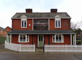
Tinsley Green is an area in the Borough of Crawley, one of seven local government districts in the English county of West Sussex. Originally a hamlet in the parish of Worth, it was absorbed by the New Town of Crawley in the 1940s and became part of the Pound Hill neighbourhood. As well as houses, farms and woodland, it became the site of the 1930s aerodrome at Gatwick—now London Gatwick Airport. The airport's first railway station was briefly known as Tinsley Green. The game of marbles has a strong local tradition, and Tinsley Green's pub hosts the British and World Marbles Championship each year.

<span class="mw-page-title-main">Ariana Afghan Airlines Flight 701</span> 1969 aviation accident

Ariana Afghan Airlines Flight 701 was involved in aviation accident on January 5, 1969. The incident involved a Boeing 727 aircraft, carrying 62 individuals, which tragically crashed into a residential property during its approach to London Gatwick Airport amidst heavy fog. The accident was primarily attributed to pilot error, specifically the failure to extend the flaps to maintain flight at the final approach speed.

<span class="mw-page-title-main">Crawley Borough Council</span> Local authority for the borough of Crawley in West Sussex, England

Crawley Borough Council is the local authority for Crawley in West Sussex, England. The council consists of 36 councillors. It is currently controlled by the Labour Party, led by Michael Jones. The administrative headquarters are at Crawley Town Hall.

<span class="mw-page-title-main">Locally listed buildings in Crawley</span> Listed buildings in Crawley, England

As of November 2010, there were 59 locally listed buildings in Crawley, a town and borough in the county of West Sussex in southeast England. One of these has subsequently been demolished. A locally listed building is defined as "a building, structure or feature that, whilst not statutorily listed by the Secretary of State, the Council considers to be an important part of Crawley's heritage due to its architectural, historic or archaeological significance". Crawley Borough Council administers the selection and deselection process, defines the criteria for inclusion, and produces and updates the local list.

<span class="mw-page-title-main">Public services in Crawley</span>

Crawley, a postwar New Town and borough in the English county of West Sussex, has a wide range of public services funded by national government, West Sussex County Council, Crawley Borough Council and other public-sector bodies. Revenue to fund these services comes principally from Council Tax. Some of Crawley's utilities and infrastructure are provided by outside parties, such as utility companies and West Sussex County Council, rather than by the borough council. To help pay for improved infrastructure and service provision in proposed major residential developments such as Kilnwood Vale and the North East Sector, the borough council has stated that as part of the Crawley Local Plan it would require developers to pay a Community Infrastructure Levy.

<span class="mw-page-title-main">Forge Wood</span>

Forge Wood is the 14th residential neighbourhood in Crawley, a town and borough in West Sussex. The 1,900 houses and other facilities will be built on open land in the northeast of the borough, adjoining the ancient village of Tinsley Green and to the north of the Pound Hill neighbourhood.

References

Notes

  1. 1 2 Review of non-Metropolitan counties: County of West Sussex and its Boundary with Surrey (PDF). LGBCE Report No. 589 (Report). Local Government Boundary Commission for England. 26 April 1990. §. 77. Archived from the original (PDF) on 17 October 2013. Retrieved 19 March 2013.
  2. 1 2 Review of non-Metropolitan counties: County of West Sussex and its Boundary with Surrey (PDF). LGBCE Report No. 589 (Report). Local Government Boundary Commission for England. 26 April 1990. Map 10. Archived from the original (PDF) on 17 October 2013. Retrieved 19 March 2013.
  3. 1 2 3 West Sussex (Map) (4th ed.). 1:10000. Philip's Street Atlases. Cartography by Ordnance Survey. Philip's. 2008. p. 6. ISBN   978-0-540-09272-7.
  4. Bird, Philip; Moore, Joe; Mulcock, John (6 January 1969). "How horror came from the sky at 2.35 am". Evening Argus (incorporating Sussex Daily News). No. Special Extra Edition. Brighton. p. 12.
  5. 1 2 "Surrey Constabulary – Part 3: Policing Change 1951–1975. Airliner crashes on approach to Gatwick Airport 1969". The Open University International Centre for the History of Crime, Policing and Justice. Open University and Robert Bartlett. 2013. Archived from the original on 31 October 2014. Retrieved 26 February 2013.
  6. Malden, H. E., ed. (1911). "A History of the County of Surrey: Volume 3. Parishes: Burstow". Victoria County History of Surrey. British History Online. pp. 176–182. Retrieved 12 March 2013.
  7. Review of non-Metropolitan counties: County of West Sussex and its Boundary with Surrey (PDF). LGBCE Report No. 589 (Report). Local Government Boundary Commission for England. 26 April 1990. §. 29. Archived from the original (PDF) on 17 October 2013. Retrieved 19 March 2013.
  8. Review of non-Metropolitan counties: County of West Sussex and its Boundary with Surrey (PDF). LGBCE Report No. 589 (Report). Local Government Boundary Commission for England. 26 April 1990. §. 30. Archived from the original (PDF) on 17 October 2013. Retrieved 19 March 2013.
  9. Review of non-Metropolitan counties: County of West Sussex and its Boundary with Surrey (PDF). LGBCE Report No. 589 (Report). Local Government Boundary Commission for England. 26 April 1990. §. 75. Archived from the original (PDF) on 17 October 2013. Retrieved 19 March 2013.
  10. Review of non-Metropolitan counties: County of West Sussex and its Boundary with Surrey (PDF). LGBCE Report No. 589 (Report). Local Government Boundary Commission for England. 26 April 1990. §. 76. Archived from the original (PDF) on 17 October 2013. Retrieved 19 March 2013.
  11. Review of non-Metropolitan counties: County of West Sussex and its Boundary with Surrey (PDF). LGBCE Report No. 589 (Report). Local Government Boundary Commission for England. 26 April 1990. §§. 81–84. Archived from the original (PDF) on 17 October 2013. Retrieved 19 March 2013.
  12. "Route 526 and 527 Timetable". Metrobus Ltd. 1 September 2012. Archived from the original on 30 January 2013. Retrieved 5 February 2013.
  13. Historic England. "Edgeworth House, Balcombe Road, Crawley (Grade II) (1187072)". National Heritage List for England . Retrieved 4 February 2013.
  14. "Planning Application CR/2006/0717/FUL". Planning application CR/2006/0717/FUL (Edgeworth Site, Buckingham Gate, Gatwick Airport, Crawley). Crawley Borough Council. 22 January 2007. Archived from the original on 26 May 2024. Retrieved 5 February 2013. Erection of new hotel, including meeting & catering facilities, 218 bedrooms and 148 parking spaces
  15. Historic England. "Wing House, Balcombe Road, Crawley (Grade II) (1187073)". National Heritage List for England . Retrieved 4 February 2013.
  16. Historic England. "Lilac Cottage, Donkey Lane, Fernhill, Crawley (Grade II) (1298874)". National Heritage List for England . Retrieved 4 February 2013.
  17. Historic England. "Old Cottage, Donkey Lane, Fernhill, Crawley (Grade II) (1187082)". National Heritage List for England . Retrieved 4 February 2013.
  18. 1 2 3 Crawley Borough Council 2010 , p. 12.
  19. 1 2 Crawley Borough Council 2010 , p. 11.
  20. Crawley Borough Council 2010 , p. 10.
  21. Kelly 1969 , §1.1.
  22. "Couple die in house wiped out in Gatwick air disaster: 50 dead". Crawley & District Observer. No. 4552. Crawley. 10 January 1969. p. 14.

Bibliography

51°09′18″N0°08′20″W / 51.155°N 0.139°W / 51.155; -0.139