The Sierra Madre Oriental is a mountain range in northeastern Mexico. The Sierra Madre Oriental is part of the American Cordillera, a chain of mountain ranges (cordillera) that consists of an almost continuous sequence of mountain ranges that form the western "backbone" of North America, Central America, South America, and Antarctica.

The Sierra de la Laguna pine–oak forests are a subtropical coniferous forest ecoregion, found in the Sierra de la Laguna mountain range at the southern tip of the Baja California Peninsula, Mexico.
The Sierra Gorda is an ecological region centered on the northern third of the Mexican state of Querétaro and extending into the neighboring states of Guanajuato, Hidalgo and San Luis Potosí. Within Querétaro, the ecosystem extends from the center of the state starting in parts of San Joaquín and Cadereyta de Montes municipalities and covering all of the municipalities of Peñamiller, Pinal de Amoles, Jalpan de Serra, Landa de Matamoros and Arroyo Seco, for a total of 250 km2 of territory. The area is extremely rugged with high steep mountains and deep canyons. As part of the Huasteca Karst, it also contains many formations due to erosion of limestone, especially pit caves known locally as sótanos. The area is valued for its very wide diversity of plant and animal life, which is due to the various microenvironments created by the ruggedness of the terrain and wide variation in rainfall. This is due to the mountains’ blocking of moisture coming in from the Gulf of Mexico, which generally makes the east side fairly moist and the west semiarid scrub brush. Most of the region is protected in two biosphere reserves, with the one centered in Querétaro established in 1997 and the one centered in Guanajuato established in 2007. The Sierra Gorda is considered to be the far west of the La Huasteca region culturally and it is home to the Franciscan Missions in the Sierra Gorda of Querétaro World Heritage Site.

The Sierra Madre de Oaxaca pine–oak forests is a tropical and subtropical coniferous forests ecoregion in Southern Mexico.

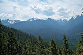
The Sierra Madre Oriental pine–oak forests are a temperate broadleaf and mixed forest ecoregion of northeastern and Central Mexico, extending into the state of Texas in the United States.

The Trans-Mexican Volcanic Belt pine–oak forests is a subtropical coniferous forest ecoregion of the Trans-Mexican Volcanic Belt of central Mexico.
The Central American pine–oak forests is a tropical and subtropical coniferous forests ecoregion in the mountains of northern Central America and Chiapas state in southern Mexico.

The Monarch Butterfly Biosphere Reserve is a World Heritage Site containing most of the overwintering sites of the eastern population of the monarch butterfly. The reserve is located in the Trans-Mexican Volcanic Belt pine-oak forests ecoregion on the border of Michoacán and State of Mexico, 100 km, northwest of Mexico City. Millions of butterflies arrive in the reserve annually. Butterflies only inhabit a fraction of the 56,000 hectares of the reserve from October–March. The biosphere's mission is to protect the butterfly species and its habitat.

The Oriental Basin, also known as the Libres-Oriental Basin, Oriental-Serdán Basin or San Juan Plains, is an endorheic basin in east-central Mexico. It covers an area of 4,958.60 square kilometers, lying in the states of Puebla, Tlaxcala, and Veracruz.
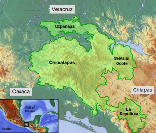
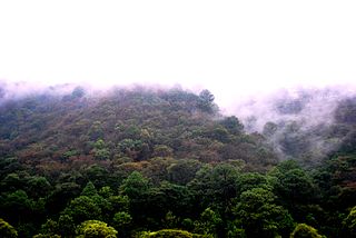
The Selva Zoque, which includes the Chimalapas rain forest, is an area of great ecological importance in Mexico. Most of the forest lies in the state of Oaxaca but parts are in Chiapas and Veracruz. It is the largest tract of tropical rainforest in Mexico, and contains the majority of terrestrial biodiversity in the country. The forest includes the Selva El Ocote, a federally-protected biosphere reserve, but is otherwise not yet protected. Despite the rich ecology of the region, a 2003 study that focused on bird populations stated that "the fauna of the heart of the Chimalapas, including its vast rainforests, have seen little or no study". As it is an impoverished region, efforts to preserve the ecology are often at odds with demands to improve the economy.
El Jabalí Flora and Fauna Protection Area is a protected natural area located in Colima State, México. It covers an area of 51.79 km2, which includes forests and several natural lakes.
The Tehuacán-Cuicatlán biosphere reserve is a protected natural area located in southeastern Mexico. Its name derives from its two main locations: Cuicatlán and Tehuacán, in the latter are their administrative offices, covers 490,186 hectares distributed among 21 municipalities in the state of Puebla and Oaxaca.

The Islas MaríasBiosphere Reserve is a UNESCO Biosphere Reserve located in the Islas Marías in the municipality (municipio) of San Blas, Nayarit, Mexico. The 641,284.73 hectares (2,476.0142 sq mi) reserve includes ecosystems with a great wealth of species of biological, economic, scientific and cultural relevance. Its biological wealth is to be found in the dry forests of its landscape, in the mangroves, the succulent rosette scrubland, the reefs, coasts and pelagic environments it harbors.

The Volcán Tacaná Biosphere Reserve is a UNESCO Biosphere Reserve at the Tacaná Volcano in Chiapas, Mexico, on the border with Guatemala. The volcano is part of the Central America Volcanic Arc. The 6,378 hectares (24.63 sq mi) reserve contains fragile ecosystems very rich in wild flora and fauna species of cultural, scientific, economic and biological relevance. Its rich biodiversity and high endemism are found particularly in the high mountain ecosystem and landscapes and in the volcanic edifice which presents geophysical features of great scientific and aesthetic value. Average annual rainfall can amount to 2,000–5,000 millimetres (79–197 in), as in the case of Soconusco.

The Guadalupe Island Biosphere Reserve,, is located in the Pacific Ocean and is part of Baja California state of Mexico. The Reserve consists of Guadalupe Island and several small islands nearby plus a large expanse of surrounding ocean. The Reserve was created by the government of Mexico on 25 April 2005 and is located 250 kilometres (160 mi) from the mainland. The Reserve is 4,770 square kilometres (1,840 sq mi) in size of which 263 square kilometres (102 sq mi) is land and the remainder is water.
Tutuaca Flora and Fauna Protection Area is a protected area in the states of Chihuahua and Sonora in northwestern Mexico. It lies in the Sierra Madre Occidental, and covers an area of 4369.86 km2. To the southeast it adjoins Papigochic Flora and Fauna Protection Area.
Campo Verde Flora and Fauna Protection Area is a protected area in northern Mexico. It covers an area of 1080.67 km2 in northwestern Chihuahua, on the border with Sinaloa. It is at the eastern edge of the Sierra Madre Occidental, where it meets the Chihuahuan Desert.
The Sierra de Huautla is a mountain range and biosphere reserve in central Mexico. Located in southern Morelos, the Sierra de Huautla is a southern extension of the Trans-Mexican Volcanic Belt range into the Balsas Basin. The dry forests of Sierra are home to a diverse community of animals and plants, and the reserve's outstanding biodiversity is recognized by UNESCO.

La Sepultura is a biosphere reserve in southern Mexico. It protects a portion of the Sierra Madre de Chiapas range in the state of Chiapas.

El Triunfo Biosphere Reserve is a biosphere reserve in southern Mexico. It is in the Sierra Madre de Chiapas in southern Chiapas.
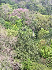

 Tropical rainforest in Tabasco
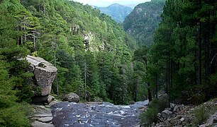 Mexiquillo in Durango.
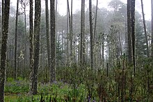
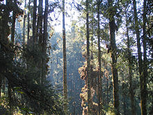
 Pine forest at the Nevado de Toluca in the State of Mexico.
 Las Pozas is located in a subtropical rainforest of San Luis Potosí.
 Autumn foliage in the Sierra Fría of Aguascalientes.
 Ruins at Palenque enveloped by tropical rainforest vegetation
 Bosque el Nixticuil in Jalisco
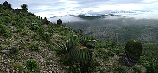
 Forest in the Sierra Gorda Biosphere Reserve in Querétaro
 Forest growth near Mineral del Chico, Hidalgo
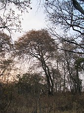
 Oak forest in the Sierra de Santa Rosa in Guanajuato
 Uxmal is surrounded by a tropical deciduous forest, where trees shed leaves during the dry season