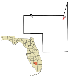
Harlem is a census-designated place (CDP) in Hendry County, Florida, United States. The population is 2,397 as of 2022.

Pryor is a census-designated place (CDP) in Big Horn County, Montana, United States. The community is located on Crow Tribe's reservation. The population was 618 at the 2010 census. The area is named for Nathaniel Hale Pryor, a sergeant in the Lewis and Clark Expedition.
St. Xavier is an unincorporated community and census-designated place (CDP) in Big Horn County, Montana, United States. The CDP population was 83 at the 2010 census.

Wyola is a census-designated place (CDP) in Big Horn County, Montana, United States. The population was 215 at the 2010 census. 79% of the residents are Native American, and the majority are members of the Crow Nation.

Fort Belknap Agency is a census-designated place (CDP) in Blaine County, Montana, United States. As of the 2010 census, its population was 1,293.

Hays is a census-designated place (CDP) in Blaine County, Montana, United States. The population was 843 at the 2010 census. The community lies within the Fort Belknap Indian Reservation, near the reservation's southern end. The nearby community of Lodge Pole lies to the east.

Fort Shaw is a census-designated place (CDP) in Cascade County, Montana, United States. The population was 280 at the 2010 census. Named for a former United States military outpost, it is part of the Great Falls, Montana Metropolitan Statistical Area.

Simms is a census-designated place (CDP) in Cascade County, Montana, United States. The population was 354 at the 2010 census. It is part of the Great Falls, Montana Metropolitan Statistical Area.

Boneau is a census-designated place (CDP) in Chouteau County, Montana, United States. The population was 380 at the 2010 census, up from 190 in 2000.

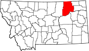
North Browning is a census-designated place (CDP) in Glacier County, Montana, United States. The population was 2,408 at the 2010 census.

South Browning is a census-designated place (CDP) in Glacier County, Montana, United States. The population was 1,785 at the 2010 census. South Browning is a rural village on the Blackfeet Indian Reservation. It is bordered to the north by the town of Browning.

Starr School is a census-designated place (CDP) in Glacier County, Montana, United States. The population was 252 at the 2010 census.

Heart Butte is a census-designated place (CDP) in Pondera County, Montana, United States. The population was 698 at the 2000 census. The town is on the Blackfeet Indian Reservation.

Victor is a census-designated place (CDP) in Ravalli County, Montana, United States. The population was 745 at the 2010 census.
Lame Deer is a census-designated place (CDP) in Rosebud County, Montana, United States. The community is named after Miniconjou Lakota chief Lame Deer, who was killed by the U.S. Army in 1877 under a flag of truce south of the town. It was the site of a trading post from the late 1870s.
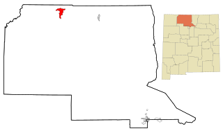
Dulce is a census-designated place (CDP) in Rio Arriba County, New Mexico, United States. The population was 2,743 at the 2010 census, almost entirely Native American. It is the largest community and tribal headquarters of the Jicarilla Apache Reservation.

Richboro is a census-designated place (CDP) in Northampton Township, Bucks County, Pennsylvania. The population was 6,378 during the 2020 census.
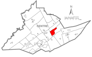
Zion is an unincorporated community and census-designated place (CDP) in Centre County, Pennsylvania, United States. The population was 2,258 at the 2020 Census.
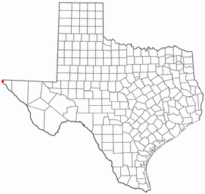
Canutillo is a census-designated place (CDP) in El Paso County, Texas, United States. The population was 6,321 at the 2010 census. It is part of the El Paso Metropolitan Statistical Area. The ZIP Codes encompassing the CDP area are 79835 and 79932.
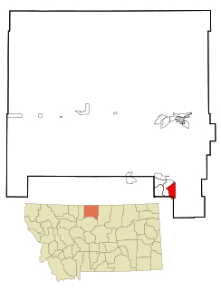
Parker School is a census-designated place (CDP) in Hill and Chouteau counties in the U.S. state of Montana. The population was 340 at the 2010 census.