Freshet

Last updated
Freshet on Ouareau River in Rawdon, Quebec, Canada Ouareau jps0029.jpg
Freshet on Ouareau River in Rawdon, Quebec, Canada
An example of usage of the term "freshet" is shown in the text on a historic marker at Durgin Bridge near Sandwich, New Hampshire. Freshets sign NH 2008.jpg
An example of usage of the term "freshet" is shown in the text on a historic marker at Durgin Bridge near Sandwich, New Hampshire.

The term freshet is most commonly used to describe a snowmelt, an annual high water event on rivers resulting from snow and river ice melting. A spring freshet can sometimes last several weeks on large river systems, resulting in significant inundation of flood plains as the snowpack melts in the river's watershed. Freshets can occur with differing strength and duration depending upon the depth of the snowpack and the local average rates of warming temperatures. Deeper snowpacks which melt quickly can result in more severe flooding. Late spring melts allow for faster flooding; this is because the relatively longer days and higher solar angle allow for average melting temperatures to be reached quickly, causing snow to melt rapidly. Snowpacks at higher altitudes and in mountainous areas remain cold and tend to melt over a longer period of time and thus do not contribute to major flooding. [1] Serious flooding from freshets in southern US states are more often related to rain storms of large tropical weather systems rolling in from the South Atlantic or Gulf of Mexico, to add their powerful heating capacity to lesser snow packs. Tropically induced rainfall influenced quick melts can also affect snow cover to latitudes as far north as southern Canada, so long as the generally colder air mass is not blocking northward movement of low pressure systems.

Contents

In the eastern part of the continent, annual freshets occur from the Canadian Taiga ranging along both sides of the Great Lakes then down through the heavily forested Appalachian mountain chain and St. Lawrence valley from Northern Maine and New Brunswick into barrier ranges in North Carolina and Tennessee.

In the western part of the continent, freshets occur throughout the generally much higher elevations of the various west coast mountain ranges that extend southward down from Alaska even into the northern parts of Arizona and New Mexico.

The term can also refer to the following:

Causes

Freshets are the result of the mass delivery of water to the landscape, either by snowmelt, heavy rains, or a combination of the two. Specifically, freshets occur when this water enters streams and results in flooding and high flow conditions. When freshets occur in the winter or early spring, the frozen ground can contribute to rapid flooding. This is because the meltwaters cannot easily infiltrate the frozen surface and instead run overland into rivers and streams, leading to a rapid flooding response. [9] Deeper snow packs with large snow water equivalents (SWE) are capable of delivering larger quantities of water to rivers and streams, compared to smaller snowpacks, given that they reach adequate melting temperatures. When melting temperatures are reached quickly and snowmelt is rapid, flooding can be more intense. [10] In areas where freshets dominate the hydrological regime, such as the Fraser River Basin in British Columbia, the timing of freshets is critical. In the Fraser River Basin, the annual freshet was observed 10 days earlier in 2006 compared to 1949. [11] In these areas, earlier freshets can result in low flow conditions later in the summer or fall.

A freshet on the Ocmulgee river, Macon, GA, United States c. 1876 Flood- Ocmulgee River, "Centennial Spring Freshet", 1876 - DPLA - 9a0e3380c379566f4f8128f77de532cd (cropped).jpeg
A freshet on the Ocmulgee river, Macon, GA, United States c. 1876

Freshets may also occur due to rainfall events. Significant rainfall events can saturate the ground and lead to rapid inundation of streams, [12] as well as contributing to snowmelt by delivering energy to snowpacks through advection. [13] In the tropics, tropical storms and cyclones can lead to freshet events. [14]

Ecology

The magnitude of freshets depends on snow accumulation and temperature. Smaller freshets have been associated with El Niño conditions, where the milder conditions lead to lower snow accumulations. The opposite is true under La Niña conditions. Runoff from freshets is a major contributor of nutrients to lakes. In La Niña conditions with stronger freshets, higher runoff, and high nutrient inputs, more positive ecological indicator species (Arcellacea) are present in lakes, indicating lower levels of ecological stress. [15] In El Niño conditions, smaller freshets contribute less runoff and result in lower nutrient inputs to lakes and rivers. In these conditions, fewer positive ecological indicator species are present. [15]

Migratory fish, such as salmon and trout, are highly responsive to freshets. In low flows present at the end of freshets, fish are more likely to ascend streams (move upstream). During high flows at the peak of a freshet, fish are more likely to descend streams. [16] There are some species of fish that are less effected from freshets than others. Goby Pomatoschistusssp for example, show similar patterns of migration and recover in population abundance and distribution after/during freshet conditions. [17] The benthic-estuarine species seem to better cope with freshets, some have even showed an attraction effect due to the extent of estuarine cues. Some species are affected by the consequences of freshets more than others. This is due to multiple factors, some include, but not limited to: differentiation in species biological anatomy, previous migration patterns, mating seasons, and feeding habits. [18]

Biogeochemical Impacts

Freshets are often associated with high levels of dissolved organic carbon (DOC) in streams and rivers. During base flows, water entering streams comes from deep in the soil where carbon contents are lower due to microbial digestion. During a freshet, water is more likely to run overland, where it dissolves the abundant, less degraded carbon present in the uppermost soil layers before entering streams. High dissolved organic carbon (DOC) levels lead to a decrease in the net primary productivity of the stream by enhancing heterotrophic microbial growth. [19] [20] Freshets have also been linked to compressing salinity gradients, increasing turbidity, and in the most intense conditions of freshets they have decreased oxygen levels. [21]

Artificial freshets have also been correlated with changes in migration patterns of adult Atlantic salmon. A study was conducted in southern Norway which showed significant alterations in migration distances. Comparing the data from pre-freshet, during freshet, and post-freshet the mean migration distances per hour of the salmon showed significant differences. [22]

Freshets may cause catastrophic changes to society, specifically in the economy and agriculture of populated environments. The floods caused by high waters from the rivers have been documented to destroy historical monuments, destroy ecosystems as well as pose a great threat to any life living near the freshet event, including human life. [23] The research of predicting the changes of water levels due to freshets have become a large topic in the scientific community due to prior and future catastrophic events.

History

Panorama from the top of a bridge, showing the true extent of the recent overland flooding south of Winnipeg. Red River Valley Overland Flooding.jpg
Panorama from the top of a bridge, showing the true extent of the recent overland flooding south of Winnipeg.

The 1997 Red River Valley Flood was the result of an exceptionally large freshet fed by large snow accumulations which melted due to rapidly warming temperatures, producing large volumes of meltwater which inundated the frozen ground. At the peak of the flood, the Red River reached a depth of 16.46 metres (54.0 ft) and a maximum discharge of 4,000 cubic metres per second (140,000 cu ft/s). This event has been referred to as “the flood of the century” in the areas impacted. [24] [25]

The Fraser River in British Columbia experiences yearly freshets fed by snowmelt in the spring and early summer. The largest freshet ever experienced in the Fraser River occurred in 1894 and resulted in an estimated peak discharge of 17,000 cubic metres per second (600,000 cu ft/s) and a peak height of 11.75 metres (38.5 ft) at Hope, BC. [26] However, due to the low population this flood had a minor impact compared to the second largest flood in 1948, which had a peak discharge of 15,200 cubic metres per second (540,000 cu ft/s) and a peak height of 10.97 metres (36.0 ft) at Hope, BC. [26] The 1948 flood caused extensive damage in the lower Fraser Valley and cost 20 million dollars at the time. [27]

Aerial view of the southern entrance to the w:Chesapeake Bay Bridge-Tunnel. The water is the w:Chesapeake Bay and w:Virginia Beach is to the right. AerialviewoftheentrancetotheChesapeakeBayBridgeTunnel.jpg
Aerial view of the southern entrance to the w:Chesapeake Bay Bridge-Tunnel. The water is the w:Chesapeake Bay and w:Virginia Beach is to the right.

In 1972, the Susquehanna River which flows into Chesapeake Bay experienced a considerably large freshet due to Tropical Storm Agnes, resulting in flooding and increased sedimentation in Chesapeake Bay. At the peak of the flood on June 24, 1972, the instantaneous peak flow was greater than 32,000 cubic metres per second (1,100,000 cu ft/s), and at the mouth of the river, the concentration of suspended solids was greater than 10,000 milligrams per liter. [28]

In southwestern Japan the Ohashi River runs between two brackish-water lagoons. In this river Ammonia "beccarii" forma 1 (a benthic foraminiferan) has been found to colonize these waters depending on seasonal changes in the ecosystem. These organisms have been studied prior and post freshet events, and have been found to recover even when their habitat has been diminished by physical disturbances. The freshets in winter or early spring cause rapid flooding. The water abundance due to the melting of snow cannot easily infiltrate the frozen surface and run into nearby rivers, in this study the Ohashi River. The many of the organisms in this river have evolved to overcome the effects of the freshets [29]

See also

Related Research Articles

<span class="mw-page-title-main">Glacier</span> Persistent body of ice that is moving under its own weight

A glacier is a persistent body of dense ice that is constantly moving under its own weight. A glacier forms where the accumulation of snow exceeds its ablation over many years, often centuries. It acquires distinguishing features, such as crevasses and seracs, as it slowly flows and deforms under stresses induced by its weight. As it moves, it abrades rock and debris from its substrate to create landforms such as cirques, moraines, or fjords. Although a glacier may flow into a body of water, it forms only on land and is distinct from the much thinner sea ice and lake ice that form on the surface of bodies of water.

<span class="mw-page-title-main">Snow</span> Precipitation in the form of ice crystal flakes

Snow comprises individual ice crystals that grow while suspended in the atmosphere—usually within clouds—and then fall, accumulating on the ground where they undergo further changes. It consists of frozen crystalline water throughout its life cycle, starting when, under suitable conditions, the ice crystals form in the atmosphere, increase to millimeter size, precipitate and accumulate on surfaces, then metamorphose in place, and ultimately melt, slide or sublimate away.

<span class="mw-page-title-main">Flood</span> Water overflow submerging usually-dry land

A flood is an overflow of water that submerges land that is usually dry. In the sense of "flowing water", the word may also be applied to the inflow of the tide. Floods are of significant concern in agriculture, civil engineering and public health. Human changes to the environment often increase the intensity and frequency of flooding. Examples for human changes are land use changes such as deforestation and removal of wetlands, changes in waterway course or flood controls such as with levees. Global environmental issues also influence causes of floods, namely climate change which causes an intensification of the water cycle and sea level rise. For example, climate change makes extreme weather events more frequent and stronger. This leads to more intense floods and increased flood risk.

<span class="mw-page-title-main">Flash flood</span> Rapid flooding of geomorphic low-lying areas

A flash flood is a rapid flooding of low-lying areas: washes, rivers, dry lakes and depressions. It may be caused by heavy rain associated with a severe thunderstorm, hurricane, or tropical storm, or by meltwater from ice or snow flowing over ice sheets or snowfields. Flash floods may also occur after the collapse of a natural ice or debris dam, or a human structure such as a man-made dam, as occurred before the Johnstown Flood of 1889. Flash floods are distinguished from regular floods by having a timescale of fewer than six hours between rainfall and the onset of flooding.

<span class="mw-page-title-main">Snowy River</span> River in south-eastern Australia

The Snowy River is a major river in south-eastern Australia. It originates on the slopes of Mount Kosciuszko, Australia's highest mainland peak, draining the eastern slopes of the Snowy Mountains in New South Wales, before flowing through the Alpine National Park and the Snowy River National Park in Victoria and emptying into Bass Strait.

<span class="mw-page-title-main">Jökulhlaup</span> Type of glacial outburst flood

A jökulhlaup is a type of glacial outburst flood. It is an Icelandic term that has been adopted in glaciological terminology in many languages. It originally referred to the well-known subglacial outburst floods from Vatnajökull, Iceland, which are triggered by geothermal heating and occasionally by a volcanic subglacial eruption, but it is now used to describe any large and abrupt release of water from a subglacial or proglacial lake/reservoir.

<span class="mw-page-title-main">Byrd Polar and Climate Research Center</span>

The Byrd Polar and Climate Research Center (BPCRC) is a polar, alpine, and climate research center at Ohio State University founded in 1960.

<span class="mw-page-title-main">Glacial lake outburst flood</span> Type of outburst flood that occurs when the dam containing a glacial lake fails

A glacial lake outburst flood (GLOF) is a type of outburst flood caused by the failure of a dam containing a glacial lake. An event similar to a GLOF, where a body of water contained by a glacier melts or overflows the glacier, is called a jökulhlaup. The dam can consist of glacier ice or a terminal moraine. Failure can happen due to erosion, a buildup of water pressure, an avalanche of rock or heavy snow, an earthquake or cryoseism, volcanic eruptions under the ice, or massive displacement of water in a glacial lake when a large portion of an adjacent glacier collapses into it.

<span class="mw-page-title-main">Surface runoff</span> Flow of excess rainwater not infiltrating in the ground over its surface

Surface runoff is the unconfined flow of water over the ground surface, in contrast to channel runoff. It occurs when excess rainwater, stormwater, meltwater, or other sources, can no longer sufficiently rapidly infiltrate in the soil. This can occur when the soil is saturated by water to its full capacity, and the rain arrives more quickly than the soil can absorb it. Surface runoff often occurs because impervious areas do not allow water to soak into the ground. Furthermore, runoff can occur either through natural or human-made processes.

<span class="mw-page-title-main">Snowmelt</span> Surface runoff produced from melting snow

In hydrology, snowmelt is surface runoff produced from melting snow. It can also be used to describe the period or season during which such runoff is produced. Water produced by snowmelt is an important part of the annual water cycle in many parts of the world, in some cases contributing high fractions of the annual runoff in a watershed. Predicting snowmelt runoff from a drainage basin may be a part of designing water control projects. Rapid snowmelt can cause flooding. If the snowmelt is then frozen, very dangerous conditions and accidents can occur, introducing the need for salt to melt the ice.

<span class="mw-page-title-main">Meltwater</span> Water released by the melting of snow or ice

Meltwater is water released by the melting of snow or ice, including glacial ice, tabular icebergs and ice shelves over oceans. Meltwater is often found during early spring when snow packs and frozen rivers melt with rising temperatures, and in the ablation zone of glaciers where the rate of snow cover is reducing. Meltwater can be produced during volcanic eruptions, in a similar way in which the more dangerous lahars form. It can also be produced by the heat generated by the flow itself.

<span class="mw-page-title-main">Perennial stream</span> Type of river

A perennial stream is a stream that has continuous flow of surface water throughout the year in at least parts of its catchment during seasons of normal rainfall, as opposed to one whose flow is intermittent. In the absence of irregular, prolonged or extreme drought, a perennial stream is a watercourse, or segment, element or emerging body of water which continually delivers groundwater. For example, an artificial disruption of stream, variability in flow or stream selection associated with the activity in hydropower installations, do not affect this status. Perennial streams do not include stagnant water, reservoirs, cutoff lakes and ponds that persist throughout the year. All other streams, or parts of them, should be considered seasonal rivers or lakes. The stream can cycle from intermittent to perpetual through multiple iterations.

<span class="mw-page-title-main">Snowpack</span> Compressed accumulation of snow

Snowpack is an accumulation of snow that compresses with time and melts seasonally, often at high elevation or high latitude. Snowpacks are an important water resource that feed streams and rivers as they melt, sometimes leading to flooding. Snowpacks provide water to down-slope communities for drinking and agriculture. High-latitude or high-elevation snowpacks contribute mass to glaciers in their accumulation zones, where annual snow deposition exceeds annual melting.
<span class="mw-page-title-main">Alluvial river</span> Type of river

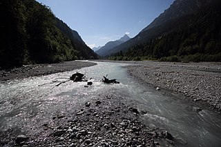
An alluvial river is one in which the bed and banks are made up of mobile sediment and/or soil. Alluvial rivers are self-formed, meaning that their channels are shaped by the magnitude and frequency of the floods that they experience, and the ability of these floods to erode, deposit, and transport sediment. For this reason, alluvial rivers can assume a number of forms based on the properties of their banks; the flows they experience; the local riparian ecology; and the amount, size, and type of sediment that they carry.

A water year is a term commonly used in hydrology to describe a time period of 12 months for which precipitation totals are measured. Its beginning differs from the calendar year because part of the precipitation that falls in late autumn and winter accumulates as snow and does not drain until the following spring or summer's snowmelt. The goal is to ensure that as much as possible of the surface runoff during the water year is attributable to the precipitation during the same water year.

The flash flood guidance system (FFGS) was designed and developed by the Hydrologic Research Center, a non-profit public-benefit corporation located in San Diego, CA, US, for use by meteorological and hydrologic forecasters throughout the world. The primary purpose of the FFGS is to provide operational forecasters and disaster management agencies with real-time information pertaining to the threat of small-scale flash flooding throughout a specified region.

<span class="mw-page-title-main">Glacial stream</span> Body of liquid water that flows down a channel formed by a glacier

A glacier stream is a channelized area that is formed by a glacier in which liquid water accumulates and flows. Glacial streams are also commonly referred to as "glacier stream" or/and "glacial meltwater stream". The movement of the water is influenced and directed by gravity and the melting of ice. The melting of ice forms different types of glacial streams such as supraglacial, englacial, subglacial and proglacial streams. Water enters supraglacial streams that sit at the top of the glacier via filtering through snow in the accumulation zone and forming slush pools at the FIRN zone. The water accumulates on top of the glacier in supraglacial lakes and into supraglacial stream channels. The meltwater then flows through various different streams either entering inside the glacier into englacial channels or under the glacier into subglacial channels. Finally, the water leaves the glacier through proglacial streams or lakes. Proglacial streams do not only act as the terminus point but can also receive meltwater. Glacial streams can play a significant role in energy exchange and in the transport of meltwater and sediment.

<span class="mw-page-title-main">Snow science</span> Interdisciplinary field of hydrology, mechanics and meteorology

Snow science addresses how snow forms, its distribution, and processes affecting how snowpacks change over time. Scientists improve storm forecasting, study global snow cover and its effect on climate, glaciers, and water supplies around the world. The study includes physical properties of the material as it changes, bulk properties of in-place snow packs, and the aggregate properties of regions with snow cover. In doing so, they employ on-the-ground physical measurement techniques to establish ground truth and remote sensing techniques to develop understanding of snow-related processes over large areas.

<span class="mw-page-title-main">Climate change in Colorado</span> Climate change in the US state of Colorado

Climate change in Colorado encompasses the effects of climate change, attributed to man-made increases in atmospheric carbon dioxide, in the U.S. state of Colorado.

<span class="mw-page-title-main">Climate change in Utah</span> Climate change in the US state of Utah

Climate change in Utah encompasses the effects of climate change, attributed to man-made increases in atmospheric carbon dioxide, in the U.S. state of Utah.

References

  1. "What is Snowmelt?". Alberta WaterPortal Society. Retrieved February 8, 2019.
  2. Gieck, Jack (1988). A Photo Album of Ohio's Canal Era, 1825–1913. Kent State University Press. pp. xvii. ISBN   9780873383530.
  3. 1 2 Brown, Lesley (1993). The New shorter Oxford English dictionary on historical principles . Oxford [Eng.]: Clarendon. ISBN   0-19-861271-0.
  4. Bonnier Corporation (January–June 1907). "Popular Science". The Popular Science Monthly. Bonnier Corporation: 68–. ISSN   0161-7370.
  5. Samuel Johnson (1773). A Dictionnary of the English Language. pp. 196–.
  6. Thomas Sheridan (1789). A Complete Dictionary of the English Language, Both with Regard to Sound and Meaning ...: To which is Prefixed a Prosodial Grammar. C. Dilly. pp. 286–.
  7. Timothy Dwight (1822). New-England and New-York. pp. 286–.
  8. Baker, N G; et al. (29 January 2020). "The Response of River-resident Fish to Reservoir Freshet Releases of Varying Profiles Intended to Facilitate a Spawning Migration". Water Resources Research. 56 (6). Hull International Fisheries Institute, University of Hull. Bibcode:2020WRR....5624196B. doi:10.1029/2018WR024196. S2CID   213488911.
  9. Pomeroy, John; Fang, Xing; Ellis, Chad; Guan, May (June 2011). "Sensitivity of Snowmelt Hydrology on Mountain Slopes to Forest Cover Disturbance". University of Saskatchewan Centre for Hydrology.
  10. Curry, Charles L.; Zwiers, Francis W. (2018). "Examining controls on peak annual streamflow and floods in the Fraser River Basin of British Columbia". Hydrology and Earth System Sciences. 22 (4): 2285–2309. Bibcode:2018HESS...22.2285C. doi: 10.5194/hess-22-2285-2018 .
  11. Kang, Do Hyuk; Gao, Huilin; Shi, John Xiaogang; Islam, Siraj ul; Dery, Stephen J (January 2016). "Impacts of a Rapidly Declining Mountain Snowpack on Streamflow Timing in Canada's Fraser River Basin". Scientific Reports. 6: 19299. Bibcode:2016NatSR...619299K. doi:10.1038/srep19299. PMC   4728390 . PMID   26813797 via ResearchGate.
  12. Shook, Kevin; Pomeroy, John (2012). "Changes in the hydrological character of rainfall on the Canadian prairies". Hydrological Processes. 26 (12): 1752–1766. Bibcode:2012HyPr...26.1752S. doi:10.1002/hyp.9383. S2CID   52266131.
  13. Shook, Kevin; Gray, D.M. (1997). "Snowmelt resulting from advection". Hydrological Processes. 11 (13): 1725–1736. Bibcode:1997HyPr...11.1725S. doi:10.1002/(SICI)1099-1085(19971030)11:13<1725::AID-HYP601>3.0.CO;2-P.
  14. Arenas, Andres Diaz (1983). "Tropical storms in Central America and the Caribbean: characteristic rainfall and forecasting of flash floods" (PDF). Proceedings of the Hamburg Symposium.
  15. 1 2 Neville, Lisa; Gammon, Paul; Patterson, Timothy; Swindles, Graeme (May 2015). "Climate Cycles Drive Aquatic Ecologic Changes in the Fort McMurray Region of Northern Alberta, Canada". GeoConvention 2015.
  16. Huntsman, A. G. (January 1948). "Freshets and Fish". Transactions of the American Fisheries Society. 75: 257–266. doi:10.1577/1548-8659(1945)75[257:FAF]2.0.CO;2.
  17. Miro, JM (December 23, 2023). "Effects of freshet events on early life stages of fish and macroinvertebrates in a highly turbid estuary of Iberian Peninsula". Esturaine Coastal and Shelf Science. 295. Bibcode:2023ECSS..29508559M. doi:10.1016/j.ecss.2023.108559.
  18. Thorstad, Eva B.; Heggberget, Tor G. (1998). "Shibboleth Authentication Request". Hydrobiologia. 371/372: 339–346. doi:10.1023/a:1017035507856 . Retrieved 2024-02-25.
  19. Meyer, J.L. (1994). "The microbial loop in flowing waters". Microbial Ecology. 28 (2): 195–199. Bibcode:1994MicEc..28..195M. doi:10.1007/BF00166808. PMID   24186445. S2CID   2938142 via SpringerLink.
  20. Voss, B.M.; Peucker-Ehrenbrink, B.; Eglinton, T.I.; Spencer, R.G.M.; Bulygina, E.; Galy, V.; Lamborg, C.H.; Ganguli, P.M.; Montluçon, D.B. (2015). "Seasonal hydrology drives rapid shifts in the flux and composition of dissolved and particulate organic carbon and major and trace ions in the Fraser River, Canada". Biogeosciences. 12 (19): 5597–5618. Bibcode:2015BGeo...12.5597V. doi: 10.5194/bg-12-5597-2015 . hdl: 20.500.11850/105179 .
  21. Miro, JM (December 23, 2023). "Effects of freshet events on early life stages of fish and macroinvertebrates in a highly turbid estuary of Iberian Peninsula". Esturaine Coastal and Shelf Science. 295. Bibcode:2023ECSS..29508559M. doi:10.1016/j.ecss.2023.108559.
  22. Thorstad, Eva B.; Heggberget, Tor G. (1998). "Shibboleth Authentication Request". Hydrobiologia. 371/372: 339–346. doi:10.1023/a:1017035507856 . Retrieved 2024-02-25.
  23. Vasil'ev, O.F. (2012). "Designing systems of operational freshet and high water prediction". Herald of the Russian Academy of Sciences. 82 (2): 129–133. Bibcode:2012HRuAS..82..129V. doi:10.1134/S1019331612020050.
  24. Heidorn, Keith (April 1, 2011). "The 1997 Red River Flood". The Weather Doctor.
  25. Nelson, Mark. "1997 Red River Flood". Flood Mitigation of the Red River Floodplain, Grand Forks, North Dakota.
  26. 1 2 "Comprehensive Review of Fraser River at Hope Flood Hydrology and Flows Scoping Study – Final Report" (PDF). BC Ministry of Environment. October 2008.
  27. "Flooding events in Canada: British Columbia". Government of Canada. December 2, 2010.
  28. Schubel, Jerry R. (1974). "Effects of Tropical Storm Agnes on the Suspended Solids of the Northern Chesapeake Bay". Suspended Solids in Water. Marine Science. Vol. 4. pp. 113–132. doi:10.1007/978-1-4684-8529-5_8. ISBN   978-1-4684-8531-8.
  29. Takata, Hiroyuki (September 1, 2010). "Life history of Ammonia "beccarii" forma 1 on hard substrate in the Ohashi River, southwestern Japan". Fundamental and Applied Limnology. 178 (1): 81–88. doi:10.1127/1863-9135/2010/0178-0081.