Gackle, North Dakota

Last updated

Gackle, North Dakota
ND Logan County Gackle.svg
Location of Gackle, North Dakota
Coordinates: 46°37′35″N99°08′28″W / 46.62639°N 99.14111°W / 46.62639; -99.14111
CountryUnited States
State North Dakota
County Logan
Founded1904
Area
[1]
  Total0.55 sq mi (1.43 km2)
  Land0.54 sq mi (1.39 km2)
  Water0.01 sq mi (0.03 km2)
Elevation
[2]
1,939 ft (591 m)
Population
 (2020) [3]
  Total281
  Estimate 
(2022) [4]
280
  Density522.30/sq mi (201.67/km2)
Time zone UTC-6 (Central (CST))
  Summer (DST) UTC-5 (CDT)
ZIP code
58442
Area code 701
FIPS code 38-28860
GNIS feature ID1036048 [2]
Website gacklend.com

Gackle is a city in Logan County, North Dakota, United States. The population was 281 at the 2020 census. [3]

Contents

History

Gackle was founded in 1904. It was named for George Gackle, a farmer. [5]

The town is home to the Gackle Public Library. German has been spoken in Gackle in the past, and is visible in the inscriptions on the First UCC Church. [6]

Many Former Residents and members of the Gackle Family reside in Minnesota, Iowa, and Colorado.

George Gackle George Gackle.png
George Gackle

Geography

According to the United States Census Bureau, the city has a total area of 0.55 square miles (1.42 km2), of which 0.54 square miles (1.40 km2) is land and 0.01 square miles (0.03 km2) is water. [7]

Demographics

Historical population
CensusPop.Note
1920 424
1930 49316.3%
1940 5378.9%
1950 60412.5%
1960 523−13.4%
1970 470−10.1%
1980 456−3.0%
1990 450−1.3%
2000 335−25.6%
2010 310−7.5%
2020 281−9.4%
2022 (est.)280 [4] −0.4%
U.S. Decennial Census [8]
2020 Census [3]

2010 census

As of the census of 2010, there were 310 people, 138 households, and 81 families residing in the city. The population density was 574.1 inhabitants per square mile (221.7/km2). There were 211 housing units at an average density of 390.7 per square mile (150.9/km2). The racial makeup of the city was 97.1% White, 0.3% African American, 1.0% Native American, 1.0% Asian, and 0.6% from two or more races. Hispanic or Latino of any race were 0.6% of the population.

There were 138 households, of which 13.8% had children under the age of 18 living with them, 53.6% were married couples living together, 3.6% had a female householder with no husband present, 1.4% had a male householder with no wife present, and 41.3% were non-families. 34.8% of all households were made up of individuals, and 16.7% had someone living alone who was 65 years of age or older. The average household size was 2.01 and the average family size was 2.56.

The median age in the city was 56.9 years. 13.2% of residents were under the age of 18; 4.2% were between the ages of 18 and 24; 15.2% were from 25 to 44; 32.7% were from 45 to 64; and 34.8% were 65 years of age or older. The gender makeup of the city was 47.7% male and 52.3% female.

2000 census

As of the census of 2000, there were 335 people, 163 households, and 93 families residing in the city. The population density was 617.3 inhabitants per square mile (238.3/km2). There were 212 housing units at an average density of 390.6 per square mile (150.8/km2). The racial makeup of the city was 99.40% White, and 0.60% from two or more races. Hispanic or Latino of any race were 0.90% of the population. 76.6% were of German and 7.6% Norwegian ancestry.

There were 163 households, out of which 14.7% had children under the age of 18 living with them, 51.5% were married couples living together, 3.7% had a female householder with no husband present, and 42.9% were non-families. 41.7% of all households were made up of individuals, and 27.0% had someone living alone who was 65 years of age or older. The average household size was 1.83 and the average family size was 2.43.

In the city, the population was spread out, with 9.6% under the age of 18, 3.6% from 18 to 24, 15.2% from 25 to 44, 26.3% from 45 to 64, and 45.4% who were 65 years of age or older. The median age was 61 years. For every 100 females, there were 74.5 males. For every 100 females age 18 and over, there were 72.2 males.

The median income for a household in the city was $22,875, and the median income for a family was $26,563. Males had a median income of $17,386 versus $14,375 for females. The per capita income for the city was $15,801. About 7.4% of families and 13.9% of the population were below the poverty line, including 5.7% of those under age 18 and 21.3% of those age 65 or over.

Related Research Articles

<span class="mw-page-title-main">Brinsmade, North Dakota</span> City in North Dakota, United States

For people with the surname, see Brinsmade (surname).

<span class="mw-page-title-main">Minnewaukan, North Dakota</span> City in North Dakota, United States

Minnewaukan is a city in Benson County, North Dakota, United States. It serves as the county seat and is fourth largest city in the county, after Fort Totten, Leeds, and Maddock. The population was 199 at the 2020 census. Minnewaukan was founded in 1884.

<span class="mw-page-title-main">Lansford, North Dakota</span> City in North Dakota, United States

Lansford is a city in Bottineau County, North Dakota, United States. The population was 238 at the 2020 census. Lansford was founded in 1903.

<span class="mw-page-title-main">Harwood, North Dakota</span> City in North Dakota, United States

Harwood is a city in Cass County, North Dakota, United States. The population was 794 at the 2020 census. It has become a bedroom community of the nearby Fargo-Moorhead area. Harwood was founded in 1881.

<span class="mw-page-title-main">Lakota, North Dakota</span> City in North Dakota, United States

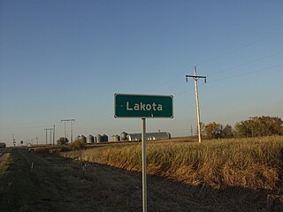
Lakota is a city in Nelson County, North Dakota, United States. It is the county seat of Nelson County Lakota is located 63 miles west of Grand Forks and 27 miles east of Devils Lake. The population was 683 at the 2020 census, making Lakota the 75th-largest city in North Dakota.

<span class="mw-page-title-main">Taylor, North Dakota</span> City in North Dakota, United States

Taylor is a city in Stark County, North Dakota, United States. The population was 230 at the 2020 census. It is part of the Dickinson Micropolitan Statistical Area.

<span class="mw-page-title-main">Ardoch, North Dakota</span> City in North Dakota, United States

Ardoch is a city in Walsh County, North Dakota, United States. The population was 31 at the 2020 census. Ardoch, named for the community of Ardoch, Ontario, was founded in 1881.

<span class="mw-page-title-main">Mound City, South Dakota</span> Town in South Dakota, United States

Mound City is a town in and the county seat of Campbell County, South Dakota, United States. The population was 69 at the 2020 census.

<span class="mw-page-title-main">Wagner, South Dakota</span> City in South Dakota, United States

Wagner is a city in Charles Mix County, South Dakota, United States. The population was 1,490 at the 2020 census. The city is served by Wagner Municipal Airport as well as YST Transit buses.

<span class="mw-page-title-main">Waubay, South Dakota</span> City in South Dakota, United States

Waubay is a city in Day County, South Dakota, United States. The population was 473 at the 2020 census.

<span class="mw-page-title-main">Webster, South Dakota</span> City in South Dakota, United States

Webster is a city in and the county seat of Day County, South Dakota, United States. The population was 1,728 at the 2020 census.

<span class="mw-page-title-main">Tripp, South Dakota</span> City in South Dakota, United States

Tripp is a city in Hutchinson County, South Dakota, United States. The population was 575 in the 2020 census.

<span class="mw-page-title-main">Central City, South Dakota</span> City in South Dakota, United States

Central City is a city in Lawrence County, South Dakota, United States. The population was 93 at the 2020 census.

<span class="mw-page-title-main">Lennox, South Dakota</span> City in South Dakota, United States

Lennox is a city in Lincoln County, South Dakota, United States, located 20 miles (32 km) southwest of Sioux Falls. The population was 2,423 at the 2020 census.

<span class="mw-page-title-main">Veblen, South Dakota</span> City in South Dakota, United States

Veblen is a city in Marshall County, South Dakota, United States. The population was 317 at the 2020 census.

<span class="mw-page-title-main">Carthage, South Dakota</span> City in South Dakota, United States

Carthage is a city in Miner County, South Dakota, United States. The population was 127 at the 2020 census.

<span class="mw-page-title-main">Crooks, South Dakota</span> City in South Dakota, United States

Crooks is a city in Minnehaha County, South Dakota, United States and is a suburb of Sioux Falls. The population was 1,362 at the 2020 census. Crooks was named New Hope until 1904. The town's present name honors W. A. Crooks, a local politician.

<span class="mw-page-title-main">Hartford, South Dakota</span> City in South Dakota, United States

Hartford is a suburban American city in Minnehaha County, South Dakota, a few miles northwest of Sioux Falls. Its population was 3,354 at the 2020 census.

<span class="mw-page-title-main">Colman, South Dakota</span> City in South Dakota, United States

Colman is a city in Moody County, South Dakota, United States. The population was 634 at the 2020 census.

<span class="mw-page-title-main">Mission, South Dakota</span> City in South Dakota, United States

Mission is a city on the Rosebud Indian Reservation in northern Todd County, South Dakota, United States. The population was 1,156 at the 2020 census.

References

  1. "ArcGIS REST Services Directory". United States Census Bureau. Retrieved September 20, 2022.
  2. 1 2 U.S. Geological Survey Geographic Names Information System: Gackle, North Dakota
  3. 1 2 3 "Explore Census Data". United States Census Bureau . Retrieved October 20, 2023.
  4. 1 2 "City and Town Population Totals: 2020-2022". United States Census Bureau. October 20, 2023. Retrieved October 20, 2023.
  5. "Profile for Gackle, North Dakota". ePodunk . Retrieved June 21, 2010.
  6. "Gackle, North Dakota". Picture Prairie Places. Retrieved December 7, 2013.
  7. "US Gazetteer files 2010". United States Census Bureau. Archived from the original on July 2, 2012. Retrieved June 14, 2012.
  8. United States Census Bureau. "Census of Population and Housing" . Retrieved January 23, 2014.