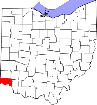
Milford is a city in Clermont and Hamilton counties in the U.S. state of Ohio. Milford is the westernmost city in Appalachian Ohio, and located along the Little Miami River and its East Fork in the southwestern part of the state, it is a part of the Cincinnati metropolitan area. The population was 6,582 at the 2020 census.

This is a list of the National Register of Historic Places listings in Hamilton County, Ohio.

The Wesley Butler Archeological District is a historic district composed of a group of archaeological sites in the southwestern corner of the U.S. state of Ohio. Located south of Elizabethtown, the district comprises three Native American mounds and the site of a Native American village, spread out over an area of 40 acres (16 ha). Although the mounds are built atop part of the village site, they are not contemporaneous: the mounds were built by Woodland peoples, but the village dates from the far older Archaic period.

The Mount Nebo Archaeological District is a historic district in the southwestern corner of the U.S. state of Ohio. Located near North Bend, the district lies near the intersection of Mount Nebo and Brower Roads. Included in the district's 40 acres (16 ha) of area are two contributing properties: one large archaeological site and one Native American mound.

The Shawnee Lookout Archeological District is a historic district in the southwestern corner of the U.S. state of Ohio. Located southwest of Cleves in Hamilton County's Miami Township, the district is composed of forty-six archaeological sites spread out over an area of 2,000 acres (810 ha). Thirty-four of these sites are located in the 1,000-acre (400 ha) Shawnee Lookout Park, which has been called one of the most beautiful parks in southwestern Ohio.

The Roberts Mound is a Native American mound in the southwestern part of the U.S. state of Ohio, United States. Located northwest of Auburn in Butler County, the mound sits in Section 36 of Reily Township; it is the only mound in the far southeastern part of the township.

The Adams County Paleo-Indian District is an archaeological site near Sandy Springs in Green Township, Adams County, Ohio, United States.

This is a list of the National Register of Historic Places listings in Clermont County, Ohio.
The Clarke Farm Site is an ancient archaeological site in the southwestern part of the U.S. state of Ohio. Located near Point Pleasant in Clermont County, it is a heavily stratified site, with nearly 8,000 years of occupation. Excavations at the site have yielded a large number of artifacts, including bones, chert, pottery, and shells. Cultures represented at the site range from Early Archaic to Fort Ancient, along with various Woodland cultures. The site encompasses an area of approximately 20 acres (8.1 ha), located along Big Indian Creek.

The Ferris Site is an archaeological site in the southwestern part of the U.S. state of Ohio. Located in Clermont County, along the Ohio River about 5 miles (8.0 km) downstream from the William H. Zimmer Power Station, the site consists of approximately 3 acres (1.2 ha) of land along an intermittent stream,
The East Fork Site is an archaeological site in the southwestern part of the U.S. state of Ohio. Located south of Batavia, it has yielded artifacts from more cultures than has any other site in Clermont County.
The Devanney Site is an archaeological site in the southwestern part of the U.S. state of Ohio. Located west of Goshen in Clermont County, it appears to have been occupied periodically for thousands of years.

The Brooke Site is an archaeological site in the northwestern portion of the U.S. state of Ohio. Located south of the city of Defiance in Defiance County, the site encompasses approximately 1 acre (0.40 ha) at the bottom of a ravine, along the Auglaize River. It was occupied by Late Woodland peoples of the Ontario and Younge Traditions.

The Winegardner Village is an archaeological site near Rushville in Fairfield County, Ohio, United States.

The Dodge Site is an archaeological site in the northwestern part of the U.S. state of Ohio. Located north of Bowling Green in Wood County, the site was inhabited by Middle Woodland and Upper Mississippian peoples. Among the artifacts discovered at the site are ceramics and stone tools. The site's stratigraphy is obvious: the Middle Woodland village site and cemetery can easily be distinguished from the Upper Mississippian occupation zone that sits on top of it. While only a small portion of the 2.2 acre (0.89 ha) site has been excavated, the artifacts that have been discovered at Dodge have contributed significantly to an understanding of the western basin of Lake Erie around AD 1300. Enough material has been recovered to facilitate radiometric dating, as well as identifying the peoples who once inhabited the site. The excavations also revealed the intensity of occupation: the Middle Woodland layer was substantially larger than the exceptionally thin Upper Mississippian component.

The Ratcliffe Mound (33-Vi-3) is a Native American mound in the southeastern part of the U.S. state of Ohio. Located in western Vinton County, it lies to the east of the community of Londonderry, at the bottom of a steep-walled valley. Sitting in the middle of farm fields near a stream, the mound is isolated in open countryside; there are no nearby woodlots. The mound is a circular cone in shape, 14 feet (4.3 m) high and 86 feet (26 m) in diameter.

The Cary Village Site is an archaeological site in the west-central portion of the U.S. state of Ohio. Located southeast of the village of Plain City in Madison County, the site occupies a group of grassy terraces located amid two farm fields. In this grassy area, archaeologists have discovered a wide range of artifacts, including stone tools, materials made of flint, and various types of pottery.

The Hillside Haven Mound is a Native American mound in the southwestern part of the U.S. state of Ohio. Located southwest of Oakland in Clinton County, it sits in dense woodland on the side of a hill. It is believed to have been conical in shape at the time of construction, but today it is rounded in shape, measuring 2.5 feet (0.76 m) high and 33 feet (10 m) in diameter.
The Ety Habitation Site is an archaeological site in the central part of the U.S. state of Ohio. Located northeast of the village of Carroll in Fairfield County, it encompasses an area of about 4 acres (1.6 ha), which is covered by a group of hillocks. Here have been found large numbers of artifacts of prehistoric man; the nature of the material found suggests that the Habitation Site was a substantial settlement for a long period, most likely from the Hopewellian period, two thousand years ago. Few Hopewellian sites have been discovered that both yielded such valuable information and were so little damaged by the passage of time; as a result, the Ety Habitation Site is a leading archaeological site.

The Bullskin Creek Site is an archaeological site in the southwestern portion of the U.S. state of Ohio. Located near Felicity in Clermont County, the site appears to have been a base camp for nomads during the Late Archaic period. The site comprises three loci: two significant areas of various debris and a large midden that underlies everything else. From these components, which cover an area of approximately 400 feet (120 m) by 600 feet (180 m), collectors and archaeologists have recovered hundreds of artifacts, including stone tools, weapons, and bone tools. Because the site is located in a farm field, it has frequently been cultivated, and the plow has brought at least five burials to the surface from a cemetery on the edge of the site. Among the types of features found at the site are ovens, trash pits, and postmolds. Bodies at the site were generally adorned with red ochre and buried in a flexed position.


