
Flat land
Hills
Mountains
The geography of Campania illustrates the geographical characteristics of Campania, a region of Italy.
The geography of Campania illustrates the geographical characteristics of Campania, a region of Italy.
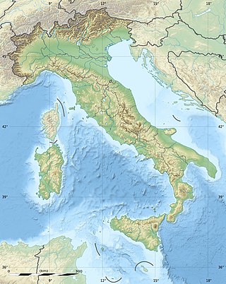
From the gulfs of Gaeta, Naples, Policastro and Salerno to the most notable elevations of the Campania Apennines, Campania extends over a morphologically very varied territory. To the north it borders Lazio and Molise; to the east, Apulia and Basilicata, which it also borders to the south; to the west the Tyrrhenian Sea. [1]
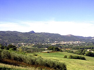
From a physical point of view, the Campania region can be divided into two areas: one mountainous and one flat: [2]
Therefore the flat area is divided into the plains: of Sessa Aurunca, [4] bathed by the river Garigliano; [5] of Capua the widest, crossed by the river Volturno; of Naples, which surrounds Vesuvius, one of the main Italian volcanoes; the countryside nocerino - sarnese close to the Lattari Mountains; of Paestum which opens onto the Gulf of Salerno and is bathed by the rivers Sele, Calore Lucano and Tanagro; of Alento which occupies a narrow portion between Monte Stella [6] and Monte Gelbison. [7]
The coasts of Campania are high and jagged and low and sandy in the plains. The main rivers are: the Volturno, which bathes Capua and flows into the Gulf of Gaeta; the Sele, which flows into the Gulf of Salerno; the Garigliano, which flows along the border with Lazio and flows into the Gulf of Gaeta; and the Ofanto, which originates in Irpinia and flows into the Adriatic Sea. [1]
The geography of Italy includes the description of all the physical geographical elements of Italy. Italy, whose territory largely coincides with the homonymous geographical region, is located in southern Europe and comprises the long, boot-shaped Italian Peninsula crossed by the Apennines, the southern side of Alps, the large plain of the Po Valley and some islands including Sicily and Sardinia. Italy is part of the Northern Hemisphere. Two of the Pelagie Islands are located on the African continent.

The Garigliano is a river in central Italy.

The Apennines or Apennine Mountains are a mountain range consisting of parallel smaller chains extending c. 1,200 km (750 mi) along the length of peninsular Italy. In the northwest they join with the Ligurian Alps at Altare. In the southwest they end at Reggio di Calabria, the coastal city at the tip of the peninsula. Since 2000 the Environment Ministry of Italy, following the recommendations of the Apennines Park of Europe Project, has been defining the Apennines System to include the mountains of north Sicily, for a total distance of 1,500 kilometres (930 mi). The system forms an arc enclosing the east side of the Ligurian and Tyrrhenian Seas.

The Volturno is a river in south-central Italy.
Monte Massico is a mountain situated in the Italian Province of Caserta (Campania) between the rivers Volturno and Garigliano.
The Province of Caserta is a province in the Campania region of southern Italy. Its capital is the city of Caserta, situated about 36 kilometres (22 mi) by road north of Naples. The province has an area of 2,651.35 square kilometres (1,023.69 sq mi), and had a total population of 924,414 in 2016. The Palace of Caserta is located near to the city, a former royal residence which was constructed for the Bourbon kings of Naples. It was the largest palace and one of the largest buildings erected in Europe during the 18th century. In 1997, the palace was designated a UNESCO World Heritage Site.

Altavilla Silentina is a town and comune located in the province of Salerno, Campania, some 100 km south of Naples, Italy.

Sessa Aurunca is a town and comune in the province of Caserta, Campania, southern Italy. It is located on the south west slope of the extinct volcano of Roccamonfina, 40 kilometres (25 mi) by rail west north west of Caserta and 30 kilometres (19 mi) east of Formia.

The Calore Irpino or Calore Beneventano or Calore river is a river in southwestern Italy. It rises from Colle Finestra, a mountain saddle between Monte Acellica and the Terminio sub-group in the Monti Picentini, sub-range of the Apennine Mountains. The river flows first in the province of Avellino, and then in that of Benevento, before flowing into the Volturno. In ancient times it was known as Calor.

The Sele is a river in southwestern Italy. Originating from the Monti Picentini in Caposele, it flows through the region of Campania, in the provinces of Salerno and Avellino. Its mouth is in the Gulf of Salerno, on the Tyrrhenian Sea, at the borders between the municipalities of Eboli and Capaccio, in the beginning point of Cilentan Coast.

Latium adiectum or Latium Novum was a region of Roman Italy between Monte Circeo and the river Garigliano, south of and immediately adjacent to Old Latium, hence its name of attached Latium.
Terra di Lavoro is the name of a historical region of Southern Italy. It corresponds roughly to the modern southern Lazio and northern Campania and upper north west and west border area of Molise regions of Italy.
San Mango sul Calore is a village and comune in the province of Avellino, in the Campania region of southern Italy.
Albanella is a town and comune in the province of Salerno in the Campania region of south-western Italy. It is located 51 kilometers from the city of Salerno.

The Monti Aurunci is a mountain range of southern Lazio, in central Italy. It is part of the Antiappennini, a group running from the Apennines chain to the Tyrrhenian Sea, where it forms the promontory of Gaeta. It is bounded to the north-west by the Ausoni Mountains, to the north by the Liri river, to the east by the Ausente, to the south-east by the Garigliano and to the south by the Tyrrhenian sea. The line between the Aurunci and the Ausoni has not been clearly established but the Aurunci are considered by convention to be east of a line through Fondi, Lenola, Pico, S. Giovanni and Incarico. Altitudes vary from hills to the 1,533 m of Monte Petrella. Main peaks include the Redentore (1,252 m) and Monte Sant'Angelo (1,402 m). They include a regional park, the Parco Naturale dei Monti Aurunci, created in 1997.

The Calore Lucano is a river in Campania, southern Italy, whose course is entirely included in the province of Salerno, within Cilento, for a total of about 63 kilometres (39 mi). It is an important left tributary of the Sele. In ancient times it was known as Calor.

The Monti Picentini is a mountain range and national park in southern Italy, part of the Apennines, traditionally part in the Campanian Apennines. They are included between the Monti Lattari, the Partenio mount, the Irpinian plateau and the Sele river valley. The chain is included in the Monti Picentini Regional Park.

Baia Domizia is a seaside resort in the Region of Campania, Italy, at the border with Latium, a natural border marked by the Garigliano River.

Ancient Campania originally indicated the territory of the ancient city of Capua in the Roman period, and later also the plains of the various neighbouring municipalities. It was a very large territory when compared with the other Italic cities of the Roman and pre-Roman period.
| Provinces |  | |
|---|---|---|
| Places | ||
| History | ||
| Politics and government | ||
| Culture | ||