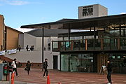
The University of Warwick is a public research university on the outskirts of Coventry between the West Midlands and Warwickshire, England. The university was founded in 1965 as part of a government initiative to expand higher education. The Warwick Business School was established in 1967, the Warwick Law School in 1968, Warwick Manufacturing Group (WMG) in 1980, and Warwick Medical School in 2000. Warwick incorporated Coventry College of Education in 1979 and Horticulture Research International in 2004.
Kenilworth is a market town and civil parish in the Warwick District in Warwickshire, England, 6 miles (10 km) south-west of Coventry, 5 miles (8 km) north of Warwick and 90 miles (140 km) north-west of London. It lies on Finham Brook, a tributary of the River Sowe, which joins the River Avon 2 miles (3 km) north-east of the town. At the 2021 Census, the population was 22,538. The town is home to the ruins of Kenilworth Castle and Kenilworth Abbey.

Southam is a market town and civil parish in the Stratford-on-Avon district of Warwickshire, England. Southam is situated on the River Stowe, which flows from Napton-on-the-Hill and joins Warwickshire's River Itchen at Stoneythorpe, just outside the town.

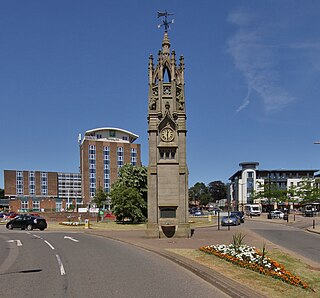
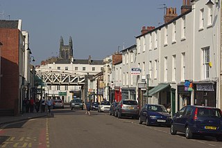
Warwick is a market town, civil parish and the county town of Warwickshire in the Warwick District in England, adjacent to the River Avon. It is 9 miles (14 km) south of Coventry, and 19 miles (31 km) south-east of Birmingham. It is adjoined with Leamington Spa and Whitnash.

Warwickshire is a county in the West Midlands region of England. The county town is Warwick, and the largest town is Nuneaton. The county is famous for being the birthplace of William Shakespeare at Stratford-upon-Avon and Victorian novelist George Eliot,, at Nuneaton. Other significant towns include Rugby, Leamington Spa, Bedworth, Kenilworth and Atherstone. The county offers a mix of historic towns and large rural areas. It is a popular destination for international and domestic tourists to explore both medieval and more recent history.
Warwick is a local government district of central Warwickshire in England. It borders the Borough of Rugby and Stratford-on-Avon District in Warwickshire as well as the West Midlands County. The City of Coventry is to the north and northeast, the Stratford-on-Avon District to the southwest and south, the Borough of Rugby to the east, and the Borough of Solihull to the west and northwest.
Coventry University is a public research university in Coventry, England. The origins of Coventry University can be linked to the founding of the Coventry School of Design in 1843. It was known as Lanchester Polytechnic from 1970 until 1987, and then as Coventry Polytechnic until the Further and Higher Education Act 1992 afforded its university status that year and the name was changed to Coventry University.

Leek Wootton is a village and former civil parish, now in the parish of Leek Wootton and Guy's Cliffe, in the Warwick district, in the county of Warwickshire, England, approximately 2 miles south of Kenilworth and 2.5 miles north of Warwick. It lies in the triangle created by Kenilworth, Warwick and Leamington Spa. In 1961 the parish had a population of 671.
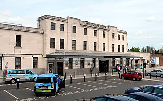
Leamington Spa railway station serves the town of Royal Leamington Spa, in Warwickshire, England. It is situated on Old Warwick Road towards the southern edge of the town centre. It is a major stop on the Chiltern Main Line between London and Birmingham, and is the southern terminus of a branch line to Coventry.

Rugby and Kenilworth was a county constituency in Warwickshire, England. It returned one Member of Parliament to the House of Commons of the Parliament of the United Kingdom. It existed from 1983 to 2010.
Budbrooke is a village and civil parish in the Warwick district of Warwickshire, England. It is 3 miles west of Warwick and according to the 2001 census the parish had a population of 2,319, reducing to 1,863 at the 2011 Census. Most of the population of Budbrooke live in Hampton Magna, a housing estate built in the late 1960s, with other smaller settlements in Budbrooke Village and Hampton on the Hill.

Kenilworth and Southam is a constituency in Warwickshire, England represented in the House of Commons of the UK Parliament since 2010 by Jeremy Wright, a Conservative who served as Culture Secretary until 24 July 2019, having previously served as Attorney General for England and Wales from 2014 to 2018.

Cubbington is a village and civil parish with a population of 3,929, adjoining the north-eastern outskirts of Leamington Spa, Warwickshire, England, approximately 3 miles from the town centre. Welsh Road, running through the village crossroads, was an old sheep drovers' route connecting London and Wales. Since the 1950s when the village expanded there have been two parts to the village: Cubbington proper which was the old village core, and New Cubbington which is to the west, although both are referred to as Cubbington. Topographically the highest point of the village sits about 100 metres (330 ft) above sea level while its lowest is about 60 metres (200 ft). For many years the electorate for Cubbington was represented in government by the MP for Warwick and Leamington but for the 2010 UK Elections it moved to the new Kenilworth & Southam constituency.

Cannon Park is a suburb in the southwest of the City of Coventry, West Midlands, England. It can be accessed via the major roads Kenpas Highway (A45) or Kenilworth Road. The area has a sizable shopping centre of the same name which features food stores, shops and eateries. Tenants include a post office, Tesco, Wilko and Iceland.
Warwick Medical School is the medical school of the University of Warwick and is located in Coventry, United Kingdom. It was opened in 2000 in partnership with Leicester Medical School, and was granted independent degree-awarding status in 2007.

The A452 is a road in England, which runs from Royal Leamington Spa, Warwickshire to Brownhills in the West Midlands. It is the major link to the M6 motorway for both Leamington and Warwick in addition to serving as Leamington's link to the M40 motorway and to Coventry.
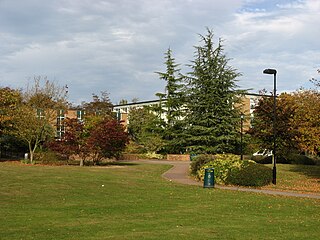
Westwood is one of three campuses of the University of Warwick.

The Coventry to Leamington Line is a railway line linking the city of Coventry with the town of Leamington Spa. The line was opened in 1844 by the London and Birmingham Railway, as far as Milverton. The line was extended to Leamington Spa Avenue in 1851. A connecting line to Berkswell opened in 1884.
Exhall Grange School is a special school located in Ash Green just outside Coventry in Warwickshire, England. The school meets the needs of children and young people age from 2 to 19 years with physical disability, visual impairment, complex medical needs, and social, communication and interaction difficulties.

Alexander Hill was a medical doctor and professor who was Master of Downing College, Cambridge from 1888 to 1907 and Vice-Chancellor of the University of Cambridge from 1897 to 1899. He was Principal of Southampton University College from 1913 to 1920.