
The Alps are the highest and most extensive mountain range that is entirely in Europe, stretching approximately 1,200 km (750 mi) across eight Alpine countries : Monaco, France, Switzerland, Italy, Liechtenstein, Germany, Austria and Slovenia.

The Alpine region of Switzerland, conventionally referred to as the Swiss Alps, represents a major natural feature of the country and is, along with the Swiss Plateau and the Swiss portion of the Jura Mountains, one of its three main physiographic regions. The Swiss Alps extend over both the Western Alps and the Eastern Alps, encompassing an area sometimes called Central Alps. While the northern ranges from the Bernese Alps to the Appenzell Alps are entirely in Switzerland, the southern ranges from the Mont Blanc massif to the Bernina massif are shared with other countries such as France, Italy, Austria and Liechtenstein.
The Alps form part of a Cenozoic orogenic belt of mountain chains, called the Alpide belt, that stretches through southern Europe and Asia from the Atlantic all the way to the Himalayas. This belt of mountain chains was formed during the Alpine orogeny. A gap in these mountain chains in central Europe separates the Alps from the Carpathians to the east. Orogeny took place continuously and tectonic subsidence has produced the gaps in between.

The Tian Shan, also known as the Tengri Tagh or Tengir-Too, meaning the "Mountains of God/Heaven", is a large system of mountain ranges in Central Asia. The highest peak in the Tian Shan is Jengish Chokusu, at 7,439 metres (24,406 ft) high. Its lowest point is the Turpan Depression, which is 154 m (505 ft) below sea level.

The Last Glacial Period (LGP), also known colloquially as the Last Ice Age or simply Ice Age, occurred from the end of the Eemian to the end of the Younger Dryas, encompassing the period c. 115,000 – c. 11,700 years ago.

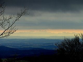
The Bavarian Alps is a collective name for several mountain ranges of the Northern Limestone Alps within the German state of Bavaria.

The Würm glaciation or Würm stage, usually referred to in the literature as the Würm, was the last glacial period in the Alpine region. It is the youngest of the major glaciations of the region that extended beyond the Alps themselves. Like most of the other ice ages of the Pleistocene epoch, it is named after a river, in this case the Würm in Bavaria, a tributary of the Amper.
The Riss glaciation, Riss Glaciation, Riss ice age, Riss Ice Age, Riss glacial or Riss Glacial is the second youngest glaciation of the Pleistocene epoch in the traditional, quadripartite glacial classification of the Alps. The literature variously dates it to between about 300,000 to 130,000 years ago and 347,000 to 128,000 years ago. It coincides with the Saale glaciation of North Germany. The name goes back to Albrecht Penck and Eduard Brückner who named this cold period after the river Riss in Upper Swabia in their three-volume work Die Alpen im Eiszeitalter published between 1901 and 1909.

The Swiss Plateau or Central Plateau is one of the three major landscapes in Switzerland, lying between the Jura Mountains and the Swiss Alps. It covers about 30% of the Swiss surface area, and is partly flat but mostly hilly. The average height is between 400 metres (1,300 ft) and 700 metres (2,300 ft) AMSL. It is by far the most densely populated region of Switzerland, the center of economy and important population of beavers.

A terminal moraine, also called an end moraine, is a type of moraine that forms at the terminal (edge) of a glacier, marking its maximum advance. At this point, debris that has accumulated by plucking and abrasion, has been pushed by the front edge of the ice, is driven no further and instead is deposited in an unsorted pile of sediment. Because the glacier acts very much like a conveyor belt, the longer it stays in one place, the greater the amount of material that will be deposited. The moraine is left as the marking point of the terminal extent of the ice.

The Molasse basin is a foreland basin north of the Alps which formed during the Oligocene and Miocene epochs. The basin formed as a result of the flexure of the European plate under the weight of the orogenic wedge of the Alps that was forming to the south.
The Alpine Foreland, less commonly called the Bavarian Foreland, Bavarian Plateau or Bavarian Alpine Foreland, refers to a triangular region of plateau and rolling foothills in Southern Germany, stretching from Lake Constance in the west to beyond Linz on the Danube in the east, with the Bavarian Alps forming its south boundary and the Danube its northern extent.

The Jungfrau-Aletsch protected area is located in south-western Switzerland between the cantons of Berne and Valais. It is a mountainous region in the easternmost side of the Bernese Alps, containing the northern wall of Jungfrau and Eiger, and the largest glaciated area in western Eurasia, comprising the Aletsch Glacier. The Jungfrau-Aletsch protected area is the first World Natural Heritage site in the Alps; it was inscribed in 2001.
Barnett Glacier is a large glacier in the Anare Mountains that flows east along the south side of Tapsell Foreland into Smith Inlet, northern Victoria Land, Antarctica. It was mapped by the United States Geological Survey (USGS) from surveys and from U.S. Navy air photos, 1960–63, and named by the Advisory Committee on Antarctic Names after Donald C. Barnett, USGS topographic engineer, a member of USGS Topo East and West, 1962–63, in which the expedition extended geodetic control from the area of Cape Hallett to the Wilson Hills and from the foot of Beardmore Glacier through the Horlick Mountains. The glacier lies on the Pennell Coast, a portion of Antarctica lying between Cape Williams and Cape Adare.

Overdeepening is a characteristic of basins and valleys eroded by glaciers. An overdeepened valley profile is often eroded to depths which are hundreds of metres below the lowest continuous surface line along a valley or watercourse. This phenomenon is observed under modern day glaciers, in salt-water fjords and fresh-water lakes remaining after glaciers melt, as well as in tunnel valleys which are partially or totally filled with sediment. When the channel produced by a glacier is filled with debris, the subsurface geomorphic structure is found to be erosionally cut into bedrock and subsequently filled by sediments. These overdeepened cuts into bedrock structures can reach a depth of several hundred metres below the valley floor.
The glacial series refers to a particular sequence of landforms in Central Europe that were formed during the Pleistocene glaciation beneath the ice sheets, along their margins and on their forelands during each glacial advance.

The Inn Glacier, also called the Inn Valley Glacier (Inntal-Gletscher). was the ice age glacier of the Alpine river, the Inn. Originating in the Swiss Upper and Lower Engadine, it flowed through the state of Tyrol in Austria. On German territory it pushed its ice front far into the Bavarian Alpine Foreland. The Inn Glacier attained its greatest thickness and extent during the Riss glaciation. The overwhelming part of the landforms seen today in the valley carved by the Inn Glacier date, however, to the last ice age, the Würm glaciation.
An alpentor in geology is the point where an entire glacier forced its way through to the Alpine Foreland from the Alps during the ice age.

