
Westbrook Estates is a well-established neighbourhood "designed to appeal to individuals and families in search of a quiet, high quality residential environment with prestigious, architecturally designed homes on large lots." It is located in south west Edmonton, Alberta, Canada.
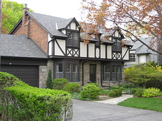
Humber Valley Village is a neighbourhood located in Toronto, Ontario, Canada. It is within the former City of Etobicoke and is a relatively affluent community. The boundaries are from Dundas Street on the south to Islington Avenue to the west, Eglinton Avenue to the north, and the Humber River in the east. The neighbourhood is in the political riding of Etobicoke Centre.
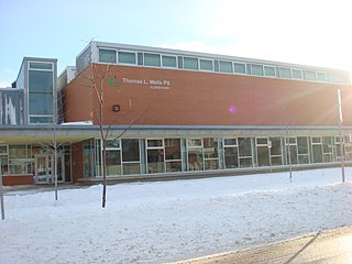
Morningside Heights is a suburban residential neighbourhood in the district of Scarborough in Toronto, Ontario, Canada. It is located in the northeast corner of the city, just north of the Malvern and west of Rouge Park and the Rouge. The subdivision, comprising approximately 750 acres (3.0 km2), was one of the last large tracts of undeveloped land within the City of Toronto, located between Finch Avenue East and Steeles Avenue East, from Tapscott Road to the Rouge River.

Rossdale is a river valley neighbourhood in the city of Edmonton, Alberta, Canada, located immediately south of the downtown core. It is a popular residential neighbourhood with easy access to downtown, the University of Alberta, the Edmonton river valley park system, and other amenities.
Oliver is one of the oldest residential neighbourhoods in the City of Edmonton, Alberta, Canada. The neighbourhood is named after Frank Oliver, an early Edmonton resident, businessman, and politician. The south east portion of the neighbourhood is also known as Grandin, with both Grandin LRT Station and Grandin School located in this part of the neighbourhood.

Shaganappi is a residential neighbourhood in the southwest quadrant of Calgary, Alberta. It is located between 17 Avenue SW and the Bow River. The Shaganappi golf course is located north of the Bow Trail.
Valley Ridge is a residential neighbourhood in the northwest quadrant of Calgary, Alberta, Canada. It is located at the western edge of the city, south of the Bow River and north of the Trans-Canada Highway. The Valley Ridge golf course is located in the northern part of the community. The community is located on the former site of the Happy Valley Campground a fun park with slides, which was a major destination for visitors to Calgary until it was closed in the 1980s; the campground was located where the golf course is now situated.
Panorama Hills is a suburban residential neighbourhood in the northwest quadrant of Calgary, Alberta. It is a new community, located at the northern edge of the city, north of Country Hills boulevard.
Bel-Aire is a wealthy residential neighbourhood in the southwest quadrant of Calgary, Alberta. It is located east of the Glenmore Reservoir and the Elbow River and west of the community of Meadowlark Park and Chinook Center and north of the neighbourhood of Mayfair. The Calgary Country Club golf course makes up its northern boundary.
Willow Park is a residential neighbourhood in the southeast quadrant of Calgary, Alberta. It is bounded to the west by Macleod Trail, to the south by Anderson Road, to the north by Southland Drive and to the east by the community of Maple Ridge. The Willow Park golf course bisects the neighbourhood from west to east, while Fairmont Drive crosses from south to north. Southcentre Mall and Willow Park shopping village are located in the southwest corner of the neighbourhood.
Windsor Park is a residential neighbourhood in the southwest quadrant of Calgary, Alberta. It is bounded by 50 Avenue S to the north, Macleod Trail to the east, 58 Avenue S to the south and the Calgary Golf & Country Club and Elbow River to the west. Chinook Centre is located southeast of the neighbourhood.
Collingwood is a residential neighbourhood in the northwest quadrant of Calgary, Alberta. It is located immediately south of the Nose Hill Park and John Laurie Boulevard, and west from 14th Street W. To the south it is bordered by Confederation Park, Canmore Park and the Confederation Park golf course.
Jackson Heights is a residential neighbourhood in the Mill Woods area of Edmonton, Alberta, Canada. It is located in the Burnewood area of Mill Woods. The neighbourhood was named in 1976 after Annie May Jackson. Jackson "became the first female police officer in Canada when she was appointed to the Edmonton Police Department in 1912."
Highland Park is a residential neighbourhood in the northwest quadrant of Calgary, Alberta. It is bounded to the north by McKnight Boulevard, to the east by Edmonton Trail, to the south by 32 Avenue N and to the west by 4 Street W. Confederation Park and Nose Hill Park are located in close proximity. The Queens Park Cemetery occupies the southwestern corner of the neighbourhood, and the Highland golf course is developed in the north.
Rosscarrock is a residential neighbourhood in the southwest quadrant of Calgary, Alberta. It is bounded to the north by Bow Trail to the east by 33 Street W, to the south by 17 Avenue S and to the west by 45 Street W. The Westbrook Mall is located in the northeast corner of the neighbourhood, and it is bordered by the Shaganappi golf course.
Greenview is a residential neighbourhood in the Mill Woods area of southeast Edmonton, Alberta, Canada. It is located to the south of the Mill Woods Golf Course.
Oleskiw is a residential neighbourhood in west Edmonton, Alberta, Canada that overlooks the North Saskatchewan River valley to the east and south. The Edmonton Golf and Country Club is a feature of the neighbourhood.
Blue Quill is a residential neighbourhood located in south west Edmonton, Alberta, Canada. Blue Quill and the adjacent neighbourhood of Blue Quill Estates are named to honour Chief Blue Quill of the Saddle Lake Band.
Blue Quill Estates is a residential neighbourhood in south west Edmonton, Alberta, Canada. Both Blue Quill Estates and the adjoining neighbourhood of Blue Quill are named to honour Chief Blue Quill of the Saddle Lake Band.
South Oak Bay is a neighbourhood located in the Municipality of Oak Bay, British Columbia, to the south of Oak Bay Avenue and lying east of the boundary between Oak Bay and Victoria, British Columbia.


