Greater Glasgow

Last updated

Greater Glasgow
Greater Glasgow.PNG
Satellite image showing the Greater Glasgow Area
Area265 km2 (102 sq mi)  [1]
Population1,028,220 (2020) [2]
Language English, Scots, Gaelic [3]
OS grid reference NS590655
  Edinburgh 42 mi (68 km)
  London 403 mi (649 km)
Country Scotland
Sovereign state United Kingdom
Post town GLASGOW
Postcode district G1–G84
Post townPAISLEY
Postcode district PA1–PA19
Post townMOTHERWELL
Postcode district ML1–ML8
Dialling code 0141, 01236, 01355, 01360, 01389, 01505, 01698, 01475
List of places
UK
Scotland

Greater Glasgow is an urban settlement in Scotland consisting of all localities which are physically attached to the city of Glasgow, forming with it a single contiguous urban area (or conurbation). It does not relate to municipal government boundaries, and its territorial extent is defined by the General Register Office for Scotland, which determines settlements in Scotland for census and statistical purposes. Greater Glasgow had a population of 1,199,629 at the time of the 2001 UK Census [4] making it the largest urban area in Scotland and the fifth-largest in the United Kingdom. [5] However, the population estimate for the Greater Glasgow 'settlement' (a chain of continuously populated postcodes) in mid-2016 was 985,290 [6] —the reduced figure explained by the removal of the Motherwell & Wishaw (124,790), Coatbridge & Airdrie (91,020), and Hamilton (83,730) settlement areas east of the city due to small gaps between the populated postcodes. The 'new towns' of Cumbernauld (which had a 2016 settlement population of 50,920) and East Kilbride (75,120) were never included in these figures despite their close ties to Glasgow due to having a clear geographical separation from the city. In the 2020 figures (with almost the same boundaries as 2016, the main difference being the re-addition of Barrhead), the Greater Glasgow population had risen to just over 1 million. [2]

Contents

A more extensive Greater Glasgow concept covers a much larger area and may include Ayrshire down to Ayr as well as the whole of Lanarkshire down to Lanark, Dunbartonshire, Renfrewshire, and Inverclyde. At present, the Glasgow City Region consists of the Glasgow City Council, North Lanarkshire, South Lanarkshire, West Dunbartonshire, East Dunbartonshire, Renfrewshire, East Renfrewshire, and Inverclyde Local Authorities, with a combined population of over 1.7 million. This city-region is described as a metropolitan area by its own strategic planning authority and is similar to the Glasgow metropolitan area identified by the European Union.

The City of Glasgow grew substantially in population during the late nineteenth and early twentieth centuries, becoming in 1912 the eighth city in Europe to reach the one million mark after Rome, London, Paris, Berlin, Vienna, St. Petersburg, and Moscow. The official population stayed over a million for fifty years. [7] Since the 1960s, successive boundary changes and large-scale relocation to suburban districts and new towns have reduced the population of the City of Glasgow council area to 593,245 at the time of the 2011 UK Census.

Urban Area

Following the local government boundary changes in 1996 and the creation of the present day unitary councils in Scotland, replacing the former regional and district councils, the Greater Glasgow Settlement Area or Urban Area was created for the 2001 Census from groups of neighbouring urban postcodes grouped so that each group of postcode units (known as a locality) contains at least a given number of addresses per unit area, and the group contains at least 500 residents. The localities that make up Greater Glasgow are listed below:

LocalityCouncil areaPopulation

(1991 census)

Population

(2001 census) [4]

Population

(2016 estimate) [6]

Population

(2020 estimate) [2]

Airdrie [lower-alpha 1] North Lanarkshire 12,43636,32637,41036,390
Bargeddie [lower-alpha 1] North Lanarkshire 2,3252,7902,9603,210
Barrhead [lower-alpha 2] East Renfrewshire 16,70317,44317,61017,890
Bearsden East Dunbartonshire 27,70727,96728,12028,470
Bellshill [lower-alpha 1] North Lanarkshire 20,07520,13420,29019,700
Bishopbriggs East Dunbartonshire 23,82523,11823,54023,680
Blantyre [lower-alpha 1] South Lanarkshire 16,90016,800
Bothwell [lower-alpha 1] South Lanarkshire 6,3806,870
Bowling West Dunbartonshire 5,5005,500560560
Brookfield [lower-alpha 3] Renfrewshire 540880
Busby East Renfrewshire 1,6171,6543,2503,310
Cambuslang South Lanarkshire 23,21224,50029,10030,790
Chapelhall [lower-alpha 1] North Lanarkshire 4,4055,6916,6907,140
Chryston [lower-alpha 1] North Lanarkshire 3,0003,100
Clarkston East Renfrewshire 18,89919,1369,8609,800
Clydebank West Dunbartonshire 29,17129,85826,32025,620
Coatbridge [lower-alpha 1] North Lanarkshire 40,32041,17043,96043,950
Duntocher and Hardgate West Dunbartonshire 7,8827,3016,8806,680
Elderslie Renfrewshire 5,1665,1805,3305,480
Erskine [lower-alpha 1] Renfrewshire 15,16615,34715,51015,010
Faifley West Dunbartonshire 6,0874,9324,8604,740
Gartcosh [lower-alpha 1] North Lanarkshire 2,2002,920
Giffnock East Renfrewshire 16,19016,17812,30012,250
Glasgow Glasgow City 658,379629,501612,040632,350
Hamilton [lower-alpha 1] South Lanarkshire 44,65853,45754,08054,480
Inchinnan [lower-alpha 1] Renfrewshire 1,2331,5741,8601,820
Johnstone Renfrewshire 18,28016,46816,09015,930
Kilbarchan Renfrewshire 3,7103,6223,4803,300
Linwood Renfrewshire 10,1839,0588,6008,450
Milngavie East Dunbartonshire 11,99212,79512,94012,840
Moodiesburn [lower-alpha 1] North Lanarkshire 6,8906,830
Motherwell [lower-alpha 1] North Lanarkshire 27,42630,30132,59032,840
Muirhead [lower-alpha 1] North Lanarkshire 1,3801,830
Netherlee East Renfrewshire 4,6004,530
Newton Mearns East Renfrewshire 19,34222,63726,60028,210
Old Kilpatrick West Dunbartonshire 2,4083,1994,6804,470
Paisley Renfrewshire 73,92574,17077,22077,270
Renfrew Renfrewshire 20,76420,25122,57024,270
Rutherglen South Lanarkshire 25,00025,00031,19030,950
Stamperland East Renfrewshire 3,6403,630
Stepps North Lanarkshire 4,9424,8027,4507,700
Thornliebank East Renfrewshire 3,9804,0514,0704,170
Uddingston [lower-alpha 1] South Lanarkshire 6,3706,300
Wishaw [lower-alpha 1] North Lanarkshire 26,43928,56430,29030,050
  1. 1 2 3 4 5 6 7 8 9 10 11 12 13 14 15 16 17 No longer included in Greater Glasgow in 2016 or 2020 figures.
  2. No longer included in Greater Glasgow in 2016 figures, but re-added in 2020.
  3. Added to figure in 2020.

Transport

Rail passengers 2018-2019 Greater Glasgow rail passengers 2018-19.png
Rail passengers 2018-2019

In 1973, the Greater Glasgow Passenger Transport Executive (later Strathclyde Passenger Transport Executive from 1983 and Strathclyde Passenger Transport Authority from 1996) was created to take over control of Glasgow Corporation Transport (which included the Glasgow Subway). Following local government reorganisation in 1975, control subsequently passed to Strathclyde Regional Council. The former PTE is now the Strathclyde Partnership for Transport, within Transport Scotland.

The city is served by the only metro system in Scotland, the Glasgow Subway; and by two international airports, Glasgow Prestwick Airport [8] and Glasgow Airport. [9]

Glasgow City Region

The Glasgow City Region [10] is a collection of local authorities clustered around Glasgow. [11] The eight constituent authorities are:

The population of this area in 2011 was 1,787,515. The city region is not a conurbation as significant parts of the council areas (and the whole of Inverclyde) are separated from Greater Glasgow by open countryside. It uses numerous other terms for itself, including Metropolitan Glasgow, [10] the metropolitan City-Region of Glasgow, [12] Glasgow and the Clyde Valley and Clydeside.

As a collection of individual local authorities the city region has no single municipal government however, following the agreement of a City Deal with the UK Government, the eight constituent authorities formally established a joint Glasgow and Clyde Valley Cabinet on 20 January 2015. This cabinet consists of the leaders of all eight councils, with the leader of Glasgow City Council being Chair of the Cabinet. [13] Prior to 2015 the eight authorities formed only a combined strategic planning authority. [12]

Metropolitan Glasgow

While the Scottish Government makes no official recognition of 'Metropolitan status' in its workings, [14] the term is used by other bodies. The European Union's statistical body Eurostat lists Glasgow as the 32nd most populous metropolitan area, or Larger Urban Zones, in the EU. Although not defining the boundaries of this metropolitan area, Eurostat state it consists "of over 1.7 million inhabitants covering an area of 3,346 km2"., [15] which is similar to the 1.75 million population of the Glasgow City Region and may suggest a correlation between the two. The Glasgow City Region's strategic development authority describes itself as the planning authority for the "Glasgow metropolitan area" [16] and the "metropolitan city-region of Glasgow". [12]

The former local government region of Strathclyde has also been identified as a metropolitan area surrounding the Greater Glasgow conurbation, and covers approximately 2.3 million people, 41% of Scotland's population. [17]

See also

Related Research Articles

<span class="mw-page-title-main">East Renfrewshire</span> Council area of Scotland

East Renfrewshire is one of 32 council areas of Scotland. It was formed in 1996, as a successor to the Eastwood district of the Strathclyde region. The northeastern part of the council area is close to Glasgow and many of the council area's northern settlements fall into the Greater Glasgow urban area.

<span class="mw-page-title-main">Inverclyde</span> Council area of Scotland

Inverclyde is one of 32 council areas used for local government in Scotland. Together with the East Renfrewshire and Renfrewshire council areas, Inverclyde forms part of the historic county of Renfrewshire, which currently exists as a registration county and lieutenancy area. Inverclyde is located in the west central Lowlands. It borders the North Ayrshire and Renfrewshire council areas, and is otherwise surrounded by the Firth of Clyde.

<span class="mw-page-title-main">East Dunbartonshire</span> Council area of Scotland

East Dunbartonshire is one of the 32 council areas of Scotland. It borders Glasgow City Council Area to the south, North Lanarkshire to the east, Stirling to the north, and West Dunbartonshire to the west. East Dunbartonshire contains many of the affluent areas north of Glasgow, including Bearsden, Milngavie, Milton of Campsie, Balmore, and Torrance, as well as many of Glasgow's commuter towns and villages. The council area covers parts of the historic counties of Dunbartonshire, Lanarkshire, and Stirlingshire.

<span class="mw-page-title-main">North Lanarkshire</span> Council area of Scotland

North Lanarkshire is one of the 32 council areas of Scotland. It borders the north-east of the Glasgow City council area and contains many of Glasgow's suburbs, commuter towns, and villages. It also borders East Dunbartonshire, Falkirk, Stirling, South Lanarkshire, and West Lothian. The council area covers parts of the historic counties of Dunbartonshire, Lanarkshire, and Stirlingshire. The council is based in Motherwell.

<span class="mw-page-title-main">Renfrewshire</span> Council area of Scotland

Renfrewshire is one of the 32 council areas of Scotland.

<span class="mw-page-title-main">Lanarkshire</span> Historic county in Scotland

Lanarkshire, also called the County of Lanark, is a historic county, lieutenancy area and registration county in the Central Lowlands of Scotland. The county is no longer used for local government purposes, but gives its name to the two modern council areas of North Lanarkshire and South Lanarkshire.

<span class="mw-page-title-main">Dunbartonshire</span> Historic county in Scotland

Dunbartonshire or the County of Dumbarton is a historic county, lieutenancy area and registration county in the west central Lowlands of Scotland lying to the north of the River Clyde. Dunbartonshire borders Perthshire to the north, Stirlingshire to the east, Lanarkshire and Renfrewshire to the south, and Argyllshire to the west.

<span class="mw-page-title-main">Clydebank</span> Town in Scotland

Clydebank is a town in West Dunbartonshire, Scotland. Situated on the north bank of the River Clyde, it borders the village of Old Kilpatrick to the west, and the Yoker and Drumchapel areas of the adjacent City of Glasgow immediately to the east. Depending on the definition of the town's boundaries, the suburban areas of Duntocher, Faifley and Hardgate either surround Clydebank to the north, or are its northern outskirts, with the Kilpatrick Hills beyond.

<span class="mw-page-title-main">Strathclyde</span> Former local government region of Scotland

Strathclyde was one of nine former local government regions of Scotland created in 1975 by the Local Government (Scotland) Act 1973 and abolished in 1996 by the Local Government etc. (Scotland) Act 1994. The Strathclyde region had 19 districts. The region was named after the early medieval Kingdom of Strathclyde centred on Govan, but covered a broader geographic area than its namesake.

<span class="mw-page-title-main">Erskine</span> Post town in Renfrewshire, Scotland

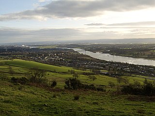
Erskine is a town in the council area of Renfrewshire, and historic county of the same name, situated in the West Central Lowlands of Scotland. It lies on the southern bank of the River Clyde, providing the lowest crossing to the north bank of the river at the Erskine Bridge, connecting the town to Old Kilpatrick in West Dunbartonshire. Erskine is a commuter town at the western extent of the Greater Glasgow conurbation, bordering Bishopton to the west and Renfrew, Inchinnan, Paisley and Glasgow Airport to the south. Originally a small village settlement, the town has expanded since the 1960s as the site of development as an overspill town, boosting the population to over 15,000. In 2014, it was rated one of the most attractive postcode areas to live in Scotland.

<span class="mw-page-title-main">Strathclyde Partnership for Transport</span> Regional transport partnership for the Strathclyde area of western Scotland

Strathclyde Partnership for Transport (SPT) is a regional transport partnership for the Strathclyde area of western Scotland. It is responsible for planning and coordinating regional transport, especially the public transport system in the area, including responsibility for operating the Glasgow Subway, the third-oldest in the world.

<span class="mw-page-title-main">Giffnock</span> Town in East Renfrewshire, Scotland

Giffnock is a town and the administrative centre of East Renfrewshire in the Central Lowlands of Scotland.

<span class="mw-page-title-main">Netherlee</span> Human settlement in Scotland

Netherlee is a suburban residential area in East Renfrewshire, Scotland. It is situated on the west bank of the White Cart Water about 4 miles (6.5 km) south of Glasgow city centre. Part of the Greater Glasgow conurbation, it is mostly contiguous with the city, and is just beyond the boundary of its local authority area. It is a separate census locality from Glasgow, like other areas such as neighbouring Giffnock and Clarkston. Netherlee is directly contiguous with Stamperland. It is also in a council ward with Clarkston and its neighbour Busby. As of 2012, Netherlee has a population of 4,550.

<span class="mw-page-title-main">Transport in Glasgow</span> Overview of transport in Glasgow

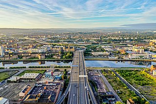
The city of Glasgow, Scotland, has a transport system encompassing air, rail, road and an underground light metro line. Prior to 1962, the city was also served by trams. Commuters travelling into Glasgow from the neighbouring local authorities of North and South Lanarkshire, Renfrewshire, East Renfrewshire, and East and West Dunbartonshire have a major influence on travel patterns, with tens of thousands of residents commuting into the city each day. The most popular mode of transport in the city is the car, used by two-thirds of people for journeys around the city.

<span class="mw-page-title-main">Central Belt</span> Demographic area of highest population density in Scotland

The Central Belt of Scotland is the area of highest population density within Scotland. Depending on the definition used, it has a population of between 2.4 and 4.2 million, including multiple Scottish cities; Greater Glasgow, Ayrshire, Falkirk, Edinburgh, Lothian and Fife.

Glasgow is a city located on the banks of the River Clyde, iScotland.

<span class="mw-page-title-main">Strathclyde Police</span>

Strathclyde Police was the territorial police force responsible for the Scottish council areas of Argyll and Bute, Glasgow City, East Ayrshire, East Dunbartonshire, East Renfrewshire, Inverclyde, North Ayrshire, North Lanarkshire, Renfrewshire, South Ayrshire, South Lanarkshire and West Dunbartonshire between 1975 and 2013. The Police Authority contained members from each of these authorities.

<span class="mw-page-title-main">Renfrewshire (historic)</span> Historic county and lieutenancy area of western Scotland

Renfrewshire or the County of Renfrew is a historic county, registration county and lieutenancy area in the west central Lowlands of Scotland. The lieutenancy area covers the three modern council areas of Inverclyde, Renfrewshire and East Renfrewshire, and this area is occasionally termed Greater Renfrewshire to distinguish it from the modern council area called Renfrewshire. The historic county additionally included territory on the south-western edge of Glasgow which was gradually transferred to the administrative area of the city as it grew.

Community Health Partnerships, known as CHPs were subdivisions of Health Boards in Scotland, from 2005 to 2015, after which their functions were fully taken over by Health and Social Care Partnerships in April 2015.

<span class="mw-page-title-main">Glasgow City Region</span> City region in Scotland

The Glasgow City Region is a somewhat urbanised city region in the western central belt of Scotland nestled in the Clyde Valley and consisting of the following eight councils: East Dunbartonshire, East Renfrewshire, Glasgow City Council, Inverclyde, North Lanarkshire, Renfrewshire, South Lanarkshire, and West Dunbartonshire. The councils, along with several others, had previously formed the Strathclyde region between 1974 and 1996.

References

  1. 1 2 3 Data Tables [Mid-2020 Population Estimates for Settlements and Localities in Scotland], National Records of Scotland, 31 March 2022. Retrieved 1 April 2022
  2. "Layout 1" (PDF). Glasgow.gov.uk. Retrieved 14 November 2012.
  3. 1 2 "Key Statistics for Settlements and Localities Scotland". General Register Office for Scotland. Archived from the original on 27 September 2007. Retrieved 8 September 2008.
  4. The UK’s major urban areas Archived 2010-01-07 at the Wayback Machine Office for National Statistics, 2005
  5. 1 2 "NRS – Background Information Settlements and Localities" (PDF). National Records of Scotland. Retrieved 29 September 2020.
  6. Archived 27 April 2009 at the Wayback Machine
  7. "Glasgow Prestwick Airport. Holidays, parking, flight arrival and departure information". Gpia.co.uk. 6 September 2012. Retrieved 14 November 2012.
  8. "Welcome to Glasgow Airport | Parking". Glasgow Airport. Retrieved 14 November 2012.
  9. 1 2 "Unknown" (PDF). Glasgow.gov.uk. Retrieved 14 November 2012.
  10. "Glasgow and Clyde Valley Structure Plan". Gcvore.gov.uk. Archived from the original on 20 May 2007. Retrieved 8 September 2008.
  11. 1 2 3 "Glasgow and the Clyde Valley Structure Plan Joint Committee | GCVSDPA". Gcvcore.gov.uk. 28 February 2009. Archived from the original on 3 April 2012. Retrieved 14 November 2012.
  12. "Committee Information - Error". www.glasgow.gov.uk.
  13. "Parliamentary Business : Scottish Parliament". Scottish.parliament.uk. 14 August 2011. Archived from the original on 5 June 2011. Retrieved 14 November 2012.
  14. "CityProfiles". Urban Audit. Archived from the original on 17 December 2007. Retrieved 14 November 2012.
  15. "Glasgow and Clyde Valley Structure Plan Joint Committee". Gcvcore.gov.uk. 7 May 1998. Archived from the original on 20 May 2007. Retrieved 14 November 2012.
  16. "Minister backs SPT on White Paper". Interchange Issue 7. Strathclyde Partnership for Transport. September 2004. Archived from the original on 13 June 2007. Retrieved 9 July 2007.

55°51′43″N4°15′16″W / 55.86200°N 4.25448°W / 55.86200; -4.25448