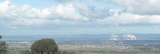
Hamilton, Victoria

Last updated

Hamilton
Victoria
Hamilton Roundabout.JPG
The intersection of Thompson and Gray streets in the centre of Hamilton
Australia Victoria Southern Grampians Shire location map.svg
Red pog.svg
Hamilton
Coordinates 37°44′0″S142°01′0″E / 37.73333°S 142.01667°E / -37.73333; 142.01667
Population10,346 (2021 census) [1]
 • Density453.8/km2 (1,175.3/sq mi)
Postcode(s) 3300
Area22.8 km2 (8.8 sq mi)
Location
LGA(s) Shire of Southern Grampians
State electorate(s) Lowan
Federal division(s) Wannon
Mean max tempMean min tempAnnual rainfall
18.9 °C
66 °F
7.5 °C
46 °F
617.7 mm
24.3 in

Hamilton is a city in south-western Victoria, Australia, at the intersection of the Glenelg Highway and the Henty Highway. The Hamilton Highway connects it to Geelong.

Contents

Hamilton is in the federal Division of Wannon, and is in the Southern Grampians local government area.

Hamilton claims to be the "Wool Capital of the World", based on its strong historical links to sheep grazing which continue today. [2] The city uses the tagline "Greater Hamilton: one place, many possibilities".

History

Early history

Hamilton was built near the junction of three traditional indigenous tribal territories—the Gunditjmara land, stretching south to the coast; the Tjapwurong land, to the north east; and the Bunganditj territory, to the west. People who lived in these areas tended to be settled rather than nomadic. The region is fertile, with ample precipitation and an abundance of flora and fauna, lessening the need to travel far for food. Historical, physical items (such as the weirs and fish traps found in Lake Condah, south of Hamilton), as well as Aboriginal accounts of early white settlers, support the local oral histories of well-established, pre-European settlements in the area.

British colonisation

On 12 September 1836, the explorer Major Thomas Mitchell was the first European to travel through the region. His reports of the fertility and abundance of ‘Australia Felix’ (as he called this region of Western Victoria) encouraged pastoralists to move into the area and set up large sheep runs. In 1839, squatter Charles Wedge, with his brothers, arrived in the area and established ‘The Grange' sheep station near the banks of the Grange Burn rivulet—where the town of Hamilton now stands. [3]

There soon followed significant conflict between Wedge's men and the local Aboriginal people. Wedge reported attacks on his shepherds, and the loss of hundreds of sheep and other livestock; in 1840, the killing of Patrick Codd—who had been employed on The Grange—led to at least three separate punitive expeditions by Wedge and co., resulting in the deaths of at least ten Aborigines. Wedge infamously had a swivel gun mounted outside of his homestead to ‘deter’ the local people from approaching the house. Regarding his extensive conflicts with the local tribes, Wedge claimed that the "depredations did not cease till many lives were sacrificed". [3] [4] [5]

The "frequent collisions" compelled the squatters of the area to go so far as to request protection from the government. [6] In 1842, temporary protection came from troopers of the Native Police, under Captain Henry Dana, and from the Border Police of New South Wales, under Captain Foster Fyans. The police magistrate from Portland, James Blair, and the new position of police magistrate to The Grange, Acheson French, were also appointed by Governor Charles Latrobe to "check the collision between the natives and the settlers". [7] [8]

Birth of the town

The proximity of The Grange to other properties and to important routes between Portland and New South Wales, led to the gradual emergence of a small town. This settlement featured an inn, a blacksmith, a small store and some random shanties and businesses nearby. The site was a local social centre and meeting point for the surrounding pastoral properties; horse races were held along the Grange Burn flat. A postal office opened on 1 July 1844 (Hamilton from 1 January 1854). [9]

The desire for a school prompted a town survey, which commenced in 1849. The township of Hamilton was formally declared in 1851. The town was named in the following way as quoted by the book "Dundas Shire Centenary 1863-1963", page 58. Quote: "In 1840, owing to police difficulties in controlling public houses on, or not on the imaginary boundary line, Henry Wade was sent from Sydney on a special mission to mark out the boundary. He completed the survey as far as Serviceton by the spring of 1847, and was then appointed District Surveyor and in 1850, laid out a township for the Grange, which he named Hamilton. It was then the prerogative of the surveyor to christen his lay-out. Wade and his family had made close friends of the Hamiltons and Gibsons of Bringalbert, there being intermarriages later."

The railway reached the town in 1877 and, along with the local railway station, would become a hub of several branch lines until their eventual closures in 1977 and 1979. [10]

Hamilton was proclaimed as a city on 22 November 1949.

Heritage listings

Hamilton contains a number of heritage-listed sites, including:

Industry and employment

Sheep grazing and agriculture are the primary industries in the surrounding shire, the area producing as much as 15% of Australia's total wool clip. [20] Inside the city of Hamilton the majority of employment is provided by the retail industry (20%) and the Health and Community Services sector (14.5%). Education is another large employer, with four Secondary Schools, two of which enrol both primary and secondary students, as well as a number of stand-alone primary schools. The unemployment rate at the 2001 Census was put at 6.1%, with a workforce participation rate of 58.9%. [21]

Climate

Like most of south-western Victoria, Hamilton has a temperate mediterranean climate (Csb). Cold fronts regularly sweep in from the Southern Ocean. Although daytime temperatures occasionally reach into the 30s even 40s during summer, daytime temperatures in the mid teens will often linger into December and are not uncommon even during the high summer months. On average Hamilton has 105 days per year with more than 1 mm of rain with a marked minimum during Summer. The town has 56.3 clear days annually. It is significantly cloudier than Melbourne due to its elevation and westerly exposure. Though snow is rare, it saw significant snowfalls on 26 July 1901 and 11 October 1910. [22] [23]

Climate data for Hamilton Airport (1983–2022); 241 m AMSL; 37.65° S, 142.06° E
MonthJanFebMarAprMayJunJulAugSepOctNovDecYear
Record high °C (°F)44.0
(111.2)
44.5
(112.1)
39.6
(103.3)
33.7
(92.7)
27.0
(80.6)
22.0
(71.6)
18.7
(65.7)
22.6
(72.7)
28.0
(82.4)
34.0
(93.2)
38.1
(100.6)
43.3
(109.9)
44.5
(112.1)
Mean daily maximum °C (°F)26.7
(80.1)
26.8
(80.2)
24.2
(75.6)
19.9
(67.8)
15.7
(60.3)
12.9
(55.2)
12.1
(53.8)
13.3
(55.9)
15.2
(59.4)
18.0
(64.4)
21.1
(70.0)
24.2
(75.6)
19.2
(66.6)
Mean daily minimum °C (°F)11.2
(52.2)
11.4
(52.5)
10.4
(50.7)
8.4
(47.1)
6.7
(44.1)
5.0
(41.0)
4.4
(39.9)
4.8
(40.6)
5.8
(42.4)
6.6
(43.9)
8.2
(46.8)
9.6
(49.3)
7.7
(45.9)
Record low °C (°F)1.5
(34.7)
2.1
(35.8)
1.5
(34.7)
−0.5
(31.1)
−1.5
(29.3)
−3.8
(25.2)
−2.8
(27.0)
−3.6
(25.5)
−3.5
(25.7)
−0.7
(30.7)
−0.1
(31.8)
0.0
(32.0)
−3.8
(25.2)
Average precipitation mm (inches)32.9
(1.30)
23.3
(0.92)
34.2
(1.35)
39.8
(1.57)
53.8
(2.12)
65.8
(2.59)
71.1
(2.80)
77.9
(3.07)
67.1
(2.64)
54.3
(2.14)
47.5
(1.87)
44.2
(1.74)
617.3
(24.30)
Average precipitation days4.73.75.16.79.911.613.714.411.79.77.56.7105.4
Mean monthly sunshine hours 257.3231.7192.2138.0105.496.0108.5130.2144.0182.9192.0217.01,995.2
Source 1: [24]
Source 2: [25]

Media

Newspaper

Hamilton and the surrounding areas is serviced by The Hamilton Spectator , a tri-weekly local newspaper published by the Spectator Observer newspaper group. Established in 1859 as the Hamilton Courier, it became the Hamilton Spectator and Grange District Advertiser in 1860, and later The Hamilton Spectator.

Television services

Local Television is transmitted from Mt Dundas Melville Forest in the VHF Band Channel 5 to 12. ABC TV, SBS TV, WIN (Nine), Seven and Southern Cross (Ten). UHF child sites exist in Coleraine ABC TV only on UHF from McKenrys Hill and Casterton from Seeleys Hill, All Services, which are on UHF. All services are DTV-B and require appropriate antenna to receive correctly. Unlike capital cities service runs on lower power and requires correct antenna. Caravan antenna for travellers might not work well. Neither will indoor aerials.

Radio

There are two radio stations based in Hamilton:

Both are owned by the Ace Radio network, which operates radio stations in the Western District of Victoria.

Many other radio stations broadcast into Hamilton, including national broadcasters the ABC transmitting from Mt Dundas Melville Forest over much of Western Victoria including outlets at Warrnambool, Portland, and Ballarat.

Stations are ABC News Radio 91.7, ABC Radio National 92.5, ABC Classic FM 93.3, ABC Local Radio 94.1, and JJJ Youth Radio 94.9. ABC local radio is broadcast out of Studios in Warrnambool via Mt Clay Portland on 96.9 which is relayed to Mt Dundas. Local Programming is during breakfast times only and often is sourced from Horsham and Ballarat Studios. AM radio 3WL on 1602 is audible in Hamilton as is 3WV on 594 from Horsham. There are also low power narrowcast services on fm in Hamilton which change from time to time. KIX Country is currently transmitting sport and racing. Vision FM currently transmits in Hamilton and Casterton. There are plans to convert 3HA to FM and change the AM service possibly to sport. Recent demolition at Melville oval saw the old 3HA broadcast box used for football since the 1949s removed.

Airports

Hamilton is serviced by an all weather airport located at Hensley Park approximately 11 km North of Hamilton. A long bitumen North South Runway can take up aircraft up to Dash 8 size as well as small jet aircraft. A gravel runway is aligned NW and SE. A CFA fire base and control centre is located at the Hamilton Airport as well as a modern terminal building and toilets. Hamilton Aero Club has its club rooms and hangar there and is open most Saturdays. AVGAS Key lock card fueling is available 24/7. Turbine fuel by arrangement. There is no airline service to Hamilton, only charter flights and as such the airport is not staffed. Pilot activated lights on:124.2 are available and an automatic weather service details on NAIPS. A non directional radio beacon on 203 kHz for instrument approaches, is one of very few NDBs remaining. For all details consult the Air Services ERSA.

Attractions and events

The gates to the Hamilton Botanical Gardens Hamilton Botanic Garden Gates.JPG
The gates to the Hamilton Botanical Gardens
The Big Wool Bales, a former tourist attraction The Big Woolbales at Hamilton (2012).jpg
The Big Wool Bales, a former tourist attraction

In 1881 William Guilfoyle, the director of the Royal Botanic Gardens, Melbourne was employed to design the Hamilton Botanic Gardens. Set in 4 acres (1.6 ha), the gardens are distinguished by rare botanic species, a superbly restored rotunda, a small zoo featuring rabbits, cockatiels and budgerigars and playground and the ornate Thomson Fountain. The garden at one point housed an emu, however, it was illegally shot in 2012. [26] The National Trust of Australia classified the gardens in 1990 with eight tree species listed on the Register of Significant Trees in Victoria.

Hamilton Gallery Established in 1961, Hamilton Gallery's renowned collection features collection of gouache and watercolour pictures by English landscape painter Paul Sandby (1731-1809).

Sheepvention, a wool-related trade-show and exhibition is held in the Hamilton Show-grounds in the first Monday & Tuesday of August each year, and attracts up to 20,000 visitors. It has a similar feel to an Agricultural show but is focused on wool and sheep. The Hamilton Agricultural Show is normally held in November.

The Big Wool Bales was an attraction (now demolished) it consisted of five linked structures designed to resemble five gigantic woolbales - a tribute to the importance of the local wool industry. Together they formed a building and a cafe containing wool-related displays such as historical memorabilia, including farming and shearing equipment, wool scales, old horse harnesses, wool presses and weaving looms, along with wool samples and rural clothing.

The Keeping Place is a small museum and living history centre run by local indigenous people.

The Sir Reginald Ansett Transport Museum celebrates the founding of Ansett Australia in Hamilton in 1935 and displays items from the early days of the Ansett Airlines' operation.

Sport

There are many sporting clubs and leagues in the Hamilton area. The city is served by one Australian rules football team; Hamilton Kangaroos . This team competes in the Hampden Football League. The city formerly had 2 teams, Hamilton Magpies and Hamilton Imperials, which played in the Western Border Football League. The teams agreed to merge at the end of the 2012 season in order to make the move to the Hampden Football League.

Netball, field hockey, basketball, soccer, tennis and cricket are other popular sports in the city. Hamilton opened a large Indoor Sports and Aquatic Centre in March 2006, which contains four basketball courts, a twenty-five-metre indoor swimming pool, 4 squash courts, a table tennis centre with 8 courts and a large gym. The city is also the home of the Hamilton Rowing Club (HRC) which competes in Rowing Victoria regattas during the summer. The Hamilton and Alexandra College Rowing Club (HACRC) sometimes compete in such events or attempt to train. Tucked behind the Historical Society in Gray Street, is the Hamilton 8-Ball and Snooker Club.

Hamilton has a horse racing club, the Hamilton Racing Club, which schedules around nine race meetings a year including the Hamilton Cup meeting in April. [27] As well as a harness racing club which has recently opened a new track, with state-of-the-art facilities.

Golfers play at the Hamilton Golf Club [28] or at the more minor course Parklands on Boundary and Hensley Park Roads. [29]

Wildlife and parks

The eastern barred bandicoot is a marsupial native to the area, and a reserve has been built to protect this and other endangered species. In more recent decades (2007), the numbers of bandicoot (both within the reserve and outside of it) have declined significantly—to the point of nearing extinction—as a result of extended drought, and predation by introduced red foxes as well as feral cats. Competition for food with the introduced rabbits is another major issue affecting the marsupials. Within the city, the public lands adjoining the river and Lake Hamilton have been subject to spasmodic tree-planting projects.

Mount Napier—the highest point on the Western District Plains—is found 15 kilometres (9.3 mi) south of Hamilton.

Education

Primary schools in Hamilton include Hamilton (Gray Street) Primary School, George Street Primary School, Hamilton North Primary School and Saint Mary's Primary School. Secondary schools include Hamilton and Alexandra College, Baimbridge College and Monivae College. There are two Primary to Year 12 schools: Hamilton and Alexandra College and Good Shepherd College.

Hamilton Special School caters to primary school-age students who have special education needs, predominantly autistic spectrum disorders and communication difficulties.

South West Institute of Technical and Further Education (TAFE) has a campus in Hamilton, offering post-secondary and trade courses and qualifications. RMIT maintains a training and research site 4 km from the centre of Hamilton, [30] which is home to the Potter Rural Community Research Network. [31] Vocational training at the site is delivered by South West TAFE while master's degrees and PhDs by research are facilitated by RMIT. [32]

Prominent people

See also

Notes

  1. "2016 Census QuickStats: Hamilton (Vic.)". Australia Bureau of Statistics. Retrieved 8 July 2017.[ permanent dead link ]
  2. Introducing Hamilton, Victoria : wool capital of the world. [Hamilton] : Hamilton Spectator Print. 1970. Archived from the original on 6 January 2023. Retrieved 3 December 2019.
  3. 1 2 Bride, Thomas Francis (1898). Letters from Victorian Pioneers. Melbourne: Government Press.
  4. Critchett, Jan (1990). A Distant Field of Murder. Carlton: Melbourne University Press. ISBN   0-522-84527-4.
  5. Clark, Ian D. (1995). Scars in the landscape : a register of massacre sites in western Victoria, 1803-1859. Canberra: Australian Institute of Aboriginal and Torres Strait Islander Studies. ISBN   0855752815. OCLC   41539940.
  6. "[COPYRIGHT.]". Bathurst Free Press and Mining Journal . New South Wales, Australia. 21 March 1890. p. 4. Archived from the original on 10 November 2023. Retrieved 9 November 2019 via National Library of Australia.
  7. Massacre Of Australian Aborigines. 1839. pp.  134.
  8. Thomson, Kathleen, "Blair, James (1813–1880)", Australian Dictionary of Biography, National Centre of Biography, Australian National University, archived from the original on 31 December 2019, retrieved 17 December 2019
  9. Premier Postal History, Post Office List, archived from the original on 10 May 2008, retrieved 11 April 2008
  10. Alan Jungwirth and Keith Lambert (1996), Weekly notice extracts 1894-1994, Weekly Notice Productions, p. 150, ISBN   0-646-30010-5
  11. "Mechanics Institute". Victorian Heritage Database (Victorian Heritage Register). Victorian Heritage Council. Archived from the original on 14 May 2018. Retrieved 10 March 2019.
  12. "Hamilton Post Office (Place ID 106135)". Australian Heritage Database . Australian Government . Retrieved 9 March 2019.
  13. "Hamilton Botanic Gardens". Victorian Heritage Database (Victorian Heritage Register). Victorian Heritage Council. Archived from the original on 13 May 2018. Retrieved 10 March 2019.
  14. "Former Hamilton Tuberculosis Chalet". Victorian Heritage Database (Victorian Heritage Register). Victorian Heritage Council. Archived from the original on 19 April 2021. Retrieved 10 March 2019.
  15. "Hamilton Gas Holder". Victorian Heritage Database (Victorian Heritage Register). Victorian Heritage Council. Archived from the original on 30 November 2017. Retrieved 10 March 2019.
  16. "Napier Club". Victorian Heritage Database (Victorian Heritage Register). Victorian Heritage Council. Archived from the original on 14 May 2018. Retrieved 10 March 2019.
  17. "Hamilton Racecourse Grandstand". Victorian Heritage Database (Victorian Heritage Register). Victorian Heritage Council. Archived from the original on 23 September 2021. Retrieved 10 March 2019.
  18. "Correagh". Victorian Heritage Database (Victorian Heritage Register). Victorian Heritage Council. Archived from the original on 31 May 2017. Retrieved 10 March 2019.
  19. "Myrniong". Victorian Heritage Database (Victorian Heritage Register). Victorian Heritage Council. Archived from the original on 14 May 2018. Retrieved 10 March 2019.
  20. "Shire of Southern Grampians Council- Department of Planning and Community Development". Archived from the original on 2 September 2006. Retrieved 2 September 2006.
  21. Know your area - Southern Grampians (S)
  22. Snow Man On A Mountain by Trove. 11 October 1910. Retrieved 28 July 2024.
  23. Heavy Snow In The Country by Trove. 29 July 1901. Retrieved 28 July 2024.
  24. "Climate statistics for". Bureau of Meteorology. Archived from the original on 3 December 2019. Retrieved 24 July 2023.
  25. "Sunshine hours from Hamilton Research Station". Bureau of Meteorology. Archived from the original on 24 July 2023. Retrieved 24 July 2023.
  26. Pech, Jono; Quirk, Clare; Neal, Matt; Thomson, Andrew (10 May 2012). "Hamilton garden's emu shot dead by slug gun". The Standard. Archived from the original on 29 March 2023. Retrieved 19 August 2023.
  27. Country Racing Victoria, Hamilton Racing Club, archived from the original on 31 October 2010, retrieved 21 November 2010
  28. Golf Select, Hamilton, archived from the original on 24 July 2008, retrieved 11 May 2009
  29. Golf Select, Parklands, archived from the original on 24 July 2008, retrieved 11 May 2009
  30. Hamilton Archived 20 December 2016 at the Wayback Machine . RMIT University. Retrieved 9 December 2016
  31. Potter Rural Community Research Network (2013), Southern Grampians - a good place to grow old Archived 10 October 2023 at the Wayback Machine , Potter Rural Community Research Network, retrieved 9 December 2016
  32. Hamilton/study-locally Hamilton - Study locally Archived 20 December 2016 at the Wayback Machine . RMIT University. Retrieved 9 December 2016
  33. Lake, P. S. (2007). "Butcher, Alfred Dunbavin (1915-1990)". Australian Dictionary of Biography . Australian National University. Archived from the original on 3 April 2015. Retrieved 30 March 2015.
  34. Browne, Geoff (1988). "Shields, Clive (1879-1956)". Australian Dictionary of Biography . Australian National University. Archived from the original on 3 April 2015. Retrieved 30 March 2015.
  35. "Howard Taylor: Phenomena | Exhibitions | MCA Australia". www.mca.com.au. Archived from the original on 10 November 2023. Retrieved 29 November 2019.
  36. Boadle, Donald (2002). "Turnbull, Sir Winton George". Australian Dictionary of Biography . Australian National University. Archived from the original on 4 April 2015. Retrieved 30 March 2015.

Related Research Articles

<span class="mw-page-title-main">Traralgon</span> City in Victoria, Australia

Traralgon is a town located in the east of the Latrobe Valley in the Gippsland region of Victoria, Australia and the most populous city in the City of Latrobe and the region. The urban population of Traralgon at the 2021 census was 26,907. It is the largest and fastest growing city in the greater Latrobe Valley area, which has a population of 77,168 at the 2021 Census and is administered by the City of Latrobe.

<span class="mw-page-title-main">Colac, Victoria</span> City in Victoria, Australia

Colac is a small city in the Western District of Victoria, Australia, approximately 150 kilometres south-west of Melbourne on the southern shore of Lake Colac.

<span class="mw-page-title-main">City of Greater Geelong</span> Local government area in Victoria, Australia

The City of Greater Geelong is a local government area in the Barwon South West region of Victoria, Australia, located in the western part of the state. It covers an area of 1,248 square kilometres (482 sq mi) and, had a population of 271,057 as of the 2021 Australian census. It is primarily urban with the vast majority of its population living in the Greater Geelong urban area, while other significant settlements within the LGA include Anakie, Balliang, Barwon Heads, Batesford, Ceres, Clifton Springs, Drysdale, Lara, Ocean Grove, Portarlington and St Leonards. It was formed in 1993 from the amalgamation of the Rural City of Bellarine, Shire of Corio, City of Geelong, City of Geelong West, City of Newtown, City of South Barwon, and parts of Shire of Barrabool and Shire of Bannockburn.

<span class="mw-page-title-main">Shire of Southern Grampians</span> Local government area in Victoria, Australia

The Shire of Southern Grampians is a local government area (LGA) in the Barwon South West region of Victoria, Australia, located in the south-western part of the state. It covers an area of 6,654 square kilometres (2,569 sq mi) and in June 2018 had a population of 16,135. It includes the city of Hamilton and the towns of Coleraine, Dunkeld and Penshurst. It was formed in 1994 from the amalgamation of the City of Hamilton, Shire of Wannon and parts of the Shire of Dundas, Shire of Kowree, Shire of Mount Rouse and Shire of Heywood.

<span class="mw-page-title-main">Eltham, Victoria</span> Suburb of Melbourne, Victoria, Australia

Eltham is a suburb of Melbourne, Victoria, Australia, 20 km north-east of the Central Business District, located within the Shire of Nillumbik local government area. Eltham recorded a population of 18,847 at the 2021 census.
<span class="mw-page-title-main">Stawell, Victoria</span> Town in Victoria, Australia

Stawell ( "stall"), is an Australian town in the Wimmera region of Victoria 237 kilometres (147 mi) west-north-west of the state capital, Melbourne. Located within the Shire of Northern Grampians local government area, it is a seat of local government for the shire and its main administrative centre. At the 2021 census, Stawell had a population of 6,220.

<span class="mw-page-title-main">Greensborough, Victoria</span> Suburb of Melbourne, Victoria, Australia

Greensborough is a suburb of Melbourne, Victoria, Australia, 17 km (11 mi) north-east from Melbourne's Central Business District, located within the City of Banyule and Shire of Nillumbik local government areas. Greensborough recorded a population of 21,070 at the 2021 census.

<span class="mw-page-title-main">Ararat, Victoria</span> City in Australia

Ararat is a town in the Central Highlands region in Victoria, Australia, about 198 kilometres (120 mi) west of Melbourne, on the Western Highway on the eastern slopes of the Ararat Hills and Cemetery Creek valley between Victoria's Western District and the Wimmera. Its urban population according to 2021 census is 8,500 and services the region of 11,880 residents across the Rural City's boundaries. It is also the home of the 2018/19 GMGA Golf Championship Final.
<span class="mw-page-title-main">Diamond Creek, Victoria</span> Suburb of Melbourne, Victoria, Australia

Diamond Creek is a suburb of Melbourne, Victoria, Australia, 23 km north-east of Melbourne's Central Business District, located within the Shire of Nillumbik local government area. Diamond Creek recorded a population of 12,503 at the 2021 census.
<span class="mw-page-title-main">Euroa</span> Town in Victoria, Australia

Euroa is a town in the Shire of Strathbogie in the north-east of Victoria, Australia. At the 2021 census, Euroa's population was 3,116.

<span class="mw-page-title-main">Kyneton</span> Town in Victoria, Australia

Kyneton is a town in the Macedon Ranges region of central Victoria, Australia. The Calder Freeway bypasses Kyneton to the north and east. Kyneton is on Dja Dja Wurrung, Taungurung and Wurundjeri Woi Wurrung country.
<span class="mw-page-title-main">Bacchus Marsh</span> Town in Victoria, Australia

Bacchus Marsh is a peri-urban town in Victoria, Australia located approximately 50 kilometres (30 mi) north-west of the state capital Melbourne, at a near equidistance to the major cities of Melbourne, Ballarat and Geelong.

<span class="mw-page-title-main">Horsham, Victoria</span> Regional city in Victoria, Australia

Horsham is a regional city in the Wimmera region of western Victoria, Australia. Located on a bend in the Wimmera River, Horsham is approximately 300 kilometres (190 mi) northwest of the state capital Melbourne. As of the 2021 census, Horsham had a population of 20,429. It is the most populous city in Wimmera, and the main administrative centre for the Rural City of Horsham local government area. It is the eleventh largest city in Victoria after Melbourne, Geelong, Ballarat, Bendigo, Wodonga, Mildura, Shepparton, Warrnambool, Traralgon, and Wangaratta.
<span class="mw-page-title-main">Dunkeld, Victoria</span> Town in Victoria, Australia

Dunkeld is a town in Victoria, Australia, at the southern end of the Grampians National Park, in the Shire of Southern Grampians. It is approx 283 km west of Melbourne on the Glenelg Highway. The town's population is holding steady but aging. At the 2016 census, Dunkeld had a population of 678.

Hamilton Airport is located 6.5 nautical miles north of Hamilton, Victoria, Australia. The airport is about 300 km (190 mi) west of Melbourne. Sharp Airlines was established at the airport and despite cancelling scheduled service in December 2014, retains a flying school at Hamilton. The airport is also home to the Hamilton Aero Club. The airport is operated by the Southern Grampians Shire Council.
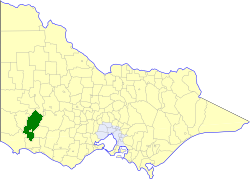
<span class="mw-page-title-main">Shire of Dundas (Victoria)</span> Local government area in Victoria, Australia

The Shire of Dundas was a local government area about 300 kilometres (186 mi) west of Melbourne, the state capital of Victoria, Australia. The shire covered an area of 3,464.39 square kilometres (1,337.6 sq mi), and existed from 1857 until 1994.

<span class="mw-page-title-main">Shire of Mount Rouse</span> Local government area in Victoria, Australia

The Shire of Mount Rouse was a local government area about 270 kilometres (168 mi) west of Melbourne, the state capital of Victoria, Australia. The shire covered an area of 1,407 square kilometres (543.2 sq mi), and existed from 1860 until 1994.

<span class="mw-page-title-main">Shire of Wannon</span> Local government area in Victoria, Australia

The Shire of Wannon was a local government area about 330 kilometres (205 mi) west of Melbourne, the state capital of Victoria, Australia. The shire covered an area of 1,977 square kilometres (763.3 sq mi), and existed from 1872 until 1994.
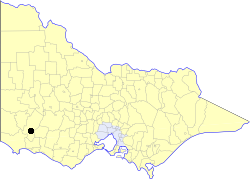
<span class="mw-page-title-main">City of Hamilton (Victoria)</span> Local government area in Victoria, Australia

The City of Hamilton was a local government area about 300 kilometres (186 mi) west of Melbourne, the state capital of Victoria, Australia. The city covered an area of 20.64 square kilometres (8.0 sq mi), and existed from 1859 until 1994. Its area was surrounded by the Shire of Dundas.

<span class="mw-page-title-main">Wannon River</span> River in Victoria, Australia

The Wannon River, a perennial river of the Glenelg Hopkins catchment, is located in the Western District of Victoria, Australia.

References

Commons-logo.svg Media related to Hamilton, Victoria at Wikimedia Commons