Hampton, New York

Last updated

Hampton
Sign in Hampton, New York.jpg
A sign for the town of Hampton on Washington County Highway 18, New York.
Washington County New York incorporated and unincorporated areas Hampton highlighted.svg
Location in Washington County and the state of New York.
Coordinates: 43°33′N73°18′W / 43.550°N 73.300°W / 43.550; -73.300
Country United States
State New York
County Washington
Area
[1]
  Total22.59 sq mi (58.51 km2)
  Land22.24 sq mi (57.61 km2)
  Water0.35 sq mi (0.90 km2)
Elevation
633 ft (193 m)
Population
 (2010) [2]
  Total938
  Estimate 
(2016) [3]
922
  Density41.45/sq mi (16.01/km2)
Time zone UTC-5 (Eastern (EST))
  Summer (DST) UTC-4 (EDT)
ZIP code(s) [4]
12837 (primary)
12887 Whitehall
Area code 518
FIPS code 36-31885
GNIS feature ID0979041
Website hamptonny.org

Hampton is a town in Washington County, New York, United States. It is part of the Glens Falls Metropolitan Statistical Area. [5] The town population was 938 at the 2010 census, an increase of 7.2% since the 2000 census. [2] The town of Hampton is located in the northeastern corner of Washington County.

Contents

History

This area of New York was part of a jurisdictional dispute between New York and Vermont. The matter was not settled until after 1790.

The town was formed in 1786 and was once called "Hampton Corners" and "Greenfield." It was founded by former American Revolutionary War officer Gideon G. Warren. The first town meeting was conducted in his home. Many of the first settlers were from Massachusetts and Connecticut. The land contains parts of early land patents, including Skene's Little Patent and those issued to groups of British officers.

In 1783, the Poultney River at the eastern town line suddenly changed course and became unnavigable due to a sudden influx of water.

Red slate and other colored slates were mined here.

The William Miller Chapel and Ascension Rock was listed on the National Register of Historic Places in 1975. [6]

Notable people

Geography

According to the United States Census Bureau, the town has a total area of 22.6 square miles (59 km2), of which, 22.6 square miles (59 km2) of it is land and 0.1 square miles (0.26 km2) of it (0.35%) is water.

The eastern part of the town forms a border with Vermont. Part of the boundary is marked by the Poultney River, which flows into Lake Champlain.

Image taken of a pond that is located in Hampton, New York Hampton Pond t.jpg
Image taken of a pond that is located in Hampton, New York

US 4 cross the town in an east–west direction. NY 22A passes along the east side of the town.

Neighboring cities and towns

Demographics

Historical population
CensusPop.Note
1820 963
1830 1,06911.0%
1840 972−9.1%
1850 899−7.5%
1860 876−2.6%
1870 9559.0%
1880 833−12.8%
1890 791−5.0%
1900 689−12.9%
1910 645−6.4%
1920 552−14.4%
1930 67321.9%
1940 594−11.7%
1950 576−3.0%
1960 469−18.6%
1970 464−1.1%
1980 55920.5%
1990 75635.2%
2000 87115.2%
2010 9387.7%
2016 (est.)922 [3] −1.7%
U.S. Decennial Census [8]

As of the census of 2010, there were 938 people, 326 households, and 228 families residing in the town. The population density was 38.6 inhabitants per square mile (14.9/km2). There were 435 housing units at an average density of 19.3 per square mile (7.4/km2). The racial makeup of the town was 98.5% White, 0.6% African American, 0.1% Native American, 0.1% Asian, and 0.7% from two or more races. Hispanic or Latino of any race were 1.0% of the population. [2]

There were 326 households, out of which 38.0% had children under the age of 18 living with them, 58.0% were married couples living together, 7.7% had a female householder with no husband present, and 30.1% were non-families. 20.6% of all households were made up of individuals, and 5.8% had someone living alone who was 65 years of age or older. The average household size was 2.65 and the average family size was 3.10. [2]

In the town, the population was spread out, with 27.6% under the age of 18, 7.0% from 18 to 24, 29.3% from 25 to 44, 27.1% from 45 to 64, and 9.1% who were 65 years of age or older. The median age was 36 years. For every 100 females, there were 98.4 males. For every 100 females age 18 and over, there were 106.9 males. [2]

The median income for a household in the town was $39,444, and the median income for a family was $46,250. Males had a median income of $29,107 versus $23,750 for females. The per capita income for the town was $17,433. About 3.8% of families and 7.1% of the population were below the poverty line, including 10.3% of those under age 18 and none of those age 65 or over. [2]

Communities and locations in Hampton

Communities

Geographical locations

Related Research Articles

<span class="mw-page-title-main">North Harmony, New York</span> Town in New York, United States

North Harmony is a town in Chautauqua County, New York, United States. The population was 2,182 at the 2020 census. The town is on the west side of Chautauqua Lake. The shore of the lake is the location of many summer resort communities.

<span class="mw-page-title-main">Beekmantown, New York</span> Town in New York, United States

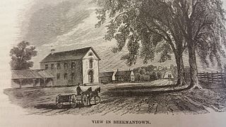
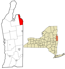
Beekmantown is a town in Clinton County, New York, United States. The population was 5,545 at the 2010 census. The town name is that of William Beekman, an original landowner. It is on the eastern border of the county, just north of Plattsburgh.

<span class="mw-page-title-main">Chesterfield, New York</span> Town in New York, United States

Chesterfield is a town in Essex County, New York, United States. The population was 2,445 at the 2010 census. The name possibly is from a location in New England.

<span class="mw-page-title-main">Crown Point, New York</span> Town in New York, United States

Crown Point is a town in Essex County, New York, United States, located on the west shore of Lake Champlain. The population was 2,024 at the 2010 census. The name of the town is a direct translation of the original French name, Pointe à la Chevelure.

<span class="mw-page-title-main">Wilmington, New York</span> Town in New York, United States

Wilmington is a town in Essex County, New York, United States. The population was 1,253 at the 2010 census. The town is named after the nearby town of Wilmington, Vermont.

<span class="mw-page-title-main">Franklin, Franklin County, New York</span> Town in New York, United States

Franklin is a town located in Franklin County, New York, United States. As of the 2010 census, the town had a population of 1,140.

<span class="mw-page-title-main">Forestport, New York</span> Town in New York, United States

Forestport is a town in Oneida County, New York, United States. The population was 1,477 at the 2020 census.

<span class="mw-page-title-main">Westmoreland, New York</span> Town in New York, United States

Westmoreland is a town in Oneida County, New York, United States. The population was 6,138 at the 2010 census.

<span class="mw-page-title-main">Hartford, New York</span> Town in New York, United States

Hartford is a town centrally located in Washington County, New York, United States. It is part of the Glens Falls Metropolitan Statistical Area. The town population was 2,193 at the 2020 census.

<span class="mw-page-title-main">Jackson, New York</span> Town in New York, United States

Jackson is a town in southeastern Washington County, New York, United States. It is part of the Glens Falls Metropolitan Statistical Area.

<span class="mw-page-title-main">Putnam, New York</span> Town in Washington County, New York, US

Putnam is a town in northern Washington County, New York, United States. It is part of the Glens Falls Metropolitan Statistical Area. The town population was 645 at the 2000 census. The town is named after Israel Putnam, a hero of the American Revolution.

<span class="mw-page-title-main">Orwell, Vermont</span> Town in Vermont, United States

Orwell is a town in Addison County, Vermont, United States. The population was 1,239 at the 2020 census. Mount Independence was the largest fortification constructed by the American colonial forces. The 300-acre (1.2 km2) site is now one of Vermont's premier state-operated historic sites.

<span class="mw-page-title-main">Shoreham, Vermont</span> Town in Vermont, United States

Shoreham is a town in Addison County, Vermont, United States. The population was 1,260 at the 2020 census.

<span class="mw-page-title-main">Georgia, Vermont</span> Town in Vermont, United States

Georgia is a town in Franklin County, Vermont, United States. The population was 4,845 at the 2020 census.

<span class="mw-page-title-main">Wells, Vermont</span> Town in Vermont, United States

Wells is a town in Rutland County, Vermont, United States. As of the 2020 census, the town had a total population of 1,214.

<span class="mw-page-title-main">Plattsburgh (town), New York</span> Town in New York, United States

Plattsburgh is a town in Clinton County, New York, United States. The population was 11,886 at the 2020 census. The town is named after Zephaniah Platt, an early land owner, and it surrounds the separate and more populous city of the same name. The town is in the eastern part of the county, in the North Country region of the state of New York. The region's airport, Plattsburgh International Airport, is located in the southern part of the town.

<span class="mw-page-title-main">Granville, New York</span> Town in New York, United States

Granville is a town on the eastern border of Washington County, New York, United States, abutting Rutland County, Vermont. It is part of the Glens Falls Metropolitan Statistical Area. The town population was 6,215 at the 2020 census.

<span class="mw-page-title-main">Fair Haven, Vermont</span> Town in Vermont, United States

Fair Haven is a town in Rutland County, Vermont, United States. The population was 2,736 at the 2020 census. Within the town is located the census-designated place of Fair Haven. The town is noted for its late 19th century residential and commercial architecture.

<span class="mw-page-title-main">Poultney (town), Vermont</span> Town in Vermont, United States

Poultney is a town in Rutland County in the southwestern part of the U.S. state of Vermont. New York state is on its western border. Castleton, Vermont, is on its northern border. Poultney was home to Green Mountain College, a private liberal arts college that closed in 2019. The Village of Poultney is entirely within the town. The town population was 3,020 at the 2020 census.

<span class="mw-page-title-main">Addison, Vermont</span> Town in Vermont, United States

Addison is a town in Addison County, Vermont, United States. It was founded October 14, 1761. The population was 1,365 at the 2020 census.

References

  1. "2016 U.S. Gazetteer Files". United States Census Bureau. Retrieved July 5, 2017.
  2. 1 2 3 4 5 6 "U.S. Census website". United States Census Bureau . Retrieved January 31, 2008.
  3. 1 2 "Population and Housing Unit Estimates" . Retrieved June 9, 2017.
  4. Washington County GIS Web Map (Map). Washington County, NY. Archived from the original on January 7, 2010. Retrieved June 19, 2010.
  5. "Metropolitan Areas and Components, 1999, with FIPS Codes". US Census Bureau. Retrieved July 7, 2009.
  6. "National Register Information System". National Register of Historic Places . National Park Service. March 13, 2009.
  7. "Photos of Hampton". TOWN OF HAMPTON, NEW YORK. Retrieved October 4, 2022.
  8. "Census of Population and Housing". Census.gov. Retrieved June 4, 2015.

Commons-logo.svg Media related to Hampton, New York at Wikimedia Commons