Overton County is a county located in the U.S. state of Tennessee. As of the 2020 census, the population was 22,511. Its county seat is Livingston. Overton County is part of the Cookeville, TN Micropolitan Statistical Area.
Mansfield is a town in Cattaraugus County, New York, United States. The population was 843 at the 2020 census. The name was thought to be that of a noble family in England.

Wildwood is an unincorporated community and census-designated place (CDP) located in the northeastern corner of Dade County, Georgia, United States. The 2020 census listed a population of 382.
Newport is an unincorporated community and census-designated place (CDP) located within Downe Township in Cumberland County, in the U.S. state of New Jersey. The area is served as United States Postal Service ZIP Code 08345.

Georgetown is an unincorporated community at the junction of Bradley, Hamilton, and Meigs counties, Tennessee. The community is located along State Route 60 near its intersection with State Route 58.

Hibernia is an unincorporated community and census-designated place (CDP) located along County Route 513 in Rockaway Township of Morris County, in the U.S. state of New Jersey. The area is served as United States Postal Service ZIP Code 07842. The community takes its name from Hibernia, the classical name for Ireland.

Layton is an unincorporated community and census-designated place (CDP) located within Sandyston Township in Sussex County, in the U.S. state of New Jersey. The area is served as United States Postal Service ZIP Code 07851.
Oak Ridge is an unincorporated community and census-designated place (CDP) located along the border of West Milford Township in Passaic County and Jefferson Township in Morris County, in the U.S. state of New Jersey. The area is served as United States Postal Service ZIP Code 07438.

Jobstown is an unincorporated community and census-designated place (CDP) located within Springfield Township in Burlington County, in the U.S. state of New Jersey. The area is served as United States Postal Service ZIP Code 08041.

Clairfield is an unincorporated community in Claiborne County, Tennessee, United States. It is located in the upper Clearfork Valley in the Cumberland Mountains of northeastern Tennessee. It is the site of a post office, assigned ZIP code 37715. The population of the Zip Code Tabulation Area corresponding to Clairfield's ZIP code was 1,002 as of the 2000 Census.

Eva is an unincorporated community and census-designated place (CDP) in Benton County, Tennessee, on the western shore of the Kentucky Lake impoundment of the Tennessee River. It is the site of Nathan Bedford Forrest State Park. As of the 2010 census, its population was 293. The ZIP Code Tabulation Area for the ZIP code (38333) that serves Eva had a population of 574 as of the 2000 U.S. Census, when Eva was not yet a CDP. Eva is centered on the junction of State Route 191, which connects the community to Nathan Bedford Forrest State Park to the north and the town of Camden to the south, and Eva Beach Road, which stretches from the center of the community to its beach along Kentucky Lake.

Harrisonville is an unincorporated community and census-designated place (CDP) located within South Harrison Township, in Gloucester County, in the U.S. state of New Jersey. The area is served as United States Postal Service ZIP Code 08039.

Ocean View is an unincorporated community and census-designated place (CDP) located within Dennis Township in Cape May County, in the U.S. state of New Jersey. The area is served as United States Postal Service ZIP Code 08230. The post office was established in 1872, with William Doolittle as the first postmaster.

Perrineville is an unincorporated community located within Millstone Township in Monmouth County, in the U.S. state of New Jersey. The area is served as United States Postal Service ZIP Code 08535.
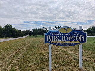
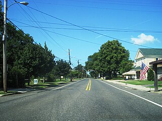
Birchwood is an unincorporated community in Hamilton and Meigs counties in Tennessee, United States. It is a rural area located along Tennessee State Route 60 and Tennessee State Route 312 northwest of Chattanooga. It is part of the Chattanooga, TN–GA Metropolitan Statistical Area.

Holmeson is an unincorporated community located within Millstone Township in Monmouth County, in the U.S. state of New Jersey. As it is located along County Route 537 through which the Monmouth–Ocean county line runs down the center, portions of the community are also located in Jackson Township. Owing to its location near Interstate 195 and Six Flags Great Adventure, the community is mostly made up of gas stations, restaurants, and small businesses though the Jackson Premium Outlets occupies land just south of the community.
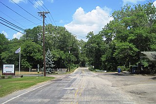
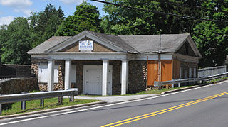
Birmingham is an unincorporated community located within Pemberton Township in Burlington County, in the U.S. state of New Jersey. As of the 2010 United States Census, the ZIP Code Tabulation Area for ZIP Code 08011 had a population of 33. Though sparsely populated, it houses a post office and a Lanxess chemical facility.

Lancaster is an unincorporated community in Smith County, Tennessee, United States, located 5.3 miles (8.5 km) southeast of Gordonsville. Lancaster had a post office with ZIP code 38569, which closed on March 4, 2011, due to the United States Postal Service closing smaller post offices around the country.
Finley is an unincorporated community in Dyer County, Tennessee, United States. It is located roughly 5.5 miles west of downtown Dyersburg along Tennessee State Route 104. Tennessee State Route 182 also passes through the community, which connects it with Interstate 155 and Lenox to the north.

Pelham is an unincorporated community and census-designated place (CDP) in Grundy County, Tennessee, United States. As of the 2010 census, its population was 403. Pelham is located at the junction of U.S. Route 41, State Route 2, and State Route 50 near the base of the Cumberland Plateau, 5.35 miles (8.61 km) north-northwest of Monteagle. Pelham has a post office with ZIP code 37366, which opened on April 4, 1832.