History of Taipei

Last updated
Part of a series on the
History of Taiwan
1640 Map of Formosa-Taiwan by Dutch He Lan Ren Suo Hui Fu Er Mo Sha -Tai Wan .jpg
Chronological
Prehistory to 1624
Dutch Formosa 1624–1662
Spanish Formosa 1626–1642
Kingdom of Tungning 1662–1683
Qing rule 1683–1895
Japanese rule 1895–1945
Republic of China rule 1945–present
Topical
Local
Lists
Flag of the Republic of China.svg   Taiwanportal

The recorded history of Taipei began with the Han Chinese settling of the Taipei Basin in 1709, leading up to the formation of the national capital of Taiwan and high-tech industry hub and that is now Taipei City. Other notable dates include the 1895 annexation of Taiwan by Japan, during which Taipei began to grow more rapidly, and in the 1950s, the USA's provision of financial assistance to the Republic of China government, after which the city continued on a path of fast structural and industrial growth.

Contents

First settlement

The region known as the Taipei basin was home to Ketagalan tribes before the 18th century. Han Chinese began to settle in the Taipei Basin in 1709.

By the late 19th century, the area of present-day Taipei was home to northern Taiwan's major Han settlements, in addition to the government-designated foreign trade port of Tamsui. The Taipei area's economic importance grew with increases in foreign trade, especially that related to tea exportation.

First Chinese official development

In 1875, the northern part of Taiwan was separated from Taiwan Prefecture and incorporated into the new Taipeh Prefecture. Having been established adjoining the flourishing townships of Bangkah and Twatutia, the new prefectural capital was known as Chengnei (Chinese : 城內 ; pinyin :chéngnèi; Pe̍h-ōe-jī :siâⁿ-lāi; lit. 'walls-inside'). Administratively, the area was part of Tamsui County (modern-day Tamsui District) and the prefectural capital. In 1879, a prohibition against the planting of rice within the marked city limits was issued, and a portion of the land was designated for official purposes. The remaining portions were offered for sale for building purposes. By the end of 1879, the four city gates were almost complete, an Examination Hall was entirely completed, and the Confucian Temple and the Prefect's Yamen were under construction. All wealthy Chinese were compelled to contribute funds, but a large amount came from successful landowner "Lim Pan-ban", of the wealthy Banqiao Lin Family. [1] [2]

In 1885, work started to create an independent Fokien-Taiwan Province, which was officially declared in 1887. The capital of the island, or Taiwan-fu, was intended to be moved from the south to the center of the island, but was temporarily moved north to Taipeh. [3]

The temporary capital of the new province was placed at Taipehfu. No sooner had this been decided upon than the city began to assume a new appearance, reflecting the energetic spirit of the governor. In 1885, the work of reconstruction commenced. A substantial wall was built to surround the city, streets were rearranged and paved with stone. A capacious yamen was constructed and the streets lit with electricity; this, we believe, being the first instance of the official adoption of electricity in any part of the empire. It was later found, however, that the system was too expensive, and, with the exception of the yamen, which continued to be thus illuminated, the lights were withdrawn.

J. W. Davidson, [4]

A new railway connecting the cities of Keelung and Taipeh (see Taiwan Railways Administration) became the earliest railroad system in China. However it did not achieve the original intent of connecting the new provincial capital in central Taiwan to a coastal port such as Keelung in the north due to construction delays. The authorities also had difficulty subduing the aboriginal population in central Taiwan. Taipeh remained the provincial capital until the Japanese takeover in 1895.

Japanese rule and leadership

Old street in Taipei. 2013 Old street, Taipei.jpg
Old street in Taipei. 2013

As settlement for losing the Sino-Japanese War, China ceded the entire island of Taiwan to Japan in 1895. During the Japanese era, Taipei, called Taihoku in Japanese, emerged as the political center of the Japanese Colonial Government. In less than a decade after the cession, Taihoku was one of the few places in the island that had already gone from a thoroughly Chinese appearance to "a thoroughly Japanese city in every respect." [5] Much of the architecture of Taipei dates from the Japanese era, including the Presidential Building which was the Office of the Governor-General of Taiwan.

In the early 20th century, a multitude of names were used to refer to the city and its suburbs. Taihoku proper was the part of the city within the city walls; the population was about 9,000, [6] and the area was mainly occupied by Japanese officials and military. Twatutia (Daitōtei in Japanese, population 41,716) was outside the walls, where European settlers lived. It stretched northward along the Tamsui River, which flows down to the port, a distance of about 10 miles (16 km). Bangkah (Banka in Japanese, pop. 27,332) was inhabited by both Japanese and Chinese with a Chinese majority. The total population of all three cities combined was over 86,000 (non-military), 83% Chinese and 17% Japanese. [7] The space current Taipei City occupies were subject to different Japanese city planning orders, including the Taipei Urban Improvement Plan Committee Regulations of 1897 and the Taiwan City Planning Order of 1936. The planning orders created urban facilities, use districts, and infrastructure outlines for the city. [8]

In 1901, Taihoku Chō (臺北廳) was one of twenty districts established, and with a population of over 294,000, was the most populous district in the 1904 census. [9] Taihoku was incorporated in 1920 as part of Taihoku Prefecture. It included Bangkah (now Wanhua), Twatutia, and Jōnai (城內) among other small settlements. The eastern village Matsuyama (松山庄, now Songshan and Xinyi District) was annexed into Taihoku City in 1938.

Nationalist rule

Non-Kuomintang Taiwanese politician Wu San-lien (2L) celebrated his landslide victory (65.5%) in the first-time Taipei city mayoral election in January 1951 with his supporters. Zhong Hua Min Guo Di Yi Wei Min Xuan Shou Du Shi Chang Wu San Lian Yu 1951Nian Sheng Xuan Hou First People-elected Mayor of Taipei, the Capital of TAIWAN.jpg
Non-Kuomintang Taiwanese politician Wu San-lien (2L) celebrated his landslide victory (65.5%) in the first-time Taipei city mayoral election in January 1951 with his supporters.
With President Chiang Kai-shek, the U.S. President Dwight D. Eisenhower waving to people during his visit to Taipei in June 1960. U.S. President Eisenhower visited TAIWAN Mei Guo Zong Tong Ai Sen Hao Yu 1960Nian 6Yue Fang Wen Tai Wan Tai Bei Shi Yu Jiang Zhong Zheng Zong Tong -2.jpg
With President Chiang Kai-shek, the U.S. President Dwight D. Eisenhower waving to people during his visit to Taipei in June 1960.

Upon the Japanese defeat in the Pacific War and its consequent surrender in August 1945, Taiwan was taken over by Chinese Nationalist troops. Subsequently, a temporary Office of the Taiwan Province Administrative Governor (臺灣省行政長官公署) was established in Taipei City. In 1947 the KMT government under Chiang Kai-shek declared island-wide martial law in Taiwan as a result of the February 28 Incident, which began with incidents in Taipei but led to an island-wide crackdown on the local population by forces loyal to Chiang.

On December 7, 1949, the Kuomintang (KMT) government under Chiang Kai-shek established Taipei as the provisional capital of the ROC after the Communists forced them to flee mainland China. Taipei was also the capital of Taiwan Province until the 1956 when the provincial administration was moved to Chunghsing Village in central Taiwan. However, the PRC does not recognize this move and still regards Taipei as the provincial capital of Taiwan.

As approved on December 30, 1966 by Executive Yuan, Taipei became a centrally administered municipality on July 1, 1967. In the following year, Taipei City expanded again by annexing Shilin, Beitou, Neihu, Nangang, Jingmei and Muzha. In 1990, 16 districts in Taipei City were consolidated into the current 12 districts.

New Taipei residents

After the 1990s, after two decades of building urban underground railway traffic, fast roads and early Taipei MRT network, such as bus lanes, had to be completed to a considerable extent relieve the pressure on traffic. In addition, Taipei has continued to construct a more convenient environment of Humanities and Education, and in a more open public conceptualism, and gradually establish a service-based, and diversity goals towards the development of the city forward. After a few years into the 21st century, the Taipei though after the ruling party, have occurred in 1997 murder of Pai Hsiao-yen's security crisis, the collapse of the East Star Building 921 earthquake events in 1999, 2001 Typhoon Nari loss of hundreds of millions of dollars, 2002 Taipei drought and water crisis of 2003 SARS crisis and other major livelihood events, but does not affect the Taipei city into an international process.

For the purposes of the expansion will be a whole, the highest in eastern Taipei, Taipei 101 as the main landmarks Xinyi District started its rapid development, has become the premier central business district of Taipei, the Taring. On the other hand, while actively internationalization, Taipei began to have cognitive and cultural value of traditional architecture. After 2000, Taipei, paying attention to the content and quality of the culture of Taiwan, and began to promote a culture of equality and the right to reproduce the historical memory, emphasizing traditional common people, and promote cultural industries, promote learning and release the Taipei government resources, and create a new culture of meteorological Taipei.

See also

Related Research Articles

Taipei Special municipality and Capital city in Republic of China

Taipei, officially Taipei City, is the de-facto capital and a special municipality of Taiwan. Located in Northern Taiwan, Taipei City is an enclave of the municipality of New Taipei City that sits about 25 km (16 mi) southwest of the northern port city of Keelung. Most of the city rests on the Taipei Basin, an ancient lakebed. The basin is bounded by the relatively narrow valleys of the Keelung and Xindian rivers, which join to form the Tamsui River along the city's western border.

Taiwan Province Province in Republic of China

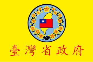
Taiwan Province is a nominal province of the Republic of China without administrative function. Its administrative powers have been transferred to the central and county governments.

Republic of Formosa 1895 short-lived republic on the island of Taiwan

The Republic of Formosa was a short-lived republic that existed on the island of Taiwan in 1895 between the formal cession of Taiwan by the Qing dynasty of China to the Empire of Japan by the Treaty of Shimonoseki and its being taken over by Japanese troops. The Republic was proclaimed on 23 May 1895 and extinguished on 21 October, when the Republican capital Tainan was taken over by the Japanese. Though sometimes claimed as the first Asian republic to have been proclaimed, it was predated by the Lanfang Republic in Borneo, established in 1777, as well as by the Republic of Ezo in Japan, established in 1869.

Keelung City in Northern Taiwan, Taiwan

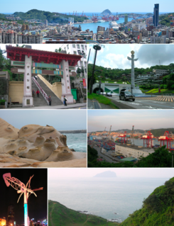
Keelung, officially known as Keelung City, is a major port city situated in the northeastern part of Taiwan. It borders New Taipei with which it forms the Taipei–Keelung metropolitan area, along with Taipei itself. Nicknamed the Rainy Port for its frequent rain and maritime role, the city is Taiwan's second largest seaport.

New Taipei City Special municipality in Republic of China

New Taipei City is a special municipality and the most populous city in Taiwan. Located in northern Taiwan, the city includes a substantial stretch of the island's northern coastline and surrounds the Taipei Basin, making it the second largest special municipality by area, behind Kaohsiung. New Taipei City is bordered by Keelung to the northeast, Yilan County to the southeast, and Taoyuan to the southwest. It completely surrounds Taipei. Banqiao District is its municipal seat and biggest commercial area. Until 2010, the area that roughly corresponds to the present New Taipei City was known as Taipei County.

Shilin District District in Northern Taipei, Republic of China

Shilin District is a district of Taipei. It is home to a large foreign population, mainly concentrated in the Tianmu area. It has long been a top choice for expatriates from Europe, US, Canada, Southeast Asia and Japan to live, run businesses, and establish embassies and offices due mainly to the natural environment—sitting at the foot of Yangmingshan—and because the international schools are all located here. The central command of the Republic of China Navy is located in Shilin.

Wanhua District District in Western Taipei, Republic of China

Wanhua District, known in Taiwanese Hokkien as Báng-kah khu and historically as "Monga" or "Monka", is a district in Taipei, Taiwan. It is Taipei's oldest district. The district is home to historic buildings such as the Bangka Lungshan Temple, an iconic historic temple, and the Red House Theater, the first and largest teahouse and playhouse in Taiwan. Taipei's oldest, but decaying, garment district is also here.

Datong District, Taipei District in Western Taipei, Republic of China

Datong District or Tatung is a district of Taipei City, Taiwan. It is located between the Taipei Metro Red Line and eastern shore of the Tamsui River, and between Civic Boulevard and the Sun Yat-sen Freeway. The southern part of this area used to be the site of Twatutia, one of the first settlements in what is now Taipei and for a time the area's commercial center. Taipei's commercial center has since shifted south east to Zhongzheng, Da'an and Xinyi, and Datong is far less important economically. One of the last vestiges of Twatutia's commercial importance disappeared with the closing of the Chien-Cheng Circle in 2006. The north was the site of the village of Daronpon.

Twatutia, is an area in Datong District, Taipei, Taiwan. It was also known as Daitōtei during Japanese rule, and Tataocheng or Dadaocheng (Mandarin) during the Kuomintang era.

Taiwan was under Japanese rule after the First Sino-Japanese War, as per the Treaty of Shimonoseki of 1895. There were still several changes until the Japanese political system was adopted in 1920.

Taihoku Prefecture

Taihoku Prefecture was an administrative division of Taiwan created in 1920, during Japanese rule. The prefecture consisted of modern-day Keelung, New Taipei City, Taipei and Yilan County. Its government office, which is now occupied by the Control Yuan of Taiwan, was in Taihoku City.

Japanese invasion of Taiwan (1895)

The Japanese invasion of Taiwan was a conflict between the Empire of Japan and the armed forces of the short-lived Republic of Formosa following the Qing Dynasty's cession of Taiwan to Japan in April 1895 at the end of the First Sino-Japanese War. The Japanese sought to take control of their new possession, while the Republican forces fought to resist Japanese occupation. The Japanese landed near Keelung on the northern coast of Taiwan on 29 May 1895, and in a five-month campaign swept southwards to Tainan. Although their advance was slowed by guerrilla activity, the Japanese defeated the Formosan forces whenever they attempted to make a stand. The Japanese victory at Baguashan on 27 August, the largest battle ever fought on Taiwanese soil, doomed the Formosan resistance to an early defeat. The fall of Tainan on 21 October ended organised resistance to Japanese occupation, and inaugurated five decades of Japanese rule in Taiwan.

Taiwan under Qing rule 1683–1895 period in Taiwanese history

Taiwan under Qing rule refers to the rule of the Qing dynasty over Formosa from 1683 to 1895. The Qing court sent an army led by general Shi Lang and annexed Taiwan in 1683. It was governed as Taiwan Prefecture of Fokien Province (Fujian) until the declaration of Fokien-Taiwan Province in 1887. Qing rule over Taiwan ended when Taiwan was ceded to Japan by the Treaty of Shimonoseki in 1895. There were more than a hundred rebellions during the Qing period. The frequency of rebellions, riots, and civil strife in Qing Taiwan led to this period being referred to by historians as “Every three years an uprising, every five years a rebellion.”

Tamsui District District in Republic of China

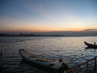
Tamsui District is a sea-side district in New Taipei, Taiwan, Republic of China. It is named after the Tamsui River; the name means "fresh water". The town is popular as a site for viewing the sun setting into the Taiwan Strait. Though modest in size, it has a large role in Taiwanese culture.

Taipei Bridge

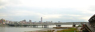
Taipei Bridge is a motor-vehicle bridge across the Tamsui River connecting Taipei with Sanchong District, New Taipei City in Taiwan. A central span carries automobile and some motorcycle traffic while narrower spans on either side carry most motorcycle traffic along with bicycle pedestrian traffic. The central bridge is 481.6 meters in length.

Taiwan Prefecture or Taiwanfu was a prefecture of Taiwan during the Qing dynasty. The prefecture was established by the Qing dynasty government in 1684, after the island "became an integral part of the Chinese Empire" in 1683. The Taiwan Prefecture Gazetteer documented it as part of Fujian Province. The Taiwan Prefecture Gazetteer was completed by Gao Gonggan in 1695, the 34th year of the reign of the Kangxi Emperor.

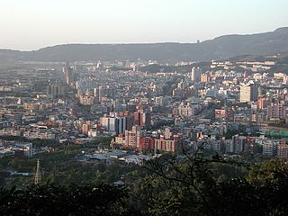
The history of Hsinchu extends over more than 400 years, making it one of the oldest cities in northern Taiwan.

Taipeh Prefecture was a Qing dynasty prefecture created from the northern part of Taiwan Prefecture, Qing-era Taiwan in 1875, while the island was still part of Fujian Province. It consisted of a region surrounding modern-day Taipei in northern Taiwan, including modern-day Hsinchu, Hsinchu County, Taoyuan City, New Taipei City, Taipei, Keelung, and Yilan County. The reorganization started after Imperial Commissioner Shen Pao-chen demanded that another prefecture be added in Taiwan to revamp the administrative organization of the northern area of the island. The walls of the prefecture capital were completed in 1884.

Tainan Prefecture was a prefecture of Taiwan under Qing rule. The prefecture was established by the Qing dynasty government in 1887, when Fokien-Taiwan Province was established. The prefecture included the districts/counties of Anping, Kagi, Fengshan, and Hengchun, and the sub-prefecture of Penghu.

The architecture of Taiwan can be traced back to stilt housing of the aborigines in prehistoric times; to the building of fortresses and churches in the north and south used to colonize and convert the inhabitants during the Dutch and Spanish period; the Tungning period when Taiwan was a base of anti-Qing sentiment and Minnan-style architecture was introduced; in Qing dynasty period, a mix of Chinese and Western architecture appeared and artillery battery flourished during Qing's Self-Strengthening Movement; During the Japanese rule of Taiwan, the Minnan, Japanese and Western culture were main influencers in architectural designs and saw the introduction and use of reinforced concrete. Due to excessive Westernization as a colony, after the retrocession of Taiwan to the Republic of China in 1945 from Japan at the end of World War II, Chinese classical style became popular and entered into international mainstream as a postmodern design style. Today, Taiwanese architecture has undergone much diversification, every style of architecture can be seen.

References

  1. Davidson (1903), p. 211.
  2. Davidson (1903), p. 281. identified as "Liu [sic] Wei yuan", see 林維源
  3. Davidson (1903), pp. 244-5: "As a result of these changes and additions, the seat of government (which had been formerly at the old town of Taiwan-fu in the south, which city had been in turn the capital of the Dutch, Koxinga, and the Chinese,) was now removed temporarily to the new city of Taipeh, which had been lately in course of construction...In connection with this, it is necessary to go further and explain that it was the intention of the government to build a new capital city in the centre of the island near Changwha."
  4. Davidson (1903), pp. 246-7.
  5. Davidson (1903), p. 593-4.
  6. Takekoshi (1907), p. 200.
  7. Chamberlain, B.; Mason, W.B. (1903). A Handbook for Travellers in Japan (7th ed.). London: J. Murray. p. 550. OL   25302448M.
  8. Goto, Y. (2018, July). Comparative Study about the City Planning Systems in Taiwan (for the Years 1895–1945) and Korea (for the Years 1912–1945) under Japanese Rule. The 18th International Planning History Society Conference, Yokohama.
  9. Takekoshi (1907), p. 199.

Bibliography