Hobart, Oklahoma

Last updated

Hobart, Oklahoma
Hobart Main Street.jpg
Main Street of Hobart, 2004
Motto(s): 
"Hobart is not just a town, It's a Community."
OKMap-doton-Hobart.PNG
Location of Hobart, Oklahoma
Coordinates: 35°01′28″N99°05′15″W / 35.02444°N 99.08750°W / 35.02444; -99.08750
Country United States
State Oklahoma
County Kiowa
Area
[1]
  Total3.36 sq mi (8.71 km2)
  Land3.36 sq mi (8.71 km2)
  Water0.00 sq mi (0.00 km2)
Elevation
[2]
1,542 ft (470 m)
Population
 (2020)
  Total3,413
  Density1,015.17/sq mi (391.91/km2)
Time zone UTC-6 (Central (CST))
  Summer (DST) UTC-5 (CDT)
ZIP code
73651
Area code 580
FIPS code 40-35000 [3]
GNIS feature ID2410770 [2]
Website hobartok.gov

Hobart is a city in, and the county seat of, Kiowa County, Oklahoma, United States. [4] It is west-southwest of Oklahoma City, and northwest of Lawton. [5] It was named for Garret Hobart, the 24th Vice President of the United States. The population was 3,413 at the 2020 Census. [6] It is served by Hobart Regional Airport. It also has two museums: the General Tommy Franks Museum and the Kiowa County Museum.

Contents

History

The present town of Hobart began almost overnight on August 6, 1901, when lots on the former Kiowa-Apache-Comanche Reservation in southern Oklahoma Territory were put up for sale. It quickly became the residence of 2,936 people, mostly living in tents. Initially, the town was nicknamed "Ragtown." Wooden structures replaced tents as fast as possible. By 1903, Hobart had electric lights, an ice plant, and some large wholesale businesses. It also had a wooden courthouse. It developed into a town whose economy was based on the production of cotton. At statehood in November 1907, Hobart had a population of 3,136. [7]

Hobart's population declined to 2,936 in 1920, but resumed growing for several years afterward. In 1930, the population was 4,982. In 1950, it reached a peak of 5,380. Thereafter, the town population went into a long-term decline that has continued to the present. [7] In the 1950 water supply in the area was improved with a series of reservoirs; the town is connected by aqueduct to Lake Hobart several kilometers to the north.

Geography

Hobart is located 120 miles (190 km) southwest of Oklahoma City and 65 miles (105 km) northwest of Lawton [7]

According to the United States Census Bureau, the city has a total area of 2.7 square miles (7.0 km2), all land.

Economy

The economy of the area around Hobart was first based on farming, with the major crops being wheat and cotton. Cattle ranching became important later. Hobart is still primarily a farm town. By the 21st century, most of the employed townspeople worked in the education, health and social services industries. [7]

Climate

Climate data for Hobart, Oklahoma (Hobart Regional Airport), 19912020 normals, records 1910present
MonthJanFebMarAprMayJunJulAugSepOctNovDecYear
Record high °F (°C)88
(31)
93
(34)
96
(36)
102
(39)
108
(42)
116
(47)
117
(47)
116
(47)
110
(43)
102
(39)
92
(33)
86
(30)
117
(47)
Mean maximum °F (°C)72.2
(22.3)
77.6
(25.3)
84.7
(29.3)
89.6
(32.0)
97.3
(36.3)
102.1
(38.9)
106.3
(41.3)
104.6
(40.3)
99.4
(37.4)
91.7
(33.2)
80.3
(26.8)
71.9
(22.2)
107.3
(41.8)
Mean daily maximum °F (°C)50.8
(10.4)
55.2
(12.9)
64.1
(17.8)
72.7
(22.6)
82.3
(27.9)
92.0
(33.3)
96.8
(36.0)
95.4
(35.2)
86.7
(30.4)
74.8
(23.8)
61.6
(16.4)
51.6
(10.9)
73.7
(23.2)
Daily mean °F (°C)39.4
(4.1)
43.4
(6.3)
51.9
(11.1)
60.1
(15.6)
70.4
(21.3)
80.2
(26.8)
84.7
(29.3)
83.4
(28.6)
75.1
(23.9)
62.9
(17.2)
50.2
(10.1)
40.9
(4.9)
61.9
(16.6)
Mean daily minimum °F (°C)28.1
(−2.2)
31.6
(−0.2)
39.8
(4.3)
47.6
(8.7)
58.4
(14.7)
68.3
(20.2)
72.6
(22.6)
71.4
(21.9)
63.5
(17.5)
51.0
(10.6)
38.8
(3.8)
30.2
(−1.0)
50.1
(10.1)
Mean minimum °F (°C)12.4
(−10.9)
15.5
(−9.2)
20.5
(−6.4)
30.1
(−1.1)
41.4
(5.2)
56.3
(13.5)
62.5
(16.9)
60.7
(15.9)
47.7
(8.7)
31.9
(−0.1)
20.5
(−6.4)
13.9
(−10.1)
7.3
(−13.7)
Record low °F (°C)−10
(−23)
−9
(−23)
2
(−17)
19
(−7)
29
(−2)
43
(6)
52
(11)
46
(8)
31
(−1)
14
(−10)
9
(−13)
−9
(−23)
−10
(−23)
Average precipitation inches (mm)0.67
(17)
0.98
(25)
1.85
(47)
2.94
(75)
4.15
(105)
3.35
(85)
2.72
(69)
2.76
(70)
2.90
(74)
2.85
(72)
1.52
(39)
1.30
(33)
27.99
(711)
Average snowfall inches (cm)2.3
(5.8)
1.4
(3.6)
0.3
(0.76)
0.0
(0.0)
0.0
(0.0)
0.0
(0.0)
0.0
(0.0)
0.0
(0.0)
0.0
(0.0)
0.0
(0.0)
0.2
(0.51)
1.3
(3.3)
5.5
(13.97)
Average precipitation days (≥ 0.01 in)3.94.26.56.59.67.66.45.96.56.24.94.472.6
Average snowy days (≥ 0.1 in)1.00.70.30.00.00.00.00.00.00.00.11.23.3
Source 1: NOAA (snow/snow days 19812010) [8] [9]
Source 2: National Weather Service [10]

Demographics

Historical population
CensusPop.Note
1910 3,845
1920 2,936−23.6%
1930 4,98269.7%
1940 5,3808.0%
1950 5,132−4.6%
1960 5,1320.0%
1970 4,638−9.6%
1980 4,7352.1%
1990 4,305−9.1%
2000 3,997−7.2%
2010 3,756−6.0%
2020 3,413−9.1%
U.S. Decennial Census [11]

As of the census [3] of 2000, there were 3,997 people, 1,584 households, and 1,031 families residing in the city. The population density was 1,472.9 inhabitants per square mile (568.7/km2). There were 1,979 housing units at an average density of 729.3 per square mile (281.6/km2). The racial makeup of the city was 80.01% White, 8.18% African American, 4.38% Native American, 0.60% Asian, 0.10% Pacific Islander, 3.83% from other races, and 2.90% from two or more races. Hispanic or Latino of any race were 8.91% of the population.

There were 1,584 households, out of which 29.3% had children under the age of 18 living with them, 49.1% were married couples living together, 11.8% had a female householder with no husband present, and 34.9% were non-families. 32.4% of all households were made up of individuals, and 17.7% had someone living alone who was 65 years of age or older. The average household size was 2.37 and the average family size was 2.99.

In the city, the population was spread out, with 25.0% under the age of 18, 8.0% from 18 to 24, 25.7% from 25 to 44, 20.8% from 45 to 64, and 20.4% who were 65 years of age or older. The median age was 39 years. For every 100 females, there were 95.2 males. For every 100 females age 18 and over, there were 89.4 males.

The median income for a household in the city was $25,781, and the median income for a family was $35,313. Males had a median income of $24,821 versus $20,345 for females. The per capita income for the city was $13,729. About 16.4% of families and 20.0% of the population were below the poverty line, including 23.2% of those under age 18 and 15.2% of those age 65 or over.

Historical sites

Five of the eight NRHP-listed sites in Kiowa County are located in Hobart:

Media

FM Radio

Frequency (MHz)Call Sign kW
105.9 KQTZ 100

Distant FM Radio

Frequency (MHz)Call Sign kW
93.5 KPRO 45
106.9 KTJI 100
103.5 KVSP 100

Newspaper The Hobart Democrat-Chief is Hobart's oldest businesses, established August 1, 1901 and still in operation in 2020. [12] The town has had two other newspapers, the Hobart Daily Chief and the Hobart Republican. [7]

Notable people

Adjacent communities

Related Research Articles

<span class="mw-page-title-main">Kiowa County, Oklahoma</span> County in Oklahoma, United States

Kiowa County is a county located in the southwestern part of the U.S. state of Oklahoma. As of the 2020 census, the population was 8,509. Its county seat is Hobart. The county was created in 1901 as part of Oklahoma Territory. It was named for the Kiowa people.

<span class="mw-page-title-main">Grady County, Oklahoma</span> County in Oklahoma, United States

Grady County is a county located in the U.S. state of Oklahoma. As of the 2020 census, the population was 54,795. Its county seat is Chickasha. It was named for Henry W. Grady, an editor of the Atlanta Constitution and southern orator.

<span class="mw-page-title-main">Kiowa, Kansas</span> City in Kiowa County, Kansas

Kiowa is a city in Barber County, Kansas, United States. As of the 2020 census, the population of the city was 902. It is located 1 mile north of the Kansas / Oklahoma state border.

<span class="mw-page-title-main">Apache, Oklahoma</span> Town in Oklahoma, United States

Apache is a town in Caddo County, Oklahoma, United States. The population was 1,444 at the 2010 census.

<span class="mw-page-title-main">Cement, Oklahoma</span> Town in Oklahoma, United States

Cement is a town in Caddo County, Oklahoma, United States. The population was 501 at the 2010 census.

<span class="mw-page-title-main">Wilson, Oklahoma</span> Town in Oklahoma, United States

Wilson is a town in Carter County, Oklahoma, United States. The population was 1,724 at the 2010 census. It is part of the Ardmore, Oklahoma Micropolitan Statistical Area. It is home to one of the oldest Assemblies of God churches in Oklahoma, the Wilson Assembly of God Church.

<span class="mw-page-title-main">Elgin, Oklahoma</span> City in Oklahoma, United States

Elgin is a city in northeastern Comanche County, Oklahoma, United States. The population was 2,156 at the 2010 census, a 78 percent increase from 1,210 at the 2000 census. It is included in the Lawton, Oklahoma Metropolitan Statistical Area. It is the site of Fort Sill National Cemetery.

<span class="mw-page-title-main">Faxon, Oklahoma</span> Town in Oklahoma, United States

Faxon is a town in Comanche County, Oklahoma, United States. It is located on Oklahoma State Highway 36 about 18.3 driving miles southwest of Lawton. The population was 136 at the 2010 census. It is included in the Lawton, Oklahoma Metropolitan Statistical Area.

<span class="mw-page-title-main">Indiahoma, Oklahoma</span> Town in Oklahoma, United States

Indiahoma is a town in Comanche County, Oklahoma, United States. It is located just south of US Route 62, about 24.4 driving miles west of Lawton.

<span class="mw-page-title-main">Walters, Oklahoma</span> City in Oklahoma, United States

Walters is a town in Cotton County, Oklahoma, United States. The population was 2,412 as of the 2020 United States census. The city, nestled between twin creeks, is the county seat of Cotton County. The city's motto is "Small town; Big heart".

<span class="mw-page-title-main">Cooperton, Oklahoma</span> Town in Oklahoma, United States

Cooperton is a town in Kiowa County, Oklahoma, United States. The population was 16 at the 2010 census, a decline of 20 percent from the total of 20 in 2000.

<span class="mw-page-title-main">Gotebo, Oklahoma</span> Town in Oklahoma, United States

Gotebo is a town in Kiowa County, Oklahoma, United States. The population was 174 at the 2020 Census.

<span class="mw-page-title-main">Lone Wolf, Oklahoma</span> Town in Oklahoma, United States

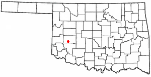
Lone Wolf is a town in Kiowa County, Oklahoma, United States. The population was 438 at the 2010 census, a decline of 12.4 percent from 500 in 2000. The town was named for Chief Lone Wolf (1843–1923), a warrior chief of the Kiowa who fought to preserve his people's autonomy and way of life.

<span class="mw-page-title-main">Mountain Park, Oklahoma</span> Town in Oklahoma, United States

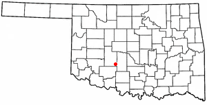
Mountain Park is a town in Kiowa County, Oklahoma, United States. The population was 409 at the 2010 census, a 4.9 percent increase from 390 in 2000.

<span class="mw-page-title-main">Mountain View, Oklahoma</span> Town in Oklahoma, United States

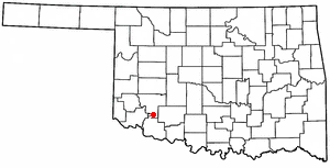
Mountain View is a town in Kiowa County, Oklahoma, United States. The population was 795 at the 2010 census, a decline of 9.7 percent from 880 in 2000.

<span class="mw-page-title-main">Snyder, Oklahoma</span> City in Oklahoma, United States

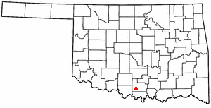
Snyder is a city in Kiowa County, Oklahoma, United States. The population was 1,394 at the 2010 census. This figure represented a decline of 7.6 percent from 1,509 persons in 2000.

<span class="mw-page-title-main">Kiowa, Oklahoma</span> Town in Oklahoma, United States

Kiowa is a town in Pittsburg County, Oklahoma, United States. The population was 731 at the 2010 census.

<span class="mw-page-title-main">Loveland, Oklahoma</span> Town in Oklahoma, United States

Loveland is a town in Tillman County, Oklahoma, United States. It is located about 38 miles southwest of Lawton, Oklahoma. The population was 13 at the 2020 Census. Loveland once had a post office that has since closed. The post office was popular around Valentine's Day, when people often drove many miles to have their valentines postmarked "Loveland".

<span class="mw-page-title-main">Rocky, Oklahoma</span> Town in Oklahoma, United States

Rocky is a town in Washita County, Oklahoma, United States. The population was 162 at the 2010 United States Census, a 6.9 percent decline from the figure of 174 in 2000. The town lies along U.S. Route 183.

<span class="mw-page-title-main">Chattanooga, Oklahoma</span> Town in Oklahoma, United States

Chattanooga is a town in Comanche and Tillman counties in the U.S. state of Oklahoma. It is located on Oklahoma State Highway 36 about 23.7 driving miles southwest of Lawton. The population was 400 at the 2020 census. The Comanche County portion of Chattanooga is included in the Lawton, Oklahoma Metropolitan Statistical Area.

References

  1. "ArcGIS REST Services Directory". United States Census Bureau. Retrieved September 20, 2022.
  2. 1 2 U.S. Geological Survey Geographic Names Information System: Hobart, Oklahoma
  3. 1 2 "U.S. Census website". United States Census Bureau . Retrieved January 31, 2008.
  4. "Find a County". National Association of Counties. Archived from the original on May 31, 2011. Retrieved June 7, 2011.
  5. "Hobart, Oklahoma". Google Maps. Retrieved October 14, 2023.
  6. "Hobart (city), Oklahoma". US Census Bureau. Retrieved October 14, 2023.
  7. 1 2 3 4 5 Taylor, Ethel Crisp. "Hobart," Encyclopedia of Oklahoma History and Culture. Accessed June 16, 2015.
  8. "U.S. Climate Normals Quick Access – Station: Hobart MUNI AP, OK (19912020)". National Oceanic and Atmospheric Administration. Retrieved March 29, 2023.
  9. "U.S. Climate Normals Quick Access – Station: Hobart Municipal Airport, OK (19812010)". National Oceanic and Atmospheric Administration. Retrieved March 29, 2023.
  10. "NOAA Online Weather Data – NWS Norman". National Weather Service. Retrieved March 29, 2023.
  11. "Census of Population and Housing". Census.gov. Retrieved June 4, 2015.
  12. "Log In". The Hobart Democrat-Chief. Retrieved August 15, 2020.