Hollister, Oklahoma

Last updated

Hollister, Oklahoma
OKMap-doton-Hollister.PNG
Location of Hollister, Oklahoma
Coordinates: 34°20′27″N98°52′16″W / 34.34083°N 98.87111°W / 34.34083; -98.87111
Country United States
State Oklahoma
County Tillman
Area
[1]
  Total0.27 sq mi (0.69 km2)
  Land0.27 sq mi (0.69 km2)
  Water0.00 sq mi (0.00 km2)
Elevation
[2]
1,122 ft (342 m)
Population
 (2020)
  Total35
  Density130.60/sq mi (50.46/km2)
Time zone UTC-6 (Central (CST))
  Summer (DST) UTC-5 (CDT)
ZIP code
73551
Area code 580
FIPS code 40-35550 [3]
GNIS feature ID2412763 [2]

Hollister is a town in Tillman County, Oklahoma, United States. The population was 35 as of the 2020 United States census. [4] The town is located about 12 driving miles east-southeast of the county seat of Frederick, and is located along Oklahoma State Highway 54. [5]

Contents

History

The Wichita Falls and Northwestern Railway (later the Missouri, Kansas and Texas Railway) founded Hollister in 1907 as a depot on its line from Wichita Falls, Texas to Frederick, Oklahoma. Hollister was built between the towns of Isadore and Parton. Many of its buildings were moved from Parton. Originally, this was the location of a railroad switch known as "Happy Jack," "Happy Spur," or just "Happy." The first station was a boxcar, and the first train arrived on November 16, 1907. The town was named for Harry L. Hollister, the depot agent in Frederick. A post office was established on February 1, 1909. [6]

Hollister's population peaked at 200 in 1940, then began a fairly steady decline. The high school closed in 1963 and the grade school in 1968. At the turn of the 21st Century, Hollister had a post office, a Baptist church and two grain elevators. [6]

Geography

According to the United States Census Bureau, the town has a total area of 0.2 square miles (0.52 km2), all land.

Climate

Climate data for Hollister, Oklahoma
MonthJanFebMarAprMayJunJulAugSepOctNovDecYear
Mean daily maximum °F (°C)50.6
(10.3)
56.3
(13.5)
65.7
(18.7)
75.9
(24.4)
83.5
(28.6)
91.9
(33.3)
97.7
(36.5)
96.4
(35.8)
87.1
(30.6)
76.8
(24.9)
63.5
(17.5)
52.8
(11.6)
74.9
(23.8)
Mean daily minimum °F (°C)24.6
(−4.1)
28.8
(−1.8)
37.4
(3.0)
48.7
(9.3)
57.0
(13.9)
66.4
(19.1)
71.0
(21.7)
69.5
(20.8)
61.9
(16.6)
49.8
(9.9)
37.9
(3.3)
27.9
(−2.3)
48.4
(9.1)
Average precipitation inches (mm)0.9
(23)
1.3
(33)
2.1
(53)
2.3
(58)
4.3
(110)
3.5
(89)
2.1
(53)
2.7
(69)
3.6
(91)
2.7
(69)
1.6
(41)
1.0
(25)
28.1
(714)
Source 1: weather.com
Source 2: Weatherbase.com [7]

Demographics

Historical population
CensusPop.Note
1930 198
1940 2001.0%
1950 172−14.0%
1960 166−3.5%
1970 105−36.7%
1980 82−21.9%
1990 59−28.0%
2000 601.7%
2010 50−16.7%
2020 35−30.0%
U.S. Decennial Census [8]

As of the census [3] of 2000, there were 60 people, 20 households, and 17 families residing in the town. The population density was 245.2 inhabitants per square mile (94.7/km2). There were 25 housing units at an average density of 102.2 per square mile (39.5/km2). The racial makeup of the town was 86.67% White, 10.00% from other races, and 3.33% from two or more races. Hispanic or Latino of any race were 10.00% of the population.

There were 20 households, out of which 30.0% had children under the age of 18 living with them, 75.0% were married couples living together, and 15.0% were non-families. 15.0% of all households were made up of individuals, and none had someone living alone who was 65 years of age or older. The average household size was 3.00 and the average family size was 3.29.

In the town, the population was spread out, with 28.3% under the age of 18, 1.7% from 18 to 24, 31.7% from 25 to 44, 28.3% from 45 to 64, and 10.0% who were 65 years of age or older. The median age was 37 years. For every 100 females, there were 140.0 males. For every 100 females age 18 and over, there were 138.9 males.

The median income for a household in the town was $21,250, and the median income for a family was $26,250. Males had a median income of $18,750 versus $21,250 for females. The per capita income for the town was $7,888. There were 26.7% of families and 39.3% of the population living below the poverty line, including 39.1% of under eighteens and none of those over 64.

Related Research Articles

<span class="mw-page-title-main">Tillman County, Oklahoma</span> County in Oklahoma, United States

Tillman County is a county located in the southwestern part of Oklahoma, United States. As of the 2020 census, the population was 6,968. The county seat is Frederick.

<span class="mw-page-title-main">McMullen, Alabama</span> Town in Alabama, United States

McMullen is a town in Pickens County, Alabama, United States. It incorporated around 1976. A series of natural disasters has caused the population to dwindle. As of 2010, it was the smallest incorporated town in the state of Alabama. It was overtaken by Oak Hill in 2020. The population was 32 at the 2020 United States census, up from 10 in 2010.

<span class="mw-page-title-main">Ragland, Alabama</span> Town in Alabama, United States

Ragland is a town in St. Clair County, Alabama, United States southeast of Ashville. It incorporated in 1899. At the 2020 census, the population was 1,693, up slightly from 1,639 in 2010. It is part of the Birmingham-Hoover-Cullman Combined Statistical Area.

<span class="mw-page-title-main">Golden Gate, Illinois</span> Village in Illinois, United States

Golden Gate is a village in Wayne County, Illinois, along the Little Wabash River. The population was 65 at the 2020 census.

<span class="mw-page-title-main">Economy, Indiana</span> Town in Indiana, United States

Economy is a town in Perry Township, Wayne County, in the U.S. state of Indiana. The population was 173 at the 2021 census.

<span class="mw-page-title-main">Elmdale, Kansas</span> City in Chase County, Kansas

Elmdale is a city in Chase County, Kansas, United States. As of the 2020 census, the population of the city was 40. It is located along U.S. Route 50 highway.

<span class="mw-page-title-main">Carter, Oklahoma</span> Town in Oklahoma, United States

Carter is a town in Beckham County, Oklahoma, United States. The population was 183 at the time of the 2020 census.

<span class="mw-page-title-main">Pettit, Oklahoma</span> Census-designated place in Oklahoma, United States

Pettit is an unincorporated community and census-designated place (CDP) in Cherokee County, Oklahoma, United States. The population was 954 at the 2010 census, a 23.7 percent increase over the figure of 771 recorded in 2000. The town was named for Mark and Eliza Pettit, townsite allottees.

<span class="mw-page-title-main">Faxon, Oklahoma</span> Town in Oklahoma, United States

Faxon is a town in Comanche County, Oklahoma, United States. It is located on Oklahoma State Highway 36 about 18.3 driving miles southwest of Lawton. The population was 136 at the 2010 census. It is included in the Lawton, Oklahoma Metropolitan Statistical Area.

<span class="mw-page-title-main">Medicine Park, Oklahoma</span> Town in Oklahoma, United States

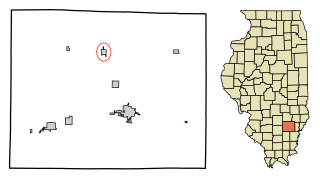
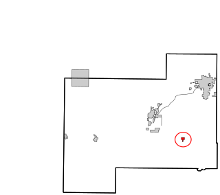
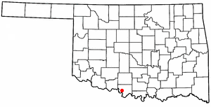
Medicine Park is a town in Comanche County, Oklahoma, United States, situated in the Wichita Mountains near the entrance to the 60,000-acre (240 km2) Wichita Mountain Wildlife Refuge. Medicine Park has a long history as a vintage cobblestone resort town. Medicine Park is located near the city of Lawton and Fort Sill. It is an exurb, part of the Lawton Metropolitan Statistical Area. Many of the original structures are constructed of naturally formed cobblestones—these red granite cobblestones are unique to the Wichita Mountains. The population was 382 at the 2010 census.

<span class="mw-page-title-main">Sterling, Oklahoma</span> Town in Oklahoma, United States

Sterling is a town in Comanche County, Oklahoma, United States. The population was 793 at the 2010 census. It is part of the Lawton Metropolitan Statistical Area.

<span class="mw-page-title-main">Rosston, Oklahoma</span> Town in Oklahoma, United States

Rosston is a town in Harper County, Oklahoma, United States. The population was 52 at the time of the 2020 census.

<span class="mw-page-title-main">Sugden, Oklahoma</span> Town in Oklahoma, United States

Sugden is a town in Jefferson County, Oklahoma, United States. The population was 22 as of the 2020 United States census.

<span class="mw-page-title-main">Oktaha, Oklahoma</span> Town in Oklahoma, United States

Oktaha is a town in Muskogee County, Oklahoma, United States.

<span class="mw-page-title-main">Wann, Oklahoma</span> Town in Oklahoma, United States

Wann is a town in Nowata County, Oklahoma, United States. The population was 125 at the 2010 census, a decrease of 5.3 percent from the figure of 132 recorded in 2000. Wann is known for the "Six Flag Poles Over Wann America.

<span class="mw-page-title-main">Paradise Hill, Oklahoma</span> Town in Oklahoma, United States

Paradise Hill is a town in the northwest corner of Sequoyah County, Oklahoma, United States. It is part of the Fort Smith, Arkansas-Oklahoma Metropolitan Statistical Area. The population was 85 at the 2010 census, a decline from the figure of 100 recorded in 2000.

<span class="mw-page-title-main">Kimball, West Virginia</span> Town in West Virginia, United States

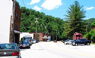
Kimball is a town in McDowell County, West Virginia, United States. Per the 2020 census, the population was 145.

<span class="mw-page-title-main">Butler, Clark County, Wisconsin</span> Town in Wisconsin, United States

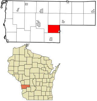
Butler is a town in Clark County in the U.S. state of Wisconsin. The population was 96 at the 2010 census.

<span class="mw-page-title-main">Liberty, Vernon County, Wisconsin</span> Town in Wisconsin, United States

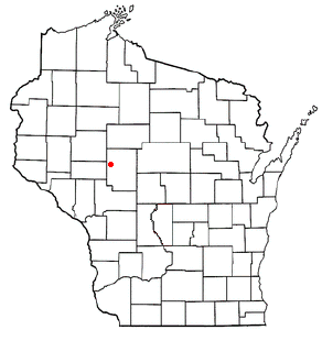
Liberty is a town in Vernon County, Wisconsin, United States. The population was 341 at the 2020 census. The unincorporated communities of Liberty and Ross are located in the town.

McKinley is an unorganized territory in Kittson County, Minnesota, United States. The population was 42 at the 2000 census.

References

  1. "ArcGIS REST Services Directory". United States Census Bureau. Retrieved September 20, 2022.
  2. 1 2 U.S. Geological Survey Geographic Names Information System: Hollister, Oklahoma
  3. 1 2 "U.S. Census website". United States Census Bureau . Retrieved January 31, 2008.
  4. "Hollister (town), Oklahoma". United States Census Bureau. Retrieved March 16, 2024.
  5. "Hollister, Oklahoma to Frederick, Oklahoma". Google Maps. Retrieved March 16, 2024.
  6. 1 2 Goodknight, Frances. Encyclopedia of Oklahoma History and Culture. "Hollister." Retrieved August 9, 2013.
  7. "Historical Weather for Hollister, Oklahoma, United States".
  8. "Census of Population and Housing". Census.gov. Retrieved June 4, 2015.