Hudsonville, Michigan

Last updated
Hudsonville, Michigan
Hudsonvillewelcomesign.jpg
Hudsonville Welcome Sign in 2023.
Nickname: 
Michigan's Salad Bowl
Ottawa County Michigan Incorporated and Unincorporated areas Hudsonville Highlighted.svg
Location of Hudsonville within Ottawa County, Michigan
Coordinates: 42°52′15″N85°51′54″W / 42.87083°N 85.86500°W / 42.87083; -85.86500
Country United States
State Michigan
County Ottawa
Government
   Mayor Mark Northrup [1]
Area
[2]
   City 4.12 sq mi (10.67 km2)
  Land4.12 sq mi (10.67 km2)
  Water0.00 sq mi (0.00 km2)
Elevation
630 ft (201 m)
Population
 (2020)
   City 7,629
  Density1,852.15/sq mi (715.19/km2)
   Metro
1,306,768 (Grand Rapids-Muskegon-Holland MSA)
Time zone UTC-5 (EST)
  Summer (DST) UTC-4 (EDT)
ZIP code
49426
Area code 616
FIPS code 26-39800 [3]
GNIS feature ID0628773 [4]
Website http://www.hudsonville.org/

Hudsonville is a city in Ottawa County in the U.S. state of Michigan and is part of the Grand Rapids metropolitan area. The population was 7,629 at the 2020 US Census. Hudsonville is nicknamed "Michigan's Salad Bowl."

Contents

History

Hudsonville was platted in 1873, soon after the Chicago and West Michigan Railway was extended to that point. [5] The town was named for Homer E. Hudson, a pioneer settler, who was also the town's first postmaster. [6] The early settlement of Hudsonville was next to a swamp, which hampered early development. In 1872, construction of the Chicago and West Michigan Railroad was completed. The railroad brought more settlers to the area, including many Dutch immigrants. [7]

Geography

According to the United States Census Bureau, the city has a total area of 4.54 square miles (11.76 km2), all land. [8]

Points of interest

Terra Square is a mixed-use community center, located in downtown Hudsonville at 3380 Chicago Drive. Terra Square offers an event space and a work space, in addition to hosting the Hudsonville Farmers Market.

Hudsonville Nature Center is located at the east end of New Holland Dr. and features 5.4 miles of hiking trails, picnic areas, and lookouts in a 76 acre nature preserve.

Terra Square Terra Square Event Center.jpg
Terra Square

Demographics

Historical population
CensusPop.Note
1930 643
1940 83730.2%
1950 1,10131.5%
1960 2,649140.6%
1970 3,52333.0%
1980 4,84437.5%
1990 6,17027.4%
2000 7,16016.0%
2010 7,116−0.6%
2020 7,6297.2%
U.S. Decennial Census [9]

2010 census

As of the census [10] of 2010, there were 7,116 people, 2,582 households, and 1,901 families living in the city. The population density was 1,718.8 inhabitants per square mile (663.6/km2). There were 2,712 housing units at an average density of 655.1 per square mile (252.9/km2). The racial makeup of the city was 94.3% White, 1.5% African American, 0.4% Native American, 0.8% Asian, 1.3% from other races, and 1.7% from two or more races. Hispanic or Latino of any race were 3.2% of the population.

There were 2,582 households, of which 37.1% had children under the age of 18 living with them, 60.4% were married couples living together, 9.8% had a female householder with no husband present, 3.4% had a male householder with no wife present, and 26.4% were non-families. 23.0% of all households were made up of individuals, and 10.2% had someone living alone who was 65 years of age or older. The average household size was 2.71 and the average family size was 3.20.

Hudsonville Nature Center Hudsonvillenaturecenter.jpg
Hudsonville Nature Center

The median age in the city was 33.5 years. 28.4% of residents were under the age of 18; 8.8% were between the ages of 18 and 24; 25.8% were from 25 to 44; 22.5% were from 45 to 64; and 14.5% were 65 years of age or older. The gender makeup of the city was 47.7% male and 52.3% female.

2000 census

As of the census [3] of 2000, there were 7,160 people, 2,514 households, and 1,920 families living in the city. The population density was 1,729.1 inhabitants per square mile (667.6/km2). There were 2,598 housing units at an average density of 627.4 per square mile (242.2/km2). The racial makeup of the city was 97.71% White, 0.47% African American, 0.27% Native American, 0.41% Asian, 0.01% Pacific Islander, 0.39% from other races, and 0.74% from two or more races. Hispanic or Latino of any race were 1.45% of the population.

There were 2,514 households, out of which 39.5% had children under the age of 18 living with them, 66.4% were married couples living together, 7.5% had a female householder with no husband present, and 23.6% were non-families. 20.4% of all households were made up of individuals, and 9.6% had someone living alone who was 65 years of age or older. The average household size was 2.80 and the average family size was 3.26.

In the city, the population was spread out, with 30.8% under the age of 18, 9.5% from 18 to 24, 28.2% from 25 to 44, 16.6% from 45 to 64, and 14.9% who were 65 years of age or older. The median age was 32 years. For every 100 females, there were 91.9 males. For every 100 females age 18 and over, there were 87.6 males.

The median income for a household in the city was $46,961, and the median income for a family was $55,372. Males had a median income of $41,418 versus $26,554 for females. The per capita income for the city was $19,286. About 2.4% of families and 4.6% of the population were below the poverty line, including 5.8% of those under age 18 and 3.6% of those age 65 or over.

Notable people

Related Research Articles

Martin Township is a civil township of Allegan County in the U.S. state of Michigan. The population was 2,723 at the 2020 census.

<span class="mw-page-title-main">Coloma, Michigan</span> City in Michigan, United States

Coloma is a city in Berrien County in the U.S. state of Michigan. The population was 1,465 at the 2020 census.

<span class="mw-page-title-main">Mason Township, Cass County, Michigan</span> Civil township in Michigan, United States

Mason Township is a civil township of Cass County in the U.S. state of Michigan. The population was 2,841 at the 2020 census.

<span class="mw-page-title-main">Olivet, Michigan</span> City in Michigan, United States

Olivet is a city in Eaton County in the U.S. state of Michigan. The population was 1,605 at the 2010 census. University Of Olivet is located in the city.

<span class="mw-page-title-main">Copper City, Michigan</span> Village in Michigan, United States

Copper City is a village in Houghton County of the U.S. state of Michigan. The population was 187 at the 2020 census. The village is within Calumet Township. With an area of 0.08 square miles (0.21 km2), it is the second-smallest incorporated municipality by area in the state of Michigan after the nearby village of Ahmeek.

<span class="mw-page-title-main">Petersburg, Michigan</span> City in Michigan, United States

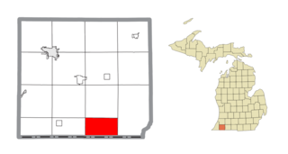
Petersburg is a city in Monroe County in the U.S. state of Michigan. The population was 1,171 at the 2020 census.

<span class="mw-page-title-main">North Muskegon, Michigan</span> City in Michigan, United States

North Muskegon is a city in Muskegon County in the U.S. state of Michigan. The population was 4,093 at the 2020 census, up from 3,786 in 2010.

<span class="mw-page-title-main">Roosevelt Park, Michigan</span> City in Michigan, United States

Roosevelt Park is a city in Muskegon County in the U.S. state of Michigan. The population was 4,172 at the 2020 census, up from 3,831 in 2010.

<span class="mw-page-title-main">Grant, Michigan</span> City in Michigan, United States

Grant is a city in Newaygo County in the U.S. state of Michigan. The population was 952 at the 2020 census. The city is adjacent to Grant Township and Ashland Township. It is a part of the Grand Rapids-Muskegon-Holland, Michigan combined statistical area.

<span class="mw-page-title-main">Sylvan Lake, Michigan</span> City in Michigan, United States

Sylvan Lake is a city in Oakland County in the U.S. state of Michigan. A northern suburb of Detroit, Sylvan Lake is located roughly 26 miles (41.8 km) from downtown Detroit, and borders Pontiac to the east. As of the 2010 census, the city had a population of 1,720. With a land area of 0.51 square miles (1.32 km2), Sylvan Lake is the fourth-smallest city by land area in the state after Clarkston, Petersburg, and neighboring Keego Harbor.

<span class="mw-page-title-main">Blendon Township, Michigan</span> Township in Michigan, United States

Blendon Township is a civil township of Ottawa County in the U.S. state of Michigan. As of the 2020 census, the township population was 7,081.

<span class="mw-page-title-main">Ferrysburg, Michigan</span> City in Michigan, United States

Ferrysburg is a city in Ottawa County in the U.S. state of Michigan. The population was 2,892 at the 2010 census.

<span class="mw-page-title-main">Georgetown Township, Michigan</span> Charter township in Michigan, United States

Georgetown Charter Township is a charter township of Ottawa County in the U.S. state of Michigan. The population was 54,091 at the time of the 2020 census. The city of Hudsonville is adjacent to the township and the unincorporated community of Jenison is within the township, which includes about half the township's population.

<span class="mw-page-title-main">Spring Lake, Michigan</span> Village in Michigan, United States

Spring Lake is a village in Ottawa County in the U.S. state of Michigan. The population was 2,497 at the 2020 census. The village is located within Spring Lake Township; the two share a ZIP code.

<span class="mw-page-title-main">Perry, Michigan</span> City in Michigan, United States

Perry is a city in Shiawassee County in the U.S. state of Michigan. The population was 2,188 at the 2010 census. The city is surrounded by Perry Township, but the two are administered autonomously.

<span class="mw-page-title-main">Hartford, Michigan</span> City in Michigan, United States

Hartford is a city in Van Buren County in the U.S. state of Michigan. The population was 2,688 at the 2010 census. The city is located within Hartford Township, but is politically independent.

<span class="mw-page-title-main">Gibraltar, Michigan</span> City in Michigan, United States

Gibraltar is a city in Wayne County in the U.S. state of Michigan. The population was 4,656 at the 2010 census.

<span class="mw-page-title-main">Rockwood, Michigan</span> City in Michigan, United States

Rockwood is a city in southeastern Wayne County in the U.S. state of Michigan. The population was 3,289 at the 2010 census.

<span class="mw-page-title-main">Michigan City, North Dakota</span> City in North Dakota, United States

Michigan City is a city in Nelson County, North Dakota, United States. The population was 263 at the 2020 census. Though the official name is Michigan City, local residents commonly refer to the city as Michigan. The town population has been declining since the 1980 census.

<span class="mw-page-title-main">Rockport (CDP), Massachusetts</span> Census-designated place in Massachusetts, United States

Rockport is a census-designated place (CDP) in the town of Rockport in Essex County, Massachusetts, United States. The population was 4,966 at the 2010 census.

References

  1. "Hudsonville City Commission | Mark Northrup, Mayor". hudsonville.org. Hudsonville, Michigan . Retrieved 5 May 2024.
  2. "2020 U.S. Gazetteer Files". United States Census Bureau. Retrieved May 21, 2022.
  3. 1 2 "U.S. Census website". United States Census Bureau . Retrieved 2008-01-31.
  4. U.S. Geological Survey Geographic Names Information System: Hudsonville, Michigan
  5. Daly, Matthew L.; Herman, Jennifer L.; Hannan, Caryn (1 December 2008). Michigan Encyclopedia. North American Book Dist LLC. p. 329. ISBN   978-1-878592-94-1.
  6. "History of Hudsonville". City of Hudsonville, MI. Retrieved 21 January 2015.
  7. Hudsonville: 1873-1973. Hudsonville, Michigan: Centennial Committee. 1973. p. 3.
  8. "US Gazetteer files 2010". United States Census Bureau. Archived from the original on 2012-01-25. Retrieved 2012-11-25.
  9. "Census of Population and Housing". Census.gov. Retrieved June 4, 2015.
  10. "U.S. Census website". United States Census Bureau . Retrieved 2012-11-25.
  11. Serba, John (November 21, 2008). "Hudsonville native Taylor Lautner's star is rising". The Grand Rapids Press. Archived from the original on 11 October 2012. Retrieved 26 April 2010.