
Waikouaiti is a small town in East Otago, New Zealand, within the city limits of Dunedin. The town is close to the coast and the mouth of the Waikouaiti River.
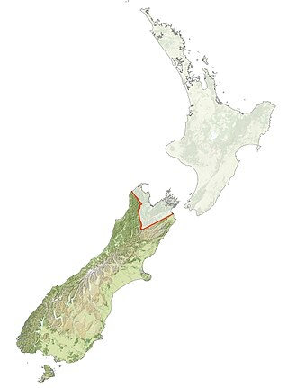
Ngāi Tahu, or Kāi Tahu, is the principal Māori iwi (tribe) of the South Island. Its takiwā is the largest in New Zealand, and extends from the White Bluffs / Te Parinui o Whiti, Mount Mahanga and Kahurangi Point in the north to Stewart Island / Rakiura in the south. The takiwā comprises 18 rūnanga corresponding to traditional settlements. According to the 2018 census an estimated 74,082 people affiliated with the Kāi Tahu iwi.

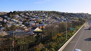
The small town of Karitane is located within the limits of the city of Dunedin in New Zealand, 35 kilometres to the north of the city centre.

The Silverpeaks is an area of rough forest and tussock and scrub covered hill country inland and to the northwest of Dunedin, New Zealand. The area is largely uninhabited; the main indication of human activity is the Taieri Gorge Railway, which preserves the route of the former Otago Central Railway that runs along the steep-sided valley of the Taieri River. Much of the area lies within the Silverpeaks Scenic Reserve.
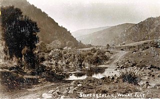
The Silver Stream is a small river flowing close to the town of Mosgiel in Otago, New Zealand.
Kāti Māmoe is a historic Māori iwi. Originally from the Hastings area, they moved in the 16th century to the South Island which at the time was already occupied by the Waitaha.
Waitaha, an early Māori iwi, inhabited the South Island of New Zealand. They were largely absorbed via marriage and conquest - first by the Ngāti Māmoe and then by Ngāi Tahu - from the 16th century onward. Today those of Waitaha descent are represented by the Ngāi Tahu iwi. Like Ngāi Tahu today, Waitaha was itself a collection of various ancient iwi. Kāti Rākai was said to be one of Waitaha's hapū.
The Kilmog, occasionally called Kilmog Hill and known in Māori as Kirimoko, is a hilly area approximately 20 kilometres north of Dunedin, New Zealand, on State Highway 1, to the north of Blueskin Bay and south of Karitane. Technically more a series of hills than a single hill, it lies between the south branch of the Waikouaiti River and the Pacific Ocean, and reaches its highest point at the 431 m (1436 ft) Hammond Hill, close to the farming community of Merton. A second peak, Porteous Hill, lies at the southern end of the Kilmog, rising to 395 m (1317 ft).
Warrington, known in Māori as Ōkāhau, is a small settlement on the coast of Otago, in the South Island of New Zealand. It is situated close to the northern shore of Blueskin Bay, an area of mudflats north of Dunedin, and is administered as part of Dunedin City. Warrington is 3 km (1.9 mi) from State Highway 1 linked by Coast Road. The Main South Line railway passes through the township and a tourist train, the Seasider passes through the settlement once or twice a week between Dunedin and Palmerston.
Long Beach, known in Māori as Warauwerawera, is a small coastal settlement in Otago, New Zealand comprising approximately 100 homes. Many of the sections were initially auctioned in October 1922 for a pound deposit. It is located within the city limits of Dunedin, and lies 15 kilometres northeast of the city centre, between Blueskin Bay and the mouth of the Otago Harbour. The small settlement of Pūrākaunui is located nearby.

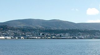
Blueskin Bay is an estuary in coastal Otago, about 25 km north of Dunedin, New Zealand. The name also unofficially describes the rural district which includes the northern slopes of Mount Cargill, the southern slopes of the Kilmog, and the townships of Doctors Point, Waitati, Evansdale, Warrington, and Seacliff.
New Zealand's Otago region is one of the more isolated outliers of the inhabited earth. Its high latitude, elevation and distance from larger foreign and domestic population centers has defined Otago at each stage of its history.
Flagstaff, known in Māori as Te Whanaupaki, is a prominent hill overlooking the northwest of the city of Dunedin, in New Zealand's South Island. Together with Mount Cargill, which lies to its northeast, it dominates the skyline of the city. Flagstaff lies seven kilometres to the north of Dunedin's city centre.
Calton Hill is an elevated southern residential suburb of the City of Dunedin in New Zealand's South Island. The suburb is named after Calton Hill in Edinburgh, Scotland, and some of its street names carry similar etymological roots.
Macraes, formerly known as Macraes Flat, and known in Māori as Ōtī, is a town in the Waitaki District in Otago, New Zealand. It is known as a mining town, with a long history of gold extraction. The town sits 55 km north of Dunedin in New Zealand's South Island.

Pūrākaunui is a small settlement in Otago, in the South Island of New Zealand. It is located within the bounds of the city of Dunedin, in a rural coastal area some 25 km to the north of the city centre.

Te Mapoutahi or simply Mapoutahi is a peninsula on the coast of Otago, New Zealand, between the townships of Waitati and Pūrākaunui, within the limits of Dunedin City. It lies some 20 kilometres (12 mi) north of Dunedin's city centre.
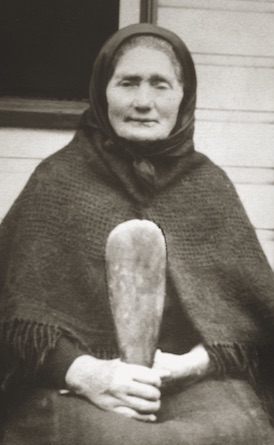
Mere (Mary) Harper, born Mary Apes / Mere Hipi and also known as Big Mary or Mere Hapa was a porter, cultural informant, and midwife of Kāi Tahu and Kāti Huirapa descent. She was the main informant for ethnographer William Anderson Taylor's work on Kāi Tahu history, and is credited as one of the midwives who paved the way for the creation of the Plunket Society of New Zealand.

Ria Tikini or Ria Te Kini, also known as Mrs Chicken, was a businesswoman, cultural informant, and midwife of Kāi Tahu and Kāti Mamoe, New Zealand Maori, descent. She was an informant for ethnographer William Anderson Taylor's work on Kāi Tahu history, and is credited as one of the midwives who paved the way for the creation of the Plunket Society of New Zealand.
Ayesha Melody Green is a painter and artist from New Zealand. Her works are inspired by her Māori heritage and often use the kokowai pigment.

