Herzogtum Lauenburg is the southernmost Kreis, or district, officially called Kreis Herzogtum Lauenburg, of Schleswig-Holstein, Germany. It is bordered by the district of Stormarn, the city of Lübeck, the state of Mecklenburg-Vorpommern, the state of Lower Saxony, and the city state of Hamburg. The district of Herzogtum Lauenburg is named after the former Duchy of Saxe-Lauenburg.

The Duchy of Saxony was originally the area settled by the Saxons in the late Early Middle Ages, when they were subdued by Charlemagne during the Saxon Wars from 772 and incorporated into the Carolingian Empire (Francia) by 804. Upon the 843 Treaty of Verdun, Saxony was one of the five German stem duchies of East Francia; Duke Henry the Fowler was elected German king in 919.

Bremen-Verden, formally the Duchies of Bremen and Verden, were two territories and immediate fiefs of the Holy Roman Empire, which emerged and gained imperial immediacy in 1180. By their original constitution they were prince-bishoprics of the Archdiocese of Bremen and Bishopric of Verden.

The Kingdom of Hanover was established in October 1814 by the Congress of Vienna, with the restoration of George III to his Hanoverian territories after the Napoleonic era. It succeeded the former Electorate of Hanover, and joined 38 other sovereign states in the German Confederation in June 1815. The kingdom was ruled by the House of Hanover, a cadet branch of the House of Welf, in personal union with the United Kingdom of Great Britain and Ireland since 1714. Since its monarch resided in London, a viceroy, usually a younger member of the British Royal Family, handled the administration of the Kingdom of Hanover.

Amt Neuhaus is a municipality in the District of Lüneburg, in Lower Saxony, Germany. Amt means "municipal office" in German. The original "municipal office of Neuhaus" existed since at least the 17th century until 1885, consecutively as part of Saxe-Lauenburg, Electorate of Hanover (1689-1810), Kingdom of Hanover (1814-1866), and the Prussian Province of Hanover (1866-1885).

The Duchy of Saxe-Lauenburg, was a reichsfrei duchy that existed 1296–1803 and 1814–1876 in the extreme southeast region of what is now Schleswig-Holstein. Its territorial center was in the modern district of Herzogtum Lauenburg and originally its eponymous capital was Lauenburg upon Elbe, though in 1619 the capital moved to Ratzeburg.

The Electorate of Hanover was an Electorate of the Holy Roman Empire, located in northwestern Germany and taking its name from the capital city of Hanover. It was formally known as the Electorate of Brunswick-Lüneburg. For most of its existence, the electorate was ruled in personal union with Great Britain and Ireland following the Hanoverian Succession.

Otterndorf is a town on the coast of the North Sea in the federal state of Lower Saxony, Germany, and is part of the collective municipality (Samtgemeinde) of Land Hadeln. The town, located in the administrative district (Landkreis) of Cuxhaven, is at the mouth of the river Medem, part of the Elbe delta. The old town centre (Altstadt) features a number of half-timbered houses.
Wanna is a village and a municipality in the integrated municipality of Land Hadeln, Lower Saxony, Germany.

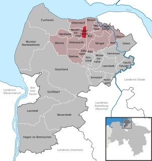
Neuhaus an der Oste is a municipality in the district of Cuxhaven, in Lower Saxony, Germany.

The Duchy of Saxe-Wittenberg was a medieval duchy of the Holy Roman Empire centered at Wittenberg, which emerged after the dissolution of the stem duchy of Saxony. The Ascanian dukes prevailed in obtaining the Saxon electoral dignity until their duchy was finally elevated to the Electorate of Saxony by the Golden Bull of 1356.

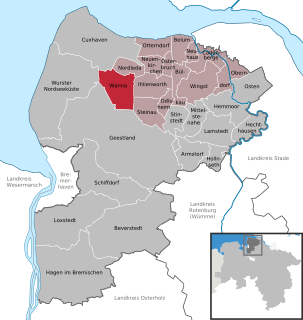
Flögeln is a village and a former municipality in the district of Cuxhaven, in Lower Saxony, Germany. Since 1 January 2015 it is part of the town Geestland.

Neuenkirchen is a municipality in the Land Hadeln collective municipality within the district of Cuxhaven, in Lower Saxony, Germany.

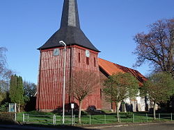
Nordleda is a municipality in the district of Cuxhaven, in Lower Saxony, Germany.

Odisheim is a municipality in the district of Cuxhaven, in Lower Saxony, Germany.
Osterbruch is a municipality in the district of Cuxhaven, in Lower Saxony, Germany.

Steinau in the Land of Hadeln is a municipality in the district of Cuxhaven, in Lower Saxony, Germany.

Hepstedt is a municipality in the district of Rotenburg, in Lower Saxony, Germany.

Westertimke is a municipality in the district of Rotenburg, in Lower Saxony, Germany.
The Stade Region emerged in 1823 by an administrative reorganisation of the dominions of the Kingdom of Hanover, a sovereign state, whose then territory is almost completely part of today's German federal state of Lower Saxony. Until 1837 the Kingdom of Hanover was ruled in personal union by the Kings of the United Kingdom of Great Britain and Ireland.