Industry, Maine

Last updated

Industry, Maine
USA Maine location map.svg
Red pog.svg
Industry
Usa edcp location map.svg
Red pog.svg
Industry
Coordinates: 44°44′59″N70°4′29″W / 44.74972°N 70.07472°W / 44.74972; -70.07472
Country United States
State Maine
County Franklin
VillagesAllens Mills
West Mills
Area
[1]
  Total30.98 sq mi (80.24 km2)
  Land29.75 sq mi (77.05 km2)
  Water1.23 sq mi (3.19 km2)
Elevation
820 ft (250 m)
Population
 (2020)
  Total788
  Density26/sq mi (10.2/km2)
Time zone UTC-5 (Eastern (EST))
  Summer (DST) UTC-4 (EDT)
ZIP code
04938
Area code 207
FIPS code 23-34820
GNIS feature ID0582528
Website www.townofindustry.com

Industry is a town in Franklin County, Maine, United States. The population was 788 at the 2020 census. [2] It was named from the industrious habits of its citizens. [3]

Contents

The former Crystal Lake Grange at Clearwater lake, which was torn down. photo taken April 20, 2002 Crystalake3.JPG
The former Crystal Lake Grange at Clearwater lake, which was torn down. photo taken April 20, 2002

Geography

According to the United States Census Bureau, the town has a total area of 30.98 square miles (80.24 km2), of which 29.75 square miles (77.05 km2) is land and 1.23 square miles (3.19 km2) is water. [1]

Demographics

Historical population
CensusPop.Note
1810 562
1820 79641.6%
1830 90213.3%
1840 1,03614.9%
1850 1,0410.5%
1860 827−20.6%
1870 725−12.3%
1880 715−1.4%
1890 545−23.8%
1900 5531.5%
1910 465−15.9%
1920 431−7.3%
1930 342−20.6%
1940 307−10.2%
1950 3152.6%
1960 262−16.8%
1970 34732.4%
1980 56362.2%
1990 68521.7%
2000 79015.3%
2010 92917.6%
2020 788−15.2%
U.S. Decennial Census [4]

2010 census

As of the census [5] of 2010, there were 929 people, 376 households, and 264 families living in the town. The population density was 31.2 inhabitants per square mile (12.0/km2). There were 625 housing units at an average density of 21.0 per square mile (8.1/km2). The racial makeup of the town was 97.2% White, 0.1% African American, 0.2% Native American, 0.1% Asian, and 2.4% from two or more races. Hispanic or Latino of any race were 0.4% of the population.

There were 376 households, of which 31.9% had children under the age of 18 living with them, 57.2% were married couples living together, 9.6% had a female householder with no husband present, 3.5% had a male householder with no wife present, and 29.8% were non-families. 23.9% of all households were made up of individuals, and 8.6% had someone living alone who was 65 years of age or older. The average household size was 2.47 and the average family size was 2.93.

The median age in the town was 44.1 years. 24.3% of residents were under the age of 18; 5.4% were between the ages of 18 and 24; 21.8% were from 25 to 44; 33.3% were from 45 to 64; and 15.5% were 65 years of age or older. The gender makeup of the town was 49.5% male and 50.5% female.

2000 census

As of the census [6] of 2000, there were 790 people, 306 households, and 219 families living in the town. The population density was 26.4 inhabitants per square mile (10.2/km2). There were 487 housing units at an average density of 16.2 per square mile (6.3/km2). The racial makeup of the town was 98.35% White, 0.63% African American, and 1.01% from two or more races. Hispanic or Latino of any race were 0.51% of the population.

There were 306 households, out of which 28.8% had children under the age of 18 living with them, 62.7% were married couples living together, 4.2% had a female householder with no husband present, and 28.4% were non-families. 20.6% of all households were made up of individuals, and 8.2% had someone living alone who was 65 years of age or older. The average household size was 2.58 and the average family size was 2.97.

In the town, the population was spread out, with 25.9% under the age of 18, 6.3% from 18 to 24, 30.1% from 25 to 44, 24.6% from 45 to 64, and 13.0% who were 65 years of age or older. The median age was 39 years. For every 100 females, there were 101.0 males. For every 100 females age 18 and over, there were 101.7 males.

The median income for a household in the town was $32,292, and the median income for a family was $36,875. Males had a median income of $29,375 versus $18,875 for females. The per capita income for the town was $14,403. About 13.1% of families and 18.1% of the population were below the poverty line, including 20.6% of those under age 18 and 18.0% of those age 65 or over.

Notable person

Related Research Articles

<span class="mw-page-title-main">New Limerick, Maine</span> Town in the state of Maine, United States

New Limerick is a town in Aroostook County, Maine, United States. The population was 574 at the 2020 census. The town was settled in 1775 and incorporated on March 18, 1837, from New Limerick Plantation. It received its name from the fact that many of its settlers had previously lived in Limerick in York County at the southern end of the state, which in turn was probably named after the Irish city of Limerick.

<span class="mw-page-title-main">St. Agatha, Maine</span> Town in the state of Maine, United States

St. Agatha is a town in Aroostook County, Maine, United States. The population was 730 at the 2020 census.

<span class="mw-page-title-main">Wayne, Maine</span> Town in the state of Maine, United States

Wayne is a town in Kennebec County, Maine, United States. Wayne is included in the Lewiston-Auburn, Maine metropolitan New England city and town area. The population was 1,129 at the 2020 census. The town was named after Revolutionary War General Anthony Wayne. During the summer, Wayne is home to Camp Androscoggin. A popular recreation spot in central Maine, Wayne is part of the Winthrop Lakes Region. The town is included in the Augusta, Maine micropolitan New England City and Town Area. and included in the Lewiston-Auburn, Maine metropolitan New England city and town area.

<span class="mw-page-title-main">Windsor, Maine</span> Town in the state of Maine, United States

Windsor is a town in Kennebec County, Maine, United States. The population was 2,632 at the 2020 census. Windsor is included in the Augusta, Maine micropolitan New England City and Town Area.

<span class="mw-page-title-main">Roxbury, Maine</span> Town in the state of Maine, United States

Roxbury is a town in Oxford County, Maine, United States. The population was 361 at the 2020 census. Ellis Pond is popular with recreational fishermen.

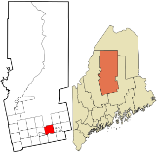
Bradley is a town in Penobscot County, Maine, United States. It is part of the Bangor Metropolitan Statistical Area. The population was 1,532 at the 2020 census. The village of Bradley is in the northwestern corner of the town.

Eddington is a town located on the eastern side of the Penobscot River in Penobscot County, Maine, United States. As of the 2020 census, the town had a population of 2,194.

<span class="mw-page-title-main">Sebec, Maine</span> Town in the state of Maine, United States

Sebec is a town in Piscataquis County, Maine, United States. The population was 665 at the 2020 census.

<span class="mw-page-title-main">Wellington, Maine</span> Town in the state of Maine, United States

Wellington is a town in Piscataquis County, Maine, United States. The town was named for Arthur Wellesley, 1st Duke of Wellington. The population was 229 at the 2020 census.

Detroit is a town in Somerset County, Maine, United States. The population was 885 at the 2020 census.

Palmyra is a town in Somerset County, Maine, United States. The population was 1,924 at the 2020 census.

<span class="mw-page-title-main">Belmont, Maine</span> Town in the state of Maine, United States

Belmont is a town in Waldo County, Maine, United States. The population was 976 at the 2020 census. It was originally known as Green Plantation. The squatters who lived there would, when alerted to the impending arrival of law officers, dress as Indians and then ignore the officers.

Cooper is a town in Washington County, Maine, United States. The community was named after General John Cooper, a landowner. The population was 168 at the 2020 census.

<span class="mw-page-title-main">Cutler, Maine</span> Town in the state of Maine, United States

Cutler is a town in Washington County, Maine, United States. The town was named after Joseph Cutler, an early settler, who hailed from Newburyport, Massachusetts. The population was 524 at the 2020 census.

Meddybemps is a town in Washington County, Maine, United States. The population was 139 at the 2020 census.

Princeton is a town in Washington County, Maine, United States. The town was named after Princeton, Massachusetts. The population was 745 at the 2020 census.

Talmadge is a town in Washington County, Maine, United States. The town was named after landowner Benjamin Tallmadge. The population was 70 at the 2020 census.

Topsfield is a town in Washington County, Maine, United States. The population was 179 at the 2020 census.

<span class="mw-page-title-main">Whitneyville, Maine</span> Town in the state of Maine, United States

Whitneyville is a town in Washington County, Maine, United States. The town was named after Colonel Joseph Whitney, a mill owner. The population was 202 at the 2020 census.

<span class="mw-page-title-main">East Millinocket, Maine</span> Town in the state of Maine, United States

East Millinocket is a town in Penobscot County, Maine, United States. The population was 1,572 at the 2020 census.

References

  1. 1 2 "US Gazetteer files 2010". United States Census Bureau. Archived from the original on December 20, 2012. Retrieved December 16, 2012.
  2. "Census - Geography Profile: Industry town, Franklin County, Maine" . Retrieved January 22, 2022.
  3. Gannett, Henry (1905). The Origin of Certain Place Names in the United States. Govt. Print. Off. pp.  165.
  4. "Census of Population and Housing". Census.gov. Retrieved June 4, 2015.
  5. "U.S. Census website". United States Census Bureau . Retrieved December 16, 2012.
  6. "U.S. Census website". United States Census Bureau . Retrieved January 31, 2008.