
A geographic information system (GIS) consists of integrated computer hardware and software that store, manage, analyze, edit, output, and visualize geographic data. Much of this often happens within a spatial database, however, this is not essential to meet the definition of a GIS. In a broader sense, one may consider such a system also to include human users and support staff, procedures and workflows, the body of knowledge of relevant concepts and methods, and institutional organizations.
A GIS file format is a standard for encoding geographical information into a computer file, as a specialized type of file format for use in geographic information systems (GIS) and other geospatial applications. Since the 1970s, dozens of formats have been created based on various data models for various purposes. They have been created by government mapping agencies, GIS software vendors, standards bodies such as the Open Geospatial Consortium, informal user communities, and even individual developers.
A GIS software program is a computer program to support the use of a geographic information system, providing the ability to create, store, manage, query, analyze, and visualize geographic data, that is, data representing phenomena for which location is important. The GIS software industry encompasses a broad range of commercial and open-source products that provide some or all of these capabilities within various information technology architectures.

Michael Frank Goodchild is a British-American geographer. He is an Emeritus Professor of Geography at the University of California, Santa Barbara. After nineteen years at the University of Western Ontario, including three years as chair, he moved to Santa Barbara in 1988, as part of the establishment of the National Center for Geographic Information and Analysis, which he directed for over 20 years. In 2008, he founded the UCSB Center for Spatial Studies.
Geographic information science or geoinformation science is a scientific discipline at the crossroads of computational science, social science, and natural science that studies geographic information, including how it represents phenomena in the real world, how it represents the way humans understand the world, and how it can be captured, organized, and analyzed. It is a sub-field of geography, specifically part of technical geography. It has applications to both physical geography and human geography, although its techniques can be applied to many other fields of study as well as many different industries.

Jack Dangermond is an American billionaire businessman and environmental scientist, who in 1969 co-founded, with Laura Dangermond, the Environmental Systems Research Institute (Esri), a privately held geographic information systems (GIS) software company. As of July 2023, his net worth was estimated at US$9.3 billion.

Java Unified Mapping Program (JUMP) is a Java based vector and raster GIS and programming framework. Current development continues under the OpenJUMP name.
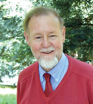
Roger Frank Tomlinson was an English-Canadian geographer and the primary originator of modern geographic information systems (GIS), and has been acknowledged as the "father of GIS."
GIS Day is an annual event celebrating geographic information systems (GIS) based technologies. The event first took place in 1999. It was initiated by spatial analytics software provider Esri. Esri president and co-founder Jack Dangermond credits Ralph Nader with being the person who inspired the creation of GIS Day. He considered the event a good initiative for people to learn about geography and the many uses of GIS. He wanted GIS Day to be a grassroots effort and open to everyone to participate.
Digital Earth is the name given to a concept by former US vice president Al Gore in 1998, describing a virtual representation of the Earth that is georeferenced and connected to the world's digital knowledge archives.
A geoportal is a type of web portal used to find and access geographic information and associated geographic services via the Internet. Geoportals are important for effective use of geographic information systems (GIS) and a key element of a spatial data infrastructure (SDI).
Distributed GIS refers to GI Systems that do not have all of the system components in the same physical location. This could be the processing, the database, the rendering or the user interface. It represents a special case of distributed computing, with examples of distributed systems including Internet GIS, Web GIS, and Mobile GIS. Distribution of resources provides corporate and enterprise-based models for GIS. Distributed GIS permits a shared services model, including data fusion based on Open Geospatial Consortium (OGC) web services. Distributed GIS technology enables modern online mapping systems, Location-based services (LBS), web-based GIS and numerous map-enabled applications. Other applications include transportation, logistics, utilities, farm / agricultural information systems, real-time environmental information systems and the analysis of the movement of people. In terms of data, the concept has been extended to include volunteered geographical information. Distributed processing allows improvements to the performance of spatial analysis through the use of techniques such as parallel processing.
Geodesign is a set of concepts and methods used to involve all stakeholders and various professions in collaboratively designing and realizing the optimal solution for spatial challenges in the built and natural environments, utilizing all available techniques and data in an integrated process. Originally, geodesign was mainly applied during the design and planning phase. "Geodesign is a design and planning method which tightly couples the creation of design proposals with impact simulations informed by geographic contexts." Now, it is also used during realization and maintenance phases and to facilitate re-use of for example buildings or industrial areas. Geodesign includes project conceptualization, analysis, design specification, stakeholder participation and collaboration, design creation, simulation, and evaluation.
Geographic information systems (GIS) play a constantly evolving role in geospatial intelligence (GEOINT) and United States national security. These technologies allow a user to efficiently manage, analyze, and produce geospatial data, to combine GEOINT with other forms of intelligence collection, and to perform highly developed analysis and visual production of geospatial data. Therefore, GIS produces up-to-date and more reliable GEOINT to reduce uncertainty for a decisionmaker. Since GIS programs are Web-enabled, a user can constantly work with a decision maker to solve their GEOINT and national security related problems from anywhere in the world. There are many types of GIS software used in GEOINT and national security, such as Google Earth, ERDAS IMAGINE, GeoNetwork opensource, and Esri ArcGIS.

Dawn Jeannine Wright is an American geographer and oceanographer. She is a leading authority in the application of geographic information system (GIS) technology to the field of ocean and coastal science, and played a key role in creating the first GIS data model for the oceans. Wright is Chief Scientist of the Environmental Systems Research Institute (Esri). She has also been a professor of geography and oceanography at Oregon State University since 1995 and is a former Oregon Professor of the Year as named by the Council for the Advancement and Support of Education and the Carnegie Foundation for the Advancement of Teaching. Wright was the first African-American female to dive to the ocean floor in the deep submersible ALVIN. On July 12, 2022, she became the first and only Black person to dive to Challenger Deep, the deepest point on Earth, and to successfully operate a sidescan sonar at full-ocean depth.
GeoSUR is a regional initiative led by spatial data producers in Latin America and the Caribbean to implement a regional geospatial network and to help establish the basis of a spatial data infrastructure in the region. GeoSUR supports the development of free access geographic services useful to find, view and analyze spatial information through maps, satellite images, and geographic data.
Michael N. DeMers is a geographer and professor emeritus of geography at New Mexico State University.

Technical geography is the branch of geography that involves using, studying, and creating tools to obtain, analyze, interpret, understand, and communicate spatial information.

Web GIS, or Web Geographic Information Systems, are GIS that employ the World Wide Web to facilitate the storage, visualization, analysis, and distribution of spatial information over the Internet. The World Wide Web, or the Web, is an information system that uses the internet to host, share, and distribute documents, images, and other data. Web GIS involves using the World Wide Web to facilitate GIS tasks traditionally done on a desktop computer, as well as enabling the sharing of maps and spatial data. While Web GIS and Internet GIS are sometimes used interchangeably, they are different concepts. Web GIS is a subset of Internet GIS, which is itself a subset of distributed GIS, which itself is a subset of broader Geographic information system. The most common application of Web GIS is Web mapping, so much so that the two terms are often used interchangeably in much the same way as Digital mapping and GIS. However, Web GIS and web mapping are distinct concepts, with web mapping not necessarily requiring a Web GIS.
Duane Francis Marble was an American geographer known for his significant contributions to quantitative geography and geographic information science (GIScience). Marble had a 40-year career as a professor at multiple institutions, retiring from the Ohio State University and holding a courtesy appointment as Professor of Geosciences at Oregon State University afterward. His early work was highly influential in computer cartography and is regarded as a significant contributor to the quantitative revolution in geography. His work on constructing a "Model Curricula" in GIScience is listed as the starting foundation built upon by the Geographic Information Science and Technology Body of Knowledge.
