
Route 110, consisting of State Route 110 (SR 110) and Interstate 110 (I-110), is a state and auxiliary Interstate Highway in the Los Angeles metropolitan area of the US state of California. The entire route connects San Pedro and the Port of Los Angeles with Downtown Los Angeles and Pasadena. The southern segment from San Pedro to I-10 in downtown Los Angeles is signed as I-110, while the northern segment to Pasadena is signed as SR 110. The entire length of I-110, as well as SR 110 south of the Four Level Interchange with US Route 101 (US 101), is the Harbor Freeway, and SR 110 north from US 101 to Pasadena is the historic Arroyo Seco Parkway, the first freeway in the western United States.

Route 710, consisting of the non-contiguous segments of State Route 710 (SR 710) and Interstate 710 (I-710), is a major north–south state highway and auxiliary Interstate Highway in the Los Angeles metropolitan area of the U.S. state of California. Also called the Los Angeles River Freeway prior to November 18, 1954, the highway was initially planned to connect Long Beach and Pasadena, but a gap in the route exists from Alhambra to Pasadena through South Pasadena due to community opposition to its construction.

The Hollywood Freeway is one of the principal freeways of Los Angeles, California and one of the busiest in the United States. It is the principal route through the Cahuenga Pass, the primary shortcut between the Los Angeles Basin and the San Fernando Valley. It is considered one of the most important freeways in the history of Los Angeles and instrumental in the development of the San Fernando Valley. It is the second oldest freeway in Los Angeles. From its southern end at the Four Level Interchange to its intersection with the Ventura Freeway in the southeastern San Fernando Valley, it is signed as part of U.S. Route 101. It is then signed as State Route 170 north to its terminus at the Golden State Freeway.

Interstate 105 (I-105) is an east–west auxiliary Interstate Highway in the Greater Los Angeles urban area of Southern California. It runs from State Route 1 (SR 1) near El Segundo and Los Angeles International Airport (LAX) to I-605 in the City of Norwalk. It is commonly known as the Century Freeway after Century Boulevard which it parallels, and also officially known as the Glenn Anderson Freeway after the late congressman Glenn M. Anderson who advocated for its construction.

State Route 60 (SR 60) is an east–west state highway in the U.S. state of California. It serves the cities and communities on the eastern side of the Los Angeles metropolitan area and runs along the south side of the San Gabriel Valley. It functions as a bypass route of Interstate 10 (I-10) through the area between the East Los Angeles Interchange in Los Angeles and Beaumont. SR 60 provides a route across several spurs of the Peninsular Ranges, linking the Los Angeles Basin with the Pomona Valley and San Gabriel Valley. The highway also runs concurrently with SR 57 and I-215. Portions of SR 60 are designated as either the Pomona Freeway or the Moreno Valley Freeway.

The East Los Angeles Interchange is an interchange complex located in Boyle Heights, Los Angeles, approximately 1 mile east of Downtown Los Angeles. With its southern portion handling over 550,000 vehicles per day, it is the busiest freeway interchange in the world. The northern portion, called the San Bernardino Split, is often considered a separate interchange. Four numbered routes converge at the interchange: Interstate 5 (I-5), I-10, U.S. Route 101 (US 101), and State Route 60 (SR 60), but the freeway segments shift alignments and directions.
The Hampton Roads Beltway is a loop of Interstate 64 and Interstate 664, which links the communities of the Virginia Peninsula and South Hampton Roads which surround the body of water known as Hampton Roads and comprise much of the region of the same name in the southeastern portion of Virginia in the United States. It crosses the harbor of Hampton Roads at two locations on large four-laned bridge-tunnel facilities: the eastern half carries Interstate 64 and uses the Hampton Roads Bridge-Tunnel and the western half carries Interstate 664 and uses the Monitor-Merrimac Memorial Bridge-Tunnel. The beltway has the clockwise direction signed as the Inner Loop, and the counter-clockwise direction signed as the Outer Loop. The entire beltway, including the bridge-tunnels, is owned and operated by the Virginia Department of Transportation.

Interstate 695 (I-695) is a 51.46-mile-long (82.82 km) auxiliary Interstate Highway that is a full beltway extending around Baltimore, Maryland, United States. I-695 is officially designated the McKeldin Beltway but is colloquially referred to as either the Baltimore Beltway or 695. The route is an auxiliary route of I-95, intersecting that route southwest of Baltimore near Arbutus and northeast of the city near White Marsh. It also intersects other major roads radiating from the Baltimore area, including I-97 near Glen Burnie, the Baltimore–Washington Parkway near Linthicum, I-70 near Woodlawn, I-795 near Pikesville, and I-83 in the Timonium area. The 19.37-mile (31.17 km) portion of the Baltimore Beltway between I-95 northeast of Baltimore and I-97 south of Baltimore is officially Maryland Route 695 (MD 695) and is not part of the Interstate Highway System but is signed as I-695. This section of the route includes the Francis Scott Key Bridge that crosses over the Patapsco River. The bridge and its approaches are maintained by the Maryland Transportation Authority (MDTA) while the remainder of the Baltimore Beltway is maintained by the Maryland State Highway Administration (MDSHA).

The Southern California freeways are a vast network of interconnected freeways in the megaregion of Southern California, serving a population of 23 million people. The Master Plan of Metropolitan Los Angeles Freeways was adopted by the Regional Planning Commission in 1947 and construction began in the early 1950s. The plan hit opposition and funding limitations in the 1970s, and by 2004, only some 61% of the original planned network had been completed.

Interstate 395 (I-395) in Virginia and Washington, D.C., is a 13.79-mile-long (22.19 km) spur route of I-95 that begins at an interchange with I-95 in Springfield and ends at an interchange with US Route 50 (US 50) in Northwest Washington, D.C. It passes underneath the National Mall near the US Capitol and ends at a junction with US 50 at New York Avenue, roughly one mile (1.6 km) north of the 3rd Street Tunnel. Despite its proximity to I-395 in Maryland, the route is unrelated and unconnected.
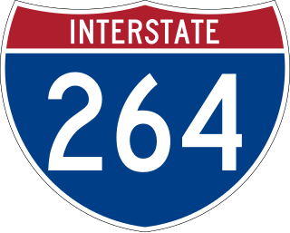
Interstate 264 (I-264) is an Interstate Highway in the US state of Virginia. It serves as the primary east–west highway through the South Hampton Roads region in southeastern Virginia. The route connects the central business districts of Chesapeake, Portsmouth, Norfolk, and Virginia Beach and serves as the most direct link between those cities and the resort beaches along Virginia's Atlantic coast.

A Texas U-turn, or Texas turnaround, boomerang, or loop around, is a lane allowing cars traveling on one side of a one-way frontage road to U-turn onto the opposite frontage road. Typically controlled by yield signs, these allow U-turning traffic to bypass two traffic signals and avoid crossing the local traffic twice.

The Harbor Transitway is a 10.3-mile (16.6 km) shared-use express bus corridor and high occupancy toll (HOT) lanes running in the median of Interstate 110 between Downtown Los Angeles and the Harbor Gateway Transit Center in Gardena, California. Buses also make intermediate stops at 37th Street/USC, Slauson, Manchester, Harbor Freeway, and Rosecrans stations. The facility opened for two-person carpools on June 26, 1996, for buses on August 1, 1996 and was converted to HOT lanes as part of the Metro ExpressLanes project on November 10, 2012.
A directional interchange, colloquially known as a stack interchange, is a type of grade-separated junction between two controlled-access highways that allows for free-flowing movement to and from all directions of traffic. These interchanges eliminate the problems of weaving, have the highest vehicle capacity, and vehicles travel shorter distances when compared to different types of interchanges.

The El Monte Busway is a 12-mile (19 km) shared-use express bus corridor (busway) and high occupancy toll (HOT) lanes running along Interstate 10 between Union Station in Downtown Los Angeles and Interstate 605 or El Monte Station in El Monte, California. Buses also make intermediate stops at Cal State LA station and Los Angeles General Medical Center station. The busway opened in January 1973 to buses only, three-person carpools were allowed to enter in 1976, and the facility was converted to HOT lanes as part of the Metro ExpressLanes project on February 22, 2013.

Harbor Freeway station is a transport hub located on the Harbor Transitway, within the Judge Harry Pregerson Interchange of Interstate 105 and Interstate 110 near Figueroa Street in the neighborhood of South Los Angeles. The station is served by the light rail C Line, the bus rapid transit J Line and other bus services. The station is owned by the California Department of Transportation (Caltrans) and operated by the Los Angeles County Metropolitan Transportation Authority (Metro).

Interstate 70 (I-70) is a part of the Interstate Highway System that runs from Cove Fort, Utah, to Woodlawn just outside of Baltimore, Maryland. In Maryland, the Interstate Highway runs 91.85 miles (147.82 km) from the Pennsylvania state line in Hancock east to the Interstate's eastern terminus at its junction with I-695. I-70 is the primary east–west Interstate in Maryland; the Interstate Highway connects Baltimore—and Washington, D.C., via I-270—with Western Maryland. The Interstate serves Frederick and Hagerstown directly and provides access to Cumberland via its junction with I-68 at Hancock. I-70 runs concurrently with its predecessor highway, U.S. Route 40 (US 40), from Hancock to Indian Springs in Washington County and from Frederick to West Friendship in Howard County.

Interstate 15 (I-15) runs north–south in the U.S. state of Utah through the southwestern and central portions of the state, passing through most of the state's population centers, including St. George and those comprising the Wasatch Front: Provo–Orem, Salt Lake City, and Ogden–Clearfield. It is Utah's primary and only north–south interstate highway, as the vast majority of the state's population lives along its corridor; the Logan metropolitan area is the state's only Metropolitan Statistical Area through which I-15 does not pass. In 1998, the Utah State Legislature designated Utah's entire portion of the road as the Veterans Memorial Highway.

The Newhall Pass interchange is a highway interchange at Newhall Pass in Southern California, United States. It is south of the city of Santa Clarita and north of the Los Angeles neighborhoods of Granada Hills and Sylmar. It connects Interstate 5 with California State Route 14. It is officially named in the memory of Los Angeles Police officer Clarence Wayne Dean, who was killed when he was unable to stop before going over a collapsed section of the interchange immediately following the 1994 Northridge earthquake.

A managed lane is a type of highway lane that is operated with a management scheme, such as lane use restrictions or variable tolling, to optimize traffic flow, vehicle throughput, or both. Definitions and goals vary among transport agencies, but managed lanes are generally implemented to achieve an improved operational condition on a highway, such as improving traffic speed and throughput, reducing air pollution, and improving safety. Types of managed lanes include high-occupancy vehicle (HOV) lanes, high-occupancy toll lanes, express toll lanes, reversible lanes, and bus lanes. Most managed lane facilities are located in the United States and Canada, although HOV and bus lanes can be found in many other countries; outside of the US and Canada, many countries use active traffic management that manage all lanes of a highway.


 I-105 (Glenn M. Anderson Freeway) – El Segundo , LAX Airport , Norwalk
  I-110 (Harbor Freeway) – San Pedro , Los Angeles