
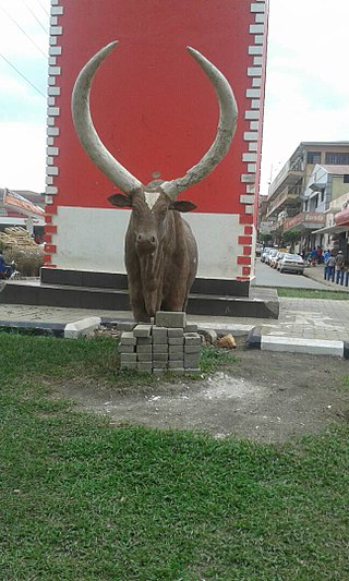
Kabale District is a district in the Western Region of Uganda. Kabale hosts the district headquarters. It was originally part of Kigezi District, before the districts of Rukungiri, Kanungu, Kisoro, Rubanda and Rukiga were excised to form separate districts. Kabale is sometimes nicknamed "Kastone" as in the local language Rukiga, a "kabale" is a small stone.

Fort Portal or Kabarole is a city located in the Western Region of Uganda. It is the seat of both Kabarole District and historically of the Tooro Kingdom.
Masaka is a district and a city in the Buganda Region in southern Uganda, west of Lake Victoria. The city is the headquarters of Masaka District.
Mbarara City is a city in the Western Region of Uganda and the second largest city in Uganda after Kampala. The city is divided into 6 boroughs of Kakoba Division, Kamukuzi Division, Nyamitanga Division, Biharwe Division, Kakiika Division, Nyakayojo Division. It is the main commercial centre of most of south western districts of Uganda and the site of the district headquarters. In May 2019, the Uganda's cabinet granted Mbarara a city status, which started on 1 July 2020.
Kisoro is a town in the Western Region of Uganda. It is the chief town of Kisoro District and the site of the district headquarters.

Arua is a city and commercial centre within the Arua District in the Northern Region of Uganda.

Bushenyi is a town in Western Uganda. It is the 'chief town' of Bushenyi District and the district headquarters are located there. The district is named after the town, in keeping with the practice in most of the districts in the country.
Rukungiri is a town in Rukungiri District of the Western Region of Uganda. It is the site of the district headquarters.
Kiboga is a town in the Buganda Region of Uganda. It is the main municipal, administrative, and commercial center of Kiboga District, and the district headquarters are located there.
Ntungamo is a town in the Western Region of Uganda. It is the largest town in Ntungamo District and the site of the district headquarters.
Luweero is a town in the Central Region of Uganda. It is the main municipal, administrative, and commercial center of Luweero District.
Lugazi is a town in the Buikwe District of the Central Region of Uganda. The town is also called "Kawolo", and the two names are interchangeably used by the local inhabitants.
Kiruhura is a town in the Western Region of Uganda. It is the largest town in Kiruhura District and the site of the district headquarters.
Lyantonde is a town in the southern part of the Central Region of Uganda. It is the main municipal, administrative, and commercial center of Lyantonde District.

Kaabong is a town in the Northern Region of Uganda. It is the chief municipal, administrative and commercial center of the eponymous Kaabong District, and the district headquarters are located in the town.
Kabale Regional Referral Hospital, commonly known as Kabale Hospital, is a hospital in the town of Kabale in Kabale District, in south-western Uganda. It is the referral hospital for the districts of Kabale, Kanungu, Rubanda, Rukiga, Kisoro and Rukungiri. It is proposed that the hospital will become the teaching hospital of Kabale University once its medical school is established.

Kigezi College Butobere is the first boys-only, boarding, senior secondary school located in Kabale District in the Western Region of Uganda.
The Mbarara–Ntungamo–Kabale–Katuna Road in Western Uganda connects the city of Mbarara, in Mbarara District, with the towns of Ntungamo, Kabale and Katuna at the international border with the Republic of Rwanda.

Rubanda District is a district in the Western Region of Uganda. The largest town in the district, Rubanda, serves as the main administrative and commercial center in the district.
Muhanga is a town in the Western Region of Uganda. It is the main commercial centre and largest town of Rukiga District. However, the district headquarters are located at Mparo.
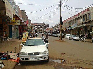
 The Main Street of Kabale
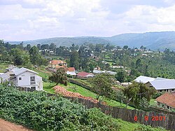 Kabale
 Kabale's landscape


