
Westmorland is a historic county in north-west England. It formed an administrative county between 1889 and 1974, after which the whole county was administered by the new administrative county of Cumbria. In 2013, the Secretary of State for Communities and Local Government, Eric Pickles, formally recognised and acknowledged the continued existence of England's 39 historic counties, including Westmorland.

Longsleddale is a valley and civil parish in the South Lakeland district of the English county of Cumbria. It includes the hamlet of Sadgill. The parish has a population of 73. As the population taken at the 2011 Census was less than 100, details are maintained in the civil parish of Whitwell and Selside.
Orton is a village and civil parish in Cumbria, England. It lies 15 miles (24 km) south of Penrith, 8 miles (13 km) from Appleby-in-Westmorland and 1.5 miles (2.4 km) from the M6 motorway. It is in the upper Lune Valley, set at the foot of Orton Scar in the Orton Fells. The Lake District is nearby. A few miles from Orton Scar is the Eden valley. The parish, historically in the county of Westmorland, now belongs to the Eden district of Cumbria. The parish had a population of 594 in 2001, decreasing to 588 at the 2011 Census.

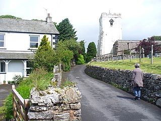
Shap is a linear village and civil parish located among fells and isolated dales in Eden district, Cumbria, England, in the historic county of Westmorland. The parish had a population of 1,221 in 2001, increasing slightly to 1,264 at the 2011 Census.

Shap Abbey was a religious house of the Premonstratensian order of Canons regular situated on the western bank of the River Lowther in the civil parish of Shap Rural, around 1.5 miles (2.4 km) from the village of Shap, in the Eden District of Cumbria, England. The site is in the care of English Heritage and managed on its behalf by the Lake District National Park.

Tebay is a village and civil parish in Cumbria, England, within the historic borders of Westmorland. It lies in the upper Lune Valley, at the head of the Lune Gorge. The parish had a population of 728 in the 2001 census, increasing to 776 at the Census 2011.

Brougham is a small village and civil parish on the outskirts of Penrith in the Eden District of Cumbria, England. According to the 2001 census the parish had a population of 279, falling marginally to 277 at the 2011 Census.

Shap Rural is a very large, but sparsely populated, civil parish in the Eden District of Cumbria in England, covering part of the Lake District National Park. It had a population of 119 in 2001, increasing to 130 at the 2011 Census.

Greysouthen is a village and civil parish between the towns of Workington and Cockermouth, in Cumbria, North West England, historically part of Cumberland, near the Lake District National Park. The village has an historic association with coal mining.

The River Lowther is a small river which flows through limestone rock in Cumbria, England. It is a tributary of the River Eamont which in turn is a tributary of the River Eden which flows into the Solway Firth near Carlisle. The Lowther begins with the confluence of the Keld Gill and the Keld Dub near the village of Keld. It flows north-west until it passes between Bampton and Bampton Grange, before turning north until it flows into the River Eamont close to Penrith.
The Penrith Co-operative Society Limited, known locally as Penrith Co-op, was a small regional consumer co-operative in the United Kingdom. The society was formed in 1890 and at the time of its merger with Scotmid it operated one department store with supermarket attached and eight small supermarkets or convenience stores in Cumbria and County Durham.

King's Meaburn is a small village and civil parish in Cumbria, England. It is 5 miles (8.0 km) from Appleby-in-Westmorland and 10 miles (16 km) from Penrith, in the valley of the River Lyvennet. The river flows just to the west of the village, and is crossed by a ford on the road to Newby and Morland. At the 2001 census the parish had a population of 105, increasing to 135 at the 2011 Census.
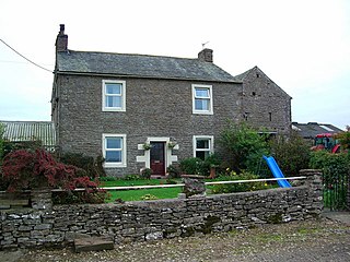
Crosby Ravensworth is a village and civil parish in the Eden district of Cumbria, England. The village is about 4 miles (6.4 km) east of the M6 motorway, and Shap. At the 2001 census the parish had a population of 538, decreasing to 517 at the 2011 Census.

Crackenthorpe is a village and civil parish in the Eden District of Cumbria, England. It is about 12 miles (19 km) south east of Penrith. The village was on the A66 road until it was by-passed. The population of the civil parish was less than 100 at the 2011 Census. Details are therefore included in the parish of Long Marton.
Little Strickland is a small village and civil parish in the Eden district of Cumbria, England. It is about 7 miles (11 km) from Penrith and 8 miles (13 km) from the small town of Appleby-in-Westmorland. The village has one place of worship and a telephone box. The population of the civil parish as taken at the 2011 Census was less than 100. Details are included in the parish of Great Strickland. On 1 April 2019 Thrimby parish was merged with Little Strickland.

St Columba's Church is in the village of Warcop, Cumbria, England. It is an active Anglican parish church in the deanery of Appleby, the archdeaconry of Carlisle, and the diocese of Carlisle. Its benefice is united with those of St Michael, Brough, St Stephen, Stainmore, and St Theobald, Musgrave. The church is recorded in the National Heritage List for England as a designated Grade I listed building. On Saint Peter's Day, 29 June, each year the church hosts a rushbearing ceremony.

The Shap Stone Avenue is a megalithic complex near Shap in Cumbria, England, comprising stone circles, a two-mile avenue of stones, and burial mounds.
Shap is a civil parish in the Eden District, Cumbria, England. It contains 31 listed buildings that are recorded in the National Heritage List for England. Of these, one is listed at Grade II*, the middle of the three grades, and the others are at Grade II, the lowest grade. The parish contains the village of Shap, the hamlet of Keld, and the surrounding countryside. Most of the listed buildings are houses and associated structures, farmhouses and farm buildings. The other listed buildings include a church and items in the churchyard, a chapel, a hotel, a former market hall, a war memorial, and four mileposts.
Shap Rural is a civil parish in the Eden District, Cumbria, England. It contains eleven listed buildings that are recorded in the National Heritage List for England. All the listed buildings are designated at Grade II, the lowest of the three grades, which is applied to "buildings of national importance and special interest". The parish is almost entirely rural, and the listed buildings consist of farm houses and farm buildings, three bridges, a lime kiln, and a monument.


